1924: Tantalus Range

Garibaldi Park Whistler A to Z: Mt James TurnerNeal Carter (14 Dec 1902 – 15 Mar 1978) was a mountaineer and early explorer of the Coast Mountains primarily in the 1920’s and 1930’s. Highly skilled as a mountaineer, Carter also excelled at cartography and surveying which he used to map the vast unnamed and unexplored mountains of BC. He named a staggering number of mountains, peaks and glaciers as well as making 25 first ascents of mountains, many of which surround what we now call the Whistler Valley. 

Read more

1925: Fighting Way to Mt. Tantalus

Garibaldi Park Whistler A to Z: Mt James TurnerNeal Carter (14 Dec 1902 – 15 Mar 1978) was a mountaineer and early explorer of the Coast Mountains primarily in the 1920’s and 1930’s. Highly skilled as a mountaineer, Carter also excelled at cartography and surveying which he used to map the vast unnamed and unexplored mountains of BC. He named a staggering number of mountains, peaks and glaciers as well as making 25 first ascents of mountains, many of which surround what we now call the Whistler Valley. 

Read more

27 Dog Friendly Whistler Trails

Dog Friendly Hiking Trails IconWhistler is very dog friendly and the number of wonderful hiking trails that your dog will love is huge. The massively varied hiking trails range from easy, short, close to Whistler Village to challenging, long and deep in the endless wilderness around Whistler. You can find dog friendly trails in and around Whistler Village that take you through deep, dark and magical forests.

Read more

A River Runs Through It

Sept 11th, 2022: The notoriously difficult biking trail in the wilderness between Emerald Forest and Rainbow Park is a pretty fun place to wander around.  It zig-zags through the deep stretch of forest with Alta Lake Road along one side and the train tracks and the River of Golden Dreams on the other.  A River Runs Through It, or ARRTI as it is more affectionately called by the locals who love it, is buried in such a thick forest that you often only see slivers of sky above and wandering off the trail leads you to bizarre and beautiful places.  

Read more

A River Runs Through It aka ARRTI

Garibaldi Park Whistler A to Z: ARRTITwentyone Mile Creek begins its long and steep journey from Rainbow Lake, high up and between Mount Sproatt and Rainbow Mountain.  Cutting between the two mountains, Twentyone Mile Creek flattens out somewhat, passes under Alta Lake Road, then winds its way through a deep and dark forest before flowing into the River of Golden Dreams near the end of Lorimer Road.  This hidden forest extends from Rainbow Park to Emerald Forest and between Alta Lake Road and the River of Golden Dreams.

Read more

Ablation Zone - Hike in Whistler Glossary

Garibaldi Park Whistler A to ZAblation Zone: the lower altitude region of a glacier where there is a net loss of ice mass due to melting, sublimation, evaporation, ice calving or avalanche.  The ablation zone of a glacier such as the Wedgemount Glacier has meltwater features such as englacial streams and a glacier window.  An englacial stream refers to meltwater flowing inside a glacier.  A glacier window is a cave-like opening at the mouth of a glacier where meltwater runs out.

Read more

Accumulation Zone - Hike in Whistler Glossary

Garibaldi Park Whistler A to Z: Accumulation ZoneAccumulation Zone: the area where snow accumulations exceeds melt, located above the firn line.  Snowfall accumulates faster than melting, evaporation and sublimation removes it.  Glaciers can be shown simply as having two zones, the accumulation zone and the ablation zone.  Separated by the glacier equilibrium line, these two zones comprise the areas of net annual gain and net annual loss of snow/ice on a glacier. 

Read more

Aiguille - Hike in Whistler Glossary

Garibaldi Park Whistler A to Z: AiguilleAiguille: a tall, narrow, characteristically distinct spire of rock. From the French word for "needle". Used extensively as part of the names for many peaks in the French Alps.  Around Whistler and in Garibaldi Park you will find several distinct aiguilles.  Shown here is the prominent aiguille that stands like a tower at the summit of Rethel Mountain above Wedgemount Lake.  Standing near the hut at Wedgemount Lake, Rethel is the towering mountain directly across the lake.

Read more

Alexander Falls Provincial Park

Alexander Falls Hike RatingAlexander Falls is a very impressive 43 metre/141 foot waterfall just 30 to 40 minutes south of Whistler in the Callaghan Valley. Open year-round and located just before Whistler Olympic Park where several of the 2010 Olympic events were held. There is a nice viewing platform on the edge of the cliff across from the falls which crash fantastically into the valley below.

Read more

Alpha Lake Park in Whistler

Whistler Parks and Lakes IconAlpha Lake Park is a beautiful little park on the shores of Alpha Lake in Creekside, just 5 kilometres south of Whistler Village.  Located partway along Lake Placid Road down past the Co-Op gas station and Nita Lake Lodge.  This quiet residential street leads to this park that is home to tennis courts, a basketball court, a huge waterfront dog park, an elaborate kids play park, a floating dock, two piers and biking/walking/running trails everywhere you look.

Read more

Alpine Zone - Hike in Whistler Glossary

Garibaldi Park Whistler A to Z: Alpine ZoneAlpine Zone or Alpine Tundra is the area above the treeline, often characterized by stunted, sparse forests of krummholz and pristine, turquoise lakes.  Mount Sproatt is an excellent example of an alpine zone in Whistler.  Dozens of alpine lakes, rugged and rocky terrain and hardy krummholz trees everywhere you look.  The hostile, cold and windy climate in the alpine zones around Whistler make tree growth difficult.  Added to that, the alpine areas are snow covered the majority of the year. 

Read more

Alta Green Lost 15k Run in Whistler

Whistler Running Easy Dog FriendlyThe Alta Green Lost 15k is a fantastic 15 kilometre(9.3 mile) trail run that takes you past three of Whistler's wonderful lakes and several gorgeous parks.  Almost entirely on the wide, paved, two lane Valley Trail, this run is constantly changing as you pass numerous stunning vantage points.  Easy to navigate and several gradual hills make this a relaxing and constantly interesting trail run.  If you are a fan of beautiful sunrises, this run is packed with spectacular ones.  If you like to jump in a lake in the middle of your run, you have many opportunities, including a naked plunge from the clothing optional pier on Lost Lake!

Read more

Alta Lake 8k Run in Whistler

Whistler Running Easy Dog FriendlyThe Alta Lake 8k is a beautiful 8 kilometre(5 mile) trail run in Whistler with a bunch of great things going for it.  Beautiful views running along the Whistler Golf Course.  Almost constant panoramic views of Whistler Mountain, Blackcomb Mountain and Wedge Mountain.  A little old growth forest of massive Western redcedars, and more than half of the route is along the majestic shore of Alta Lake.  This trail, like the Whistler Golf Course 5k, is accessible directly from Whistler Village, or from the convenient and free parking at the end of Lorimer Rd, just a 5 minute drive from anywhere in Whistler.

Read more

Ancient Cedars & Showh Lakes Hike in Whistler

Ancient Cedars Hike RatingAncient Cedars is a nice, easy/moderate 2.5 kilometre (1.6 mile) hiking trail on the far side of Cougar Mountain, just 13.1 kilometres north of Whistler Village. A small, untouched grove of huge western red-cedars hidden high up in the mountains. Often overlooked by hikers, certainly there are other groves of massive cedars found in other Whistler area hikes.

Read more

Ancient Cedars Maps

Ancient Cedars Hike RatingAncient Cedars is a nice, easy/moderate 2.6 kilometre(1.6 mile) hiking trail on the far side of Cougar Mountain, just 13.1 kilometres north of Whistler Village. A small, untouched grove of huge western redcedar hidden high up in the mountains. Often overlooked by hikers, certainly there are other groves of massive cedars found in other Whistler area hikes.

Read more

Arborlith or Lithophyte - Hike in Whistler Glossary

Garibaldi Park Whistler A to Z: KrummholzEvery unusual phenomenon in the forest seems to have a name, but one natural work of art seems to be without a commonly used name.  Big trees with sprawling roots that wrap around huge boulders, glacier erratics or jagged bedrock are sometimes called lithophytes which translates from Latin lith and phyte as stone and plant.  Lithophyte is not the best description for these because they don't so much live on rock as encompass it.

Read more

Arete - Hike in Whistler Glossary

Garibaldi Park Whistler A to Z: AreteArête: a thin ridge of rock formed by two glaciers parallel to each other. Sometimes formed from two cirques meeting. From the French for edge or ridge.  Around Whistler and in Garibaldi Provincial Park you will see dozens of excellent examples.  At the Wedge-Weart Col above and beyond Wedgemount Lake is a prominent arête that links these two highest mountains in Garibaldi ParkWedge Mountain is 2892 metres(9488 feet) and Mount Weart is 2835 metres(9301 feet).

Read more

Armchair Glacier - Hike in Whistler Glossary

Garibaldi Park Whistler A to Z: Alpine ZoneArmchair Glacier is one of the many easily identifiable mountain features around Whistler.  Along with Wedge Mountain and Black Tusk, Armchair Glacier has a distinct shape that it is named after.  Armchair Glacier can be seen from a considerable distance and from many places in Whistler.  In the winter it is a solid white ridge with three peaks and in the summer the ridge and peaks are bare rock and the glacier can be seen as a solid, horizontal line below. 

Read more

Bears - Hike in Whistler Glossary

Garibaldi Park Whistler A to Z: BearsWhistler, the surrounding mountains, and Garibaldi Provincial Park are home to two types of bears.  Black bears and grizzly bears.  Black bears are frequently seen throughout the valley and often in Whistler Village.  Grizzly bears, on the other hand, are rarely seen, and only deep in the wilderness, well away from Whistler Village.  Black bears around Whistler are generally skittish and will flee into the forest when approached by people.

Read more

Bench - Hike in Whistler Glossary

Garibaldi Park Whistler A to Z: BenchBench: a flat section in steep terrain.  Characteristically narrow, flat or gently sloping with steep or vertical slopes on either side.  A bench can be formed by various geological processes.  Natural erosion of a landscape often results in a bench being formed out of a hard strip of rock edged by softer, sedimentary rock.  The softer rock erodes over time, leaving a narrow strip of rock resulting in a bench.  Coastal benches form out of continuous wave erosion of a coastline.  

Read more

Bergschrund or Schrund - Hike in Whistler Glossary

Garibaldi Park Whistler A to ZBergschrund or abbreviated schrund: a crevasse that forms from the separation of moving glacier ice from the stagnant ice above. Characterized by a deep cut, horizontal, along a steep slope. Often extending extremely deep, over 100 metres down to bedrock. Extremely dangerous as they are filled in winter by avalanches and gradually open in the summer.  The Wedgemount Glacier at Wedgemount Lake is a great way to view bergschrund up close in Whistler. 

Read more

Best Aerial Views

Aerial Views WhistlerAerial views of Whistler hiking trails give you a nice perspective on how beautiful this part of the world is.  Wedge Glacier is hard to grasp its immensity from across the valley.  Up close, from above, the endless rows of crevasses and massive contours give this hulking glacier a more complete picture.  

Read more

Best Free Camping in Whistler

Free Camping IconWhistler is surrounded by an immense wilderness dotted with spectacular, hidden lakes and amazing places to set up a tent.  Decades of logging activity has left a network of forest service roads that has opened easy access to these places.  Some of these you can drive to and some you may need a 4x4 to comfortably get to.

Read more

Best Sights Sea to Sky

Sea to Sky HighwayThe Sea to Sky Highway links Vancouver to Whistler and has several stops along the way that are often overlooked. Porteau Cove, for example, is surprisingly unknown even to locals that have driven past hundreds of times. Just off the highway the parking area is just steps from the huge pier stretching way out over the ocean.

Read more

Best Trails This Week!

March 25th, 2023: What trails are good this week?  If you are dying for summer to come, Lillooet Lake is paradise these days.  Just an hours drive north of Whistler is the first of several beach campsites along this massive lake.  Strawberry Point is the first one you come to along the In-Shuck-Ch gravel road that runs along the edge of Lillooet Lake.  The campsites along the lake don't open until April 1st, so you can visit or camp for free before then.

Read more

Best Trails This Week!

February 11th, 2023: What trails are good this week?  Driving up into the mountains is a great way to seek out some springtime snow.  Alexander Falls is beautiful these days with deep snow everywhere.  Not really a hike as the walk from your car to the viewpoint is just a hundred metres or so, it is worth the drive, especially on a sunny day!  High up in the Callaghan Valley, Alexander Falls is easy to get to in any weather and amazing in February.

Read more

Best Whistler & Garibaldi Park Hiking April

Whistler Spring HikingApril in Whistler is a wonderful time of year.  The winter deep freeze ends and T-shirt weather erupts.  The village comes alive with overflowing patios and the excitement of approaching summer can be seen everywhere.  The snow in the village starts the month measured in feet and ends the month, having mostly melted, about halfway up to mid-station on Whistler Mountain.  Early in April the usual favourite places to snowshoe are warm and wonderful.

Read more

Best Whistler & Garibaldi Park Hiking December

Whistler Winter HikingDecember hiking in Whistler is mainly done on snowshoes, though not always. If it hasn't snowed much recently then trails such as Whistler Train Wreck and Rainbow Falls can be done fairly easily without snowshoes. The wonderful, multi-use trail network in Whistler, the Valley Trail is amazing on foot all winter with some sections plowed, some left snow covered and even a few sections groomed for free cross country skiing.

Read more

Best Whistler & Garibaldi Park Hiking Trails August

Whistler Summer HikingAugust hiking in Whistler definitely has the most consistently great, hot weather.  You can feel the rare pleasure of walking across a glacier shirtless and still hot.  Even in the high elevations and on glaciers the temperatures are often a beautifully hot 20c plus.  There are numerous glaciers that are readily accessible via Whistler area hiking trails.  Wedgemount Lake has one of these beautiful glaciers just steps from its far shore.

Read more

Best Whistler & Garibaldi Park Hiking Trails June

Whistler Summer HikingJune is a pretty amazing month to hike in Whistler and Garibaldi Park.  The average low and high temperatures in Whistler range from 9c to 21c(48f/70f).  The summer tourist season in Whistler doesn’t kick into high gear until the end of June, so most trails remain relatively quiet.  The higher elevation hiking trails in Whistler and Garibaldi Park with have lingering snow well into June and sometimes early July.

Read more

Best Whistler & Garibaldi Park Hiking Trails March

Whistler Spring HikingMarch is usually a snowy month in Whistler, though in 2024 not a whole lot of snow has fallen. Snowshoes are already not necessary for lots of trails in and around Whistler. If you have not been to Whistler Train Wreck, you have to, it's a must see. It's a decades old train wreck which was turned into an art exhibit in 2011 when local artists painted extraordinary murals over the mangled train cars.  

Read more

Best Whistler & Garibaldi Park Hiking Trails May

Whistler Spring HikingMay is an extraordinarily beautiful time of year in Whistler.  The days are longer and warmer and a great lull in between seasons happens.  Whistler is fairly quiet in May and nobody goes hiking.  This is because most of the trails have quite deep snow.  This keeps everyone away, and for good reason.  The best Garibaldi Park and Whistler area trails are mostly steep and at high elevations, so hiking or snowshoeing in deep snow is exhausting.

Read more

Best Whistler & Garibaldi Park Hiking Trails November

Whistler Fall HikingNovember in Whistler is when the temperatures plummet and the first heavy snow falls in the alpine and often in Whistler Village.  The hiking opportunities become limited to easier and lower elevation hikes such as to Nairn Falls, Brandywine Falls and Rainbow Falls.  Waterfalls are a great in Whistler, huge and impressive.  Also, most can be accessed year-round. Alexander Falls, located high up in beautiful Callaghan Valley, just metres from a snow plowed road. 

Read more

Best Whistler & Garibaldi Park Hiking Trails September

Whistler Fall HikingSeptember hiking in Whistler is possibly the best month of all.  The snow has melted far up to the mountain tops, yet the temperatures are still quite high.  And just like that wonderful phenomenon of May and June, there are no annoying bugs.  And with the passing of the first week of September, the summer season officially ends, so the number of hikers dwindles to virtually none by the second week.

Read more

Best Whistler Hiking & Snowshoeing February

Whistler Winter HikingFebruary is a great month for snowshoeing in Whistler and Garibaldi Park.  The days slowly get longer, but the temperatures stay consistently cold.  Expect several days of -12c and of course much colder in the mountains.  February is a great month for trying some overnight snowshoeing trips.  There are even several huts that are available to use.  Some are free and some have a reasonably low cost.

Read more

Bivouac or Bivy - Hike in Whistler Glossary

Garibaldi Park Whistler A to Z: BivouacBivouac or Bivy: a primitive campsite or simple, flat area where camping is possible.  Traditionally used to refer to a very primitive campsite comprised of natural materials found on site such as leaves and branches or simply sleeping under the stars.  Often used interchangeably with the word camp, however, bivouac implies a shorter, quicker and much more basic and naturally constructed camp setup.  

Read more

Black Tusk in Garibaldi Provincial Park

Black Tusk Hike RatingBlack Tusk is the extraordinarily iconic and appropriately named mountain that can be seen from almost everywhere in Whistler. The massive black spire of crumbling rock juts out of the earth in an incredibly distinct way that appears like an enormous black tusk plunging out of the ground. Whether you spot it in the distance from the top of Whistler Mountain or from vantage points along the Sea to Sky Highway, its appearance is unmistakable.

Read more

Black Tusk Maps

Black Tusk Hike RatingBlack Tusk is the extraordinarily iconic and appropriately named mountain that can be seen from almost everywhere in Whistler.  The massive black spire of crumbling rock juts out of the earth in an incredibly distinct way that appears like an enormous black tusk plunging out of the ground.  Whether you spot it in the distance from the top of Whistler Mountain or from vantage points along the Sea to Sky Highway, its appearance is breathtaking.

Read more

Blackcomb Mountain Hike in Whistler

Blackcomb Mountain Hike RatingBlackcomb Mountain holds an impressive and ever growing array of hiking trails. From the moment you arrive at the Rendezvous Lodge, you see hiking trails ascend into the distance. The Rendezvous Lodge is home to a cafeteria style restaurant, a fine dining restaurant, gift shops, washrooms, and quite a lot else.  The Rendezvous Lodge is centre of activity on Blackcomb Mountain and the Roundhouse Lodge is the same on Whistler Mountain.

Read more

Blue Face in Parkhurst Ghost Town, Whistler

Garibaldi Park Whistler A to ZBack in 2011 Kups, a Whistler local and now professional muralist painted a hauntingly surreal, blue face on the side of this house.  This beautiful mural, along with the fact that this is the last fully intact house in Parkhurst makes it the most well known and photographed structure in the old ghost town.  It is difficult to figure out why the Blue Face house outlasted all the others, but it appears to still be quite structurally sound.

Read more

Blueberry Hill 6k Run in Whistler

Blueberry Hill Steep, Dog Friendly Run in WhistlerThe Blueberry Hill 6 kilometre(3.7 mile) trail run is a beautiful running route that is packed with great views and a wonderfully varied terrain.  From Whistler Village you run along the edge of Whistler Golf Course on the wide, paved, two lane trail to the start of the Blueberry Trail.  The Blueberry Trail quickly ascends through a deep forest as a few small switchbacks take you high up on the edge of Blueberry Hill. This five minutes of gruelling ascent then levels off and you get the first of several nice viewpoints, high above Alta Lake

Read more

Blueberry Park in Whistler

Whistler Parks and Lakes IconBlueberry Park is a very scenic park on Alta Lake that most Whistler locals don't even know about.  If you have been to Rainbow Park you would have noticed several piers across Alta Lake surrounded by forest.  These public piers sit at the edge of Blueberry Park, with the Blueberry Trail running from one side of the forest to the other in a loop trail along the shore and up through the forest.  

Read more

Blueberry Trail Snowshoeing Whistler

The Blueberry Trail is a relatively unknown, though very scenic trail that ascends quickly up to a cliff viewpoint high above Alta Lake.  Another trail hugs the shoreline of Alta Lake through a wonderfully deep forest past four secluded piers.  The trails connect a few hundred metres past the fourth pier, so you can continue to the north end of the park in Tapleys near Whistler Cay, or loop back to the south trailhead off St. Anton Way. 

Read more

Brandywine Falls Provincial Park

Brandywine Falls Hike RatingBrandywine Falls is one of the must see sights on the drive to or from Whistler, and arguably the nicest of Whistler’s numerous beautiful waterfalls.  Located about halfway between Squamish and Whistler, the falls drop from a 70 metre/230 foot, unnaturally abrupt looking cliff to the valley below.  Brandywine Falls Provincial Park is such a popular, accessible and beautiful sight that it has a large and elaborate viewing platform directly opposite the falls.

Read more

Brandywine Falls Snowshoeing in Whistler

Brandywine Snowshoe RatingBrandywine Falls Provincial Park is a beautiful park centred around the wonderful falls that plunge 70 metres down a vertical wall of glacier fractured rock.  The peculiar, angular cubes of rock that the cliffs surrounding the falls is the result of lava rapidly cooling against a glacier.  The rapid cooling causes solid rock to fracture in bizarrely angular ways known as columnar jointing.  From the viewing platform across from the falls you can make out four distinct layers of columnar jointing separated by glacial till.

Read more

Brandywine Meadows Hike in Whistler

Brandywine Meadows Hike RatingBrandywine Meadows is a nice, relatively short hike to a massive flower filled valley high up in Callaghan Valley. Located 40 minutes south of Whistler, this tough and sometimes muddy trail gains a huge 550 metres of elevation in just 3 kilometres(1.9 miles), trailhead to meadows.  The trailhead is tricky to find and involves a fairly long gravel road journey that is passable without a 4x4, but barely.

Read more

Brandywine Meadows Maps

Brandywine Falls Rates With Us at 7 out of 10Brandywine Meadows is a nice, relatively short hike to a massive flower filled valley high up in Callaghan Valley. Located 40 minutes south of Whistler, this tough and sometimes muddy trail gains a huge 550 metres of elevation in just 3 kilometres(1.9 miles), trailhead to meadows.  The trailhead is tricky to find and involves a fairly long gravel road journey that is passable without a 4x4, but barely.

Read more

Brew Lake Hike in Whistler

Brew Lake Hike RatingBrew Lake is beautiful mountain lake just a short drive south of Whistler and is relatively unknown and seldom hiked. Laying at the base of Mount Brew, Brew Lake lays in a massive alpine valley of enormous erratics.  On first seeing Brew Lake it looks serene, yet wild and hostile.  The lake is surrounded on one side by idyllic tree covered hills and lakeside cliffs and on the other side a brutal looking wasteland of huge boulders sloping up to the sky.

Read more

Brew Lake Maps

Brew LakeBrew Lake is beautiful mountain lake just a short drive south of Whistler and is relatively unknown and seldom hiked. Laying at the base of Mount Brew, Brew Lake lays in a massive alpine valley of enormous erratics.  On first seeing Brew Lake it looks serene, yet wild and hostile.  The lake is surrounded on one side by idyllic tree covered hills and lakeside cliffs and on the other side a brutal looking wasteland of huge boulders sloping up to the sky.

Read more

Bungee Bridge - Hike in Whistler Glossary

Garibaldi Park Whistler A to Z: Mt James TurnerWhistler Bungee Bridge, also known as the Cheakamus Bungee Bridge is a very convenient and beautiful attraction on the way to or from Whistler from Vancouver.  Just 20 minutes south of Whistler Village on the Sea to Sky Highway, then just a 3 kilometre logging road takes you right to the stairs up to this amazing bridge.  Open year-round and surprisingly accessible, even in the snowy winter months.  Thousands of cars drive the Sea to Sky Highway past the turnoff to this wonderful bridge every day and never take a look. 

Read more

Bushwhack - Hike in Whistler Glossary

Bushwhack WhistlerBushwhack is a term often used in Canada and the United States to refer to hiking off-trail where no trail exists.  Literally means 'bush' and 'whack'.  To make your own trail through the forest by whacking or cutting your way through the bush.  A bushwhacker is a term sometimes used to describe someone who spends a lot of time in the wilderness.  Bushwhacking is also usually needed to plot a new trail through deep forest. 

Read more

Cairns Inukshuks Inuksuks - Whistler Glossary

Garibaldi Park Whistler A to Z: CairnsCairns, inukshuks or inuksuks are a pile or arrangement of rocks used to indicate a route, landmark or a summit.  The word cairn originates from the Scottish Gaelic word carn.  A cairn or inukshuk can be either large and elaborate or as simple as a small pile of rocks.  To be effective a cairn marking a trail has to just be noticeable and obviously man-made.  In the alpine areas around Whistler, above the treeline, cairns are the main method of marking a route. 

Read more

Callaghan Lake Maps

Callaghan Lake RatingCallaghan Lake Park is a relatively untouched wilderness of rugged mountainous terrain. The valley walls were formed by relatively recent glaciation. Evidence of this can be seen in the considerable glacial till and slide materials visible across the lake. Around the lake you will see talus slopes, flat rock benches, cirques, hanging valleys, tarns, waterfalls and upland plateaus with bogs.

Read more

Callaghan Lake Park

Callaghan Lake Hike RatingCallaghan Lake Park is a relatively untouched wilderness of rugged mountainous terrain. The valley walls were formed by relatively recent glaciation. Evidence of this can be seen in the considerable glacial till and slide materials visible across the lake. Around the lake you will see talus slopes, flat rock benches, cirques, hanging valleys, tarns, waterfalls and upland plateaus with bogs.

Read more

Caterpillar D8 in Parkhurst Ghost Town, Whistler

Garibaldi Park Whistler A to Z: NunatukAlong the shore of Green Lake, you will find a monstrous old Caterpillar tractor that dates from the 1930’s.  Abandoned here in the 1950’s, it looks as if the driver parked it one day and just never returned to work.  In fact that may have been the case as one day in 1956, the sawmill at Parkhurst shut down forever and the town was abandoned.  For a logging town in the 1950's having everyone suddenly leave was not unusual and in fact Parkhurst vacated every year when the sawmill shut for the winter.

Read more

Caterpillar RD8 in Parkhurst Ghost Town, Whistler

Garibaldi Park Whistler A to Z: NunatukThe second Caterpillar tractor in Parkhurst Ghost Town is considerably harder to find despite being just a few metres from the hulking Caterpillar at the shore of Green Lake.  If you bushwhack through the dense forest toward the point of land that the Parkhurst Sawmill was located you will find this second tractor also abandoned in 1956.  This tractor is much easier to identify than the other one and appears to be a Caterpillar RD8 built in 1936.

Read more

Cheakamus Lake in Garibaldi Provincial Park

Cheakamus Lake Hike RatingCheakamus Lake is a wonderfully relaxing way to get in the wilderness easily and quickly from Whistler Village. The trail begins on the far side of Whistler Mountain, 8 kilometres from the Sea to Sky Highway at Cheakamus Crossing across from Function Junction.  This 8 kilometre stretch of logging road is fairly bumpy and potholed, but does have the benefit of allowing you to drive the elevation gain instead of hiking it.

Read more

Cheakamus Lake Maps

Cheakamus Lake Hike RatingCheakamus Lake is a wonderfully relaxing way to get in the wilderness easily and quickly from Whistler Village.  The trail begins on the far side of Whistler Mountain, 8 kilometres from the Sea to Sky Highway at Cheakamus Crossing across from Function Junction.  This 8 kilometre stretch of logging road is fairly bumpy and potholed, but does have the benefit of allowing you to drive the elevation gain instead of hiking it.

Read more

Cheakamus River Hike in Whistler

Cheakamus River Hike RatingCheakamus River is a beautiful, crashing, turquoise coloured river that flows from Cheakamus Lake, through Whistler Interpretive Forest, then down past Brandywine Falls to Daisy Lake, then all the way to Squamish where it merges with Squamish River and into the ocean. Cheakamus River has quite an extensive network of hiking and biking trails that run alongside it.  The Riverside trail and the Farside trail run on either side of Cheakamus River and connect at both ends by bridges.

Read more

Cheakamus River Snowshoeing Whistler

Snowshoe Rating CheakamusCheakamus River is a beautiful, crashing, turquoise coloured river that flows from Cheakamus Lake, through Whistler Interpretive Forest at Cheakamus Crossing, then down past Brandywine Falls to Daisy Lake. Also a popular kayaking route, the main attraction to Cheakamus River is the wonderful and quite extensive network of trails that run along either side of it.  The Riverside trail and the Farside trail hug both sided of Cheakamus River and connect at both ends by bridges.

Read more

Cirque - Hike in Whistler Glossary

Garibaldi Park Whistler A to Z: CirqueCirque: a glacier-carved bowl or amphitheater in the mountains.  To form, the glacier must be a combination of size, a certain slope and more unexpectedly, a certain angle away from the sun. In the northern hemisphere, this means the glacier must be on the northeast slope of the mountain, away from the suns rays and the prevailing winds. Thick snow, protected in this way, grows thicker into glacial ice, then a process of freeze-thaw called nivation, chews at the lower rocks, hollowing out a deep basin.

Read more

Cletrac in Parkhurst Ghost Town, Whistler

Garibaldi Park Whistler A to Z: NunatukAdjacent to the huge Caterpillar tractor in Parkhurst is a large disintegrating wooden dock that is a great place to take in the wonderful view of Green Lake.  From the dock if you look to the right you will see a large triangle of deep forest jutting out into the lake.  This is where the Parkhurst Sawmill once operated for thirty years.  Looking at the almost impenetrable forest now, it is hard to picture this area without trees and with train tracks extending into a large building housing the sawmill with an enormous steel chimney several dozen metres tall. 

Read more

Cloudraker Skybridge & Raven’s Eye Cliff Walk

Garibaldi Park Whistler A to Z: CloudrakerThe Cloudraker Skybridge and the Raven’s Eye Cliff Walk are new additions to the summit of Whistler Mountain.  The Cloudraker Skybridge stretches 130 metres from just steps from the top of the Peak Express Chair across to the West Ridge.  The Raven’s Eye Cliff Walk is a viewing platform that extends over 12 metres up and out from the West Ridge.  Both of these exhilarating viewing areas tower way above Whistler Bowl.

Read more

Coast Douglas-fir

Garibaldi Park Whistler A to Z: NunatukCoast Douglas-fir trees are medium to extremely large trees that you will encounter in Whistler and Garibaldi Park. They are the second tallest conifer trees in the world after the coast redwood and the third tallest of all trees in the world after Eucalyptus regnans. Coast Douglas-fir, also known as Pacific Douglas-fir, Oregon pine and Douglas spruce range along the coast of British Columbia, Washington and Oregon and have been known to reach heights of 120 metres (390 feet).

Read more

Coast Mountains - Hike in Whistler Glossary

Garibaldi Park Whistler A to Z: Coast MountainsThe Coast Mountains run from the Yukon down to Vancouver along the west coast of British Columbia in a band that averages 300 kilometres wide(190 miles).  The length of the Coast Mountains is roughly 1600 kilometres(1000 miles).  They are often referred to as the BC Coastal Range or the Coast Range.  The Coast Mountains are comprised of three mountain ranges, the Pacific Ranges, the Kitimat Ranges, and the Boundary Ranges.

Read more

Columnar Jointing - Cheakamus Valley Basalts

Garibaldi Park Whistler A to Z: Mt James TurnerColumnar Jointing: bizarre looking columns of oddly angular rock formations that can be found in many places around Whistler and worldwide.  Generally found in large clusters packed together in a uniformly vertical array of columns that appear to be several metres long and usually more than 30 centimetres in diameter.  Surface erosion causes the columns to fracture and break apart, giving the appearance of an ancient, crumbling wall.

Read more

Cordilleran Ice Sheet

Garibaldi Park Whistler A to Z: Mt James TurnerThe Cordilleran Ice Sheet covered most of north-west North America for much of the last 2.6 million years.  At the Last Glacial Maximum during the Last Glacial Period(26,500 years ago), the Cordilleran Ice Sheet likely covered as much as 2.5 million square kilometres.  Stretching from Alaska to Oregon, British Columbia was entirely covered in ice that in many places over two kilometres thick.  At the Continental Divide of North America the Cordilleran Ice Sheet merged with the Laurentide Ice Sheet.

Read more

Cornice - Hike in Whistler Glossary

Garibaldi Park Whistler A to ZCornice: a wind deposited wave of snow on a ridge, often overhanging a steep slope or cliff.  They are the result of snow building up on the crest of a mountain.  Cornices are extremely dangerous to travel on or below.  A common refrain of climbers is that if you can see the drop-off of a cornice, you are too close to the edge.  Cornices are dangerous for several reasons.  They can collapse from hiking across or they can collapse from above.

Read more

Corrie Lake in Garibaldi Park

Garibaldi Park Whistler A to ZCorrie Lake is the surreal looking lake that can be seen across the valley from Whistler Mountain.  While hiking the High Note trail along Whistler Mountain it slowly comes into view, seemingly hanging in the forest on an otherwise steep sided, broad mountain.  The broad mountain that Corrie Lake sits within is called Corrie Ridge, which extend from Corrie Peak to Gentian Ridge.  The ridge is named Corrie Ridge because Corrie Peak is the highest peak along the ridge.

Read more

Crevasse - Hike in Whistler Glossary

Garibaldi Park Whistler A to ZCrevasse: is a split or crack in the glacier surface, often with near vertical walls.  Crevasses form out of the constant movement of a glacier over irregular terrain.  Crevasses are both revered for their dramatic beauty and feared for their inherent danger.  Crevasses are often dozens of metres deep and less than a metre wide.  The fear of slipping into one of these treacherously narrowing chasms is well founded. 

Read more

Deadfall, Windthrow, Blowdown & Windsnap

Garibaldi Park Whistler A to Z: DeadfallDeadfall means a tangled mass of fallen trees and branches.  There are several name variations for fallen trees that are commonly used in Whistler.  Windthrow, blowdown and windsnap are used somewhat interchangeably with deadfall.  Deadfall is a more generalized term that literally means dead and fallen, as in a dead and fallen tree.  Windthrow and blowdown, however are more specifically used to refer to trees blown over and uprooted by strong winds during storms. 

Read more

Emerald Forest - Hike in Whistler Glossary

Garibaldi Park Whistler A to Z: Mt James TurnerEmerald Forest is a cute little forest that is well hidden between Whistler Cay and Alpine.  From Whistler Village, if you go down to the end of Lorimer Road you will see the Valley Trail branch off in three directions.  If you take the direction toward Meadow Park, you will immediately cross the bridge over the River of Golden Dreams.  The paved trail then continues to Meadow Park, but if you take the first left after crossing the train tracks, you will come to the old gravel pit and the start of the Emerald Forest trails.

Read more

Fall Camping in Whistler: Cal-Cheak

October 22nd, 2022: The Cal-Cheak campground just south of Whistler sits in a tranquil, huge tree forest, nestled between Callaghan Creek and Cheakamus River.  Both Callaghan Creek and Cheakamus River are huge and chaotic torrents of turquoise water that surround the campground on three sides.  Cal-Cheak Recreation Site is divided into three campsite areas, Callaghan Camp is adjacent to Callaghan Creek, the North Camp is along Cheakamus River, and the South Camp has both merging around it. 

Read more

Fall Camping in Whistler: Newt Lake

Sept 25th, 2022: Newt Lake is a fantastic, emerald coloured and very hidden lake up on the far side of Cougar Mountain.  In the busy summer months you are not likely to see anyone on the trail or at the lake.  In the much quieter fall months, you almost certainly won’t.  The unmarked trailhead is found at the end of the Ancient Cedars trail between the “TREES IN THE ANCIENT CEDARS… DOUGLAS-FIR” info board and the bridge.

Read more

Fall Hiking in Whistler: Jane Lakes

Oct 10th, 2022: Jane Lakes consist of three lakes that are well hidden in the vast wilderness adjacent to Whistler’s Interpretive ForestWest Jane Lake, East Jane Lake and Little Jane Lake are all so engulfed in the forest that they remain unseen until just a few metres away from the shore.  So hidden in fact, that when you do catch a glimpse of West Jane Lake, the biggest of the three, you can’t help but be shocked at the sudden sprawling view.

Read more

Fitzsimmons 9k Run in Whistler

Whistler Running Easy Dog FriendlyThe Fitzsimmons 9k is a 9 kilometre(5.6 mile) running route through tranquil forests along the beautiful Fitzsimmons Creek and the scenic forest around Lost Lake.  There are plenty of nice viewpoints along the main trail as well as quite a few short trails that lead to several access points to the lake, some with great places to sit and relax in the sun and take in the view.  Lost Lake has a very popular beach at one end and in the height of summer can get busy as it is the most convenient beach from Whistler Village.  There are several swimming platforms out in the lake as well as a wonderful and huge pier along the right hand side of the lake.

Read more

Fitzsimmons Creek Hike in Whistler Glossary

Garibaldi Park Whistler A to Z: The FissileFitzsimmons Creek is the beautiful and huge creek that crashes through Whistler Village.  When walking from Whistler Village to the Upper Village, you will cross the nice, covered bridge over Fitzsimmons Creek.  It passes through Whistler Village and pours into Green Lake at the north end of Whistler.  Fitzsimmons Creek originates from Overlord Glacier and Russet Lake, about 12 kilometres up the valley that separates Whistler Mountain and Blackcomb Mountain.

Read more

Flank aka Rainbow-Sproatt Flank Trail

Flank Trail Hike RatingHiking and biking trails are so abundant in Whistler that many go unnoticed, neglected or taken for granted.  The Flank Trail is one of these.  Most people in Whistler don't even know about it, but the ones that do, love it.  Officially known as the Rainbow-Sproatt Flank Trail, it runs the length of Whistler Valley, opposite Whistler Mountain and Blackcomb Mountain, and connects Rainbow Mountain and Mount Sproatt with dozens of hiking and biking trails.

Read more

Garibaldi Lake in Garibaldi Provincial Park

Garibaldi Lake Hike RatingGaribaldi Lake is the centre and base for much of the hiking in Garibaldi Provincial Park. The Garibaldi Lake campsite is located on the amazing, turquoise shores of this massive and mostly still wild mountain lake. There are no trails around the edge of the lake except the small section leading to the campsites, so your view is an impossibly coloured lake edged by swaths of forest and a magnificent glacier towering in the distance.

Read more

Garibaldi Lake Maps

Garibaldi Lake Hike RatingGaribaldi Lake is the centre and base for much of the hiking in Garibaldi Provincial Park. The Garibaldi Lake campsite is located on the amazing, turquoise shores of this massive and mostly still wild mountain lake. There are no trails around the edge of the lake except the small section leading to the campsites, so your view is an impossibly coloured lake edged by swaths of forest and a magnificent glacier towering in the distance.

Read more

Garibaldi Provincial Park Guide

Whistler Hiking TrailsGaribaldi Provincial Park is an enormous mountain wilderness park stretching from Pemberton to Squamish in British Columbia.  At almost 2000 square kilometres, the park partly surrounds Whistler and is accessible by foot or by gondola from Whistler Village.  Garibaldi Provincial Park is characterized by dense British Columbia coastal rainforest, snow-capped mountains, glaciers and innumerable mountain lakes.  The park has a tremendous variety of impressive hiking trails to glacier fed, turquoise lakes, surreal mountain summits, remote alpine huts, glaciers, flower filled valleys and a mostly untouched wilderness stretching beyond the horizon.

Read more

Gemel or Inosculation - Hike in Whistler Glossary

Garibaldi Park Whistler A to Z: GemelInosculation is the technical name for two or more trees that have fused together into a single bizarre looking tree. They are colloquially known as gemels, a name derived from the Latin word gemellus which means "a pair" or "twin". Gemels are a natural phenomenon where trees of the same species grow close enough to rub against each other. Gradually the bark where the two trees contact each other wears away and exposes the cambium.

Read more

Glacier Window - Hike in Whistler Glossary

Garibaldi Park Whistler A to ZGlacier Window: the cave-like opening at the mouth of a glacier where meltwater runs out.  Glacier windows are often extraordinarily beautiful.  A blue glow often colours the inside and the walls are filled with centuries old glacial till.  You can often see deep into the clear walls and the enormous magnitude of a glacier can be appreciated from up close.  The popular and easily accessible glacier window at the terminus of the Wedgemount Glacier at Wedgemount Lake is a stunning example of this.

Read more

Golf Course 5k Run in Whistler

Whistler Running Easy Dog FriendlyFor half of the year in Whistler, from mid November to April, jogging and trail running becomes difficult due to snow.  During this time there are only a few areas of the Valley Trail system that are plowed consistently.  The Golf Course 5k is a beautiful 5 kilometre(3.1 mile) route around Whistler Golf Course, and a great, scenic and convenient option to run year round, and right from Whistler Village!  If you are not staying in Whistler Village, convenient and free parking can be found at the end of Lorimer Road.

Read more

Green Lake - Hike in Whistler Glossary

Garibaldi Park Whistler A to Z: Green LakeGreen Lake is the marvellously vivid, green coloured lake just north of Whistler Village.  Driving north on the Sea to Sky Highway, Green Lake appears along the highway on your right.  The vivid colour is always impressive and on a sunny day can be spectacular.  One of the best, and easiest places in Whistler to capture an extraordinary sunrise or sunset photo is along the Green Lake viewpoint along the edge of the highway.

Read more

Green Lake Loop Hike in Whistler

Garibaldi Park Whistler A to Z: NunatukThe Green Lake Loop is the original trail that runs around the back side of Green Lake.  Before the Sea to Sky Highway was cut through the valley in 1964, the road for vehicles went through a treacherous route on the opposite side of Green Lake.  With the Sea to Sky Highway open for cars, the old road behind Green Lake became the trail known as the Green Lake Loop.  The Green Lake Loop stretches a windy and often steep 6 kilometre arc up around Green Lake and emerges from the forest 30 metres to the left of Wedge Creek bridge.

Read more

Hike in Whistler Glossary

Ablation Zones in Garibaldi Park, Whistler

Garibaldi Park Whistler Geology: Ablation ZoneAblation Zone: the lower altitude region of a glacier where there is a net loss of ice mass due to melting, sublimation, evaporation, ice calving or avalanche.  The ablation zone of a glacier such as the Wedgemount Glacier has meltwater features such as englacial streams and a glacier window.  An englacial stream refers to meltwater flowing inside a glacier.  A glacier window is a cave-like opening at the mouth of a glacier where meltwater runs out.  The ablation zone is located below the firn line.  Firn originated from Swiss German and means "last year's snow".  It has been compacted and recrystallized making it harder and more compact than snow, though less compact than glacial ice.  A glacier such as the Wedgemount Glacier which stretches from Wedge Mountain down toward Wedgemount Lake, the ablation zone is very beautiful.  A big pool of meltwater spills down the rock face and into turquoise coloured Wedgemount Lake.  The pool of water is at the toe of Wedgemount Glacier and the large glacier window appears like a huge, gaping mouth.  Big chunks of ice float in the pool and chunks of glacier split off into the water.  Whistler and Garibaldi Park Geology: Ablation Zone continued...

Ablation Zone Wedgemount Glacier

Accumulation Zones in Garibaldi Park, Whistler

Garibaldi Park Whistler A to Z: Accumulation ZoneAccumulation Zone: the area where snow accumulations exceeds melt, located above the firn line.  Snowfall accumulates faster than melting, evaporation and sublimation removes it.  Glaciers can be shown simply as having two zones, the accumulation zone and the ablation zone.  Separated by the glacier equilibrium line, these two zones comprise the areas of net annual gain and net annual loss of snow/ice on a glacier.  The accumulation zone stretches from the higher elevations and pushes down, eventually reaching the ablation zone near the terminus of the glacier where the net loss of snow/ice exceeds the gain.  The Wedgemount Glacier in Garibaldi Provincial Park in Whistler is an ideal place to see an accumulation zone up close.  From across Wedgemount Lake you can see the overall picture of both the accumulation zone and ablation zone of a glacier.  The Wedgemount Glacier is also relatively easy and safe to examine closely and hike onto.  The left side of the glacier is frequented in the summer and fall months by experienced hikers on their way to Wedge Mountain and Mount Weart.  Extreme caution is always needed and if you don't know how to remain safe while travelling on a glacier, you should avoid doing so.  Whistler and Garibaldi Park Geology: Accumulation Zone continued...

Accumulation Zone Wedgemount Glacier

Adit Lakes in Garibaldi Park, Whistler

Garibaldi Park Whistler A to Z: Alpine ZoneRusset Lake sits in a wide, glacier carved valley at the base of The Fissile.  In the direction opposite The Fissile, up on a plateau less than a kilometre away are two small tarns called Adit LakesAdit Lakes sit in a broad, boulder strewn alpine zone with an incredible view of Spearhead Range.  Just a few metres from Adit Lakes the plateau drops off quickly into the huge valley that separates the Spearhead Range and Fitzsimmons Range.  The Spearhead Range is named for its jagged array of spearhead shaped peaks that extend to include Blackcomb MountainAdit Lakes sit on a plateau in Fitzsimmons Range.  From Adit Lakes you can look across the Musical Bumps all the way to the summit of Whistler Mountain.  Musical Bumps is the collective name for the series of broad mountain peaks that have musical names.  Viewed from Adit Lakes are Oboe Summit, Flute Summit and Piccolo Summit.  The Singing Pass trail connects from the Musical Bumps trail and takes you down the valley between Whistler Mountain and  Read more

Hiking Gear Rentals

Renting Hiking & Camping Gear in Whistler is Easy!


WeRentGear is a full service online hiking and camping gear rental company in Whistler.

They take all the hassle out of renting by delivering gear right to your door.

Garibaldi Park Camping Gear Rental


Renting Gear is Simple!

Reserve Now!1. Reserve Online

Figure out the gear you would like and book through our reservation page here or the booking section further down this page. We will send you a confirmation of the booking and make sure we know where to deliver your gear for you when you get to Whistler. We have the largest inventory of high quality rental hiking and camping gear from Vancouver to Whistler. Our booking page is easy to use and our cancellation policy is amazing. Free cancellations anytime for any reason as long as you let us know more than 24 hours before delivery. If you need to change your delivery or pick up time or location, we don't mind. 


2. Gear ArrivesGear Arrives

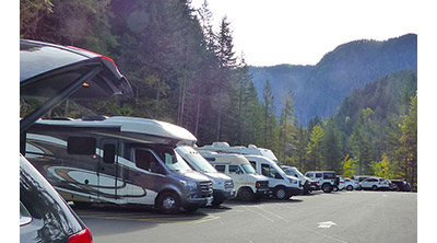
 We deliver right to your door anywhere in Whistler and to all Garibaldi Park trailheads except Diamond Head in Squamish. We will be waiting for you at the trailhead when you arrive or if you are already in Whistler at a house, hotel, condo, etc we will deliver and pick up right to your door. We are happy to deliver to your hotel's Front Desk or Bell Desk before your arrival to make your vacation even more worry free! If you would like the gear delivered the day before so you can pack and prepare, let us know when you book and we will make it happen! Prefer to pick up? We have a 24 hour pick up and drop off location 3 minutes from Whistler Village! 
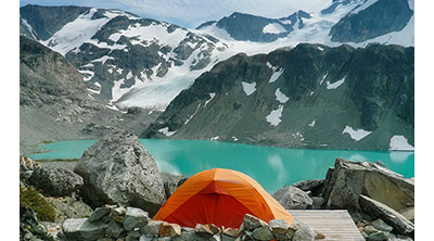
 

Camp in Paradise3. Camp in Paradise

 Hike into paradise and camp in beautiful Whistler and incredible Garibaldi Park. With the best quality and highest rated hiking gear money can buy, you will have the trip of a lifetime. We do all the work and you have all the fun!  We rent the best quality and highest rated gear on the market. MSR tents, Osprey backpacks, MSR WindBurner Stove Systems, Rab Ascent 700 sleeping bags, Therm-a-Rest XTherm MAX sleeping pads, MSR Evo Ascent snowshoes and more. We also rent complete hiking gear kits. We can equip one person, couples or large groups with everything you need except food and water! We are proud to be Whistler's best source for rental hiking gear. We have the best gear, the best prices and best service! 
 

Easy Returns 4. Easy Returns

 When you return from your hike, let us know where and when you'd like us to drop by and pick up the gear. Staying at a hotel? Leave the gear with the Bell Desk or Front Desk. Living in Whistler or staying in an AirBnB, just leave the gear outside your door and text us. We will pick it up and you don't need to wait around. We deliver it to you perfectly clean and don't mind if you return it a mess. We have a precise and methodical cleaning and maintenance process and we go to great lengths to ensure the gear you get is like new. Though we don't have a retail location in Whistler, we do have a convenient 24 hour pick up and drop off location near Whistler Village!


WeRentGear Camping and Hiking Gear Rentals 

We Rent Osprey Atmos AG 65 and Aura AG 65 Packs

Rent Osprey Packs Whistler and Garibaldi ParkWe rent Osprey Atmos AG 65 and Aura AG 65 backpacks. These 65 litre packs are widely regarded as the best and most innovative packs in the world. Perfect for overnight expeditions in the mountains around Whistler and in Garibaldi Provincial Park. They have Osprey's innovative Anti-Gravity™ suspension system which contours to your body providing seamless comfort and excellent mobility. The mesh back separates your back from the pack which allows ventilation and phenomenal comfort. They are designed for a load range of 30-50 pounds or 13-23 kilograms. Some of the features include: Internal compression - Adjustable harness - Internal reservoir sleeve - Compression straps, removable floating top lid, dual zippered front pockets, removable pad straps, Fit-on-the-Fly™ hipbelt, Stow-on-the-Go™trekking pole attachment, FlapJacket™, tool attachment and quite a lot more. The Atmos is designed for males, and the Aura for females. We also carry a range of sizes from large to extra small, so we can get you a perfect fit. Rent Osprey packs for Whistler and Garibaldi Park here...

We Rent MSR Hubba Hubba NX 2 Person Tents
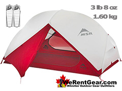
Rent MSR Tents WhistlerWe rent MSR Hubba Hubba NX 2 person tents. One of the highest rated, lightweight, compact and versatile tents on the market. Perfect for overnight expeditions in Whistler and Garibaldi Provincial Park. Designed for backpackers who need a tent that can do it all while still being compact and lightweight, MSR Hubba Hubba 2 person tent feels as light and efficient to use as it does to carry.  From its optimized, symmetrical geometry and non-tapered floor that maximize space, down to its integrated, adjustable stake-out loops that speed setup, this tent redefines lightweight liveability. Ultralight: Very lightweight at just 1.60 kg or 3 lb 8 oz. Maximum Space: Head and elbow room throughout tent; two large side-entry vestibules to store gear. Liveable: Two large StayDry™ doors with built-in rain gutters; adaptable, cross-ventilating rainfly. Easy Setup & Packing: Unified hub-and-pole system with color-coded clips; ultra-compact compression stuff sack. The MSR Hubba Hubba NX is one of the most liveable tents for its weight. The two door design and airy ventilation make it feel like you have tons of space.

...
Read more

Hoary Marmot - Hike in Whistler Glossary

Garibaldi Park Whistler A to Z: Hoary MarmotHoary Marmots are the cute, pudgy, twenty plus pound ground squirrels that have evolved to live quite happily in the hostile alpine areas around Whistler.  In the northwest of North America, marmots have a distinct grey in their hair, a hoary colour, so have been named hoary marmots. They manage to survive quite happily in the alpine, largely by hibernating for 8 months of the year and largely for having a surprisingly varied array of food in such an inhospitable environment.

Read more

Jane Lakes Hike in Whistler

Jane Lakes Hike RatingJane Lakes are a very remote feeling set of lakes in the beautiful wilderness near Cheakamus Crossing.  Consisting of three lakes, West Jane Lake, East Jane Lake and Little Jane Lake, they have a great network of hiking trails that link and circle them all.  The area has been logged for decades and an old logging road once led to West Jane Lake.  Many years ago, you could have driven a 4x4 all the way to lake.  In recent years the growing forest narrowed the old road into an overgrown trail.

Read more

Joffre Lakes Snowshoeing Whistler

Joffre Snowshoe RatingJoffre Lakes Provincial Park is a hiking paradise in the summer and a skiing and snowshoeing paradise in the winter.  About 1 hour and 20 minutes north of Whistler gets you to the Joffre Lakes trailhead.  Located up on the Duffy Lake Road north of Pemberton, Joffre Lakes is well known for its incredibly surreal, turquoise water.  In the winter of course, all three of the Joffre Lakes are frozen over but the trail is popular with skiers and snowshoers between the months of November and April.

Read more

Keyhole Falls - Best Whistler Waterfalls

Best Whistler Waterfalls - Keyhole FallsMount Meager erupted here 2400 years ago and filled the valley with debris that cemented into rock that blocked Lillooet River.  Eventually water erosion cut a channel through the breccia dam, and Keyhole Falls were born.  The trail to Keyhole Hot Springs shows you plenty of examples of breccia, which is larger pieces of angular rock cemented together with small particles or a mineral cement that forms these marvels.

Read more

Keyhole Hot Springs - Whistler Hiking Trails & Maps

Keyhole Hot Springs RatingKeyhole Hot Springs (aka Pebble Creek Hot Springs) is located 100 kilometres from Whistler (Village Gate Blvd). Though much of the drive to Keyhole is on logging roads, the route is driveable by most cars without any trouble. The massive Innergex hydroelectric project turned this once quiet wilderness into a war-zone in recent years. On the plus side, the old logging roads near Keyhole Hot Springs are now well maintained and smooth.

Read more

Krummholz - Hike in Whistler Glossary

Garibaldi Park Whistler A to Z: KrummholzWhen you hike in the alpine in Whistler and Garibaldi Provincial Park, you will often encounter unbelievably hardy and sometimes mangled looking trees.  Weathering high winds, freezing temperatures, deep snow and usually growing where most other things can't.  These weather battered trees are called krummholz.  Krummholz is a German derived word that comes from two words, krumm and holz.  Krumm means bent, crooked, twisted and holz means wood.

Read more

Lakeside Park in Whistler

Whistler Parks and Lakes IconLakeside Park on the shore of Alta Lake in Whistler is a beautiful beach park just a short distance from Whistler Village.  Located on the Valley Trail, it is just 2 kilometres or a 30 minute walk, or 10 minute bike ride away.  Similar to the popular Rainbow Park across the lake, Lakeside has a concession stand for food and drinks, picnic tables, BBQ stands, canoe and kayak rentals a huge grass field, pier, a sandy beach and an elaborate little kids play are.

Read more

Live Whistler Webcams

Whistler WebcamsThere are plenty of amazing webcams in Whistler set up by the Mountain and the Municipality of Whistler.  On Whistler Mountain there are several webcams that update images every few minutes from the summit of Whistler Mountain and down at the Roundhouse Lodge.  On Blackcomb Mountain there are several more webcams at Rendezvous Lodge that point in six different directions, completing a panoramic view.  

Whistler & Garibaldi Hiking

Easy Hiking Trail WhistlerAlexander Falls  Moderate Hiking Trail Whistler Dog FriendlyAncient Cedars  Moderate Hiking Trail WhistlerBlack Tusk  Pay Use Hiking Trail WhistlerBlackcomb Mountain  Easy Hiking Trail WhistlerBrandywine Falls  Moderate/Hard Hiking Trail Whistler Dog FriendlyBrandywine Meadows  Moderate/Hard Hiking Trail Whistler Dog FriendlyBrew Lake  Easy Hiking Trail WhistlerCallaghan Lake  Moderate Hiking Trail WhistlerCheakamus Lake  Whistler Hiking Trail EasyCheakamus River  Whistler Hiking Trail HardCirque Lake  Whistler Hiking Trail EasyFlank Trail  Moderate Hiking Trail WhistlerGaribaldi Lake  Moderate Hiking Trail WhistlerGaribaldi Park  Moderate Hiking Trail WhistlerHelm Creek  Moderate Hiking Trail Whistler Dog FriendlyJane Lakes  Joffre Lakes Hike in Whistler in SeptemberJoffre Lakes  Moderate Hiking Trail Whistler Dog FriendlyKeyhole Hot Springs  Hiking Trail Hard Dog FriendlyLogger’s Lake  Whistler Hiking Trail EasyMadeley Lake  Moderate/Hard Hiking Trail Whistler Dog FriendlyMeager Hot Springs Easy Hiking Trail WhistlerNairn Falls  Whistler Hiking Trail HardNewt Lake Moderate Hiking Trail WhistlerPanorama Ridge  Whistler Hiking Trail EasyParkhurst Ghost Town  Hiking Trail Hard Dog FriendlyRainbow Falls  Moderate Hiking Trail WhistlerRainbow Lake  Moderate/Hard Hiking Trail Whistler Dog Friendly

...
Read more

Lodgepole Pine Trees in Whistler

Garibaldi Park Whistler A to Z: NunatukAlong Whistler’s Valley Trail near Rainbow Park you come across some impressively unusual trees. Unlike most other Whistler trees with straight trunks and slender branches, these lodgepole pines have wide gnarled trunks and magnificently huge, muscular branches. The branches of are of various sizes, ranging from very thick and long to enormous and long enough to disappear into the forest canopy. The more impressive branches emerge from the trunk nearly horizontal, then abruptly bend skyward.

Read more

Logger's Lake - Best Whistler Aerial Views

Whistler Aerial ViewsLogger’s Lake is an amazing little lake hidden up in the deep forest above the more well known Cheakamus River. The lake, almost unbelievably exists in a long extinct volcano. However, as soon as you see the lake up close, you quickly come to believe it. The lake sits in a beautifully volcano-shaped bowl, with one side of the bowl a crumbling array of huge, cube shaped boulders leading down to, and spilling into the lake.

Read more

Lost Lake 6k Run in Whistler

Whistler Running Easy Dog FriendlyThe Lost Lake 6k is a nice 6 kilometre(3.7 mile) running route that takes you from Whistler Village out and around Lost LakeLost Lake, along with the Whistler Golf Course 5k trail run are two of the most convenient and scenic trail runs adjacent to Whistler Village.  Both can be started in Whistler Village and both have almost constant views and easy to follow routes.  Depending on where you are in the Village you can access the Lost Lake Park via many different directions, however the Fitzsimmons Trail between Lot 1 and Lot 2 is possibly the nicest.

Read more

Lost Lake Park in Whistler

Whistler Parks and Lakes IconLost Lake is a tranquil and secluded lake that hides in the forest extending from Whistler Village.  Just a 20 minute, leisurely walk or 5 minute bike ride along the well signed Valley Trail will lead you to this beautiful little lake.  The wide and paved Valley Trail turns into a wide and gravel trail as you enter Lost Lake Park and.  Trails circle the lake and extend in all directions. 

Read more

Madeley Lake - Best Whistler Aerial Views

Whistler Aerial ViewsMadeley Lake is a beautiful, remote mountain lake hidden high up in the Callaghan Valley.  From Whistler Village expect to take 40 minutes to drive there.  You can drive directly to the lake, however the access road is pretty bad with deep waterbars.  An average 4x4 can make it quite easily, though most cars with have great difficulty driving over the numerous deep water cut gouges in the road.  

Read more

Madeley Lake Access

September 5th, 2022: Madeley Lake is a stunning wilderness lake high up in the Callaghan Valley that is easily accessible by a decades old logging road.  Until 2020, you could drive all the way to the end of the lake and walk the short trail to the old campsite nestled in the forest.  This little corner of paradise has been included in area granted to be part of Whistler Olympic Park built for the 2010 Winter Olympics.  

Read more

Meadow Park in Whistler

Whistler Parks and Lakes IconMeadow Park is a huge recreation area in Whistler that has a hockey rink, huge gym, swimming pool, squash courts, baseball diamonds, tennis courts, basketball courts, ball hockey court and a wonderfully elaborate kids play park.  Meadow Park is wonderfully located along the River of Golden Dreams, a cute little, slow, winding river that connects Alta Lake and Green Lake.

Read more

Moraine - Hike in Whistler Glossary

Garibaldi Park Whistler A to Z: KrummholzMoraines are glacially deposited ridges of debris that accumulate at the sides or terminus of a glacier.  Lateral moraines form at the sides of glaciers and terminal moraines at the terminus of a glacier.  Terminal moraines mark the maximum advance of a glacier.  Moraines are made up of glacial debris ranging in size from enormous boulders to fine glacial flour.  Boulders and rocks in moraines are generally rounded due to the churning and grinding within the glacier as it moved.

Read more

Mount James Turner - Hike in Whistler Glossary

Garibaldi Park Whistler A to Z: Mt James TurnerIf you make it to the summit of Wedge Mountain you will notice off in the distance a beautifully symmetrical mountain that stands out among the rest.  Surrounded by glaciers on all sides, Mount James Turner has an almost to perfect cone shape to it.  The third highest mountain in Garibaldi Provincial Park at 2703 metres(8868 feet), it is only surpassed by Wedge Mountain at 2892 metres(9488 feet) and Wedge's neighbour Mount Weart 2835 metres(9301 feet).

Read more

Mountain Hemlock Trees in Whistler

Garibaldi Park Whistler A to Z: NunatukMountain hemlock is a species of hemlock that thrives along the west coast of North America from Alaska to California. In Whistler and Garibaldi Park you will encounter them high up on the mountains in subalpine areas battered by harsh winters. If you encounter a brutalized, yet strangely beautiful tree mangled by long winters, it is a good chance it is a mountain hemlock. Trees that have a weather worn, twisted appearance are known as krummholz, and the mountains around Whistler have plenty of these extraordinary trees.

Read more

Nairn Falls Snowshoeing Whistler

Nairn Falls RatingNairn Falls Provincial Park is located just a twenty minute drive north of Whistler Village.  There is a nice, relaxing 1.2 kilometre hiking/snowshoeing trail that runs along Green River to a gorgeous viewing area in the midst of Nairn Falls.  The popular trail is actually hike-able year-round, so you most likely will not need your snowshoes unless there has been lots of new snow in the last couple days.  The trail is well marked and doesn't gain any significant elevation, making it a very easy, kid friendly trail. 

Read more

Neal Carter Mountaineer

Garibaldi Park Whistler A to Z: Mt James TurnerNeal Carter (14 Dec 1902 – 15 Mar 1978) was a mountaineer and early explorer of the Coast Mountains primarily in the 1920’s and 1930’s. Astoundingly skilled as a mountaineer, Carter also excelled at cartography and surveying which he used to map the vast unnamed and unexplored mountains of BC. He named a staggering number of mountains and alpine features, as well as making at least 25 first ascents, many around what we now call the Whistler Valley. 

Read more

Newt Lake Hike in Whistler

Newt Lake Hike RatingNewt Lake is cute little hidden lake high up on the far side of Cougar Mountain near Ancient Cedars.  Its location is a wonderful mix of unexpected characteristics that combine to make it a gorgeous place to see, as well as an unforgettable place to spend the night.  The lake itself is comparatively small, but its irregular shape, deep water and dramatically varied topography make it seem pretty big.  The terrain around the lake is chaotic combination of monstrous boulders, rocky cliffs and weather battered forest.

Read more

Nita Lake Park in Whistler

Whistler Parks and Lakes IconNita Lake is a tranquil little lake located in Creekside, just 4 kilometres south of Whistler Village.  Whistler's beautiful Valley Trail runs right along the edge of Nita Lake and continues past the beautiful Nita Lake Lodge.  A small gravel beach with a creek flowing through it gives the park consistently good fishing.  Two picnic tables sit in a forest clearing next to the creek.  At the end of the lake there are two piers.  One is a public pier and the other is for Nita Lake Lodge guests.

Read more

No Car? No Problem!

No Car No Problem IconWhistler as a resort has a wonderful car-free core. The Village Stroll runs through the heart of Whistler Village and is entirely car free. If you are visiting Whistler or living here and you don't have a car, it's no problem. On foot or on a bike you can travel the extensive network of non-motorized trails. 

Read more

Northair Mine in Callaghan Valley, Whistler

Garibaldi Park Whistler A to Z: Northair MineNorthair Mine is wonderful, hidden world high up in Callaghan Valley.  It was a gold mine run by the Northair Group from 1976 until was abandoned in 1982 due to waning profitability and slumping gold prices.  The buildings and construction equipment were removed, leaving only the cement foundations and a scattering of metal cables.  For decades the foundations and surrounding area remained untouched except for the occasional visitor to the old ruins or the nice lake beside it. 

Read more

Northair Mine Murals

November 18th, 2022: Way up in the Callaghan Valley on the back side of Mount Sproatt is an abandoned gold mine.  Old cement foundations and two unexpectedly beautiful lakes mark the location of Northair Mine, abandoned in 1982.  For about five years it was a fairly productive gold mine that extracted five tons of gold.  Largely forgotten for years, in the last decade it has come to life in stunning colour by graffiti artists and professional muralists.

Read more

Nunatuk - Hike in Whistler Glossary

Garibaldi Park Whistler A to Z: NunatukNunatuk: a rock projection protruding through permanent ice or snow.  Their distinct appearance in an otherwise barren landscape often makes them identifiable landmarks.  Nunatuks are usually crumbling masses of angular rock as they are subject to severe freeze/thaw periods.  There is a very prominent nunatuk on Wedgemount Glacier, high up near the summit of Wedge Mountain.  Another nunatuk once stood down the glacier near Wedgemount Lake, however the glacier retreated above it several years ago.

Read more

Nurse Log and Nurse Stump

Garibaldi Park Whistler A to Z: NunatukSurprisingly often in Whistler's forests you will find a tree growing on an old fallen tree or out of a decaying tree stump. Decaying logs and stumps in the forest actually give new trees some interesting survival advantages. Though a tree stump or log appears to be an inhospitable place for a new tree to grow, the opposite is actually true for a bunch of not so obvious reasons. Known a nurse log or nurse stump the fallen or cut down and removed tree opens some of the forest canopy and allows more sunlight in.

Read more

Pacific Yew or Western Yew

Garibaldi Park Whistler A to Z: NunatukThe Pacific yew or western yew is a coniferous tree that grows in Whistler and along the coast from Alaska to California. The Pacific yew’s unique appearance stands out among other more numerous and commonly known trees. The trunk is often contorted in angular directions toward gaps in the forest canopy and the branches are extremely long and sinewy. Branches tend to stretch toward the light and needles tend to only grow near the ends where light is found.

Read more

Paper Birch or White Birch

Garibaldi Park Whistler A to Z: NunatukPaper birch, also known as white birch is a type of birch tree that grows in northern North America. Named for its paper-like, white or cream coloured bark that easily peels off in large white, horizontal sheets. Leaves are rounded at the base and with a pointed tip and have a length ranging from 5-12cm or 2-5 inches. Wood is excellent for firewood and pulpwood. The bark is particularly flammable. Usually grow to 20 metres (66 feet), but have been known to grow at tall as 40 metres (130 feet).

Read more

Parkhurst Ghost Town Snowshoeing Whistler

Parkhurst Snowshoe RatingAt the north end of Green Lake hides one of the most unusual, interesting and scenic snowshoe trails in Whistler, Parkhurst Ghost Town.  From the 1920’s to 1950’s a small logging town with several dozen houses and a sawmill, the town quickly vacated in 1956 when the sawmill ceased operating.  Decades of snowy winter crushed the old sawmill and all but two of the old houses.  Various types of logging machinery, old vehicles, trucks, Caterpillar tractors and a Cletrac tractor lay in the forest unmoved for almost seventy years. 

Read more

Parkhurst Ridge in Parkhurst Ghost Town, Whistler

Garibaldi Park Whistler A to Z: NunatukParkhurst Ridge is an incredible place for a lot of reasons.  Of course, the view is spectacular with Green Lake's absurdly vivid green coloured water.  Snowy mountains all around.  Wonderfully varied clifftop terrain with easily accessible cliff plateaus leading like giant steps down to the water.  The forest on the ridge is sparse enough to be always sunny, but with plenty of trees to make it feel secluded.

Read more

Plow Tree in Parkhurst Ghost Town, Whistler

Garibaldi Park Whistler A to Z: NunatukHidden in the tangle of forest along Green Lake where the old Parkhurst Sawmill once operated, is the bizarre and beautiful Parkhurst Plow Tree.  A very large aspen has managed to grow, probably since 1956, through a big triangular gap in a huge, 4 ton steel tractor plow.  Spilling over the top of the plow, the bark of the aspen has molded itself over the plow and has grown to a width about twice the size of the gap within the plow. 

Read more

Rainbow Falls Snowshoeing Whistler

Rainbow Falls Snowshoe RatingRainbow Falls is a fantastic way go get yourself into some deep snow quickly from Whistler Village.  The short 2.2 kilometre, winding, and ever-changing loop trail to Rainbow Falls partly overlaps the Rainbow Trail which continues on to Rainbow Lake.  The trailhead is marked as the Rainbow Trail, and the trail quickly ascends into the forest winding left, right, up and down almost constantly.  Twentyone Mile Creek can always been seen or heard as you snowshoe through the forest to the somewhat hidden Rainbow Falls.

Read more

Rainbow Lodge - Hike in Whistler Glossary

Garibaldi Park Whistler A to Z: Mt James TurnerRainbow Lodge was a popular wilderness lodge in the small community called Alta Lake, and what would eventually be called Whistler  It was a fishing and relaxing destination and easily accessible from Vancouver via the train route that counted it as one of the main train stations in the valley.  Open by Alex and Myrtle Philip in 1914, Rainbow Lodge brought tourism to a sparsely inhabited region populated mostly by loggers and miners. 

Read more

Rainbow Park Snowshoeing Whistler

Rainbow Park Snowshoe RatingRainbow Park is one of the hugely popular swimming beaches in Whistler in the summer.  In the winter it is a spectacular vantage point across Alta Lake to Whistler Mountain and Blackcomb Mountain.  The beautiful ski run lines snake down the mountains and by December Alta Lake is usually completely frozen.  Hockey games occur at various spots on the lake and the Valley Trail leading to and from Rainbow Park is buried in snow and unplowed all winter.  When the heavy snow of December comes, the valley trail becomes a snowshoeing and cross country ski trail.

Read more

Sawmill Site in Parkhurst Ghost Town, Whistler

Garibaldi Park Whistler A to Z: NunatukThe sawmill at Parkhurst operated on the triangle of land that juts out into Green Lake and also extended north between the train tracks and the lake.  The old sawmill was almost certainly crushed under heavy snow in the years following its closure in 1956.  With the town abandoned there were no caretakers to maintain any of the old structures and the crushing weight of spring snow eventually flattened all but two of the old houses and the sawmill buildings.

Read more

Scree or Scree Slope - Whistler Glossary

Garibaldi Park Whistler A to ZScree: from the Norse “skridha”, landslide.  The small, loose stones covering a slope. Also called talus, the French word for slope. Scree is mainly formed from the annual freeze/thaw periods of spring and fall, where water seeps into cracks in the rock and expands when freezing.  Scree slopes are a common obstacle or simply part of the scenery around Whistler.  The terrain at Wedgemount Lake is dominated by scree slopes and a massive erratic field around the lake.

Read more

Shannon Falls - Best Whistler Waterfalls

Whistler Area Waterfalls - Shannon FallsShannon Falls towers above Howe Sound at 335 metres as the third tallest falls in BC.  The wonderful, though very short trail winds through a beautiful old growth forest to get to the base of the falls.  From your car to the viewpoint takes only about four minutes.  You can continue along the trail and join with the Stawamus Chief trail which goes to the three marvelous summits of The Chief.

Read more

Sloquet Hot Springs Hike in Whistler

Sloquet Hot Springs RatingSloquet Hot Springs is a wonderfully wild set of shallow, man-made pools fed by a small, all natural, and very hot, waterfall. The pools stretch from the waterfall to the large and crashing Sloquet River. The large, spread out campsite for the hot springs lies a short 5 minute walk from the springs. You have to follow a dark and quickly descending trail toward the crashing river.

Read more

Sproatt East Trail Hike in Whistler

Sproatt East Hike RatingThe Sproatt East trail is a beautifully wild, steep, but relatively short trail to the magnificent, wide open alpine and summit of Mount Sproatt.  Mount Sproatt (1834 metres) towers over Whistler Valley directly across from Whistler Mountain (2181 metres) and Blackcomb Mountain (2436 metres).  There are several routes and trails to access Sproatt and the Sproatt East trail is arguably the shortest and certainly the most convenient from Whistler.

Read more

Still Unresolved Plane Crash in the Callaghan Valley

January 18th, 2023: Alexander Falls, high up in the Callaghan Valley in Whistler has some interesting historical murals and a mysterious plaque. The information board with as short history of the areas surrounding the falls, complete with museum-like pictures of the regions logging history. One depicts, "A Land of Giants" and describes, with photos, how incredibly huge trees were cut down and moved. One picture from 1910, shows 10 men sitting on an enormous, felled tree and looking tiny by comparison.

Read more

Tarn - Hike in Whistler Glossary

Garibaldi Park Whistler A to ZTarn: a small alpine lake.  The word tarn originates from the Norse word tjorn which translates to English as pond.  In the United Kingdom, tarn is widely used to refer to any small lake or pond.  In British Columbia tarn is used specifically for small mountain lakes.  Around Whistler tarns number in the hundreds and many are so small and/or hidden as to remain unnamed.  Russet Lake in Garibaldi Provincial Park could be called a tarn, however its relatively large size dominates the area and the term lake seems more appropriate. 

Read more

Taylor Meadows Snowshoeing Whistler

Taylor Meadows Snowshoe RatingTaylor Meadows, in Garibaldi Provincial Park is an amazing place to snowshoe in the winter near Whistler.  Beautiful snowy meadows surrounded by mountains everywhere you look.  Black Tusk towering in the distance so close and blanketed in wonderful, beautiful snow.  Garibaldi Lake is accessible as well on this snowshoeing hike.  The Taylor Meadows trail forks partway up, left goes to Taylor Meadows, right to Garibaldi Lake.  The trail joins again at the far side of both campsites.

Read more

The Fissile in Garibaldi Provincial Park

Garibaldi Park Whistler A to Z: The FissileThe Fissile is the stunning Matterhorn-looking mountain that is visible from Village Gate Boulevard in Whistler.  Looking up from Village Gate you will see the distant Peak2Peak Gondola spanning Whistler Mountain and Blackcomb Mountain.  In the background distance you will see The Fissile.  In the bright sunshine of summer it will be vibrantly coloured red.  In the evening it turns dark red then fades into an ominous black.  In the winter months, of course, The Fissile is a striking, white pyramid. 

Read more

The Table in Garibaldi Park

Garibaldi Park Whistler A to Z: The TableThe Table is an extraordinary flat-topped mountain located in Garibaldi Park just one kilometre south of Garibaldi Lake.  Sometimes reflexively referred to as Table Mountain, The Table is its commonly used name and distinguishes it from the dozens of mountains worldwide named Table Mountain.  About 12000 years ago, the Cordilleran Ice Sheet covered much of North America with a thickness measured in hundreds of metres.  The Table formed when an erupting volcano forced magma to the surface of the ice and solidified with a strikingly, near-perfect flat surface. 

Read more

Train Wreck Falls - Best Whistler Waterfalls

Best Whistler Waterfalls - Train Wreck FallsWhistler Train Wreck is a hidden little world of brightly graffiti painted, wrecked train cars along a gorgeous stretch of Cheakamus River.  One particularly stunning section of the river, unseen by nearly all visitors to Train Wreck, is the marvelously broad and crashing Train Wreck Falls.  In the past, the falls were easily spotted on the trail to Train Wreck, but with the recent installation of the bridge to Train Wreck, the access trail was redirected.

Read more

Train Wreck Hike in Whistler

Whistler Train Wreck RatingThe trail to Whistler Train Wreck is an easy, yet varied route through deep forest, across a great suspension bridge over Cheakamus River, to a stunning array of wrecked train cars. The trail from your car to the wrecks only takes about 15 minutes, however once you reach one wreck, you see another, then another. There are seven wrecks in total that are spread over an area about 400 metres long.

Read more

Train Wreck Maps

Whistler Hiking Trail RatingThe trail to Whistler Train Wreck is an easy, yet varied route through deep forest, across a great suspension bridge over Cheakamus River, to a stunning array of wrecked train cars. The trail from your car to the wrecks only takes about 15 minutes, however once you reach one wreck, you see another, then another. There are seven wrecks in total that are spread over an area about 400 metres long.

Read more

Usnea or Old Man's Beard

Garibaldi Park Whistler A to Z: UsneaThe pale green shub-like growths hanging from trees in the forests around Whistler is called usnea.  These bushy, coral-like fruticose lichens anchor to bark and branches on trees and hang like tinsel on a Christmas tree.  known as old man’s beard, usnea tends to thrive on dead and dying trees and is can appear to be harming their hosts.  They actually do no harm to trees and prefer dying ones for their lack of sunlight blocking canopy growth. 

Read more

Waterbars and Cross-Ditches

Garibaldi Park Whistler A to Z: Mt James TurnerWaterbar and Cross-Ditch: the purpose of a waterbar or cross-ditch is to capture and redirect surface water from the road and channel it across the road surface beyond the shoulder of the road.  A waterbar differs from a cross-ditch as it collects only road surface water and not water flowing down a ditch line or creek.  Waterbars often form naturally across forest service roads over time by seasonal flooding.  Man-made waterbars are visibly different than natural ones in that they are deeper, straighter and have a berm on the downhill side.

Read more

Wedge Creek in Whistler

Garibaldi Park Whistler A to Z: NunatukWedge Creek cuts through the valley that separates Wedge Mountain and Blackcomb Mountain and empties into Green River near the north end of Green Lake.  Wedge Creek is notable for the mountain pass between Wedge and Blackcomb that runs between it and Billygoat Creek. The original name for the pass, officially adopted in 1930 was Wedgemount Pass, however it was changed in 1957 to Wedge Pass to avoid confusion with nearby Wedgemount Creek which flows from Wedgemount Lake.

Read more

Wedgemount Lake Snowshoeing Whistler

Wedge Snowshoe RatingWedgemount Lake is a steep and difficult hike in the summer when there is no snow.  It doesn't require technical skill, but it is just exhausting.  You gain 1220 metres of elevation in just 7 kilometres(+2 in the winter) and hiking with a heavy pack takes about 2.5 to 3.5 hours to reach the lake.  In the winter, on snowshoes, the Wedgemount Lake trail is considerably harder, as well as a couple kilometres longer owing to the undrivable, snow buried access road. 

Read more

Western Hemlock Trees in Whistler

Garibaldi Park Whistler A to Z: NunatukWestern hemlock (tsuga heterophylla) is a large evergreen coniferous tree that is native to the west coast of North America. Unlike many other trees in Whistler, western hemlocks don't mind growing in the shade, and their tolerance for shade is only surpassed by two other local trees, the Pacific yew and Pacific silver fir. The Pacific yew and the Pacific silver fir are also quite numerous in Whistler and manage to thrive under the taller and more established trees blocking much of the sunlight.

Read more

Western Redcedar Trees in Whistler

Garibaldi Park Whistler A to Z: NunatukWestern redcedar is a very large tree commonly found in the Pacific Northwest. Frequently growing up to 70 metres and with a trunk diameter of 7 metres, they can live well over 1000 years. Specific is tricky to accurately measure on living trees, however, the oldest verified western redcedar was recorded as 1460 years old. The big western redcedars in Whistler's Ancient Cedars forest are thought to be 1000 years old.

Read more

Whistler Hiking News & Blog

Great Snowshoeing This Week!

Hike in Whistler News and Blog10 Jan 2023: what trails are good this week?  Rainbow Falls is a fun and easy 1.1 kilometre(one way) trail to the cute and hidden waterfalls.  They are not huge and impressive, but the trail is fun as it bends and ascends quickly up the forest along Twentyone Mile Creek.  The snow is deep all winter and you almost always need snowshoes to get there.  If you hike a bit further beyond Rainbow Falls you connect to the Flank Trail which crosses Twentyone Mile Creek.  The bridge across is always deeply buried in snow and you always feel like you are in a winter wonderland!  Huge boulders below the bridge are buried in massive pillows of snow and it is quite easy to snowshoe along the creek which crashes through.  You can continue along the Flank Trail and connect back down to the Rainbow trailhead where you started.  This circle route is fantastic and you can easily snowshoe the route un under an hour.

Rainbow Falls Snowshoe Map v13

Snowshoeing the Sproatt East Trail

The Sproatt East trail is another great trail to snowshoe in January.  This trail begins high up in Stonebridge, the neighbourhood across the valley from Whistler Village.  The trailhead begins very high up the side of Mount Sproatt, allowing you to start snowshoeing way up the mountain.  The Sproatt East trail winds through the forest, across several winding bridges, and up to several great views across the valley.  The trail to the summit of Sproatt is a very steep and challenging 5 kilometres, one way.  There are several stunning plateaus along the trail and make worthy destinations on their own.  The second plateau along the trail is just 2.4 kilometres from the trailhead.  Still challenging in the winter with snowshoes, but much easier than going all the way to the summit of Sproatt.  The first plateau is fairly easy and just 1.4 kilometres from the trailhead and still with wonderful views.

Sproatt East Snowshoe Map v2

Best Whistler Hiking and Snowshoe Trails January

Madeley Lake Accessible Again!

Hike in Whistler News and BlogHike in Whistler News: July 28th, 2022: Whistler Olympic Park blocked vehicle access to Madeley lake back in 2020, which meant that you had to hike several kilometres up the ascending logging road to get there.  This year, evidently due to pressure from the public, they have moved the gate much farther up the road to the Hanging Lake trailhead.  It is still about 500 metres from Madeley Lake and well over a kilometre to the Madeley campsite.  At the gate there is a large area for parking and the hike to the lake is not too far.  This is a picture of the new gate and parking area.  On the right you can see the Madeley to Hanging Lake trailhead.

Madeley Lake Trailhead Parking in 2022

Winter 2021/2022 Hiking Gear Rental Sale!

Hike in Whistler News and BlogHike in Whistler News: November 10th, 2021: We are celebrating winter with a huge sale!  25% off everything!  We rent the best hiking gear at the best prices and with the best service.  We deliver and pick up anywhere in Whistler for free.  If you are driving up from Vancouver to go to Garibaldi Provincial Park, we deliver/pickup to the Rubble Creek trailhead for free as well!(on rental bookings over $100).  Let us do all the gear planning, maintenance and cleanup for you!  Pick up your gear at the trailhead and we will pick it up when you are done! We rent everything you could possibly need to hike in Whistler and beyond. We Rent complete hiking kits, so all you need is to bring clothes, food and drinks. All our hiking gear is top quality, ultralight and very expensive.. but not for you. We rent our top quality gear at bargain prices and all summer long we are taking 20% off our already amazingly low prices!

Searching Availability...

Madeley Lake Accessible Again!

Hike in Whistler Blog July 8th 2020 Madeley Lake Accessible AgainHike in Whistler Blog: July 8th, 2020: One of Whistler's most impressive drive-to mountain lakes, Madeley Lake is accessible once again. It appears a large public outcry forced, or at least embarrassed Whistler Olympic Park into opening the gate that was installed in the springtime barring public access. They have also removed the sign on the gate warning that entering the area is considered trespassing. Whistler Sport Legacies managed to gain control over this road in recent years by arguing the necessity to groom it in the winter. Evidently a forest service road cannot be legally groomed for skiing, so granting Whistler Sport Legacies the lease on Madeley Lake Road must have seemed like a harmless decision. To then parlay that decision into blocking the road in the summer to the public seems very dishonest.

Madeley Lake Gate Open

Considerable hiking trail maintenance work in the last few years has gone on around Madeley Lake, which links it to Hanging Lake and Rainbow Lake. Obviously the trail work would not have been done if the trail was to be blocked by Whistler Olympic Park. The most shocking thing about Whistler Sport Legacies installing the gate is that no one seems to have known about it. Continued here...

Madeley Lake Closed?

Read more

Whistler Hiking Trails

Whistler Hiking TrailsHiking in Whistler is spectacular and wonderfully varied. Looking at a map of Whistler you see an extraordinary spider web of hiking trails that are unbelievably numerous. Easy trails, moderate trails and challenging hiking trails are all available. Another marvellous thing about hiking in Whistler is that Garibaldi Provincial Park wraps around it. Whistler Mountain and Blackcomb Mountain push into this massive wilderness park. You can ride a gondola to the alpine of Whistler Mountain and hike for days into Garibaldi Park's stunning heart!

Read more

Whistler Spruce Trees

Garibaldi Park Whistler A to Z: NunatukWhistler spruce is a hybrid of the Sitka spruce and the interior Engelmann spruce. Sitka spruce trees thrive in the rainforests of the Pacific Northwest along the West Coast of North America, whereas Engelmann spruce trees grow in the much drier interior. The Whistler spruce is a fast growing tree that gets impressively large very fast. Possibly the best place to get a good look at big Whistler spruce trees is along the Valley Trail at the end of Lorimer Road.

Read more

Whistler Train Wreck Over the Years

February 1st, 2023: The beautiful murals that make Whistler Train Wreck the magical place it is today began appearing in 2011 when this hidden place was known by just a few Whistler locals.  Artists ranging from aspiring graffiti artists that mostly remain unnamed, to tremendously gifted professional mural artists like Kups.  Kups is a prolific mural artist with stunning works that can be seen all over Whistler and the lower mainland.  One of his hauntingly beautiful murals can be found inside the first boxcar you come to after crossing the bridge into Whistler Train Wreck.

Read more

Whistler Train Wreck Snowshoeing Whistler

Train Wreck Snowshoe RatingThe trail to Whistler Train Wreck is an easy, yet varied route through deep forest, across a great suspension bridge over Cheakamus River, to a stunning array of wrecked train cars. The trail from your car to the wrecks only takes about 15 minutes, however once you reach one wreck, you see another, then another. There are seven wrecks in total that are spread over an area about 400 metres long.

Read more

Whistler's Best Dog Friendly Snowshoe Trails

February 10th, 2023: There are plenty of dog friendly snowshoe trails in Whistler.  They range from easy and quick to get to, to a bit of a drive and a bit more challenging.  Blueberry Park is a wonderful trail just a 2 minute drive from Whistler Village.  You can even walk there in about 20 minutes.  This deep forest park has a great 3 kilometre circle route that takes you up Blueberry Hill and then down along the shore of Alta Lake where you pass by four piers set into the frozen lake.  

Read more

Wye in Parkhurst Ghost Town, Whistler

Garibaldi Park Whistler A to Z: NunatukWhen hiking to Parkhurst Ghost Town, the first area you will encounter after you cross the disintegrating bridge over Wedge Creek is the wye.  In railroad terminology a wye is a large turnaround area which traces a large triangle shape and allows trains to exit the main train tracks and turnaround.  The original wye in the area was Mons Wye located about where the Catholic church at the end of Lorimer Road is today.

Read more

Whistler Hiking Trails

Russet Lake is a surreal little paradise that lays at the base of The Fissile, in Garibaldi Provincial Park. The Fissile is the strikingly bronze mountain visible from Whistler Village.  From the Village ...
Read more
Sloquet Hot Springs is a wonderfully wild set of shallow, man-made pools fed by a small, all natural, and very hot, waterfall. The pools stretch from the waterfall to the large and crashing Sloquet River. The ...
Read more
Hiking and biking trails are so abundant in Whistler that many go unnoticed, neglected or taken for granted.  The Flank Trail is one of these.  Most people in Whistler don't even know about it, but the ones ...
Read more
Blackcomb Mountain holds an impressive and ever growing array of hiking trails. From the moment you arrive at the Rendezvous Lodge, you see hiking trails ascend into the distance. The Rendezvous Lodge is ...
Read more

Vancouver Hiking Trails

The Kitsilano beaches begin as soon as you cross the Burrard Bridge and enter the residential paradise of Kitsilano. Though only this first beach is named ...
Read more
Mount Strachan is part of the trio of mountains, also Black Mountain and Hollyburn Mountain that form a bowl, or Cypress Bowl that give the resort its name.  ...
Read more
Mystery Lake is an easy, well marked trail that leads to a cute mountain lake that is perfect for relaxing, swimming or having a picnic.  It is just 1.5k ...
Read more
This beautifully forested hiking trail is a local favourite running route comparable to the Grouse Grind.  In 4.5k the trail rises 730 metres and hardly ever in ...
Read more

Whistler Snowshoe Trails

At the north end of Green Lake hides one of the most unusual, interesting and scenic snowshoe trails in Whistler, Parkhurst Ghost Town.  From the 1920’s to 1950’s a small logging town with several dozen ...
Read more
The Blueberry Trail is a relatively unknown, though very scenic trail that ascends quickly up to a cliff viewpoint high above Alta Lake.  Another trail hugs the shoreline of Alta Lake through a wonderfully ...
Read more
Cheakamus River is a beautiful, crashing, turquoise coloured river that flows from Cheakamus Lake, through Whistler Interpretive Forest at Cheakamus Crossing, then down past Brandywine Falls to Daisy Lake. ...
Read more
Hiking and biking trails are so abundant in Whistler that many go unnoticed, neglected or taken for granted.  The Flank Trail is one of these.  Most people in Whistler don't even know about it, but the ones that ...
Read more

Hike in Whistler Glossary

Alpine Zone or Alpine Tundra is the area above the treeline, often characterized by stunted, sparse forests of krummholz and pristine, turquoise lakes.  Mount ...
Read more
Mountain hemlock is a species of hemlock that thrives along the west coast of North America from Alaska to California. In Whistler and Garibaldi Park you ...
Read more
The Pacific yew or western yew is a coniferous tree that grows in Whistler and along the coast from Alaska to California. The Pacific yew’s unique ...
Read more
The Fitzsimmons Range is a subsection of the Garibaldi Ranges that covers the area between the valleys of Cheakamus Lake and Fitzsimmons Creek.  Fitzsimmons ...
Read more
When hiking to Parkhurst Ghost Town, the first area you will encounter after you cross the disintegrating bridge over Wedge Creek is the wye.  In railroad ...
Read more
Adjacent to the huge Caterpillar tractor in Parkhurst is a large disintegrating wooden dock that is a great place to take in the wonderful view of Green ...
Read more
The Green Lake Loop is the original trail that runs around the back side of Green Lake.  Before the Sea to Sky Highway was cut through the valley in 1964, ...
Read more
Along the shore of Green Lake, you will find a monstrous old Caterpillar tractor that dates from the 1930’s.  Abandoned here in the 1950’s, it looks as if the ...
Read more

Best Hiking by Month

April in Whistler is a wonderful time of year.  The winter deep freeze ends and T-shirt weather erupts.  The village comes alive with overflowing patios and ...
Read more
May is an extraordinarily beautiful time of year in Whistler.  The days are longer and warmer and a great lull in between seasons happens.  Whistler is fairly ...
Read more
June is a pretty amazing month to hike in Whistler and Garibaldi Park.  The average low and high temperatures in Whistler range from 9c to 21c(48f/70f).  ...
Read more
July is a wonderful time to hike in Whistler and Garibaldi Provincial Park.  The weather is beautiful and the snow on high elevation hiking trails is long ...
Read more

Best of Whistler

Whistler is very dog friendly and the number of wonderful hiking trails that your dog will love is huge. The massively varied hiking trails range from easy, short, ...
Read more
There are plenty of excellent, kid and family friendly hiking trails and destinations in and around Whistler. Kid and family friendly generally means an easy and ...
Read more
Whistler is surrounded by an immense wilderness dotted with spectacular, hidden lakes and amazing places to set up a tent.  Decades of logging activity has left a ...
Read more
Whistler as a resort has a wonderful car-free core. The Village Stroll runs through the heart of Whistler Village and is entirely car free. If you are visiting Whistler or ...
Read more

Hike in Whistler News & Blog

February 1st, 2023: The beautiful murals that make Whistler Train Wreck the magical place it is today began appearing in 2011 when this hidden place was ...
Read More
March 25th, 2023: What trails are good this week?  If you are dying for summer to come, Lillooet Lake is paradise these days.  Just an hours drive north of ...
Read More
February 10th, 2023: There are plenty of dog friendly snowshoe trails in Whistler.  They range from easy and quick to get to, to a bit of a drive and a bit ...
Read More
September 5th, 2022: Madeley Lake is a stunning wilderness lake high up in the Callaghan Valley that is easily accessible by a decades old logging road.  ...
Read More

Best Whistler Waterfalls

Holloway Falls is the beautiful waterfalls you see partway along the Joffre Lakes Provincial Park trail.  Located between Middle Joffre Lake and Upper ...
Read more
Rainbow Falls is located just a short hike from the start of the Rainbow Trail to Rainbow Lake.  The trailhead is along Alta Lake Road on the far side of ...
Read more
Alexander Falls is a very impressive 43 metre/141 foot waterfall just 30 to 40 minutes south of Whistler in the Callaghan Valley.  Accessible year-round, ...
Read more
Nairn Falls is a wonderful, crashing and chaotic waterfall that surrounds you from the deluxe viewing platform that allows you to safely watch it from ...
Read more

Explore BC Hiking Destinations!

Whistler Hiking Trails

Hiking in Whistler is spectacular and wonderfully varied. Looking at a map of Whistler you see an extraordinary spider web of hiking trails that are unbelievably numerous. Easy trails, moderate trails and challenging hiking trails are all available. Another marvellous ...
Read more

Squamish Hiking Trails

Squamish is located in the midst of a staggering array of amazing hiking trails. Garibaldi Provincial Park sprawls alongside Squamish and up and beyond Whistler. Tantalus Provincial Park lays across the valley to the west and the wonderfully remote Callaghan Valley ...
Read more

Vancouver Hiking Trails

Vancouver is surrounded by seemingly endless hiking trails and mountains to explore.  Massive parks line up one after another.  Mount Seymour Provincial Park, Lynn Canyon Park, Grouse Mountain, Cypress Park and the enormous Garibaldi Park all contribute to Vancouver ...
Read more

Clayoquot Hiking Trails

Clayoquot Sound has a staggering array of hiking trails within it.  Between Tofino and Ucluelet, Pacific Rim Park has several wilderness and beach trails, each one radically different from the last.  The islands in the area are often Provincial parks on their own with ...
Read more

Victoria Hiking Trails

Victoria has a seemingly endless number of amazing hiking trails.  Most take you to wild and beautiful Pacific Ocean views and others take you to tranquil lakes in beautiful BC Coastal Rainforest wilderness.  Regional Parks and Provincial Parks are everywhere you turn in ...
Read more

The West Coast Trail

The West Coast Trail was created after decades of brutal and costly shipwrecks occurred along the West Coast of Vancouver Island.  One shipwreck in particular was so horrific, tragic and unbelievable that it forced the creation of a trail along the coast, which ...
Read more