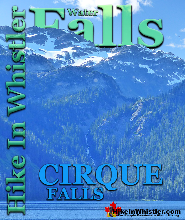
![]() Cirque Falls crashes down from Cirque Lake to Callaghan Lake, connecting these two remarkably beautiful and very different lakes. Where Callaghan Lake is a large, easy to get to mountain lake, Cirque Lake is an extraordinarily serene and hidden lake that takes a bit of planning and effort to get to. Though it is just two kilometres up a steep, yet easily manageable trail, the Cirque Lake trailhead is hidden at the far end of Callaghan Lake.
Cirque Falls crashes down from Cirque Lake to Callaghan Lake, connecting these two remarkably beautiful and very different lakes. Where Callaghan Lake is a large, easy to get to mountain lake, Cirque Lake is an extraordinarily serene and hidden lake that takes a bit of planning and effort to get to. Though it is just two kilometres up a steep, yet easily manageable trail, the Cirque Lake trailhead is hidden at the far end of Callaghan Lake.
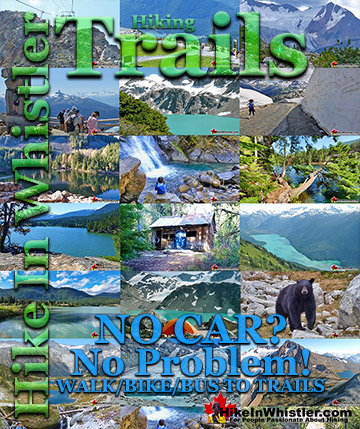
Whistler & Garibaldi Hiking
![]() Alexander Falls
Alexander Falls ![]() Ancient Cedars
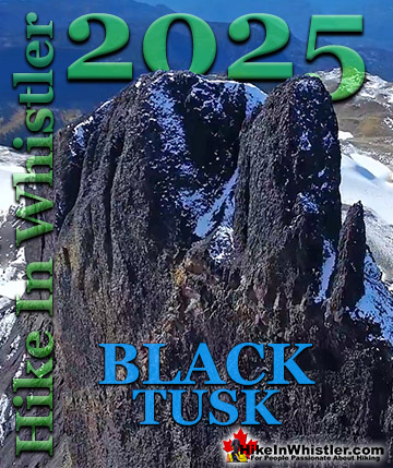
Ancient Cedars ![]() Black Tusk
Black Tusk ![]() Blackcomb Mountain
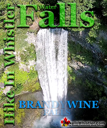
Blackcomb Mountain ![]() Brandywine Falls
Brandywine Falls ![]() Brandywine Meadows
Brandywine Meadows ![]() Brew Lake
Brew Lake ![]() Callaghan Lake
Callaghan Lake ![]() Cheakamus Lake
Cheakamus Lake ![]() Cheakamus River
Cheakamus River ![]() Cirque Lake
Cirque Lake ![]() Flank Trail
Flank Trail ![]() Garibaldi Lake
Garibaldi Lake ![]() Garibaldi Park
Garibaldi Park ![]() Helm Creek
Helm Creek ![]() Jane Lakes
Jane Lakes ![]() Joffre Lakes
Joffre Lakes ![]() Keyhole Hot Springs
Keyhole Hot Springs ![]() Logger’s Lake
Logger’s Lake ![]() Madeley Lake
Madeley Lake ![]() Meager Hot Springs
Meager Hot Springs ![]() Nairn Falls
Nairn Falls ![]() Newt Lake
Newt Lake ![]() Panorama Ridge
Panorama Ridge ![]() Parkhurst Ghost Town
Parkhurst Ghost Town ![]() Rainbow Falls
Rainbow Falls ![]() Rainbow Lake
Rainbow Lake ![]() Ring Lake
Ring Lake ![]() Russet Lake
Russet Lake ![]() Sea to Sky Trail
Sea to Sky Trail ![]() Skookumchuck Hot Springs
Skookumchuck Hot Springs ![]() Sloquet Hot Springs
Sloquet Hot Springs ![]() Sproatt East
Sproatt East ![]() Sproatt West
Sproatt West ![]() Taylor Meadows
Taylor Meadows ![]() Train Wreck
Train Wreck ![]() Wedgemount Lake
Wedgemount Lake ![]() Whistler Mountain
Whistler Mountain
![]() January
January ![]() February
February ![]() March
March ![]() April
April ![]() May
May ![]() June
June ![]() July
July ![]() August
August ![]() September
September ![]() October
October ![]() November
November ![]() December
December
With the massive snowfall and long winters, combined with the rapid, trail-consuming forest growth in BC's Coast Mountains, finding the Cirque Lake trail is mangled, obscured and overgrown. Keeping to the trail and even finding the trailhead would be nearly impossible without the help of Cirque Falls and Cirque Creek. The trailhead, in fact, is so well concealed by the forest that it is completely invisible from the lake. Paddling up to the end of Callaghan Lake and where you assume the trailhead to be leaves you some probable options that entice you away from the actual trailhead. Flatter terrain, gaps in the forest and a more obvious entry point to the forest can be found on the right side of the end of the lake. The left side and middle, you rule out quickly as they are both too steep and the impenetrable wall of the rainforest looks uninviting.


If you park your canoe, kayak, or paddleboard on the enticing right side, you will find a beautiful ancient forest of big trees and few ground level bushes. This wonderful, dark forest you find occasionally is the result of a big, thick ceiling of trees blocking the sunlight and not allowing a thick jungle to grow at the ground level. Instead you step from the lake into the forest and find yourself in a remarkably wide open forest, shielded from the outside world by a wall to the lake and a nearly unbroken ceiling of trees. This area you can immediately see is a gradually sloping valley that ascends up and eventually curves right, leading you to Telemagique Lake and then around and down to Madeley Lake, Whistler Olympic Park and Alexander Falls Provincial Park. This route is rarely done as a hiking route, but frequently done as a ski touring route in the winter. There is even the remains of an old cabin, just steps from the shoreline here that you can't help but visualize standing in this magnificently peaceful, wild and beautiful forest. After a moment, you then wonder how many dozens, or hundreds of these little huts exist in the vast wilderness that stretches for hundreds of kilometres in all directions around the Callaghan Valley and the Whistler Valley.


Though this beautiful forest at the end of Callaghan Lake on the right side is well worth exploring, it is not where you will find the trailhead to Cirque Lake. The key to finding the trailhead and where to park your boat is not something you see, but something you hear. Cirque Falls, though a relatively thin waterfall, is very tall as it crashes down much of the almost two kilometres from Cirque Lake to Callaghan Lake. You will have almost certainly heard Cirque Falls, long before seeing it as you paddle down the lake. It is a odd feeling to hear loud crashing water that must be quite close, yet you are in the middle of a large lake with a clear view in all directions and nothing to explain it. The source is of course Cirque Falls. Halfway down the length of Callaghan Lake from where you started at the boat launch at the campsite, you will pass through the narrowest section of the lake, about a half kilometre wide. This is when you first get a really good look at the far end of the lake, still over a kilometre away. If you focus on the steep cliffs and narrow gap in the mountains in the distance, you will make out the source of the crashing water sound you have been looking for.

Cirque Falls and Cirque Creek make their way down from Cirque Lake to Callaghan Lake in one relatively smooth, yet very steep arc. You can see it emerge from high up in the distance, through the thick forest, then disappear again into the unbroken and pristine looking forest that surrounds Callaghan Lake. Though you will never see the Cirque Lake trailhead until you are right on top of it, you can find it easily by following the sound of crashing water. The trailhead is where Cirque Creek meets Callaghan Lake. There is a gravel bar, built up over the decades and a large fallen tree jutting out into the lake, giving you an unexpectedly easy and convenient exit from the lake. It almost seems purpose built for a canoe to slide alongside and then dragged into the forest where you find the unmarked trailhead and a lovely clearing.

Cirque Creek leads you quickly up through the forest and alongside Cirque Falls. Due to the chaotic terrain and thick forest, generally only hear the falls, though you do catch the occasional glimpse. The falls are not as beautiful as Alexander Falls or Brandywine Falls, but more like a smaller version of Wedgemount Falls. With the exception of from the middle of Callaghan Lake, Cirque Falls is hard to see. You can, however, get close to the top of the falls relatively easily by hiking down from the edge of Cirque Lake. Cirque Lake narrows into a channel, just below the cliffs where the trail first meets the lake. You can scramble down and follow Cirque Creek for a few dozen metres before it steeply descends towards Callaghan Lake.


More Great Hiking in the Callaghan Valley
![]() The Callaghan Valley lays quietly across from Whistler despite being home to some incredible hikes. Ring & Conflict Lake and Cirque Lake are two phenomenal hiking destinations in the valley that few people have even heard of. Cirque Lake resides high above Callaghan Lake at the end of a very steep, though very short hike that runs startlingly close to the almost vertical falls that empty Cirque Lake. Ring & Conflict Lake sit high up in the mountains 10 kilometres west of Callaghan Lake. You will never, or at least comparatively rarely see anyone on the trails to Cirque Lake, Ring & Conflict Lake for several reasons. First is location. Despite the Callaghan Valley being tremendously beautiful geographically. The distant mountains are snow covered, even in September. The lakes are emerald coloured and crystal clear. The forests are an untouched blanket of beautiful green. The creeks, rivers and waterfalls are everywhere in your view or if not in view, heard as distant sounds of running water. Despite this beauty, it seems that the biggest reason for the Callaghan Valley's lack of use as a hiking destination is its location next to Garibaldi Park. The beautiful and well known park focuses all the throngs of hikers in the justifiably popular areas of Garibaldi Lake, Black Tusk, Taylor Meadows, Wedgemount Lake and Elfin Lakes. Laying outside this monstrously famous Provincial Park exists the relatively untouched and unknown Callaghan Valley. The second big reason of course is that the hikes in the Callaghan Valley are unmaintained or at least rarely maintained. The campsite at Callaghan Lake is maintained to a very high standard, however the trail to Cirque Lake evidently doesn't fall into any park jurisdiction and finding the unmarked trailhead is a challenge. There are flagging tapes along the trail after the trailhead. The third reason, at least for Cirque Lake, for being hardly hiked is the fact that the unmarked trailhead starts at the far end of Callaghan Lake. So you need to canoe or otherwise, boat there. This added impediment surely contributes to this wonderful trail, continuing to be infrequently hiked. The fourth, more practical, yet inexplicable reason is that the road to Callaghan Lake Provincial Park is horribly unmaintained. Obviously grading this poor logging road is expensive, however it is beyond neglected. Boulders, waterbars and potholes exist on this road to such a high degree that the neglect seems malicious. In fact, the moment you leave the deluxe road to the Olympic Nordic Centre the monstrous potholes begin, presumably scaring away any 4x4 lacking tourists Callaghan Lake Provincial Park bound. The Callaghan Valley gets a lot of drive in traffic since the recent paving of the road and installation of Whistler Olympic Park for the 2010 Olympics. This road is open year-round and in the summer is frequented by bear watchers. The grass along the road is a favourite for bears and in the summer months consistently ensures at least a couple bears along the route to the Callaghan Valley. Whistler has quite a few beautiful waterfalls to see. From Squamish there is Shannon Falls, then Brandywine Falls closer to Whistler. Rainbow Falls in Whistler and Nairn Falls twenty minutes north. Out of these, Alexander Falls in the Callaghan Valley is both impressively huge and convenient to see. It is located just before the turnoff to Callaghan Lake. You can drive to the viewing platform and actually see the falls without leaving your car.
The Callaghan Valley lays quietly across from Whistler despite being home to some incredible hikes. Ring & Conflict Lake and Cirque Lake are two phenomenal hiking destinations in the valley that few people have even heard of. Cirque Lake resides high above Callaghan Lake at the end of a very steep, though very short hike that runs startlingly close to the almost vertical falls that empty Cirque Lake. Ring & Conflict Lake sit high up in the mountains 10 kilometres west of Callaghan Lake. You will never, or at least comparatively rarely see anyone on the trails to Cirque Lake, Ring & Conflict Lake for several reasons. First is location. Despite the Callaghan Valley being tremendously beautiful geographically. The distant mountains are snow covered, even in September. The lakes are emerald coloured and crystal clear. The forests are an untouched blanket of beautiful green. The creeks, rivers and waterfalls are everywhere in your view or if not in view, heard as distant sounds of running water. Despite this beauty, it seems that the biggest reason for the Callaghan Valley's lack of use as a hiking destination is its location next to Garibaldi Park. The beautiful and well known park focuses all the throngs of hikers in the justifiably popular areas of Garibaldi Lake, Black Tusk, Taylor Meadows, Wedgemount Lake and Elfin Lakes. Laying outside this monstrously famous Provincial Park exists the relatively untouched and unknown Callaghan Valley. The second big reason of course is that the hikes in the Callaghan Valley are unmaintained or at least rarely maintained. The campsite at Callaghan Lake is maintained to a very high standard, however the trail to Cirque Lake evidently doesn't fall into any park jurisdiction and finding the unmarked trailhead is a challenge. There are flagging tapes along the trail after the trailhead. The third reason, at least for Cirque Lake, for being hardly hiked is the fact that the unmarked trailhead starts at the far end of Callaghan Lake. So you need to canoe or otherwise, boat there. This added impediment surely contributes to this wonderful trail, continuing to be infrequently hiked. The fourth, more practical, yet inexplicable reason is that the road to Callaghan Lake Provincial Park is horribly unmaintained. Obviously grading this poor logging road is expensive, however it is beyond neglected. Boulders, waterbars and potholes exist on this road to such a high degree that the neglect seems malicious. In fact, the moment you leave the deluxe road to the Olympic Nordic Centre the monstrous potholes begin, presumably scaring away any 4x4 lacking tourists Callaghan Lake Provincial Park bound. The Callaghan Valley gets a lot of drive in traffic since the recent paving of the road and installation of Whistler Olympic Park for the 2010 Olympics. This road is open year-round and in the summer is frequented by bear watchers. The grass along the road is a favourite for bears and in the summer months consistently ensures at least a couple bears along the route to the Callaghan Valley. Whistler has quite a few beautiful waterfalls to see. From Squamish there is Shannon Falls, then Brandywine Falls closer to Whistler. Rainbow Falls in Whistler and Nairn Falls twenty minutes north. Out of these, Alexander Falls in the Callaghan Valley is both impressively huge and convenient to see. It is located just before the turnoff to Callaghan Lake. You can drive to the viewing platform and actually see the falls without leaving your car.

Complete Hiking and Camping Guide for Cirque Lake

Must See Whistler Waterfalls!
Guides to the Best of Whistler, Garibaldi Park & Sea to Sky!

Explore BC Hiking Destinations!
Whistler Hiking Trails
Squamish Hiking Trails
Vancouver Hiking Trails
Clayoquot Hiking Trails
Victoria Hiking Trails
The West Coast Trail
