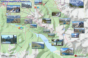
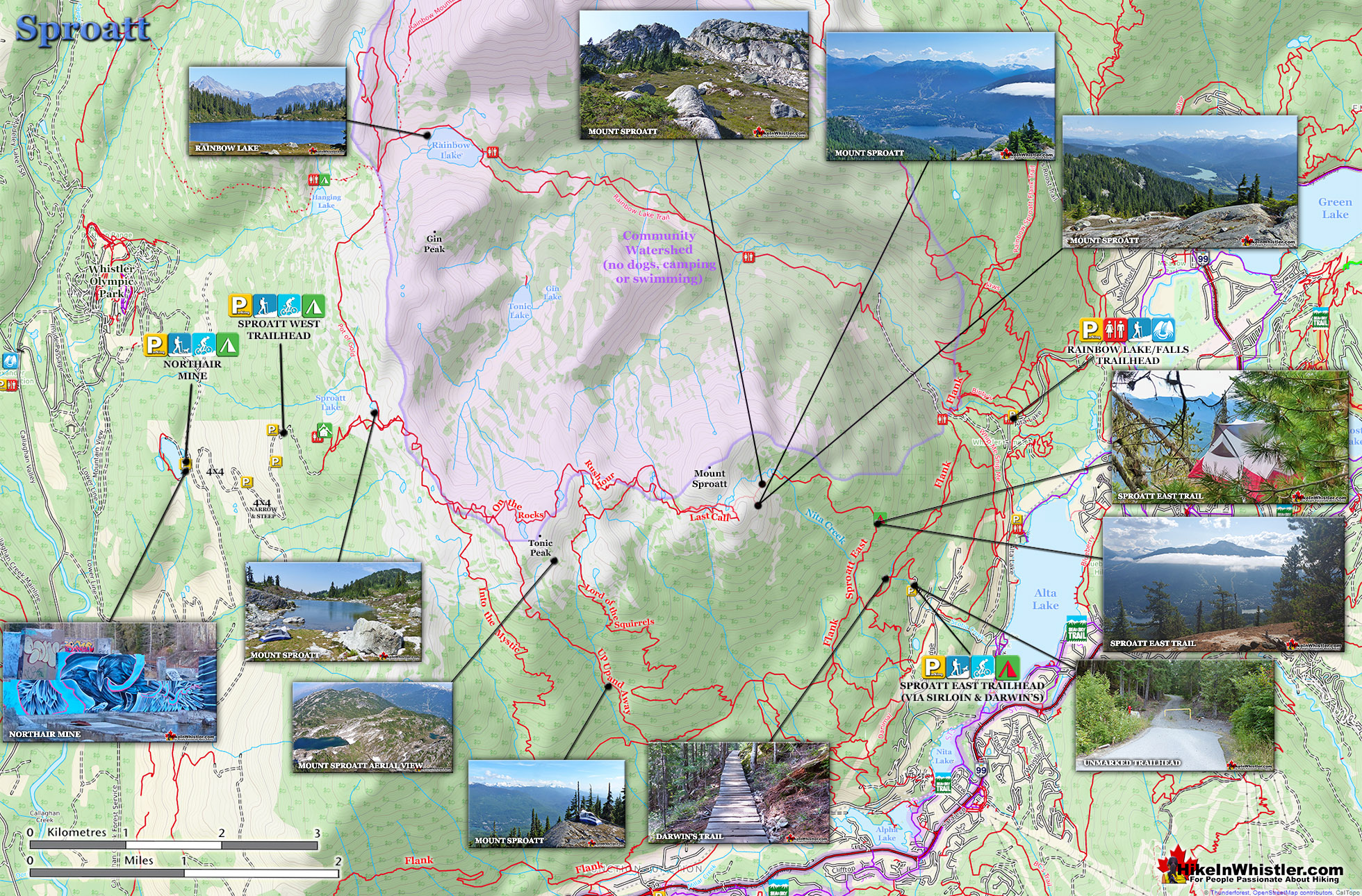
Mount Sproatt, or as it is known locally as just Sproatt, is one of the many towering mountains visible from Whistler Village. Above and beyond Alta Lake, directly across from Whistler Mountain and Blackcomb Mountain, you will see this quiet giant. Its unremarkable appearance hides the growing network of trails that stretch through some startlingly beautiful terrain.
Multiple trailheads & access points
Wild, hostile terrain rarely visited by humans
Connecting trails to Rainbow, Hanging & Madeley
No crowds & endless idyllic tarns to swim
Dozens of perfect spots for a tent
Vast terrain full of adventurous routes
Dog friendly, unlike most Whistler trails
Easy to get lost in the vast alpine
No grand turquoise lakes like Wedge
Need a 4x4 to get to the Callaghan trailhead
Next time you walk through Whistler Village and cross the pedestrian bridge(with Village Gate Boulevard below you), you will see Mount Sproatt in the distance. It is the rocky giant, abruptly steep on one end and gently sloping on the other. At its summit you may be able to make out the small weather recording structure. What you can't see from Whistler Village is the extraordinarily beautiful alpine paradise that lays beyond it. Lakes and tarns everywhere you look. Fields of alpine flowers and wonderfully mangled, yet strikingly beautiful forests of krummholz. Hostile looking fields of boulders and absurdly placed erratics the size of trucks. Beyond, of course, endless stunning view of distant, snowy mountains. From the towering elevation of much of the Sproatt trail network you look across or even down on distant mountains. Rainbow Mountain looks incredible from much of the trail. Four teeth-like, jagged grey peaks in a row that face you from Rainbow Mountain, just 5 kilometres away look enormous.
Sproatt West(Northair) Trail Map
A couple kilometres closer you spot Hanging Lake and the Lord of the Rings style valley that stretches 2 kilometres from its shores to the abrupt cliffs at your feet. Several times along the trail you see the clearly defined ski runs on Whistler Mountain and Blackcomb Mountain and once in a while you can spot Alta Lake and Whistler Village. Though a hive of snowmobile and ski/riding activity in the winter and spring, Sproatt is infrequently hiked in the summer.
The alpine hiking trails on Whistler Mountain are the ultimate in luxurious hiking. Little hiking effort gets you amazing views of turquoise lakes, snowy mountain, valleys of ...
Ring Lake is a fantastically serene and wonderfully remote lake similar to Cirque Lake, but considerably farther to hike to reach it. The 10 kilometre(6.2 mile) hike takes you ...
Mount Sproatt, or as it is known locally as just Sproatt, is one of the many towering mountains visible from Whistler Village. Above and beyond Alta Lake, directly across ...
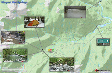
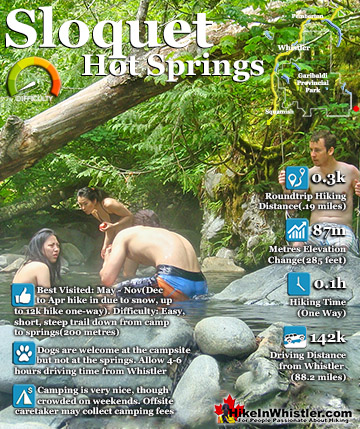
Sloquet Hot Springs is a wonderfully wild set of shallow, man-made pools fed by a small, all natural, and very hot, waterfall. The pools stretch from the waterfall to the ...
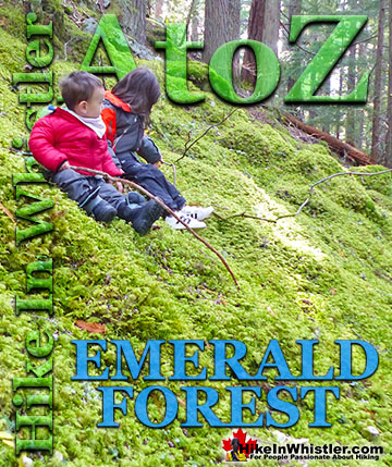
Emerald Forest is a cute little forest that is well hidden between Whistler Cay and Alpine. From Whistler Village, if you go down to the end of Lorimer ...
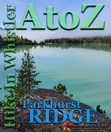
Parkhurst Ridge is an incredible place for a lot of reasons. Of course, the view is spectacular with Green Lake's absurdly vivid green coloured water. ...
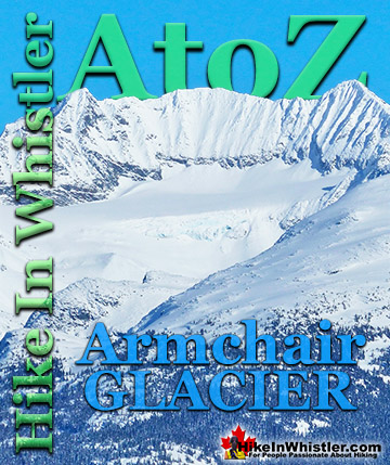
Armchair Glacier is one of the many easily identifiable mountain features around Whistler. Along with Wedge Mountain and Black Tusk, Armchair Glacier has a ...
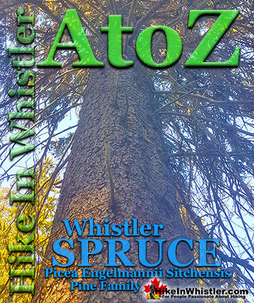
Whistler spruce is a hybrid of the Sitka spruce and the interior Engelmann spruce. Sitka spruce trees thrive in the rainforests of the Pacific Northwest ...
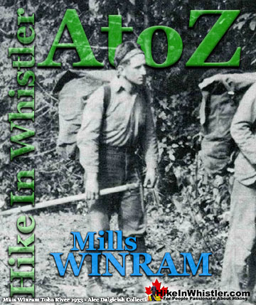
Mills Winram was a very active mountaineer from Vancouver with some very notable ascents in the 1920's and 1930's. He, along with Fred Parkes and Stan ...
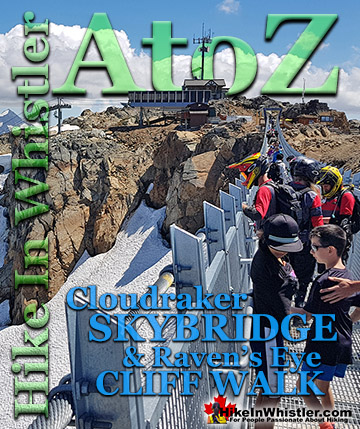
The Cloudraker Skybridge and the Raven’s Eye Cliff Walk are new additions to the summit of Whistler Mountain. The Cloudraker Skybridge stretches 130 ...
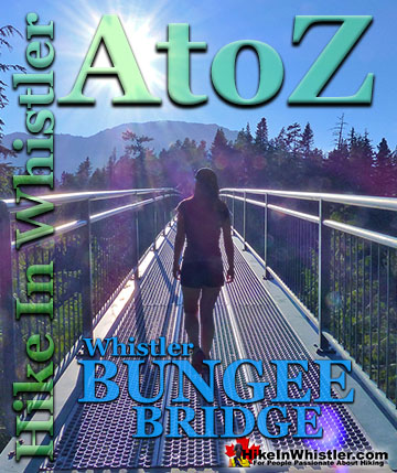
Whistler Bungee Bridge, also known as the Cheakamus Bungee Bridge is a very convenient and beautiful attraction on the way to or from Whistler from ...
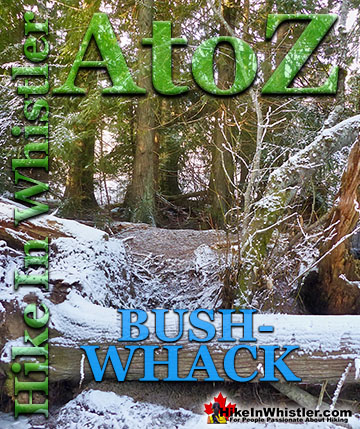
Bushwhack is a term often used in Canada and the United States to refer to hiking off-trail where no trail exists. Literally means 'bush' and 'whack'. To ...
Sloquet Hot Springs is a wonderfully wild set of shallow, man-made pools fed by a small, all natural, and very hot, waterfall. The pools stretch from the waterfall to the large and crashing Sloquet River. The ...
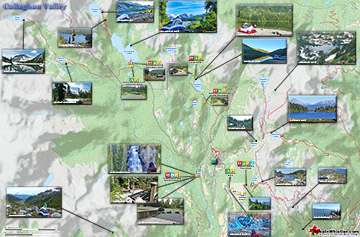
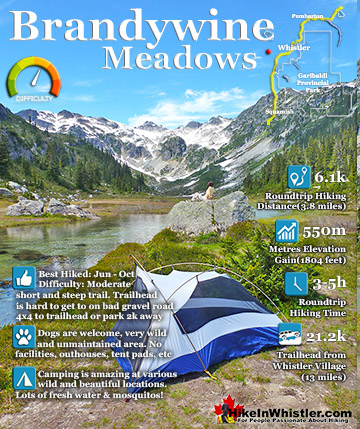
Brandywine Meadows is a nice, relatively short hike to a massive flower filled valley high up in Callaghan Valley. Located 40 minutes south of Whistler, this tough and sometimes muddy trail gains a huge 550 ...
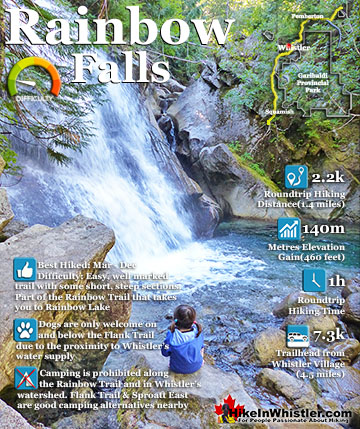
The short, winding, and ever-changing hiking trail to Rainbow Falls is the same as the much more popular trailhead for Rainbow Lake. The trailhead is marked as the Rainbow Trail, and the trail quickly ...
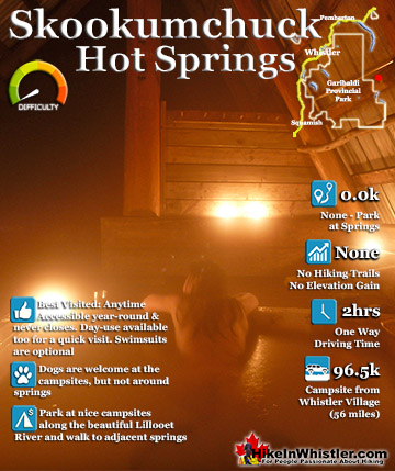
Skookumchuck Hot Springs(aka T'sek Hot Springs and St. Agnes Well), located two hours north of Whistler along the edge of the huge Lillooet River. The name Skookumchuck means "strong water" in the language ...
 Multiple trailheads & access points
 Easy to get lost in the vast alpine