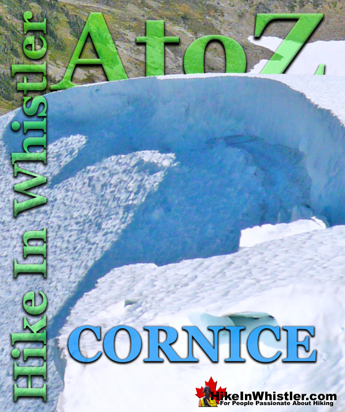
Cornice: a wind deposited wave of snow on a ridge, often overhanging a steep slope or cliff. They are the result of snow building up on the crest of a mountain. Cornices are extremely dangerous to travel on or below. A common refrain of climbers is that if you can see the drop-off of a cornice, you are too close to the edge. Cornices are dangerous for several reasons. They can collapse from hiking across or they can collapse from above.
A third danger to consider is the fact that they can often trigger a massive avalanche that extends a considerable distance from its starting point. The cornice shown in the above and below images are of Panorama Ridge in Garibaldi Provincial Park, Whistler. Panorama Ridge is easily one of the most amazing hikes in Garibaldi Provincial Park. The 15 kilometre hike from the trailhead at Rubble Creek to Panorama Ridge takes you through beautiful and deep forests, across countless idyllic streams, through meadows filled with flowers, and past dozens of jaw dropping viewpoints. The amazing views start once you reach Taylor Meadows and get even more spectacular as the trail progresses. Once you arrive at Panorama Ridge and its phenomenal vantage point, high above Garibaldi Park, you will stare in wonder. Mesmerized first by Garibaldi Lake, far below you and looking unnaturally blue, the lake looks amazing surrounded by green, untouched wilderness and snow capped mountains. The main trailhead for Panorama Ridge is at Rubble Creek, 25 kilometres south of Whistler Village on the Sea to Sky Highway you will see a Garibaldi Park sign indicating the turnoff. From the highway a paved road runs for 2 kilometres to the Rubble Creek trailhead and parking area. This is the most popular and close trailhead for Garibaldi Lake, Taylor Meadows and Black Tusk as well as Panorama Ridge.
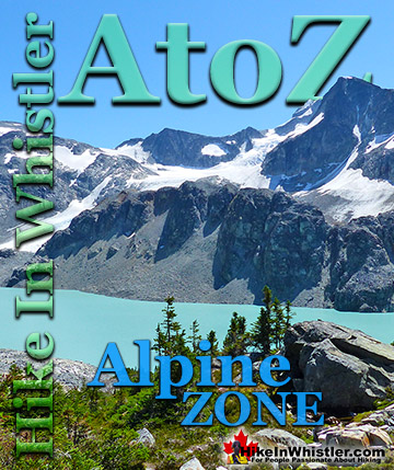
More Whistler & Garibaldi Park Hiking A to Z!
If you make it to the summit of Wedge Mountain you will notice off in the distance a beautifully symmetrical mountain that stands out among the rest. ...
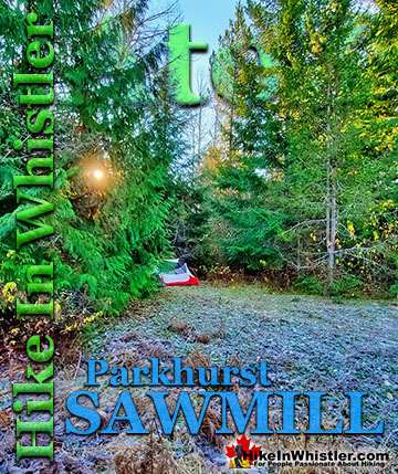
The sawmill at Parkhurst operated on the triangle of land that juts out into Green Lake and also extended north between the train tracks and the lake. The ...
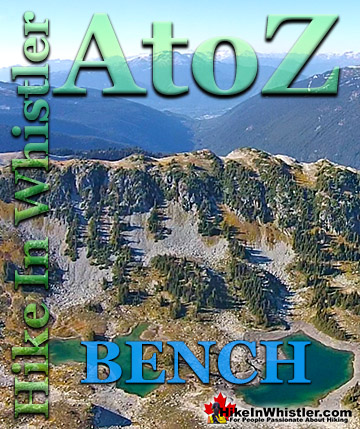
Bench: a flat section in steep terrain. Characteristically narrow, flat or gently sloping with steep or vertical slopes on either side. A bench can be ...
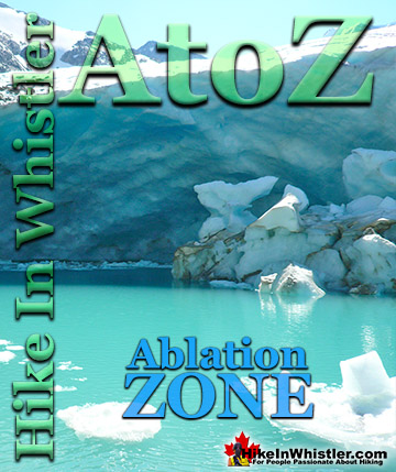
Ablation Zone: the lower altitude region of a glacier where there is a net loss of ice mass due to melting, sublimation, evaporation, ice calving or ...
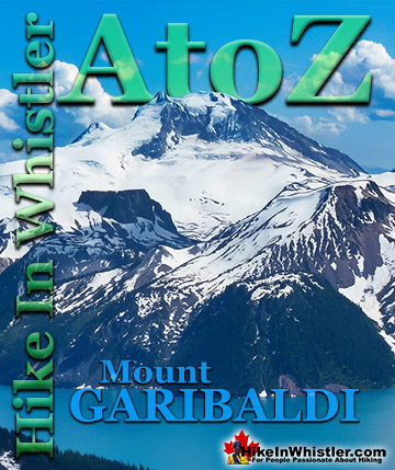
Mount Garibaldi is the huge, potentially active volcano that Garibaldi Provincial Park is named after. Mount Garibaldi also lends its name to the Garibaldi ...
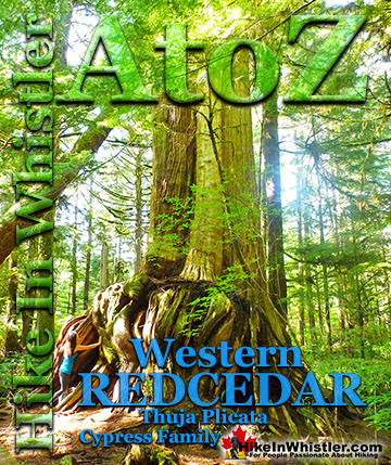
Western redcedar is a very large tree commonly found in the Pacific Northwest. Frequently growing up to 70 metres and with a trunk diameter of 7 metres, ...
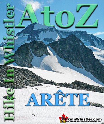
Arête: a thin ridge of rock formed by two glaciers parallel to each other. Sometimes formed from two cirques meeting. From the French for edge or ridge. Around ...
Alpine Zone or Alpine Tundra is the area above the treeline, often characterized by stunted, sparse forests of krummholz and pristine, turquoise lakes. Mount ...
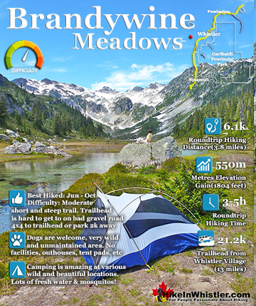
Brandywine Meadows is a nice, relatively short hike to a massive flower filled valley high up in Callaghan Valley. Located 40 minutes south of Whistler, this tough and sometimes muddy trail gains a huge 550 ...
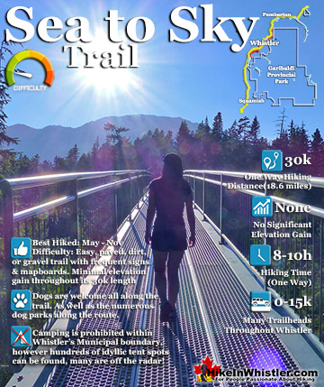
The Sea to Sky Trail is a 180 kilometre multi-use trail that runs from Squamish to D'Arcy. The trail is still under construction in many parts, however, the amazing route through Whistler is finally in ...
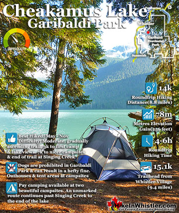
Cheakamus Lake is a wonderfully relaxing way to get in the wilderness easily and quickly from Whistler Village. The trail begins on the far side of Whistler Mountain, 8 kilometres from the Sea to Sky Highway ...
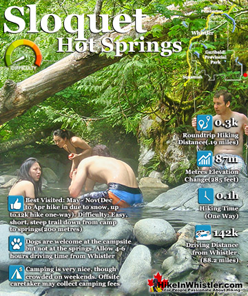
Sloquet Hot Springs is a wonderfully wild set of shallow, man-made pools fed by a small, all natural, and very hot, waterfall. The pools stretch from the waterfall to the large and crashing Sloquet River. The ...
April in Whistler is a wonderful time of year. The winter deep freeze ends and T-shirt weather erupts. The village comes alive with overflowing patios and ...
May is an extraordinarily beautiful time of year in Whistler. The days are longer and warmer and a great lull in between seasons happens. Whistler is fairly ...
June is a pretty amazing month to hike in Whistler and Garibaldi Park. The average low and high temperatures in Whistler range from 9c to 21c(48f/70f). ...
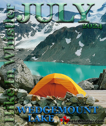
July is a wonderful time to hike in Whistler and Garibaldi Provincial Park. The weather is beautiful and the snow on high elevation hiking trails is long ...
Hiking in Whistler is spectacular and wonderfully varied. Looking at a map of Whistler you see an extraordinary spider web of hiking trails that are unbelievably numerous. Easy trails, moderate trails and challenging hiking trails are all available. Another marvellous ...
Squamish is located in the midst of a staggering array of amazing hiking trails. Garibaldi Provincial Park sprawls alongside Squamish and up and beyond Whistler. Tantalus Provincial Park lays across the valley to the west and the wonderfully remote Callaghan Valley ...
Clayoquot Sound has a staggering array of hiking trails within it. Between Tofino and Ucluelet, Pacific Rim Park has several wilderness and beach trails, each one radically different from the last. The islands in the area are often Provincial parks on their own with ...
Victoria has a seemingly endless number of amazing hiking trails. Most take you to wild and beautiful Pacific Ocean views and others take you to tranquil lakes in beautiful BC Coastal Rainforest wilderness. Regional Parks and Provincial Parks are everywhere you turn in ...
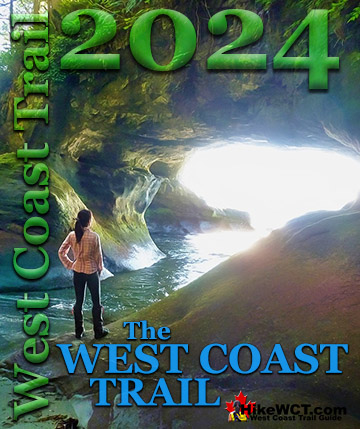
The West Coast Trail was created after decades of brutal and costly shipwrecks occurred along the West Coast of Vancouver Island. One shipwreck in particular was so horrific, tragic and unbelievable that it forced the creation of a trail along the coast, which ...