![]() Victoria has a seemingly endless number of amazing hiking trails. Most take you to wild and beautiful Pacific Ocean views and others take you to tranquil lakes in beautiful BC Coastal Rainforest wilderness. Regional Parks and Provincial Parks are everywhere you turn in Victoria and finding them is not too difficult. These are some of the best of the best hiking trails in and around Victoria.
Victoria has a seemingly endless number of amazing hiking trails. Most take you to wild and beautiful Pacific Ocean views and others take you to tranquil lakes in beautiful BC Coastal Rainforest wilderness. Regional Parks and Provincial Parks are everywhere you turn in Victoria and finding them is not too difficult. These are some of the best of the best hiking trails in and around Victoria.
Victoria Hiking Trails
![]() Avatar Grove
Avatar Grove ![]() Bear Hill
Bear Hill ![]() East Sooke Park
East Sooke Park ![]() Elk/Beaver Lake
Elk/Beaver Lake ![]() Esquimalt Lagoon
Esquimalt Lagoon ![]() Fort Rodd Hill
Fort Rodd Hill ![]() Francis/King
Francis/King ![]() Galloping Goose
Galloping Goose ![]() Goldstream Park
Goldstream Park ![]() Gowlland Tod
Gowlland Tod ![]() Grass Lake
Grass Lake ![]() John Dean Park
John Dean Park ![]() Juan de Fuca Trail
Juan de Fuca Trail ![]() Lone Tree Hill
Lone Tree Hill ![]() Mill Hill
Mill Hill ![]() Mount Doug
Mount Doug ![]() Mount Tolmie
Mount Tolmie ![]() Sooke Potholes
Sooke Potholes ![]() Spectacle Lake
Spectacle Lake ![]() Thetis Lake
Thetis Lake ![]() Witty's Lagoon
Witty's Lagoon
Whistler & Garibaldi Hiking
![]() Alexander Falls
Alexander Falls ![]() Ancient Cedars
Ancient Cedars ![]() Black Tusk
Black Tusk ![]() Blackcomb Mountain
Blackcomb Mountain ![]() Brandywine Falls
Brandywine Falls ![]() Brandywine Meadows
Brandywine Meadows ![]() Brew Lake
Brew Lake ![]() Callaghan Lake
Callaghan Lake ![]() Cheakamus Lake
Cheakamus Lake ![]() Cheakamus River
Cheakamus River ![]() Cirque Lake
Cirque Lake ![]() Flank Trail
Flank Trail ![]() Garibaldi Lake
Garibaldi Lake ![]() Garibaldi Park
Garibaldi Park ![]() Helm Creek
Helm Creek ![]() Jane Lakes
Jane Lakes ![]() Joffre Lakes
Joffre Lakes ![]() Keyhole Hot Springs
Keyhole Hot Springs ![]() Logger’s Lake
Logger’s Lake ![]() Madeley Lake
Madeley Lake ![]() Meager Hot Springs
Meager Hot Springs ![]() Nairn Falls
Nairn Falls ![]() Newt Lake
Newt Lake ![]() Panorama Ridge
Panorama Ridge ![]() Parkhurst Ghost Town
Parkhurst Ghost Town ![]() Rainbow Falls
Rainbow Falls ![]() Rainbow Lake
Rainbow Lake ![]() Ring Lake
Ring Lake ![]() Russet Lake
Russet Lake ![]() Sea to Sky Trail
Sea to Sky Trail ![]() Skookumchuck Hot Springs
Skookumchuck Hot Springs ![]() Sloquet Hot Springs
Sloquet Hot Springs ![]() Sproatt East
Sproatt East ![]() Sproatt West
Sproatt West ![]() Taylor Meadows
Taylor Meadows ![]() Train Wreck
Train Wreck ![]() Wedgemount Lake
Wedgemount Lake ![]() Whistler Mountain
Whistler Mountain
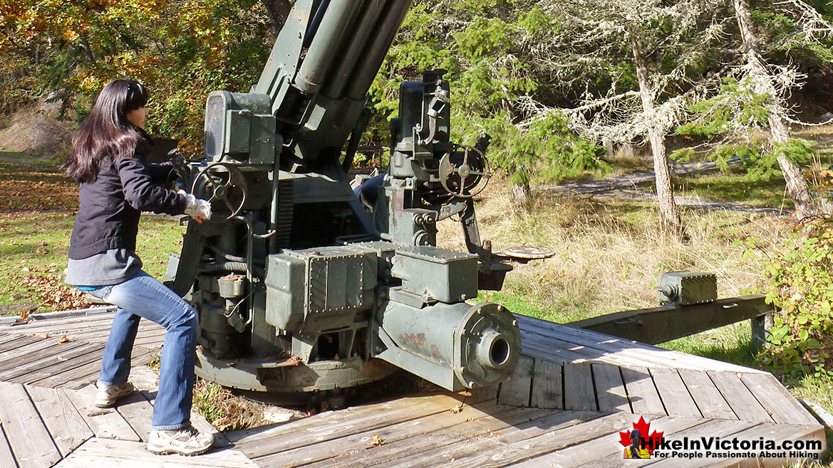
Sooke is a nice coastal town, less than an hours drive from Victoria with amazingly deep and beautiful forests, lakes and rivers. Sooke Potholes is an extraordinary example of this. Over thousands of years, swirling water have created amazingly deep pools in this otherwise, massive and crashing river. This has created an astonishing river-world fun park of sorts. Cliffs, fallen trees, rock outcrops over the river. Mill Hill Regional Park is a well hidden though wonderfully short hike to amazing views of Victoria, Esquimalt and the Western Communities. The hike is only 15 minutes to the summit with a branching trail that leads to Thetis Lake Park. This is a remarkably seldom hiked park in Victoria. It is rare to see anyone on the trail or at the beautiful summit. The views are amazing. Gowlland Tod Provincial Park is a beautiful park running along the Saanich Inlet just a short drive from downtown Victoria. Accessible from Goldstream Park at one end and Brentwood Bay, near Butchart Gardens at the other. From beautiful ocean views of the inlet to wonderful mountain views from Mount Work, this park has a great variety of characteristically Victoria hiking. Goldstream Provincial Park and Mount Finlayson are beautiful places that are definitely a must-see on any visit to Victoria. Huge coastal rainforest trees everywhere. An impressively golden river, an abandoned gold mine and one of the highest mountains in Victoria. As soon as you leave your car you can feel the wonderful forest alive around you. Fort Rodd Hill is astonishingly beautiful and incredibly interesting as a tourist attraction in Victoria that most never see. This fact is amazing as it is wonderful and unquestionably, or at least arguably, as good or better than any other attraction around. The entry fee is surprisingly low at just $8.50, what a phenomenal deal! You can crawl all over all the real pre World War I era defensive structures and even play with, and all but fire a genuine World War II Anti-Aircraft Gun... which is in the parking lot!
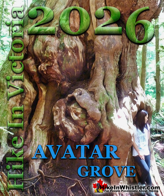
Amazing Avatar Grove Near Port Renfrew
![]()
Fort Rodd Hill Anti Aircraft Gun in the Parking Lot!
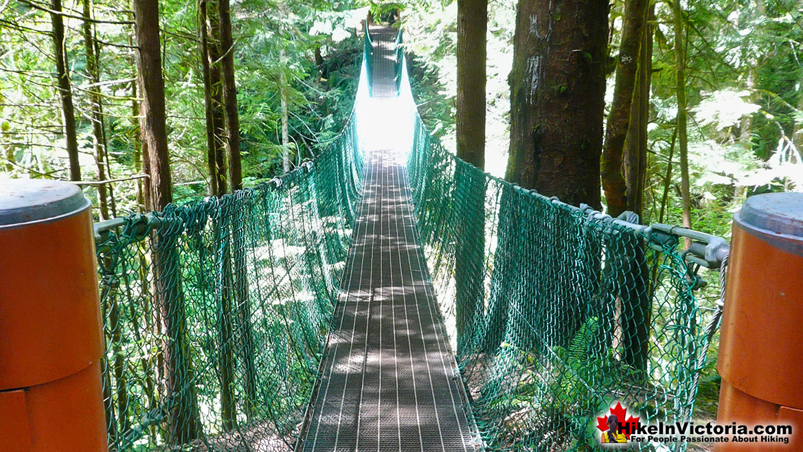
Bridge on the Juan de Fuca Trail
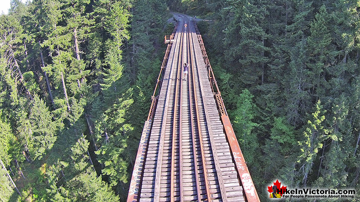
The Fantastic Train Trestle at Goldstream Park
Gorgeous Gowlland Tod Park in Victoria
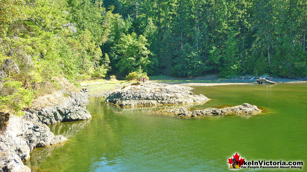
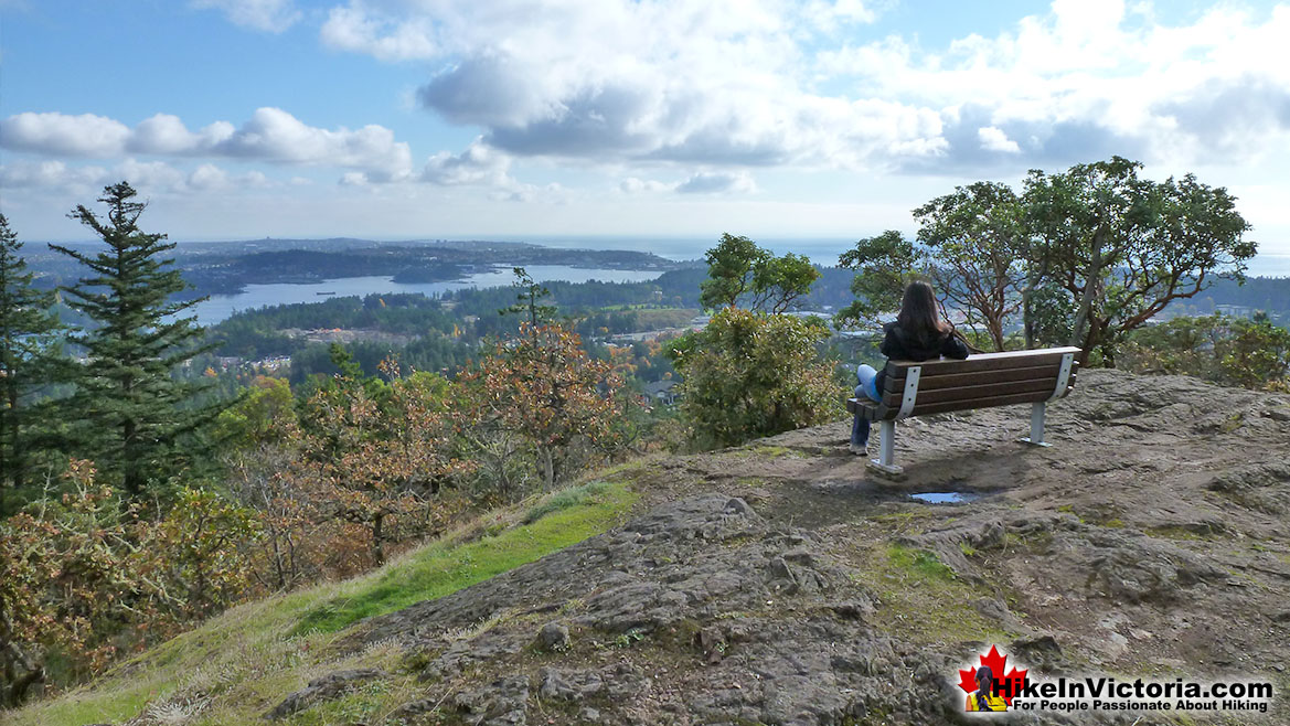
Mill Hill View of Victoria
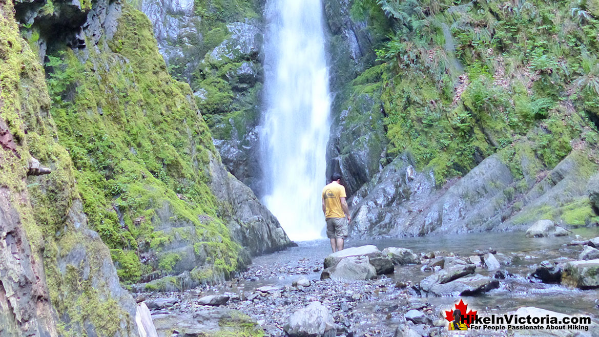
Niagara Falls in Goldstream Park
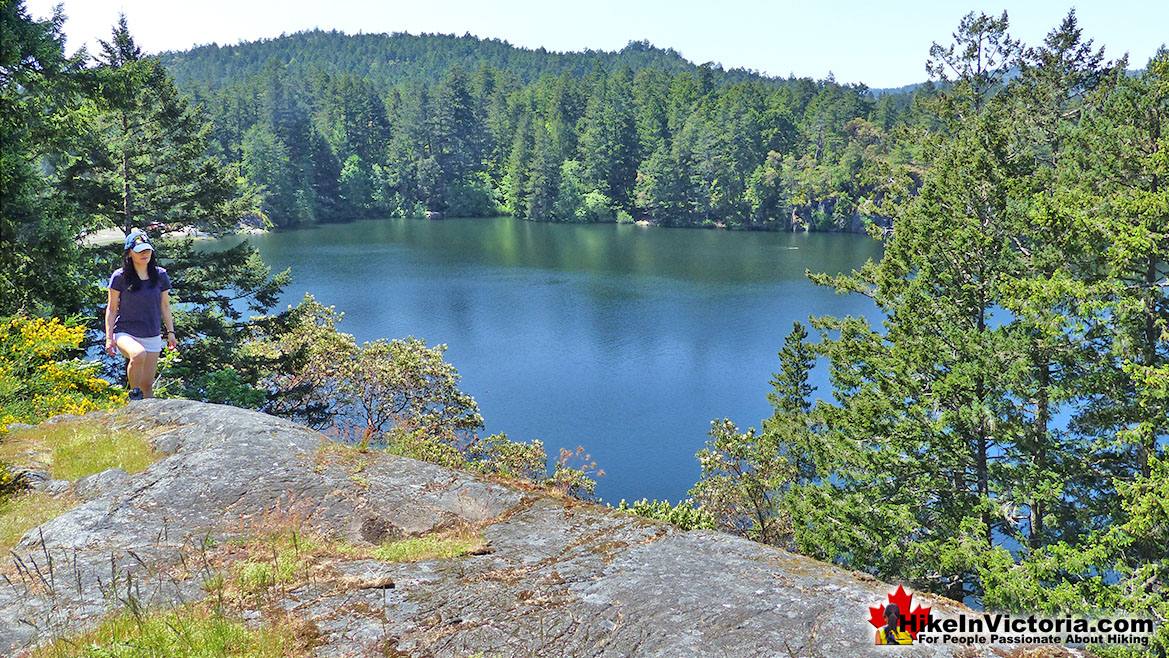
Thetis Lake Park
The Juan de Fuca Trail in Victoria
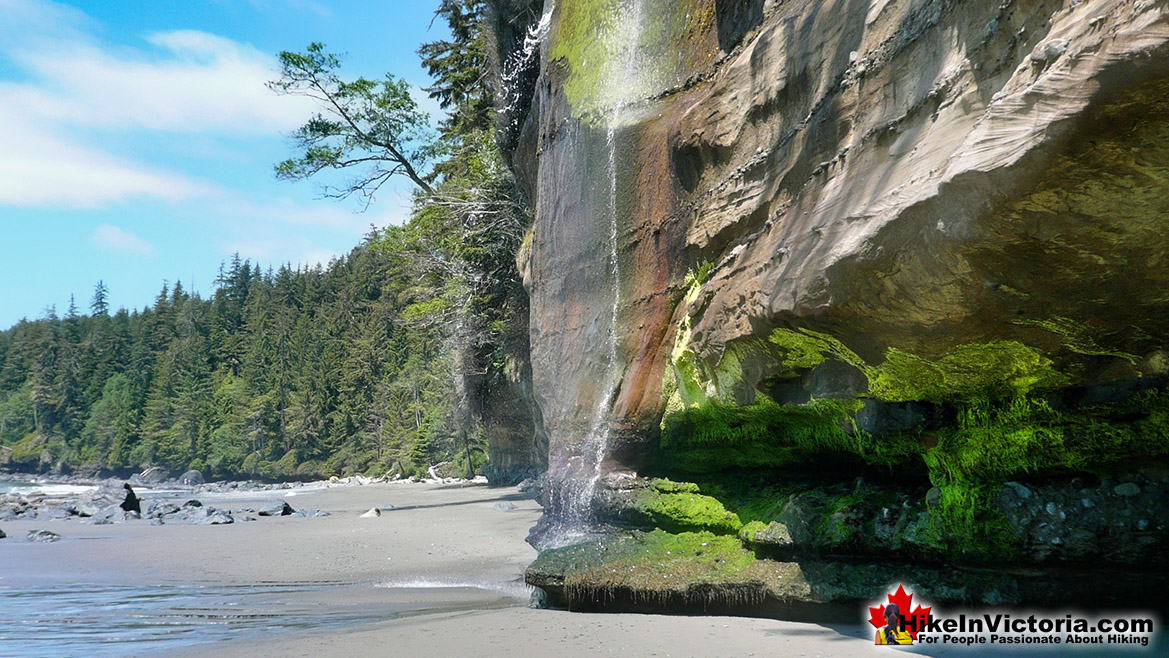
![]() Juan de Fuca Trail is a beautiful wilderness trail that hugs the west coast of Vancouver Island between Jordan River(north of Sooke) and Port Renfrew. Established as a provincial park in 1995, the Juan de Fuca Trail traces its origins to the 1889 telegraph line that connected Victoria and Bamfield. The telegraph line connected Bamfield to the British Empire via a transpacific cable. This cable required patrolmen to routinely check the line. Linesmen were housed in in cabins along the route. Juan de Fuca Trail and the West Coast Trail share this function, however, the West Coast Trail continued to function as a lifesaving trail, long after what would eventually be the Juan de Fuca Trail fell into disuse. Decades later, in the 1970's, with the growing popularity of the West Coast Trail, a renewed interest in the area continued to grow. Public interest in the area collided with logging companies pushing into the area. The Victoria Sierra Club filed lawsuits in an attempt to halt logging in the Sombrio Creek and Parkinson Creek regions. The Victoria Sierra Club was successful in halting the logging and the "West Coast Strip" was preserved as a future park. Finally in the 1990's the provincial government acquired and set aside land for the proposed provincial park. The beautiful 47 kilometre Juan de Fuca Trail we see today was finally constructed and officially designated as the Juan de Fuca Marine Trail in Juan de Fuca Provincial Park. The trail and the park are simply known as Juan de Fuca Trail. The park is named after Juan de Fuca Strait, the large channel of water that separates Vancouver Island from the mainland of North America. Juan de Fuca Strait is also the international boundary between Canada and the United States. Juan de Fuca was a Greek sailor and explored the area four centuries ago and originally name it the "Strait of Anian". In 1787 British Captain Charles Barkley, following Juan de Fuca's writings about the area two centuries earlier, rediscovered "Juan de Fuca's" strait. The name stuck, and it has been known ever since as Juan de Fuca Strait. As a Vancouver Island coast hiking trail, Juan de Fuca Trail is comparable to the world renowned West Coast Trail. There are some distinct differences however. The Juan de Fuca Trail is much tamer and easily accessible at numerous access trailheads, whereas the West Coast Trail has only three access points. The West Coast Trail is brutally difficult with many difficult ladders and water crossings and is effectively a 75 kilometre, self sustained trek through the wilderness. Juan de Fuca Trail has few challenging sections and no frightening ladder climbs or cable car crossings to negotiate. Also, owing to the number of access points, Juan de Fuca Trail is usually hiked in sections as daytrips or short 1 night trips.
Juan de Fuca Trail is a beautiful wilderness trail that hugs the west coast of Vancouver Island between Jordan River(north of Sooke) and Port Renfrew. Established as a provincial park in 1995, the Juan de Fuca Trail traces its origins to the 1889 telegraph line that connected Victoria and Bamfield. The telegraph line connected Bamfield to the British Empire via a transpacific cable. This cable required patrolmen to routinely check the line. Linesmen were housed in in cabins along the route. Juan de Fuca Trail and the West Coast Trail share this function, however, the West Coast Trail continued to function as a lifesaving trail, long after what would eventually be the Juan de Fuca Trail fell into disuse. Decades later, in the 1970's, with the growing popularity of the West Coast Trail, a renewed interest in the area continued to grow. Public interest in the area collided with logging companies pushing into the area. The Victoria Sierra Club filed lawsuits in an attempt to halt logging in the Sombrio Creek and Parkinson Creek regions. The Victoria Sierra Club was successful in halting the logging and the "West Coast Strip" was preserved as a future park. Finally in the 1990's the provincial government acquired and set aside land for the proposed provincial park. The beautiful 47 kilometre Juan de Fuca Trail we see today was finally constructed and officially designated as the Juan de Fuca Marine Trail in Juan de Fuca Provincial Park. The trail and the park are simply known as Juan de Fuca Trail. The park is named after Juan de Fuca Strait, the large channel of water that separates Vancouver Island from the mainland of North America. Juan de Fuca Strait is also the international boundary between Canada and the United States. Juan de Fuca was a Greek sailor and explored the area four centuries ago and originally name it the "Strait of Anian". In 1787 British Captain Charles Barkley, following Juan de Fuca's writings about the area two centuries earlier, rediscovered "Juan de Fuca's" strait. The name stuck, and it has been known ever since as Juan de Fuca Strait. As a Vancouver Island coast hiking trail, Juan de Fuca Trail is comparable to the world renowned West Coast Trail. There are some distinct differences however. The Juan de Fuca Trail is much tamer and easily accessible at numerous access trailheads, whereas the West Coast Trail has only three access points. The West Coast Trail is brutally difficult with many difficult ladders and water crossings and is effectively a 75 kilometre, self sustained trek through the wilderness. Juan de Fuca Trail has few challenging sections and no frightening ladder climbs or cable car crossings to negotiate. Also, owing to the number of access points, Juan de Fuca Trail is usually hiked in sections as daytrips or short 1 night trips.
More Best Victoria Hiking - Juan de Fuca Trail
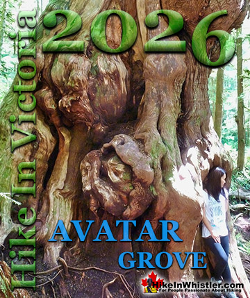
Avatar Grove in Port Renfrew
![]() Avatar Grove and Canada's gnarliest tree is an amazing thing to see and finding it is half the fun. The cute little town of Port Renfrew, known for it's logging, amazing fishing and home of one of the trailheads to the world renowned West Coast Trail, is now reworking it's image to include this fantastic wonder. Dubbed Canada's gnarliest tree this mammoth cedar will surely leap from the unknown to the feature of millions of tourist photos in the coming days and years. Avatar Grove is a 50 hectare area of old growth forest it has shot to prominence in this part of the world and groups everywhere you look are embracing it as something to be saved, admired and loved. Not cut into lumber. The Victoria based Ancient Forest Alliance is at the forefront of rescuing and protecting Avatar Forest. They discovered, named and drove it into the world's eyes. Avatar Grove is slowly growing into a hiking destination. Wooden stars and a boardwalk is being constructed and seems to grow month to month. There is even a viewing platform for the gnarly tree at an ideal location to take in the view. Though Avatar Grove and Canada's gnarliest tree is a couple hours drive from Victoria, the drive is very scenic. The various sections/trailheads of the Juan de Fuca Trail are all easy stops on the way to Avatar Grove. East Sooke Regional Park, Witty's Lagoon, Fort Rodd Hill and many more sights are also located along the way.
Avatar Grove and Canada's gnarliest tree is an amazing thing to see and finding it is half the fun. The cute little town of Port Renfrew, known for it's logging, amazing fishing and home of one of the trailheads to the world renowned West Coast Trail, is now reworking it's image to include this fantastic wonder. Dubbed Canada's gnarliest tree this mammoth cedar will surely leap from the unknown to the feature of millions of tourist photos in the coming days and years. Avatar Grove is a 50 hectare area of old growth forest it has shot to prominence in this part of the world and groups everywhere you look are embracing it as something to be saved, admired and loved. Not cut into lumber. The Victoria based Ancient Forest Alliance is at the forefront of rescuing and protecting Avatar Forest. They discovered, named and drove it into the world's eyes. Avatar Grove is slowly growing into a hiking destination. Wooden stars and a boardwalk is being constructed and seems to grow month to month. There is even a viewing platform for the gnarly tree at an ideal location to take in the view. Though Avatar Grove and Canada's gnarliest tree is a couple hours drive from Victoria, the drive is very scenic. The various sections/trailheads of the Juan de Fuca Trail are all easy stops on the way to Avatar Grove. East Sooke Regional Park, Witty's Lagoon, Fort Rodd Hill and many more sights are also located along the way.
![]()
More Best Victoria Hiking - Avatar Grove
East Sooke Regional Park
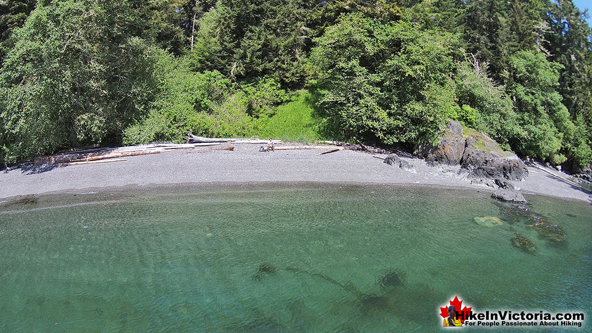
![]() East Sooke Regional Park is a convenient and easily accessible way to experience the wild, west coast of Vancouver Island. Weather blasted rocky cliffs, sandy beaches and deep coastal forest trails run throughout the park. Every few minutes along the coast you come to another startlingly desolate ocean vantage point. Everything about East Sooke Regional Park is just great and should not be missed on a trip to Victoria anytime of the year. The sheer size of this park and number of trails, over 50 kilometres of them. The Coastal Trail, almost 12 kilometres long, stretches out linearly in an array of pocket beaches, rocky viewpoints and fantastically alive tide pools. It hugs the cliff, ducks into the forest and back out to another stunning ocean viewpoint. It does this over and over again. Dozens of times, and not once does it get boring. The Strait of Juan de Fuca and swirling mass of green and blue stretches out toward the Olympic Mountains in the United States. East Sooke Regional Park has three main access points and trailheads. This allows the huge park to be divided up into three manageable parts, each one with very different attributes. The Aylard Farm trailhead is the easy, family friendly and relaxing way to see East Sooke Regional Park. A few short, 5 minute trails take you down to beaches, tidal pools and picnic areas. The Anderson Cove trailhead is popular with hikers tackling the more challenging trails to Babbington Hill and Mount Maguire. The Pike Road trailhead is the furthest west access to East Sooke Park with an easy, 1.5 kilometre trail leading down to Iron Mine Beach.
East Sooke Regional Park is a convenient and easily accessible way to experience the wild, west coast of Vancouver Island. Weather blasted rocky cliffs, sandy beaches and deep coastal forest trails run throughout the park. Every few minutes along the coast you come to another startlingly desolate ocean vantage point. Everything about East Sooke Regional Park is just great and should not be missed on a trip to Victoria anytime of the year. The sheer size of this park and number of trails, over 50 kilometres of them. The Coastal Trail, almost 12 kilometres long, stretches out linearly in an array of pocket beaches, rocky viewpoints and fantastically alive tide pools. It hugs the cliff, ducks into the forest and back out to another stunning ocean viewpoint. It does this over and over again. Dozens of times, and not once does it get boring. The Strait of Juan de Fuca and swirling mass of green and blue stretches out toward the Olympic Mountains in the United States. East Sooke Regional Park has three main access points and trailheads. This allows the huge park to be divided up into three manageable parts, each one with very different attributes. The Aylard Farm trailhead is the easy, family friendly and relaxing way to see East Sooke Regional Park. A few short, 5 minute trails take you down to beaches, tidal pools and picnic areas. The Anderson Cove trailhead is popular with hikers tackling the more challenging trails to Babbington Hill and Mount Maguire. The Pike Road trailhead is the furthest west access to East Sooke Park with an easy, 1.5 kilometre trail leading down to Iron Mine Beach.
More Best Victoria Hiking - East Sooke Park
Witty's Lagoon Regional Park
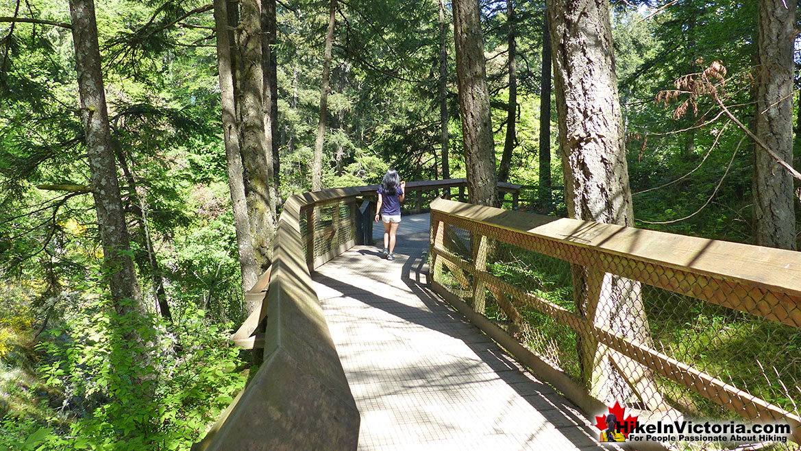
![]() Witty’s Lagoon Regional Park is a wonderful coastal park overlooking the Strait of Juan de Fuca. Located in Metchosin, a scenic and largely rural community that is part of the Western Communities. If you are driving from downtown Victoria, you are just a 30 minute drive away and much of that drive is quite nice. Fort Rodd Hill and Esquimalt Lagoon are definitely worth visiting on the way to Witty’s Lagoon. Witty’s Lagoon Regional Park is a very family friendly park with its large beach, Nature Centre and over 5 kilometres of forest hiking trails. With the tide out a huge salt marsh is revealed, teeming with life. Over 160 species of birds have been documented in the park. This sand dune ecosystem is fun to explore and attracts bird watchers as well as frolicking dogs. The cute little Nature Centre is located at the main parking area for Witty’s Lagoon. Here you will find helpful CRD Regional Parks staff and volunteer naturalists ready to answer questions and help introduce you to the park. The Nature Centre is only open weekends and holidays from 12pm to 4pm. Past the Nature Centre you become immersed in a forest unexpectedly large Douglas-fir trees. The nice, wide trail sloped downward slightly as you walk along Bilston Creek and past Sitting Lady Falls. These falls are not terribly large or impressive, but marvelously scenic in this deep, dark forest. As Victoria hiking trails go, Witty’s Lagoon is not overly exciting. The Thetis Lake trails, for example are much more scenic as they skirt the lake, often from high above. What makes Witty’s Lagoon Regional Park a wonderful place to visit is because of a variety of nice features. The first great feature is its location. Metchosin is a rural, coastal escape from the big city. When you visit the park, you often find long time locals who evidently visit the park frequently.
Witty’s Lagoon Regional Park is a wonderful coastal park overlooking the Strait of Juan de Fuca. Located in Metchosin, a scenic and largely rural community that is part of the Western Communities. If you are driving from downtown Victoria, you are just a 30 minute drive away and much of that drive is quite nice. Fort Rodd Hill and Esquimalt Lagoon are definitely worth visiting on the way to Witty’s Lagoon. Witty’s Lagoon Regional Park is a very family friendly park with its large beach, Nature Centre and over 5 kilometres of forest hiking trails. With the tide out a huge salt marsh is revealed, teeming with life. Over 160 species of birds have been documented in the park. This sand dune ecosystem is fun to explore and attracts bird watchers as well as frolicking dogs. The cute little Nature Centre is located at the main parking area for Witty’s Lagoon. Here you will find helpful CRD Regional Parks staff and volunteer naturalists ready to answer questions and help introduce you to the park. The Nature Centre is only open weekends and holidays from 12pm to 4pm. Past the Nature Centre you become immersed in a forest unexpectedly large Douglas-fir trees. The nice, wide trail sloped downward slightly as you walk along Bilston Creek and past Sitting Lady Falls. These falls are not terribly large or impressive, but marvelously scenic in this deep, dark forest. As Victoria hiking trails go, Witty’s Lagoon is not overly exciting. The Thetis Lake trails, for example are much more scenic as they skirt the lake, often from high above. What makes Witty’s Lagoon Regional Park a wonderful place to visit is because of a variety of nice features. The first great feature is its location. Metchosin is a rural, coastal escape from the big city. When you visit the park, you often find long time locals who evidently visit the park frequently.
More Best Victoria Hiking - Witty's Lagoon
The Extraordinary Sooke Potholes
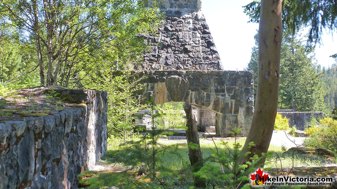
![]() Nothing, including the river ever runs in anything close to a straight line. So many amazing vantage points, so many unbelievable swimming spots. If you are interested in venturing further, you can follow the potholes for quite a distance. About 3k in fact, as they snake through the river valley. As if the place couldn't get any more interesting, it does. There is a ruin (of sorts) of an unfinished convention centre, long abandoned, though magnificent in it size and complexity. It would have been quite a building, with its enormous fireplace and huge log beam construction. Now it remains as a curiosity, perched on the edge of a cliff, far above the Sooke Potholes.
Nothing, including the river ever runs in anything close to a straight line. So many amazing vantage points, so many unbelievable swimming spots. If you are interested in venturing further, you can follow the potholes for quite a distance. About 3k in fact, as they snake through the river valley. As if the place couldn't get any more interesting, it does. There is a ruin (of sorts) of an unfinished convention centre, long abandoned, though magnificent in it size and complexity. It would have been quite a building, with its enormous fireplace and huge log beam construction. Now it remains as a curiosity, perched on the edge of a cliff, far above the Sooke Potholes.
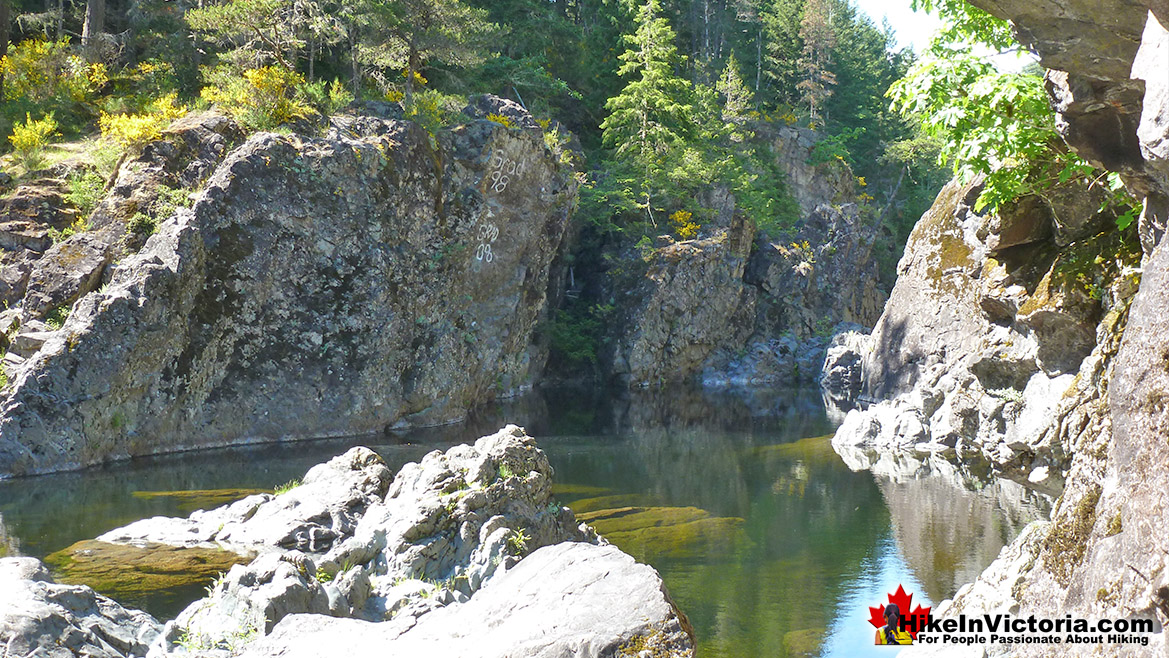
The Beautiful Old Ruins at Sooke Potholes
More Best Victoria Hiking - Sooke Potholes
Fort Rodd Hill in Victoria
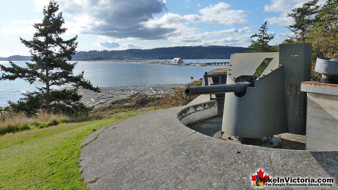
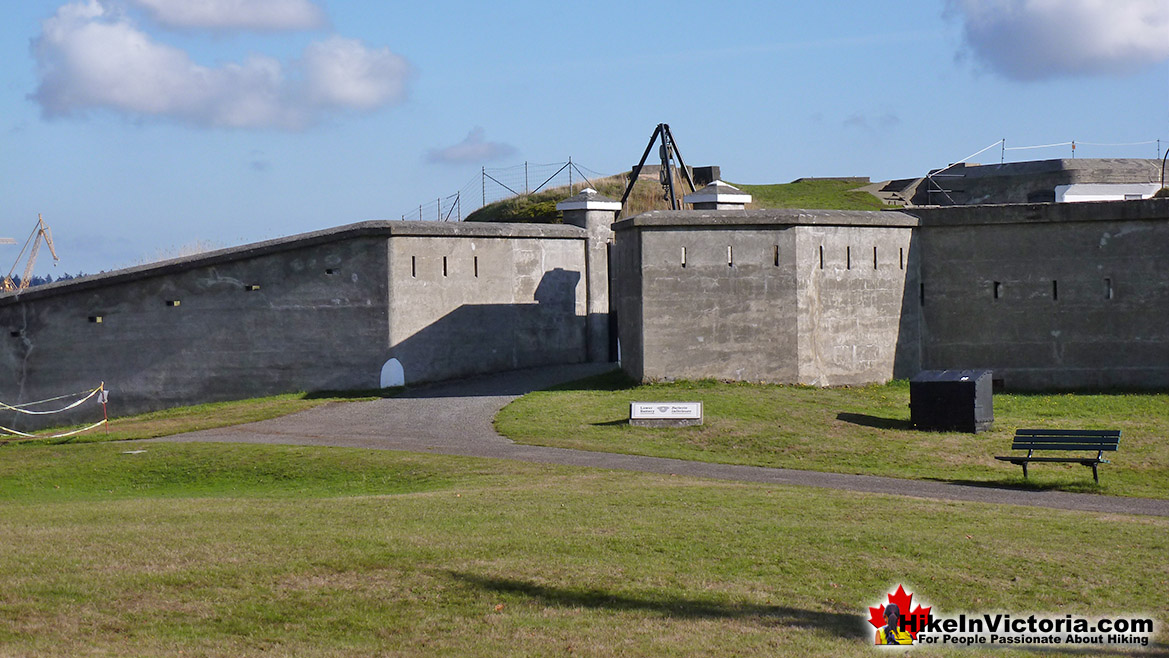
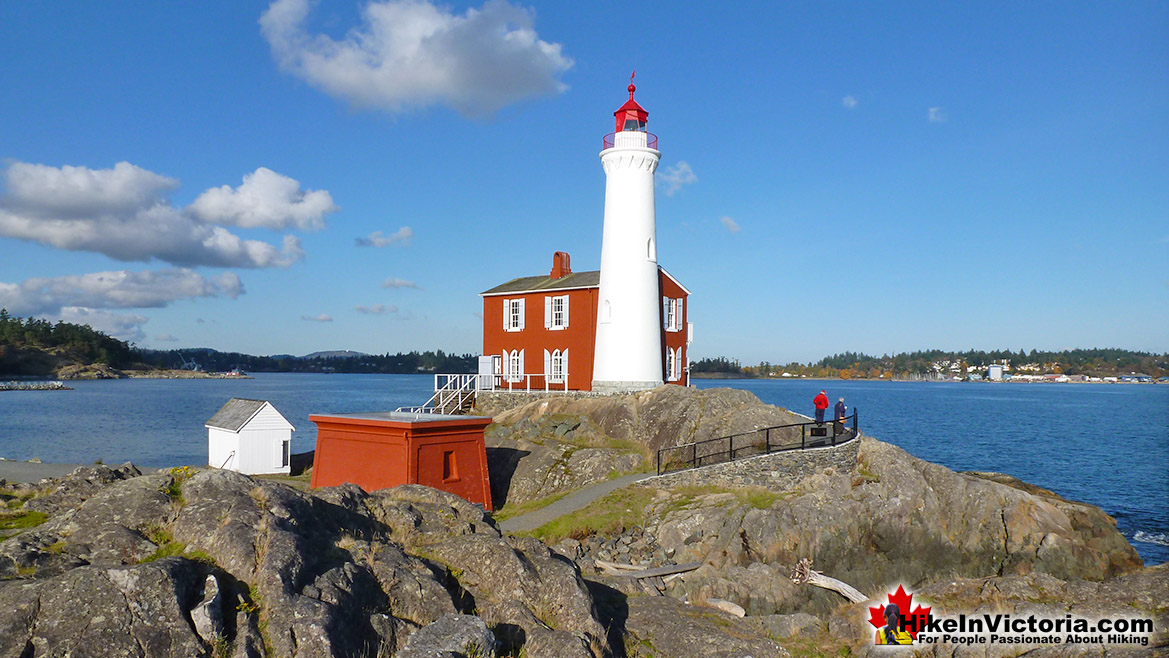
![]() Fort Rodd Hill National Historic Park has so much to see it spills onto the parking lot. What unbelievable place! Though you could make your way through at a rushed pace in about 30 minutes, expect to take over two hours at a moderate pace as there is such an astonishingly huge amount to see. Real fortifications from a century ago as if frozen in time. Thick cement walls that indestructible. Gun slits in the metre thick walls that you can peer through as though you had to defend the fort yourself. Some buildings even have sound effects as you walk in. The enormous anti-ship guns are still in place. These monstrous barrels pointing out to sea as if still looking for invading ships to fire upon. About the only drawback to Fort Rodd Hill is that you can't bring your dog with you, but this is for a pretty amazing reason. Once in a while you will spot deer roaming the grounds, so allowing dogs in the park would cause quite a disturbance! Another wonderful sight to see at Fort Rodd Hill is the Fisgard Lighthouse. You can go inside and climb stairs up to the top and inside you will find wonderful displays on its history.
Fort Rodd Hill National Historic Park has so much to see it spills onto the parking lot. What unbelievable place! Though you could make your way through at a rushed pace in about 30 minutes, expect to take over two hours at a moderate pace as there is such an astonishingly huge amount to see. Real fortifications from a century ago as if frozen in time. Thick cement walls that indestructible. Gun slits in the metre thick walls that you can peer through as though you had to defend the fort yourself. Some buildings even have sound effects as you walk in. The enormous anti-ship guns are still in place. These monstrous barrels pointing out to sea as if still looking for invading ships to fire upon. About the only drawback to Fort Rodd Hill is that you can't bring your dog with you, but this is for a pretty amazing reason. Once in a while you will spot deer roaming the grounds, so allowing dogs in the park would cause quite a disturbance! Another wonderful sight to see at Fort Rodd Hill is the Fisgard Lighthouse. You can go inside and climb stairs up to the top and inside you will find wonderful displays on its history.
Fort Rodd Hill Fortifications
Fisgard Lighthouse in Fort Rodd Hill
More Best Victoria Hiking - Fort Rodd Hill
Explore BC Hiking Destinations!

Whistler Hiking Trails

Squamish Hiking Trails

Vancouver Hiking Trails

Clayoquot Hiking Trails
Victoria Hiking Trails


