![]() Madeley Lake is a gorgeous mountain lake located high up in the Callaghan Valley just a short drive past Alexander Falls. From Whistler Village it takes about 50 minutes to drive the 27.4 kilometres to get to the parking area for both Madeley Lake and Hanging Lake. A new gate installed in 2022 blocks Madeley Lake FSR which continues two kilometres to the far end of Madeley Lake near the campsite.
Madeley Lake is a gorgeous mountain lake located high up in the Callaghan Valley just a short drive past Alexander Falls. From Whistler Village it takes about 50 minutes to drive the 27.4 kilometres to get to the parking area for both Madeley Lake and Hanging Lake. A new gate installed in 2022 blocks Madeley Lake FSR which continues two kilometres to the far end of Madeley Lake near the campsite.
 Amazing, remote feeling corner of Whistler
- Driving there is very scenic and beautiful
- Madeley has a cute beach
- Tidy & cute campsite with picnic tables & fire rings
- Beach is south facing & always sunny
- Free campsites at both lakes
- Madeley Creek flows through the campsite
- Stunning mountain views all around
- Swimming is amazing, though freezing!
 Whistler Olympic Park blocks the road
Visiting Madeley Lake now involves a boring walk up the old logging road to get there. It also makes bringing a canoe, kayak or paddleboard to the lake out of the question for most. This parking area is also where you find the trailhead for the Madeley-Hanging Lake trail. The Madeley-Hanging Lake trail is a moderately challenging trail that ascends through the forest for 6.2 kilometres to the free campsite at Hanging Lake. The trail connects to the Rainbow Trail, reaching Rainbow Lake in just one kilometre. At the south end of the lake, the Rainbow Trail takes you 8 kilometres down the valley to emerge at the Rainbow Trail trailhead on Alta Lake Road. These two trails meet at Rainbow Lake and the trails combined are known as the Rainbow Madeley trail, which is 16.1 kilometres long, trailhead to trailhead. Rainbow Lake is the source of much of Whistler’s water supply and therefore camping, swimming and dogs are not allowed. Hanging Lake is just outside the watershed area and none of the restrictions apply. Camping is free at the Hanging Lake campsite which is unmaintained. The campsite at Madeley Lake is also free and well outside the watershed area so there are no restrictions. Beautiful Madeley Lake is the main attraction and the trail to Hanging Lake is not very popular, especially compared to the increasingly busy Rainbow Trail which is conveniently located in Whistler off Alta Lake Road, not far from Rainbow Park. The Hanging Lake campsite is popular in the summer, though nearly everyone hikes there via the Rainbow Trail instead of the Madeley-Hanging Lake trail. Hanging Lake is nice, though Rainbow Lake and Madeley Lake are beautiful by comparison. Out of the three lakes, Madeley is the best by far in terms of scenery, serenity and size.
Madeley Lake and Hanging Lake Map
Madeley is the largest of the three lakes and situated in a south facing valley aimed directly at the sun. The small pebble beach at the far end at the campsite is amazing and always sunny. The beach slopes steeply into the lake and perfect for jumping in if you can stand the always freezing cold the glacier fed water. The campsite is spread throughout the forest behind this beach extending along the shore as well as along Madeley Creek which is filled with boulders and crisscrossed with deadfall trees. A few metal fire pits can be found in various clearings around the campsite as well as a couple of picnic tables and one very old outhouse in the forest. The campsite extends along the far end of Madeley Lake through a gorgeous and deep old forest. A trail skirts around the top of the lake and continues around the far side of the lake. The battered old trail is sometimes hard to follow, but it continues along the lake and connects to the Madeley-Hanging Lake trail just a few hundred metres from the trailhead parking area for both lakes. Most hikers avoid this section around the back side of Madeley Lake and start their hike to Hanging Lake from the trailhead at the parking area.

Madeley Lake Trail Stats:
Driving There: 50 minutes from Whistler Village(27.4 kilometres/17 miles) Hiking Distance to Madeley Lake: 500 metres to lake or 2 kilometres to campsite. Hiking Time: 20 minutes to lake or 45 minutes to campsite. Elevation Gain: Minimal Fees: None Campsites: Yes Camping Allowed: Yes Difficulty: Easy walk along Madeley FSR. Kid Friendly: Yes. Stroller Friendly: Yes. Dog Friendly: Yes
Madeley-Hanging Lake Trail Stats:
Driving There: 50 minutes from Whistler Village(27.4 kilometres/17 miles) Hiking Distance to Hanging Lake: 6.2 kilometres/3.8 miles to campsite. Hiking Time: 2-3 hours to Hanging Lake. Elevation Gain: 437 metres/1434 feet. Fees: None Campsites: Yes Camping Allowed: Yes Difficulty: Moderate, though can be challenging due to overgrown trail, deadfall, creek crossing, muddy and steep trail. Kid Friendly: Not very fun for kids. Stroller Friendly: No. Dog Friendly: Yes
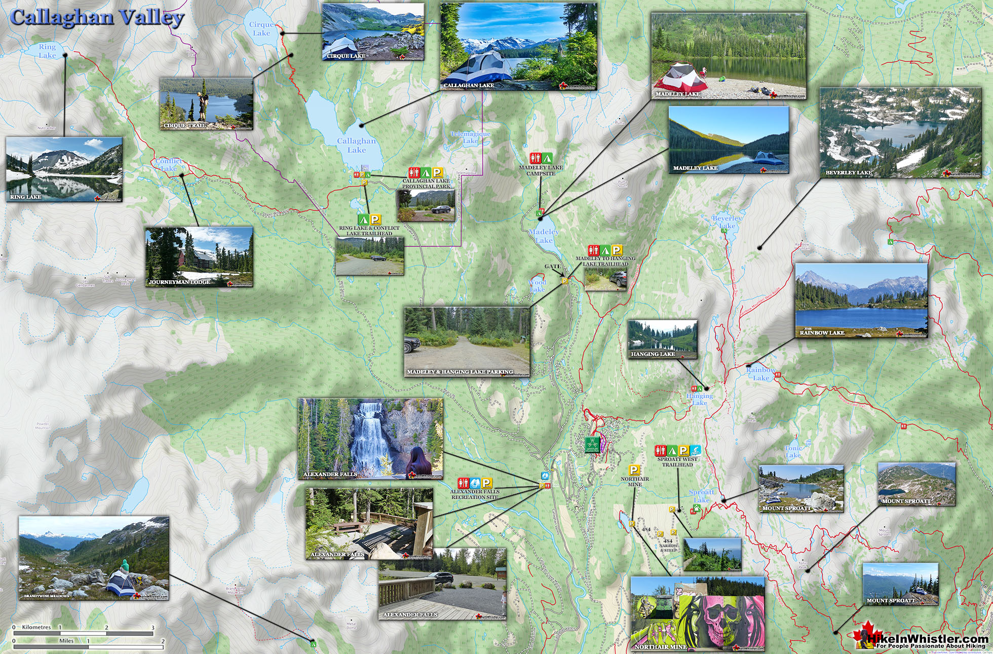
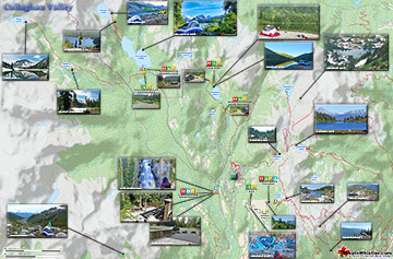
Callaghan Valley Map

Callaghan Valley Map Wider Area

More Whistler & Garibaldi Park Hiking Maps!
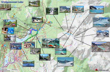
Wedgemount Lake Maps
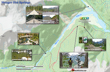
Meager Hot Springs Maps
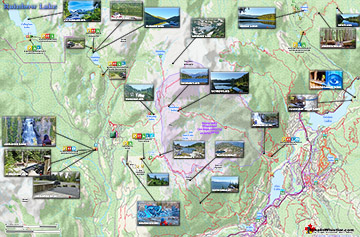
Rainbow Lake Maps
Ring Lake Maps

Whistler & Garibaldi Park Glossary A to Z

The Best Whistler & Garibaldi Park Hiking Trails!