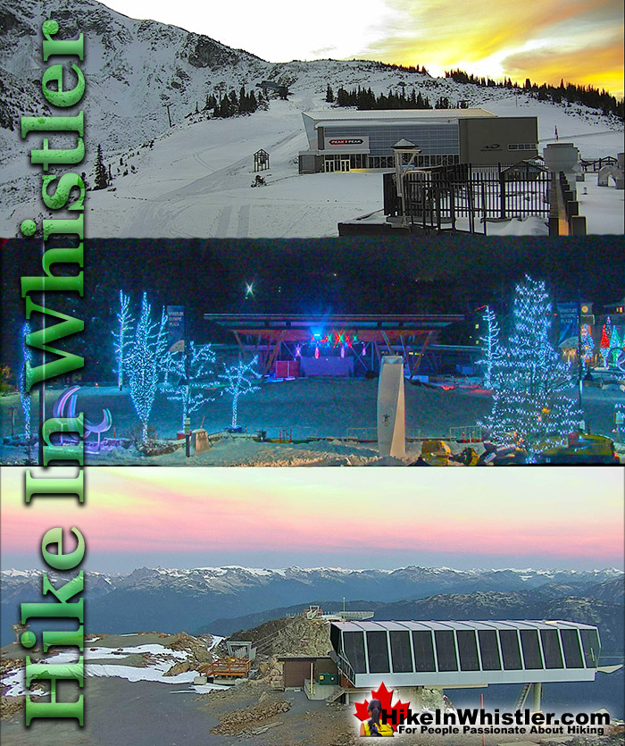
![]() There are plenty of amazing webcams in Whistler set up by the Mountain and the Municipality of Whistler. On Whistler Mountain there are several webcams that update images every few minutes from the summit of Whistler Mountain and down at the Roundhouse Lodge. On Blackcomb Mountain there are several more webcams at Rendezvous Lodge that point in six different directions, completing a panoramic view.
There are plenty of amazing webcams in Whistler set up by the Mountain and the Municipality of Whistler. On Whistler Mountain there are several webcams that update images every few minutes from the summit of Whistler Mountain and down at the Roundhouse Lodge. On Blackcomb Mountain there are several more webcams at Rendezvous Lodge that point in six different directions, completing a panoramic view.
Whistler & Garibaldi Hiking
![]() Alexander Falls
Alexander Falls ![]() Ancient Cedars
Ancient Cedars ![]() Black Tusk
Black Tusk ![]() Blackcomb Mountain
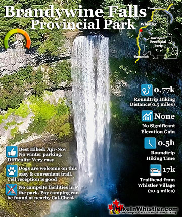
Blackcomb Mountain ![]() Brandywine Falls
Brandywine Falls ![]() Brandywine Meadows
Brandywine Meadows ![]() Brew Lake
Brew Lake ![]() Callaghan Lake
Callaghan Lake ![]() Cheakamus Lake
Cheakamus Lake ![]() Cheakamus River
Cheakamus River ![]() Cirque Lake
Cirque Lake ![]() Flank Trail
Flank Trail ![]() Garibaldi Lake
Garibaldi Lake ![]() Garibaldi Park
Garibaldi Park ![]() Helm Creek
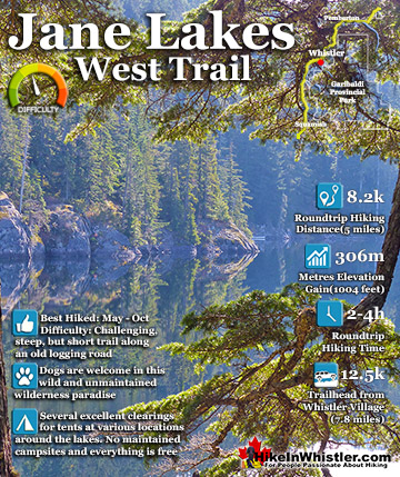
Helm Creek ![]() Jane Lakes
Jane Lakes ![]() Joffre Lakes
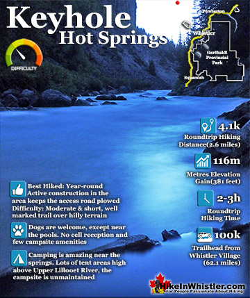
Joffre Lakes ![]() Keyhole Hot Springs
Keyhole Hot Springs ![]() Logger’s Lake
Logger’s Lake ![]() Madeley Lake
Madeley Lake ![]() Meager Hot Springs
Meager Hot Springs ![]() Nairn Falls
Nairn Falls ![]() Newt Lake
Newt Lake ![]() Panorama Ridge
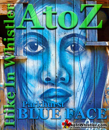
Panorama Ridge ![]() Parkhurst Ghost Town
Parkhurst Ghost Town ![]() Rainbow Falls
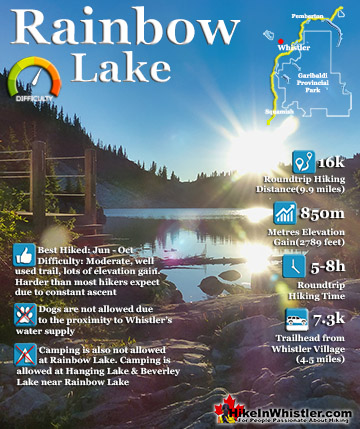
Rainbow Falls ![]() Rainbow Lake
Rainbow Lake ![]() Ring Lake
Ring Lake ![]() Russet Lake
Russet Lake ![]() Sea to Sky Trail
Sea to Sky Trail ![]() Skookumchuck Hot Springs
Skookumchuck Hot Springs ![]() Sloquet Hot Springs
Sloquet Hot Springs ![]() Sproatt East
Sproatt East ![]() Sproatt West
Sproatt West ![]() Taylor Meadows
Taylor Meadows ![]() Train Wreck
Train Wreck ![]() Wedgemount Lake
Wedgemount Lake ![]() Whistler Mountain
Whistler Mountain
![]() January
January ![]() February
February ![]() March
March ![]() April
April ![]() May
May ![]() June
June ![]() July
July ![]() August
August ![]() September
September ![]() October
October ![]() November
November ![]() December
December
Down in Whistler Village there are the Village webcams that cover Mountain Square, where the two mountains meet and the centre of Whistler. There are also two beautiful livestream webcams set up by the Municipality of Whistler. The Whistler Olympic Plaza livestream webcam is placed overlooking the plaza with Blackcomb Mountain in the background, The Fissile in the distance and the edge of Whistler Mountain on the right. The Muni have another livestream camera, about a kilometre away at Whistler Golf Course pointing down the first fairway. They also have a camera at the Crabapple Hut that updates every few minutes capturing a relaxing view of the golf course and distant Blackcomb Mountain, The Fissile and Whistler Mountain.
Whistler Olympic Plaza Livestream Webcam:
This fantastic livestream webcam is located at the north end of Whistler Village overlooking Whistler Olympic Plaza. Whistler Olympic Plaza was built for the 2010 Winter Games for medal ceremonies and has since become one of the most popular areas in Whistler Village for special events and concerts. The backdrop of the concert stage is Blackcomb Mountain and Whistler Mountain, which are captured by the webcam nicely. The Fissile can also be seen in the distance between the two mountains. The stage has a wonderful view of the mountains across the valley and almost always get commented on by performers on the stage during concerts. In the winter months, the stage disappears and the cemented area is transformed into a skating rink. The grass field becomes a mountain of snow and elaborate sledding ramps are carved out of it. Many of the big events in Whistler are centred here as well, including the Ironman, the Gran Fondo, the Whistler Half Marathon and many more.
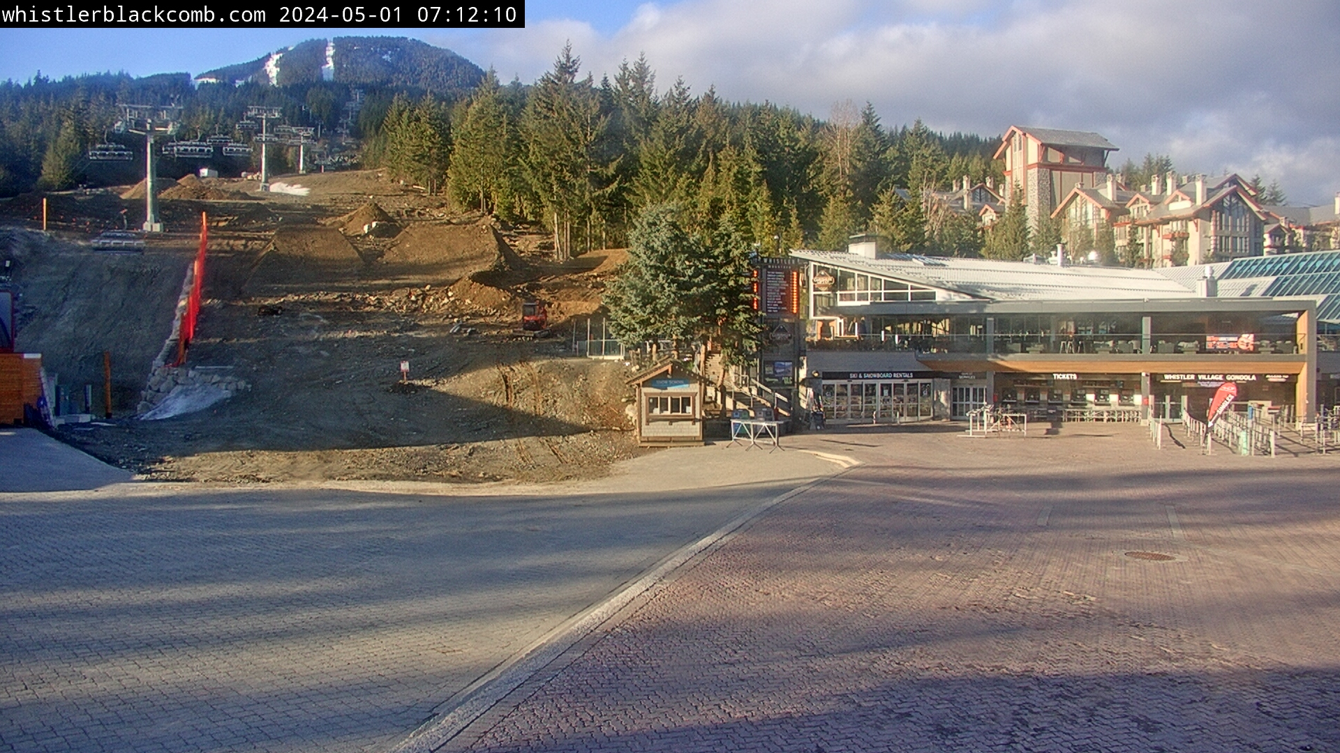
Whistler Golf Club Livestream Webcam:
Whistler Golf Club has this nice livestream webcam over their first tee. Though it serves a functional purpose of monitoring for golfer start times, it also has a nice view down the first fairway. The Whistler Golf Course is also a very popular place for spotting bears, and you might get lucky and spot one wandering through on a nice, sunny spring, summer or fall day.
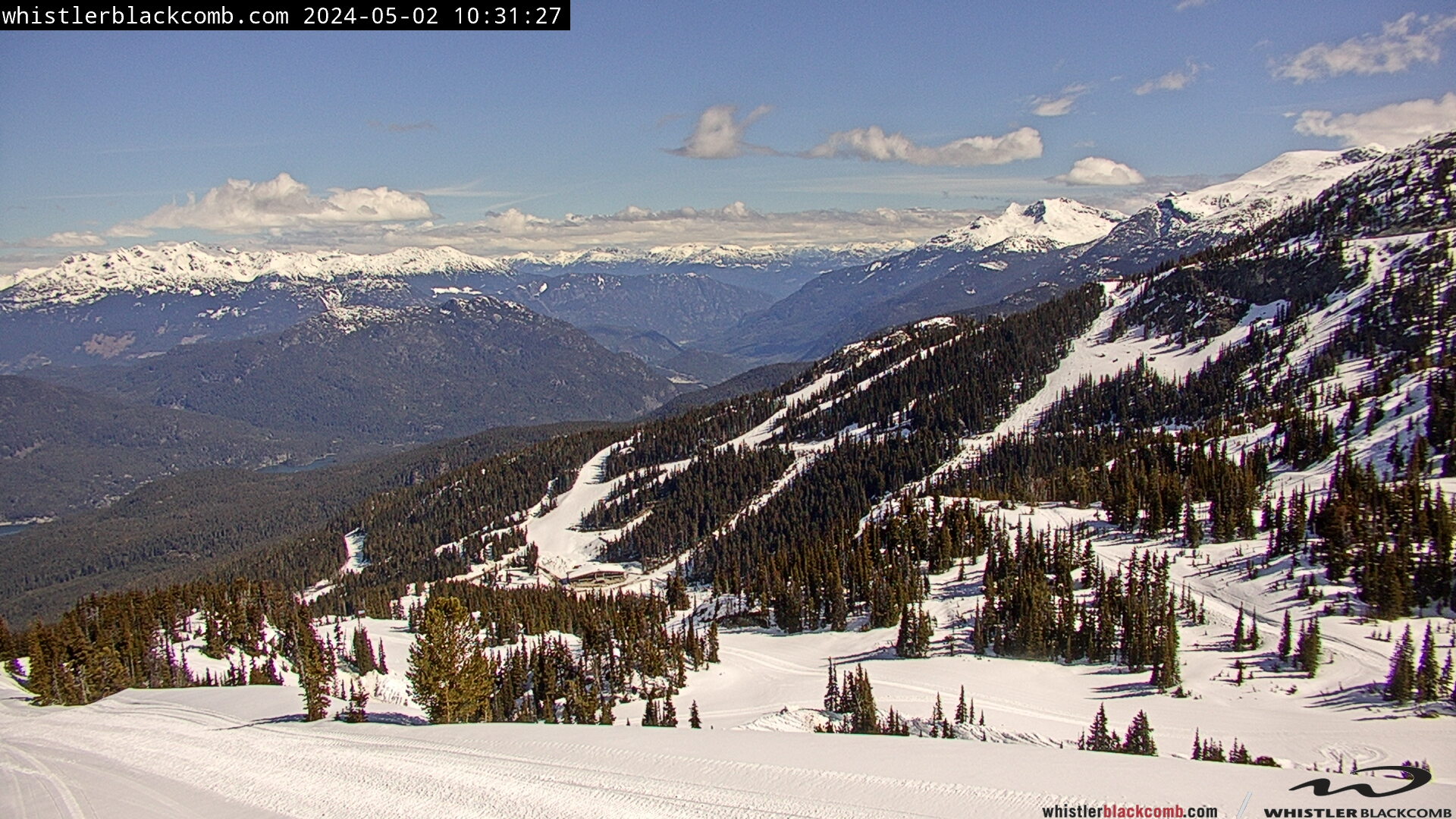
Whistler Mountain Roundhouse Webcam:
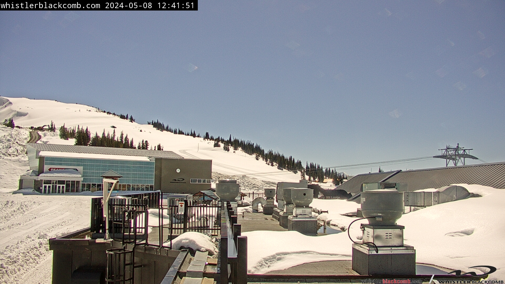
The Roundhouse webcam is possibly the best camera for checking the current weather and conditions for Whistler. You instantly get a glimpse of how much snow there is, if the sun is out and how busy it is with people. The position of the camera and the buildings facing south also gives you some great images. Sunrises on this camera are almost always stunning as the sunlight reflects off the buildings, lighting them up dramatically against the blackness beyond. In the summer the foreground grassy areas are bright green and the rest of the years an unbroken layer of white from the snow. At 1850 metres or 6069 feet the Roundhouse often is surrounded in a sea of clouds, giving it a magical appearance that you never get tired of seeing.
Whistler Mountain Emerald and Helipad Webcams:
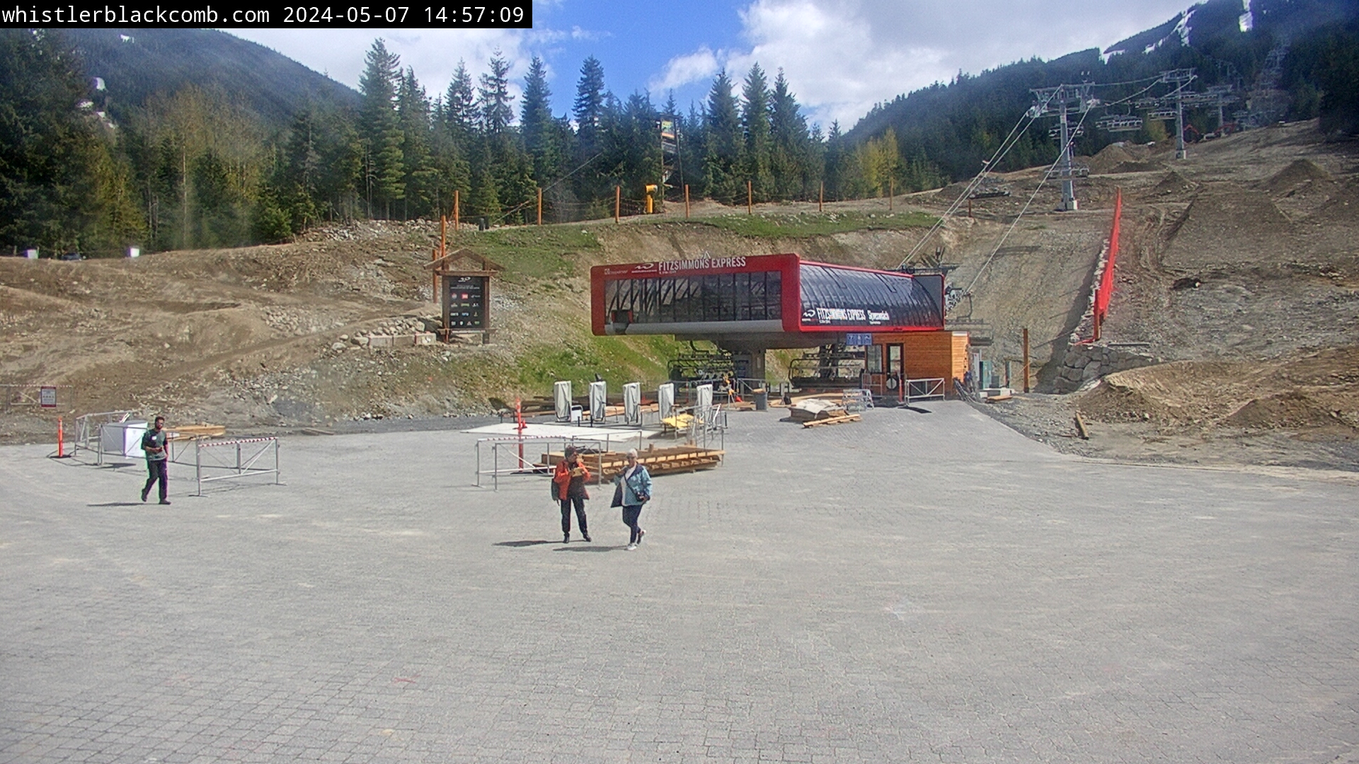
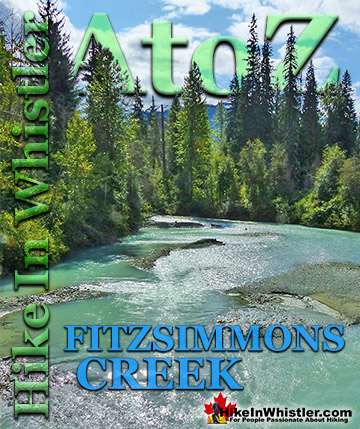
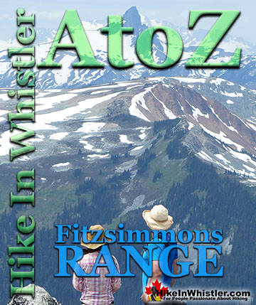
To the right of the Roundhouse webcam are two more cameras the Emerald camera and the Helipad camera. They both look out toward the Emerald Chair and Blackcomb Mountain beyond. A fantastic vantage point to the Spearhead Range, the mountain range that Blackcomb Mountain is part of. Whistler Mountain lays in the Fitzsimmons Range directly across the valley facing the Spearhead Range. Whistler Mountain and Blackcomb Mountain are separated by Fitzsimmons Creek which cuts between them down the valley, through Whistler Village and into Green Lake. In the summer this camera shows the starting point for hikers heading to the summit of Whistler Mountain via Pika's Traverse and Mathews' Traverse, or to Russet Lake via the Musical Bumps trail. The nice and easy Spearhead Loop trail links to the challenging Harmony Meadows trail or the moderately challenging Harmony Lake trail to connect to the challenging High Note trail, which in turn connects to the amazing Musical Bumps trail. The Musical Bumps trail takes you along the beautiful, undulating ridge extending from the peak of Whistler Mountain and ends at the Singing Pass trail. The Singing Pass trail then takes you up to Russet Lake or back down to Whistler Village, mostly running parallel to Fitzsimmons Creek. The Singing Pass trail which predates Whistler as a ski town, is one of the main gateway trailheads to Garibaldi Provincial Park. These days, the Singing Pass trailhead is found at the bus stop up the stars from the Dubh Linn Gate Pub. The original trailhead and parking area is located 5 kilometres up the valley at the end of the mostly intact old gravel road that leads to the once used parking lot. A landslide destroyed a section of this road a few decades ago and the road has since become a trail.


Whistler Mountain Big Red Webcam:
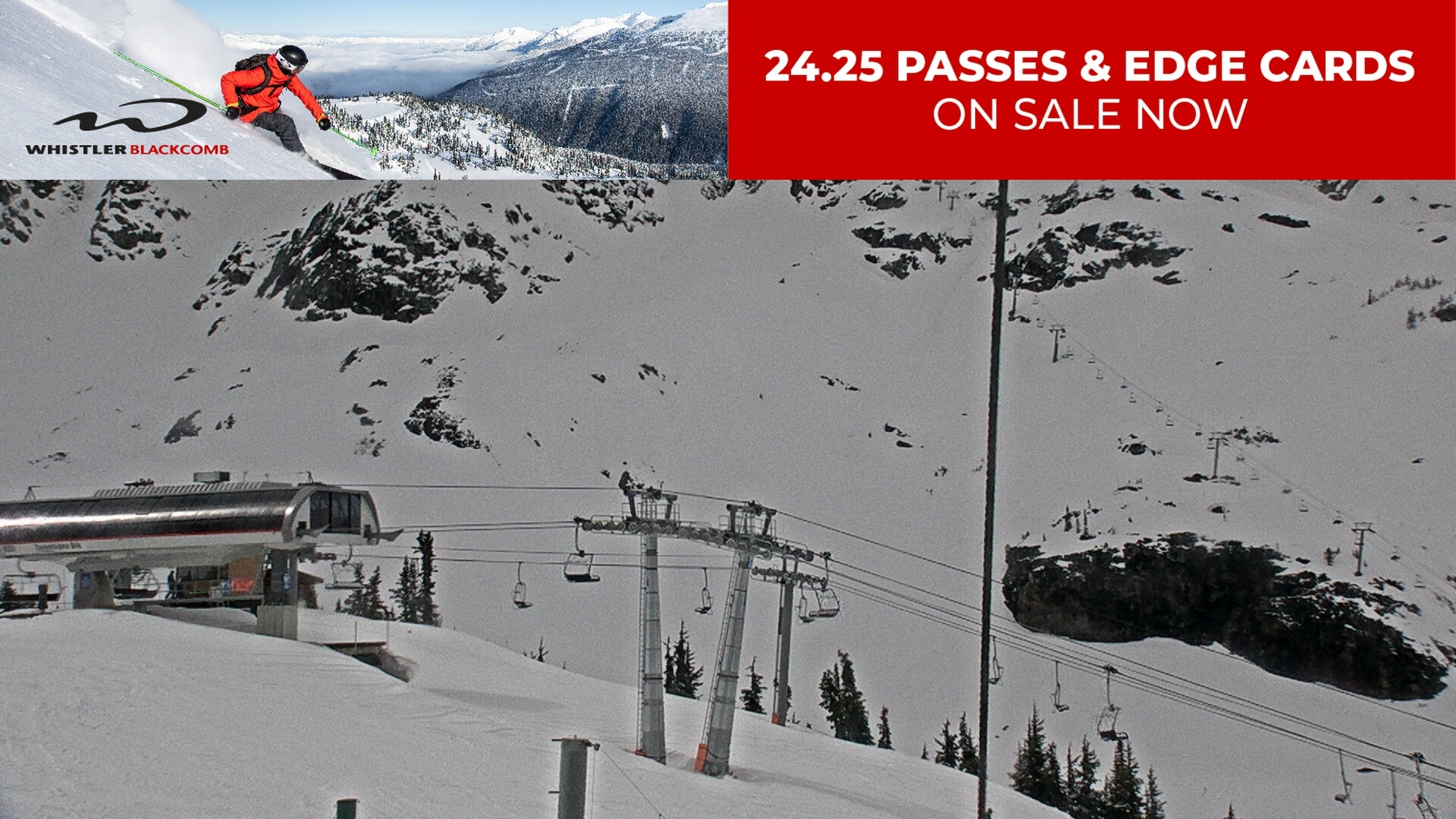
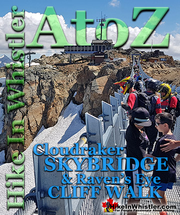
This is the Big Red webcam that is directed at the Big Red Express chair that connects from the Creekside Gondola. This camera gives you an excellent view of the Peak Express chair which rises steeply up to the summit of Whistler Mountain. At the summit you can see the Cloudraker Skybridge stretching across Whistler Bowl to the Raven's Eye viewpoint. In the winter months the Cloudraker Skybridge is taken apart, leaving just the cables stretching across Whistler Bowl. This is a great camera to see Whistler Mountain for conditions as well as a look at whether the Peak Express chair is open. This steep and exposed chairlift is frequently closed due to harsh weather conditions.
Whistler Mountain Valley South Webcam:
This is another camera angle from the cluster of webcams near the Roundhouse on Whistler Mountain. This one is called Valley South and gives an excellent view of the mountains across the valley opposite Whistler and Blackcomb mountains. These two mountains are Mount Sproatt and Rainbow Mountain. These two mountains are home to a huge network of trails that extend into the Callaghan Valley beyond. On the other side of Mount Sproatt and to the left of Rainbow Mountain is Rainbow Lake. Rainbow Lake is reached by a popular hiking trail that starts near Rainbow Park on the far side of Alta Lake. The Rainbow Trail cuts between the two mountains to reach Rainbow Lake, a pretty mountain lake and the source of much of Whistler's water. This camera is not only a great way to view of these two mountains, but occasionally gives you a startlingly beautiful view of Whistler Valley. Occasionally the valley fills with clouds and looks like a river of white flowing down the valley. An amazing sight to see, and not as rare as you might think.
Whistler Mountain Peak Webcams:
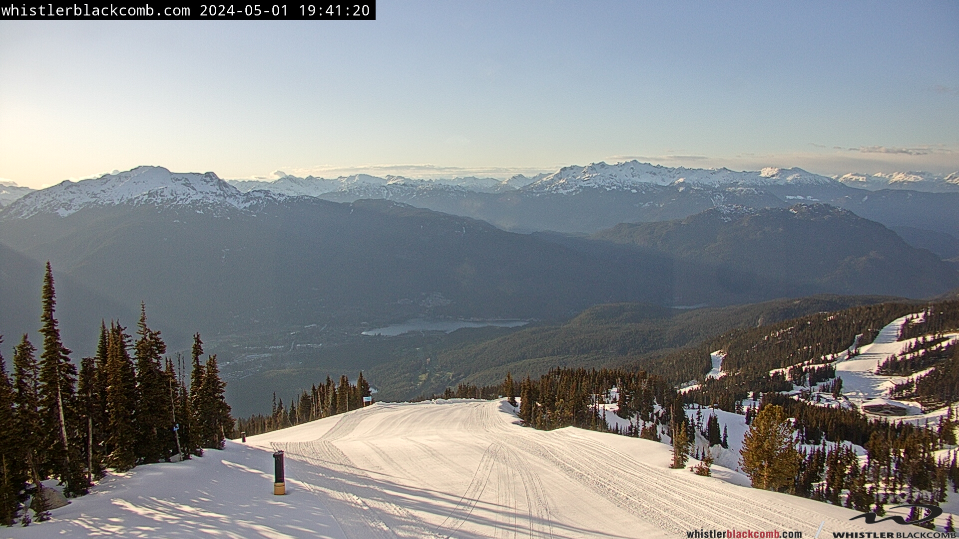
These webcams are located in a cluster at the top of Whistler Mountain. They are the Whistler Peak South, Whistler Peak West and the Whistler Peak North cameras. The Whistler Peak South webcam is a stunning view of Whistler Valley and the snowy mountains beyond. Similar to the Whistler Mountain Valley South camera, this one captures the extraordinary river of clouds that occasionally stretches down the valley. On a clear, sunny day you can see almost to the ocean and on a cloudy day you can check the weather or snow conditions at the summit of Whistler Mountain. The Whistler Peak West camera is an amazing camera that overlooks the top of the Peak Express chair as well as the Cloudraker Skybridge over to the Raven's Eye viewpoint. This camera has the inukshuk at the far left whereas the Peak South camera has it on the far right. This gives an anchor point to connect these two amazing Whistler summit viewpoints. The third camera is the Whistler Peak North camera and is a continuation of the previous two cameras to create a panorama of the summit of Whistler Mountain. This camera shows the top of the Peak Express appear over the cliffs, bringing skiers and snowboarders in the winter and hikers and bikers in the summer. In the distance, far down the valley you can see Green Lake and in the top left corner Rainbow Mountain. When there has been a lot of snow, this camera is particularly amazing as the snow piles high on the Peak Express chair towers and looks absolutely wonderful. This camera seems to move occasionally, so don't be surprised if it is accidentally pointing in a strange direction.

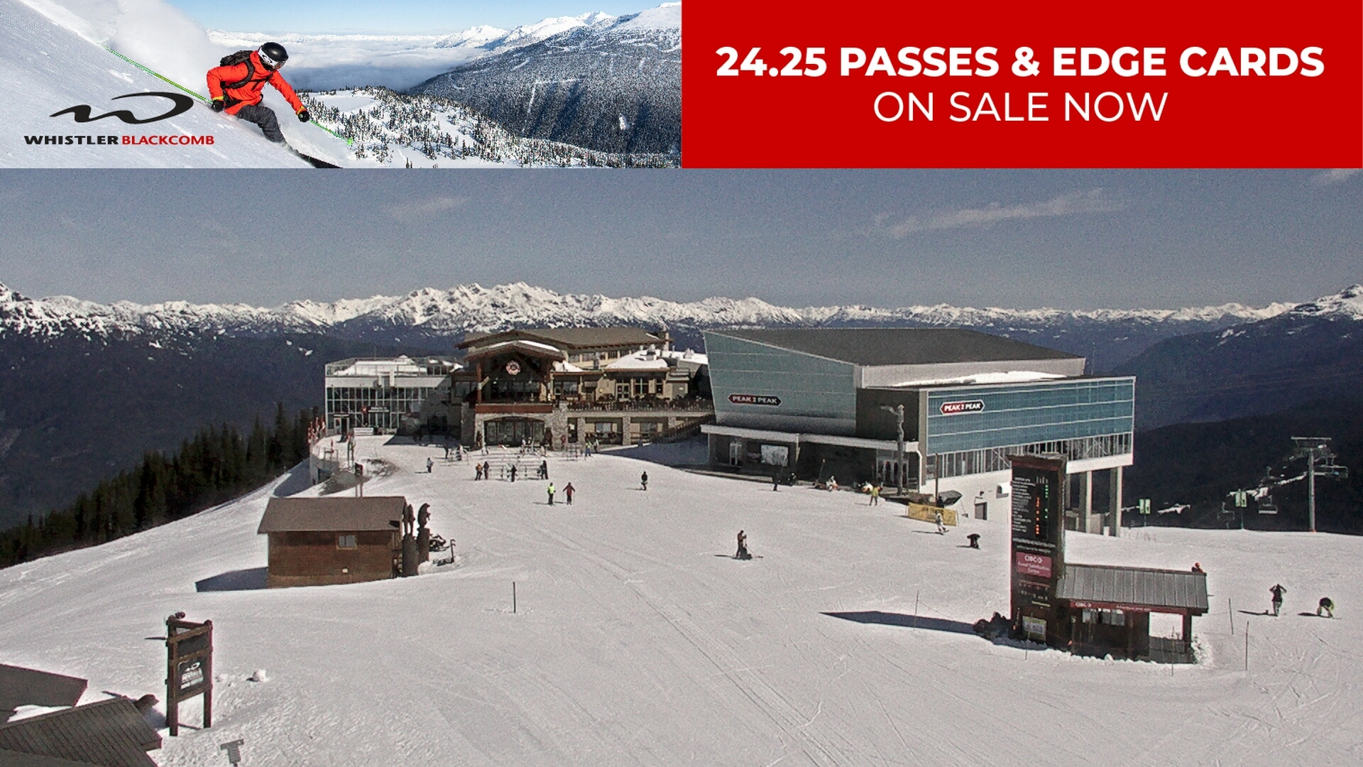
Blackcomb Mountain Peak2Peak Webcam:
Similar to the cluster of webcams at the Roundhouse Lodge, the Rendezvous Lodge on Blackcomb Mountain has a set of cameras as well. These cameras give you a 360 degree view of Blackcomb Mountain. The Peak2Peak webcam looks from the Rendezvous Lodge across to the Peak2Peak Gondola building. In the summer months this camera gives you a fantastic view of the start of the Blackcomb Mountain hiking trails that extend up beyond and to the right of the Peak2Peak building. The area in the middle left is where most visitors head to get great views down the valley.
Blackcomb Gondola Webcam:
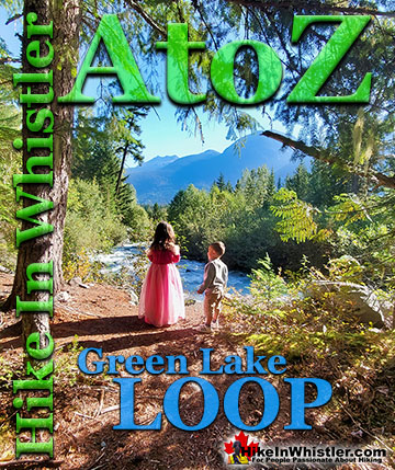
This beautiful camera gives you a great view of the Blackcomb Gondola as it arrives and departs from next to the Rendezvous Lodge. Down in Whistler Valley you can see Whistler's two large lakes, Alta Lake and Green Lake. Rising above Alta Lake is Mount Sproatt and to the right of Mount Sproatt is Rainbow Mountain. Back down in the valley in the far right is Green Lake. Whistler Village is hidden behind the cluster of trees in the middle of the image.
Blackcomb Mountain Wishbone Webcam:
The Blackcomb Mountain Wishbone camera gives you a direct view of Green Lake in the centre of the picture. Part of Whistler Village can be seen to the left of Green Lake. Below Green Lake you can see Chateau Whistler Golf Course and to the left of that is Lost Lake partially obscured by trees. Rainbow Mountain, on the left stretches to the sky, while the smaller mountain on the far right is Cougar Mountain. The snowy mountain above and beyond Cougar Mountain is Ipsoot Mountain which towers above Pemberton. This camera is named for the ski run visible in the lower, middle left that extends down to the Glacier Creek Lodge at the far right, bottom of the image.
Blackcomb Mountain Glacier Creek Webcam:
The Glacier Creek webcam has Glacier Creek Lodge in the bottom left corner. Wedge Mountain can be seen in the top right of the image. Wedge Mountain is the highest summit in the Garibaldi Ranges and Garibaldi Provincial Park at 2895 metres or 9497 feet. Wedgemount Lake is arguably the most beautiful hike in Garibaldi Park. The emerald green Wedgemount Lake is surrounded by mountains on all sides with Wedge Glacier stretching from the end of the lake up to Wedge Mountain. Wedge Mountain, Blackcomb Mountain and Whistler Mountain are the three mountains that dominate the skyline from Whistler Village.
The Crystal Road and Couloir Webcams:
These two cameras complete the 360 degree panorama that the six Rendezvous Lodge cameras combine to make. The Crystal Road webcam is named for the ski run that is visible in the middle left of the image. The Couloir webcam is named from the couloir it faces. A couloir is the name for a steep mountainside gorge, shown here rising above Jersey Cream Bowl
Whistler Village Webcams:
These three webcams show Skier's Plaza at the base of Whistler Mountain. Three of Whistler's best and best known pubs are found here. The GLC, the Longhorn and Dubh Linn Gate, though the Dubh Linn Gate is not visible on these cameras, though one camera is just above their patio.
The Crabapple Hut Webcam:
The Crabapple Hut webcam is located on Whistler Golf Course. The Crabapple Hut is a small hut that sells food and drinks at the far end of the golf course. The webcam looks down the fairway to Blackcomb Mountain. On a clear day it also gives an excellent view of the Peak2Peak Gondola and The Fissile beyond.
Hwy 99 at Portage Rd, Pemberton


Hwy 99 at Lorimer Rd, Whistler Village


Hwy 99 at Village Gate Blvd, Whistler Village


Hwy 99 at Lake Placid Rd, Whistler Creekside


Hwy 99 at Function Junction, Whistler


Hwy 99 at Daisy Lake


Hwy 99 at Alice Lake, Squamish


Hwy 99 at Britannia Beach


More live webcams for Tofino click here and for Vancouver click here.
Guides to the Best of Whistler
 Best Dog Friendly Hiking Trails
Whistler is very dog friendly and the number of wonderful hiking trails that your dog will love is huge. The massively varied hiking trails range from easy, short, close to Whistler Village to challenging, long and deep in the endless wilderness around Whistler. You can find dog friendly trails in and around Whistler Village that take you through deep, dark and magical forests. Or you can drive beyond Whistler Village and take your dog to spectacular alpine lakes. Some requiring little or no hiking, while others are found after hiking challenging and long trails. Many of these places are comparatively quiet and often you and your dog will have the the wilderness to yourselves. In and around Whistler Village you have Lost Lake with its spider web of trails... Continued here.
 Best Free Whistler Camping
Whistler is surrounded by an immense wilderness dotted with spectacular, hidden lakes and amazing places to set up a tent. Decades of logging activity has left a network of forest service roads that has opened easy access to these places. Some of these you can drive to and some you may need a 4x4 to comfortably get to. Some places to camp for free you can drive to, some require a short hike and others are fairly long hikes to reach. Beautiful Callaghan Valley is home to several incredible and free places to camp. Callaghan Lake has a great free drive-to campsite just steps from this spectacular alpine lake. If you have a canoe, you can paddle to the end of Callaghan Lake and hike the short, but steep trail up to Cirque Lake. This gorgeous lake is deep in the alpine wilderness... Continued here.
 No Car? No Problem! Whistler Trails
Whistler as a resort has a wonderful car-free core. The Village Stroll runs through the heart of Whistler Village and is entirely car free. If you are visiting Whistler or living here and you don't have a car, it's no problem. On foot or on a bike you can travel the extensive network of non-motorized trails. The Valley Trail snakes through Whistler Village and extends in several directions, all of which lead to beautiful parts of Whistler. The Sea to Sky Trail and the Lost Lake trails continue this massive, car-free network of trails running almost everywhere in Whistler. When it comes to many of the best hiking trails, getting to the trailheads on foot, by bike or public transit can be tricky at best or complicated and impractical at worst. Many trailheads are far from Whistler Village and... Continued here.
 Kid Friendly Whistler Hiking Trails
There are plenty of excellent, kid and family friendly hiking trails and destinations in and around Whistler. Kid and family friendly generally means an easy and somewhat short trail that a toddler can happily manage. Some of these trails are flat enough to be stroller friendly, such as Brandywine Falls, Whistler Mountain and Blackcomb Mountain. Others such as Logger’s Lake, Cheakamus River and Madeley Lake have short enough trails to reach them that you can manage with little kids that don't want to hike too far. Some of these hikes and walks are popular and close to Whistler Village, like Whistler Mountain, Blackcomb Mountain, Lost Lake Park, Rainbow Park and Meadow Park. Others are a beautiful, but far drive into the mountains and tricky to find... Continued here.
 Best Sights Sea to Sky 99
The Sea to Sky Highway links Vancouver to Whistler and has several stops along the way that are often overlooked. Porteau Cove, for example, is surprisingly unknown even to locals that have driven past hundreds of times. Just off the highway the parking area is just steps from the huge pier stretching way out over the ocean. This gigantic pier is actually a rarely used emergency dock for BC Ferries, though more often used by visitors for its stunning views of Howe Sound. Porteau Cove is an excellent pit stop on the way to Whistler, not only for the spectacular views of Howe Sound, but one of the nicest picnic spots and most convenient restrooms! Other attractions along the Sea to Sky Highway are more obvious, such as Shannon Falls, the Sea to Sky Gondola... Continued here.
 Whistler Train Wreck Murals
The colourful graffiti and murals that make Whistler Train Wreck the magical place it is today began appearing in 2011, when this hidden place was known by just a few Whistler locals. In the summer of 2011 several Whistler artists came here for "The Train Wreck Paint Jam" and transformed the mangled wreckage into a surreal art exhibit. The artists ranged from aspiring graffiti artists to professional artists like Kups. Remnants of one of his murals from 2011 is found inside the first boxcar you come to after crossing the bridge into Whistler Train Wreck. Several of the original murals were gorgeous. Brilliantly coloured and surreal in such an unusual, tranquil and hidden forest with seven mangled train boxcars scattered. Like some sort of haunting art gallery... Continued here.
Amazing Whistler & Garibaldi Park Hiking!

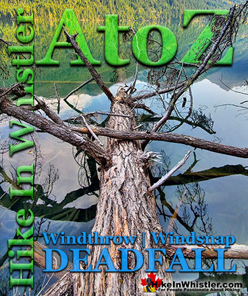
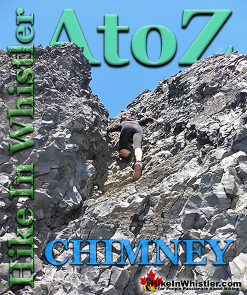
Whistler & Garibaldi Park Hiking Glossary A to Z
Whistler & Garibaldi Park Best Hiking by Month!


Explore BC Hiking Destinations!

Whistler Hiking Trails

Squamish Hiking Trails

Vancouver Hiking Trails

Clayoquot Hiking Trails
Victoria Hiking Trails

