![]() June is a pretty amazing month to hike in Whistler and Garibaldi Park. The average low and high temperatures in Whistler range from 9c to 21c(48f/70f). The summer tourist season in Whistler doesn’t kick into high gear until the end of June, so most trails remain relatively quiet. The higher elevation hiking trails in Whistler and Garibaldi Park often have lingering snow well into June and sometimes early July.
June is a pretty amazing month to hike in Whistler and Garibaldi Park. The average low and high temperatures in Whistler range from 9c to 21c(48f/70f). The summer tourist season in Whistler doesn’t kick into high gear until the end of June, so most trails remain relatively quiet. The higher elevation hiking trails in Whistler and Garibaldi Park often have lingering snow well into June and sometimes early July.
Whistler Hiking in June
- Joffre Lakes
- Cheakamus Lake
- Whistler Train Wreck
- Cheakamus River & Logger's Lake
- Alexander Falls
- Madeley Lake
- Parkhurst Ghost Town
- Ancient Cedars, Showh Lakes & Newt Lake
- Brandywine Falls
- Nairn Falls
- Rainbow Falls
- Sea to Sky Trail
- Skookumchuck Hot Springs
- Rainbow Lake
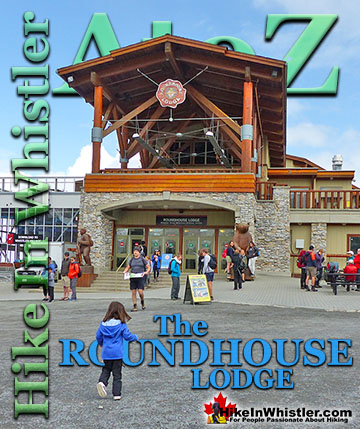
Because of the snow, many trails are not easily accessible or still require snowshoes, at least in the alpine, well into June. Wedgemount Lake is accessible, but snow on the last, steep ascent is way too daunting for your average hiker, so should be avoided until late June or early July. The approach to Panorama Ridge is similarly difficult if you have to contend with deep snow. The trail to Black Tusk is far less challenging in June, however you will certainly encounter snow as you start ascending off the main trail for the increasingly sleep route to the final summit route. The branching trail off the Cheakamus Lake trail to Helm Creek is also challenging in June due to lingering snow. Most years it takes until mid June for the snow to melt from the steep and north facing trail. It is not unusual to have a metre of snow on the ground at Helm Creek in late June or even the start of July. Whistler Mountain and Blackcomb Mountain open for the summer season in late May, however, most of the trails don’t emerge from the snow until well into June. You can still hike a bit around the Roundhouse on Whistler Mountain and Rendezvous Lodge on Blackcomb Mountain, but you will not get far due to the snow. Cheakamus Lake in Garibaldi Provincial Park is an excellent place to hike in June. It is reliably free of snow by mid May and much less busy than it will be in July and August. Cheakamus River flows down the valley from Cheakamus Lake and trails on either side are accessible year-round and definitely worth hiking in June. You can start hiking just steps from your car along one side of Cheakamus River for two kilometres. Cross the picturesque suspension bridge and return to your car via the other side of the river. The winding trails hug this beautiful river and give you several beautiful viewpoints over the chaotic, swirling torrent of water below. Logger’s Lake is a nice and short detour off the Cheakamus River trail at the suspension bridge. Just a 5 minute hike up to the shores of Logger’s Lake. This amazing little lake exists in an extinct volcano and this fact becomes wonderfully obvious as you hike around the perimeter. One side is a boulder strewn shore that slopes up sharply to the abrupt cliff ridge that extends around much of the lake. An easy hike overlooking a very secluded feeling volcano lake.
Wild and Beautiful Logger's Lake!

Back along Cheakamus River if you continue downriver past or through the little neighbourhood, Cheakamus Crossing you will find more hiking trails. The Sea to Sky Trail runs through Cheakamus Crossing and runs south through the wilderness all the way to Brandywine Falls. Or runs north through the centre of Whistler Village to Lost Lake, then up and around the far side of Green Lake past Parkhurst Ghost Town. It continues past the end of Green Lake and passes fairly close to the trailhead for Wedgemount Lake before bending down through WedgeWood Estates to the Sea to Sky Highway. The south end of the Sea to Sky Trail in Cheakamus Crossing connects to Whistler Train Wreck via a beautiful suspension bridge over Cheakamus River. June is a particularly good time to check out Whistler Train Wreck as you have nice weather and few visitors. Train Wreck Falls is amazing to see from several impossibly idyllic viewpoints. Broad, rock cliffs lay directly across from the falls as well as adjacent to, and further downriver.
Train Wreck Falls is Gorgeous in June

Guides to the Best of Whistler
 Best Dog Friendly Hiking Trails
Whistler is very dog friendly and the number of wonderful hiking trails that your dog will love is huge. The massively varied hiking trails range from easy, short, close to Whistler Village to challenging, long and deep in the endless wilderness around Whistler. You can find dog friendly trails in and around Whistler Village that take you through deep, dark and magical forests. Or you can drive beyond Whistler Village and take your dog to spectacular alpine lakes. Some requiring little or no hiking, while others are found after hiking challenging and long trails. Many of these places are comparatively quiet and often you and your dog will have the the wilderness to yourselves. In and around Whistler Village you have Lost Lake with its spider web of trails... Continued here...
 Best Free Whistler Camping
Whistler is surrounded by an immense wilderness dotted with spectacular, hidden lakes and amazing places to set up a tent. Decades of logging activity has left a network of forest service roads that has opened easy access to these places. Some of these you can drive to and some you may need a 4x4 to comfortably get to. Some places to camp for free you can drive to, some require a short hike and others are fairly long hikes to reach. Beautiful Callaghan Valley is home to several incredible and free places to camp. Callaghan Lake has a great free drive-to campsite just steps from this spectacular alpine lake. If you have a canoe, you can paddle to the end of Callaghan Lake and hike the short, but steep trail up to Cirque Lake. This gorgeous lake is deep in the alpine wilderness... Continued here...
 No Car? No Problem! Whistler Trails
Whistler as a resort has a wonderful car-free core. The Village Stroll runs through the heart of Whistler Village and is entirely car free. If you are visiting Whistler or living here and you don't have a car, it's no problem. On foot or on a bike you can travel the extensive network of non-motorized trails. The Valley Trail snakes through Whistler Village and extends in several directions, all of which lead to beautiful parts of Whistler. The Sea to Sky Trail and the Lost Lake trails continue this massive, car-free network of trails running almost everywhere in Whistler. When it comes to many of the best hiking trails, getting to the trailheads on foot, by bike or public transit can be tricky at best or complicated and impractical at worst. Many trailheads are far from Whistler Village and... Continued here...
 Kid Friendly Whistler Hiking Trails
There are plenty of excellent, kid and family friendly hiking trails and destinations in and around Whistler. Kid and family friendly generally means an easy and somewhat short trail that a toddler can happily manage. Some of these trails are flat enough to be stroller friendly, such as Brandywine Falls, Whistler Mountain and Blackcomb Mountain. Others such as Logger’s Lake, Cheakamus River and Madeley Lake have short enough trails to reach them that you can manage with little kids that don't want to hike too far. Some of these hikes and walks are popular and close to Whistler Village, like Whistler Mountain, Blackcomb Mountain, Lost Lake Park, Rainbow Park and Meadow Park. Others are a beautiful, but far drive into the mountains and tricky to find... Continued here...
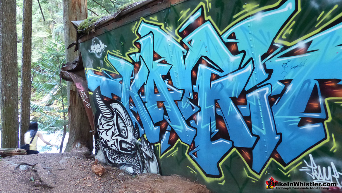
 Whistler Train Wreck Murals
The colourful graffiti and murals that make Whistler Train Wreck the magical place it is today began appearing in 2011, when this hidden place was known by just a few Whistler locals. In the summer of 2011 several Whistler artists came here for "The Train Wreck Paint Jam" and transformed the mangled wreckage into a surreal art exhibit. The artists ranged from aspiring graffiti artists to professional artists like Kups. Remnants of one of his murals from 2011 is found inside the first boxcar you come to after crossing the bridge into Whistler Train Wreck. Several of the original murals were gorgeous. Brilliantly coloured and surreal in such an unusual, tranquil and hidden forest with seven mangled train boxcars scattered. Like some sort of haunting art gallery... Continued here.
 Northair Mine Murals
Way up in the Callaghan Valley on the back side of Mount Sproatt is an abandoned gold mine. Old cement foundations and two unexpectedly beautiful lakes mark the location of Northair Mine, abandoned in 1982. It was a fairly productive gold mine that extracted five tons of gold. Largely forgotten for years, in the last decade it has come to life in stunning colour by graffiti artists and professional muralists. In the summer of 2013, the first mural appeared on the blank foundation walls of Northair Mine. A creation of a professional Whistler artist PETKO. Painted on one of the inside, pillar walls, the mural is about 8 feet tall and five feet wide of what looks like a robot snake in front of a cube background. It stood out in striking contrast to the grey walls in the background... Continued here.
Best Whistler & Garibaldi Park Hiking in June
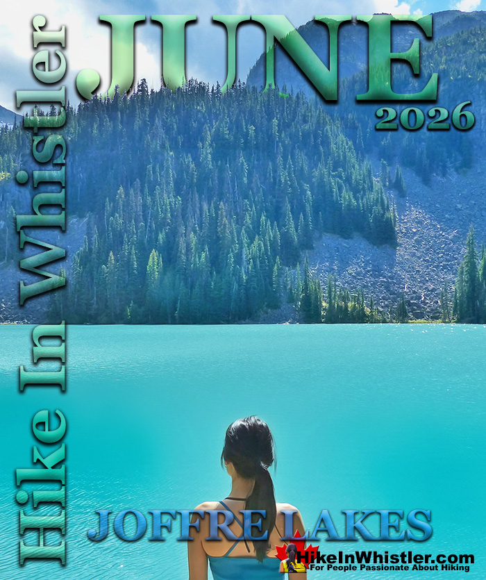
Joffre Lakes is Fantastic in June
![]() Joffre Lakes is one of the best places to hike in June in and around Whistler. The trail to Joffre Lakes seems to emerge from the winter snow sooner than other high elevation hiking trails in Whistler. Joffre Lakes Park can get ridiculously busy in the summer months and June is considerably less chaotic than July and August. Still, on a sunny weekend in June, you should set out for the Joffre Lakes trailhead early as you will still see it busy. Remember as well that if you plan on camping, you need to reserve online before you go as BC Parks is attempting to control the rising popularity of Joffre Lakes. Day hiking is still free, though you have to get a day pass online. Parking is also still free, however keep in mind that overflow parking along the highway is no longer allowed.
Joffre Lakes is one of the best places to hike in June in and around Whistler. The trail to Joffre Lakes seems to emerge from the winter snow sooner than other high elevation hiking trails in Whistler. Joffre Lakes Park can get ridiculously busy in the summer months and June is considerably less chaotic than July and August. Still, on a sunny weekend in June, you should set out for the Joffre Lakes trailhead early as you will still see it busy. Remember as well that if you plan on camping, you need to reserve online before you go as BC Parks is attempting to control the rising popularity of Joffre Lakes. Day hiking is still free, though you have to get a day pass online. Parking is also still free, however keep in mind that overflow parking along the highway is no longer allowed.
Beautiful Joffre Lakes Usually Snow Free in June

Upper Joffre Lake and Matier Glacier


More Joffre Lakes in June click here.
Cheakamus Lake is Beautiful in June
![]() Cheakamus Lake is another amazing hiking trail in Whistler in June. Similar to Joffre Lakes, the Cheakamus Lake trail emerges from the snow in mid May and is the first snow free hiking trail in Garibaldi Provincial Park of the year. New in 2018 you have to reserve online to camp at Cheakamus Lake. There are two excellent campsites on the shore of this stunningly beautiful alpine lake. Day hiking at Cheakamus Lake is still free as it is will all Garibaldi Park trails. Cheakamus Lake has a terribly potholed, 8 kilometre access road to the trailhead. All cars can get up this road, however it is so potholed that you tend to have to drive slow. This inconvenience keeps a lot of visitors away and choosing other Garibaldi Provincial Park access points. Cheakamus Lake is a very popular day-hiking destination and most visitors only hike to the start of the lake, just 4 kilometres from the trailhead. If you keep hiking the next 3 kilometres to the end of the Cheakamus Lake trail you will encounter few hikers and better and better views. The Cheakamus Lake trail runs along the edge of the lake, usually within a few metres of the shore, so you rarely don’t have a beautiful view of the lake. The much quieter campsite at the end of the Cheakamus Lake trail is the Singing Creek campsite. Spending the night here is a wonderfully remote and peaceful campsite in paradise. In June, with snow still covering the mountains in the distance, Cheakamus Lake is particularly wonderful!
Cheakamus Lake is another amazing hiking trail in Whistler in June. Similar to Joffre Lakes, the Cheakamus Lake trail emerges from the snow in mid May and is the first snow free hiking trail in Garibaldi Provincial Park of the year. New in 2018 you have to reserve online to camp at Cheakamus Lake. There are two excellent campsites on the shore of this stunningly beautiful alpine lake. Day hiking at Cheakamus Lake is still free as it is will all Garibaldi Park trails. Cheakamus Lake has a terribly potholed, 8 kilometre access road to the trailhead. All cars can get up this road, however it is so potholed that you tend to have to drive slow. This inconvenience keeps a lot of visitors away and choosing other Garibaldi Provincial Park access points. Cheakamus Lake is a very popular day-hiking destination and most visitors only hike to the start of the lake, just 4 kilometres from the trailhead. If you keep hiking the next 3 kilometres to the end of the Cheakamus Lake trail you will encounter few hikers and better and better views. The Cheakamus Lake trail runs along the edge of the lake, usually within a few metres of the shore, so you rarely don’t have a beautiful view of the lake. The much quieter campsite at the end of the Cheakamus Lake trail is the Singing Creek campsite. Spending the night here is a wonderfully remote and peaceful campsite in paradise. In June, with snow still covering the mountains in the distance, Cheakamus Lake is particularly wonderful!
Beautiful Forest on the Trail to Cheakamus Lake

Springtime Fishing at Cheakamus Lake

Amazing Views Along the Cheakamus Lake Trail

Amazing Campsites at Cheakamus Lake


More Cheakamus Lake in June click here.
Whistler Train Wreck in June
![]() Whistler Train Wreck is also a beautiful place to hike in June in Whistler. Accessible year-round, the Train Wreck trail in June is often sunny, bright and beautiful. The sun beams through the trees making the graffiti painted train wrecks bright and beautiful. Cheakamus River is always gorgeous along Whistler Train Wreck, but on a sunny June day it is a vivid, green and white swirling torrent crashing between rock cliffs on either side. May and June temperature rises fill the river with meltwater and makes Cheakamus River particularly beautiful as it crashes past Whistler Train Wreck. Train Wreck Falls is particularly stunning in June and best viewed from the Train Wreck side of Cheakamus River. Cheakamus River has quite a network of hiking and biking trails that extend like a spider web all around it. On the opposite side of the river from Whistler Train Wreck is the Trash Trail. This takes you to the closest viewpoint to Train Wreck Falls, where you can stand at the rocky edge where the water plummets into the white swirling pool below.
Whistler Train Wreck is also a beautiful place to hike in June in Whistler. Accessible year-round, the Train Wreck trail in June is often sunny, bright and beautiful. The sun beams through the trees making the graffiti painted train wrecks bright and beautiful. Cheakamus River is always gorgeous along Whistler Train Wreck, but on a sunny June day it is a vivid, green and white swirling torrent crashing between rock cliffs on either side. May and June temperature rises fill the river with meltwater and makes Cheakamus River particularly beautiful as it crashes past Whistler Train Wreck. Train Wreck Falls is particularly stunning in June and best viewed from the Train Wreck side of Cheakamus River. Cheakamus River has quite a network of hiking and biking trails that extend like a spider web all around it. On the opposite side of the river from Whistler Train Wreck is the Trash Trail. This takes you to the closest viewpoint to Train Wreck Falls, where you can stand at the rocky edge where the water plummets into the white swirling pool below.
Gorgeous Train Wreck Falls in June

Whistler Train Wreck

Whistler Train Wreck Continued...
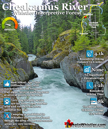
Cheakamus River & Logger's Lake in June
![]() Logger’s Lake is a wonderful, hidden lake that sits in an ancient volcano. This becomes quickly evident if you hike up the short trail to the viewpoint over the lake. In June the lake would have recently emerged from the winter snow and on a sunny June day it looks like a secret paradise. In June Logger’s Lake is a beautiful place for a swim. With construction in Cheakamus Crossing blocking driving access to the Logger’s Lake trailhead parking until at least 2024, you now have to park further away and hike in. Most park in the big Whistler Interpretive Forest parking lot just off the Sea to Sky Highway and hike or bike 3.6 kilometres to the trailhead. If you want to park as close as possible to the Logger's Lake trailhead, the best parking is found along the Cheakamus Lake FSR at the unmarked parking area for MacLaurin's Crossing, shown on the map below. This gets you just 664 metres from the trailhead and is a nice and easy route that crosses the beautiful MacLaurin's Crossing bridge over Cheakamus River then along the easy Riverside trail. Hiking or biking distance to Logger’s Lake from the MacLaurins Crossing parking is 1 kilometre. If you start from the parking lot at Whistler Interpretive Forest the hiking or biking distance to Logger’s Lake is about 4 kilometres.
Logger’s Lake is a wonderful, hidden lake that sits in an ancient volcano. This becomes quickly evident if you hike up the short trail to the viewpoint over the lake. In June the lake would have recently emerged from the winter snow and on a sunny June day it looks like a secret paradise. In June Logger’s Lake is a beautiful place for a swim. With construction in Cheakamus Crossing blocking driving access to the Logger’s Lake trailhead parking until at least 2024, you now have to park further away and hike in. Most park in the big Whistler Interpretive Forest parking lot just off the Sea to Sky Highway and hike or bike 3.6 kilometres to the trailhead. If you want to park as close as possible to the Logger's Lake trailhead, the best parking is found along the Cheakamus Lake FSR at the unmarked parking area for MacLaurin's Crossing, shown on the map below. This gets you just 664 metres from the trailhead and is a nice and easy route that crosses the beautiful MacLaurin's Crossing bridge over Cheakamus River then along the easy Riverside trail. Hiking or biking distance to Logger’s Lake from the MacLaurins Crossing parking is 1 kilometre. If you start from the parking lot at Whistler Interpretive Forest the hiking or biking distance to Logger’s Lake is about 4 kilometres.
Logger's Lake Crater Rim View


More Logger's Lake in June click here.
Alexander Falls - Best Whistler Hiking in June
![]() Alexander Falls in June is beautiful with the spring runoff making the falls considerably more impressive than almost any other month. June also is the first month that you will find black bears emerging from the forest in the Callaghan Valley in numbers. The drive to Alexander Falls once you leave the Sea to Sky Highway is one of the easiest ways to spot bears. Callaghan Valley Road was only paved just before the 2010 Winter Olympic Games. Before being paved, Callaghan Valley Road was a gravel logging road and not very appealing to most. Now that it is paved, it has become a popular bear watching attraction, especially in June. Bears love the grass that grows along the road and it is not unusual in June to see 3 or more bears along Callaghan Valley Road, on the way to Alexander Falls.
Alexander Falls in June is beautiful with the spring runoff making the falls considerably more impressive than almost any other month. June also is the first month that you will find black bears emerging from the forest in the Callaghan Valley in numbers. The drive to Alexander Falls once you leave the Sea to Sky Highway is one of the easiest ways to spot bears. Callaghan Valley Road was only paved just before the 2010 Winter Olympic Games. Before being paved, Callaghan Valley Road was a gravel logging road and not very appealing to most. Now that it is paved, it has become a popular bear watching attraction, especially in June. Bears love the grass that grows along the road and it is not unusual in June to see 3 or more bears along Callaghan Valley Road, on the way to Alexander Falls.
Beautiful Alexander Falls


More Alexander Falls in June click here.
Madeley Lake - Best Whistler Hiking in June
![]() Madeley Lake is another beautiful sight to see in the Callaghan Valley in late June. Just past the turnoff to Alexander Falls on your left you will see a bridge that crosses the river just up from the top of Alexander Falls. If you follow the gravel road across the bridge you will soon see Madeley Lake Road on your right. Follow this increasingly bumpy logging road for 5-10 minutes and you will reach a gate. A new gate installed in 2022 blocks Madeley Lake FSR which continues two kilometres to the far end of Madeley Lake near the campsite. Madeley Lake is an idyllic, mountain lake that will have just emerged from the snow in May. In June the lake is gorgeous. At the end of Madeley Lake Road you will come to a bridge and the end of the road. If you walk across the bridge you will see a trail on your right descend into the forest along the river. This short trail takes you to the Madeley Lake campsite. A cute little forested campsite at the edge of the lake. Beautiful in June and you often will have the lake to yourself. **the access road to Madeley Lake is sometimes impassable due to snow until early June.
Madeley Lake is another beautiful sight to see in the Callaghan Valley in late June. Just past the turnoff to Alexander Falls on your left you will see a bridge that crosses the river just up from the top of Alexander Falls. If you follow the gravel road across the bridge you will soon see Madeley Lake Road on your right. Follow this increasingly bumpy logging road for 5-10 minutes and you will reach a gate. A new gate installed in 2022 blocks Madeley Lake FSR which continues two kilometres to the far end of Madeley Lake near the campsite. Madeley Lake is an idyllic, mountain lake that will have just emerged from the snow in May. In June the lake is gorgeous. At the end of Madeley Lake Road you will come to a bridge and the end of the road. If you walk across the bridge you will see a trail on your right descend into the forest along the river. This short trail takes you to the Madeley Lake campsite. A cute little forested campsite at the edge of the lake. Beautiful in June and you often will have the lake to yourself. **the access road to Madeley Lake is sometimes impassable due to snow until early June.


More Madeley Lake in June click here.
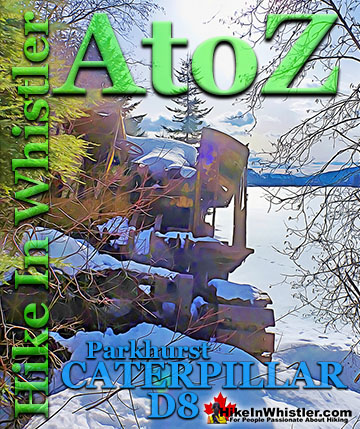
Parkhurst Ghost Town - Best Whistler Hiking in June
![]() Parkhurst Ghost Town is a long abandoned logging town that is locally famous as the decades old sight of a squatters community. The famous picture of 14 naked people in front of the old Toad Hall building holding skis is for many, symbolizes Whistler in a way nothing else can. The Toad Hall building is long gone and all but one of the old Parkhurst houses have collapsed. There are lots of little curiosities from the old ghost town strewn throughout the wild wilderness on the far side of Green Lake. June is an excellent time of year to explore the area as the weather is often warm, there are rarely any people to bump in to, and the annoying mosquitoes of the summer have not begun attacking in force yet!
Parkhurst Ghost Town is a long abandoned logging town that is locally famous as the decades old sight of a squatters community. The famous picture of 14 naked people in front of the old Toad Hall building holding skis is for many, symbolizes Whistler in a way nothing else can. The Toad Hall building is long gone and all but one of the old Parkhurst houses have collapsed. There are lots of little curiosities from the old ghost town strewn throughout the wild wilderness on the far side of Green Lake. June is an excellent time of year to explore the area as the weather is often warm, there are rarely any people to bump in to, and the annoying mosquitoes of the summer have not begun attacking in force yet!
Parkhurst Ghost Town Blue Face House


More Parkhurst Ghost Town in June click here.
Ancient Cedars, Showh Lakes & Newt Lake in June
![]() Ancient Cedars is another good hiking trail to try in June. Snow covers the access road well into May, so the trail will have only recently appeared. Ancient Cedars is a cute, short and fairly easy hiking trail to a nice grove of thousand year old trees. Another trail extends to Showh Lakes, two impossibly scenic little wilderness lakes up there in the deep forest. The lakes are so immersed in the wilderness that the forest spills over the lake, leaving few areas where you can actually get to the water. Bring a canoe and you will be floating in paradise on a warm, sunny June day. Connecting trails from Ancient Cedars lead to Showh Lakes and a challenging trail connects to the beautifully tranquil Newt Lake.
Ancient Cedars is another good hiking trail to try in June. Snow covers the access road well into May, so the trail will have only recently appeared. Ancient Cedars is a cute, short and fairly easy hiking trail to a nice grove of thousand year old trees. Another trail extends to Showh Lakes, two impossibly scenic little wilderness lakes up there in the deep forest. The lakes are so immersed in the wilderness that the forest spills over the lake, leaving few areas where you can actually get to the water. Bring a canoe and you will be floating in paradise on a warm, sunny June day. Connecting trails from Ancient Cedars lead to Showh Lakes and a challenging trail connects to the beautifully tranquil Newt Lake.
Kid Friendly and Fun Ancient Cedars

Showh Lakes Near Ancient Cedars

Newt Lake is a Secluded Paradise


More Ancient Cedars in June click here.
Brandywine Falls - Best Whistler Hiking in June
![]() Brandywine Falls is always beautiful, easy and convenient to see, but in June it is especially impressive due to the huge volume of water from spring runoff. Several times the volume of water than you would see in the winter months, in June Brandywine Falls is particularly impressive and well worth the five minute hike. The impressive falls are just one of a few sights to see in Brandywine Falls Provincial Park. Swim Lake, the Whistler Bungee Bridge and the Sea to Sky Trail running through the park make it a hiking, biking, jogging, snowshoeing paradise. You can set off from Whistler Village by bike on the Sea to Sky Trail and reach the falls in about an hour or two.. and rarely emerge from forest!
Brandywine Falls is always beautiful, easy and convenient to see, but in June it is especially impressive due to the huge volume of water from spring runoff. Several times the volume of water than you would see in the winter months, in June Brandywine Falls is particularly impressive and well worth the five minute hike. The impressive falls are just one of a few sights to see in Brandywine Falls Provincial Park. Swim Lake, the Whistler Bungee Bridge and the Sea to Sky Trail running through the park make it a hiking, biking, jogging, snowshoeing paradise. You can set off from Whistler Village by bike on the Sea to Sky Trail and reach the falls in about an hour or two.. and rarely emerge from forest!


More Brandywine Falls in June click here.
Nairn Falls - Best Whistler Hiking in June
![]() Nairn Falls is another of Whistler’s beautiful waterfalls that are accessible year-round. As with all the other waterfalls around Whistler, the melting snow fills the lakes and rivers and all the waterfalls are most impressive. May and June are the months when the winter snow causes Nairn Falls to become the most crashing and chaotic, as the huge volume of water pours through the narrow channels of rock that make up the falls. Nairn Falls Provincial Park is located just a short 20 minute drive north of Whistler.
Nairn Falls is another of Whistler’s beautiful waterfalls that are accessible year-round. As with all the other waterfalls around Whistler, the melting snow fills the lakes and rivers and all the waterfalls are most impressive. May and June are the months when the winter snow causes Nairn Falls to become the most crashing and chaotic, as the huge volume of water pours through the narrow channels of rock that make up the falls. Nairn Falls Provincial Park is located just a short 20 minute drive north of Whistler.


More Nairn Falls in June click here.
Rainbow Falls - Best Whistler Hiking in June
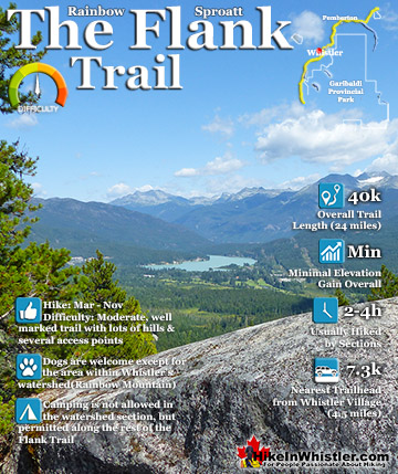
![]() Rainbow Falls is the least impressive and smallest of notable Whistler waterfalls, however it is very fun to hike to and quite pretty when you see it up close. Where the other waterfalls around Whistler are mostly seen at a distance, Rainbow Falls is the opposite. You don’t see it until you nearly stumble into it. Though you can hear it from a distance, you don’t see it until you round the last corner. Then you find it in a little, hidden world surrounded by the deep wilderness of the Coastal Rainforest. In June the volume of water seems to crash from all directions. In other months the water is much less dramatic. Rainbow Lake is where Whistler gets its drinking water from and you will see the water treatment building adjacent to the falls about a hundred metres away. Next to the water treatment building the Rainbow Trail and the Flank Trail overlap. If you follow the Flank Trail to the right you will almost immediately come to a cute little bridge over 21 Mile Creek as it crashes below. In May and June the creek is bursting with meltwater and you can see it crash over Rainbow Falls just a couple dozen metres away. In the winter and late summer months you can walk down the mostly dry creek bed and wander among the polished boulders to the top of the falls. May and June are the best months to see Rainbow Falls if you want to see it loud and crashing.
Rainbow Falls is the least impressive and smallest of notable Whistler waterfalls, however it is very fun to hike to and quite pretty when you see it up close. Where the other waterfalls around Whistler are mostly seen at a distance, Rainbow Falls is the opposite. You don’t see it until you nearly stumble into it. Though you can hear it from a distance, you don’t see it until you round the last corner. Then you find it in a little, hidden world surrounded by the deep wilderness of the Coastal Rainforest. In June the volume of water seems to crash from all directions. In other months the water is much less dramatic. Rainbow Lake is where Whistler gets its drinking water from and you will see the water treatment building adjacent to the falls about a hundred metres away. Next to the water treatment building the Rainbow Trail and the Flank Trail overlap. If you follow the Flank Trail to the right you will almost immediately come to a cute little bridge over 21 Mile Creek as it crashes below. In May and June the creek is bursting with meltwater and you can see it crash over Rainbow Falls just a couple dozen metres away. In the winter and late summer months you can walk down the mostly dry creek bed and wander among the polished boulders to the top of the falls. May and June are the best months to see Rainbow Falls if you want to see it loud and crashing.


More Rainbow Falls in June click here.
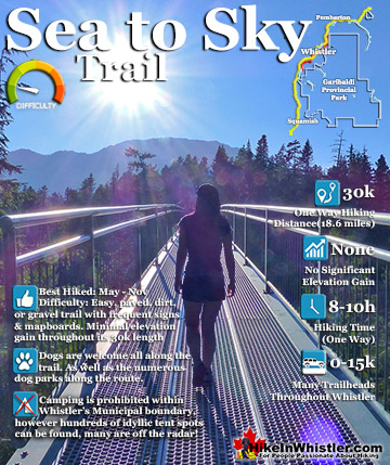
Sea to Sky Trail - Best Whistler Hiking in June
![]() Sea to Sky Trail is the massive, multi-use trail that passes through Whistler and overlaps the Valley Trail. The Sea to Sky Trail passes through or close to so many beautiful sights and parks in Whistler it is hard to list them all. Whistler Train Wreck, Brandywine Falls, Cheakamus River, Alpha Lake, Nita Lake, Wayside Park, Lakeside Park, Blueberry Park, Whistler Village, Lost Lake Park, up behind Green Lake past Parkhurst Ghost Town, along Green River passing the access road to the Wedgemount Lake trailhead, then north to Pemberton and beyond! In June the Sea to Sky Trail is absolutely amazing. On a sunny June day you can hike or bike the trail for hours and be blown away at constantly having to stop to soak in a beautiful view. The summer tourist season hasn’t kicked in yet in June and most of the Sea to Sky Trail will be deserted and wonderfully serene.
Sea to Sky Trail is the massive, multi-use trail that passes through Whistler and overlaps the Valley Trail. The Sea to Sky Trail passes through or close to so many beautiful sights and parks in Whistler it is hard to list them all. Whistler Train Wreck, Brandywine Falls, Cheakamus River, Alpha Lake, Nita Lake, Wayside Park, Lakeside Park, Blueberry Park, Whistler Village, Lost Lake Park, up behind Green Lake past Parkhurst Ghost Town, along Green River passing the access road to the Wedgemount Lake trailhead, then north to Pemberton and beyond! In June the Sea to Sky Trail is absolutely amazing. On a sunny June day you can hike or bike the trail for hours and be blown away at constantly having to stop to soak in a beautiful view. The summer tourist season hasn’t kicked in yet in June and most of the Sea to Sky Trail will be deserted and wonderfully serene.

More Sea to Sky Trail in June click here.
Skookumchuck Hot Springs in June
![]() Skookumchuck Hot Springs and Sloquet Hot Springs are both amazing places to visit in June. Skookumchuck Hot Springs is accessible year-round, however Sloquet is not really due to snow. You could hike the access road in the winter on snowshoes, but it is too far for most. The snow on the access road melts in late April or in May, so in June Sloquet is reliably free of snow and not a whole lot of people until summer. Try to avoid weekends for Skookumchuck and Sloquet in June as both can get busy pretty easily. Skookumchuck and Sloquet both have excellent campgrounds you can drive right to. Skookumchuck is right along the Lillooet River which is huge, crashing and beautiful in June. The campsites at Sloquet are just up from the hot springs. June may be the best time to visit both Skookumchuck and Sloquet as the weather is often very nice and they are not as busy as July and August.
Skookumchuck Hot Springs and Sloquet Hot Springs are both amazing places to visit in June. Skookumchuck Hot Springs is accessible year-round, however Sloquet is not really due to snow. You could hike the access road in the winter on snowshoes, but it is too far for most. The snow on the access road melts in late April or in May, so in June Sloquet is reliably free of snow and not a whole lot of people until summer. Try to avoid weekends for Skookumchuck and Sloquet in June as both can get busy pretty easily. Skookumchuck and Sloquet both have excellent campgrounds you can drive right to. Skookumchuck is right along the Lillooet River which is huge, crashing and beautiful in June. The campsites at Sloquet are just up from the hot springs. June may be the best time to visit both Skookumchuck and Sloquet as the weather is often very nice and they are not as busy as July and August.


More Skookumchuck Hot Springs in June click here.
Snowshoe Hikes - Best Whistler Hiking in June
Whistler Mountain and Blackcomb Mountain hiking trails remain buried in snow until late June and you can’t hike very far. Sightseeing access to both mountains only opens in late May and the snow keeps hikers from hiking very far until it melts a few weeks later. Still worth paying for a lift pass in June as the accessible hiking trails are short, but very beautiful and the Peak2Peak Gondola is amazing to ride. When the hiking trails emerge from the snow in late June, Whistler Mountain and Blackcomb Mountain become spectacular places to hike. The trails to Garibaldi Lake, Helm Creek and Taylor Meadows are usually not free of snow until well into June. The trail from Rubble Creek to Garibaldi Lake and Taylor Meadows does get a lot of hikers in June and any snow you do encounter should be packed down and easy to hike on. The problem is hiking beyond Garibaldi Lake or Taylor Meadows will be increasingly difficult due to snow on the trail. Early June especially, and late June much less so. As the trail to Helm Creek is much less hiked, you may find it too difficult to hike without snowshoes well into June. Also, the trail is easy to lose if you are the first to hike it and the snow is still deep. The already challenging hiking trails to Black Tusk and Panorama Ridge are far more exhausting with lingering snow and best hiked in late June, July or August.

More Taylor Meadows hiking in June click here.
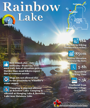
Rainbow Lake - Best Whistler Hiking in June
![]() The trail to Rainbow Lake is often challenging due to steep sections with snow well into June. You can generally make it to the lake in early June, but you may be slogging through deep snow sections and getting wet and exhausted. Rainbow Lake is best hiked after the snow has melted from around the lake which is usually by late June. Brandywine Meadows is often buried in snow well into June and the trail and access roads are not reliably free of snow until late June. Callaghan Lake's access road is often blocked with patches of deep snow until mid June and not reliably accessible until late June most years. Cirque Lake, above Callaghan Lake is not accessible by most hikers due to snow until late June or better yet, July, August or September. Ring Lake is not reliably free of snow and accessible to hike until late June most years. The trailhead is near the Callaghan Lake campsite and the access road is often blocked by patches of deep snow well into June(usually late June). The hiking and biking trails on Mount Sproatt are usually covered in snow at the higher elevations until well into June and best hiked when reliably free of snow in July and August.
The trail to Rainbow Lake is often challenging due to steep sections with snow well into June. You can generally make it to the lake in early June, but you may be slogging through deep snow sections and getting wet and exhausted. Rainbow Lake is best hiked after the snow has melted from around the lake which is usually by late June. Brandywine Meadows is often buried in snow well into June and the trail and access roads are not reliably free of snow until late June. Callaghan Lake's access road is often blocked with patches of deep snow until mid June and not reliably accessible until late June most years. Cirque Lake, above Callaghan Lake is not accessible by most hikers due to snow until late June or better yet, July, August or September. Ring Lake is not reliably free of snow and accessible to hike until late June most years. The trailhead is near the Callaghan Lake campsite and the access road is often blocked by patches of deep snow well into June(usually late June). The hiking and biking trails on Mount Sproatt are usually covered in snow at the higher elevations until well into June and best hiked when reliably free of snow in July and August.


More Rainbow Lake hiking in June click here.
Whistler and Garibaldi Park Hiking by Month!


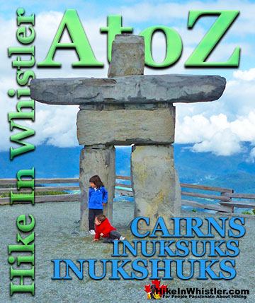
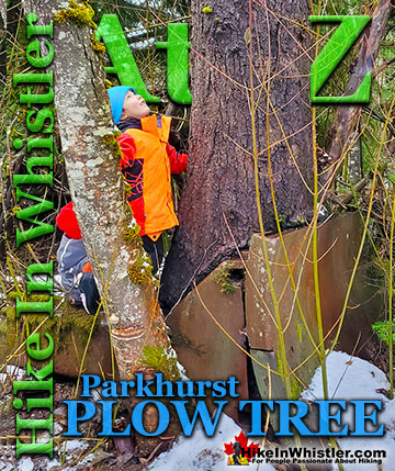
Whistler Hiking Glossary A to Z

Whistler, Garibaldi Park & Sea to Sky Hiking Trails!