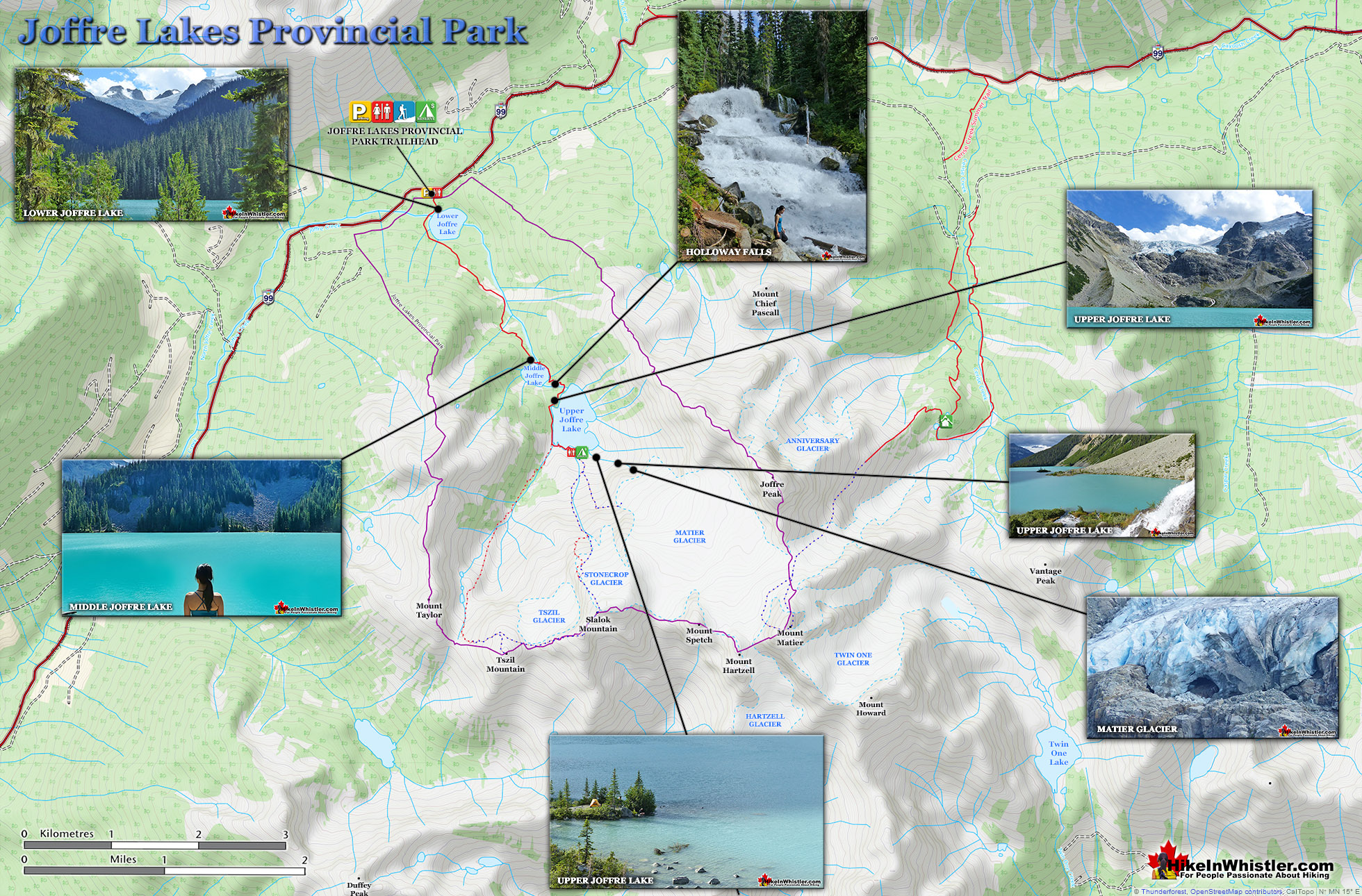
![]() The three Joffre Lakes are some of the most stunning lakes you are likely to ever see. Each lake gets progressively more beautiful and impossibly turquoise from one to the next. By the third lake the intense colour is breathtaking. The mighty Matier Glacier rises above and beyond the third lake, making the experience even more spectacular with such a looming presence.
The three Joffre Lakes are some of the most stunning lakes you are likely to ever see. Each lake gets progressively more beautiful and impossibly turquoise from one to the next. By the third lake the intense colour is breathtaking. The mighty Matier Glacier rises above and beyond the third lake, making the experience even more spectacular with such a looming presence.
 Very scenic drive to get there
- Less challenging than most other trails
- Amazing lakes to marvel at their colour
- The campsite is in a very natural setting
- Free of snow & hikeable as early as April
- Alpine terrain extends in many directions
- One tent site is on an island!
- Stunning glacier looms above the campsite
 No longer dog friendly as of summer 2018
- Overcrowded much of the summer
The Joffre Lakes trail is rough and tricky in some parts, but not terribly difficult. It is also short compared to Whistler area trails at just 5.5 kilometres(one way). Hiking at a moderate pace, give yourself 1.5 - 2 hours to get to the third lake and campsites. Lots of trail construction work has been done in the past few years as a new trail has replaced much of the old trail. The old boulder section between the lower and middle lakes has now been covered with a new dirt trail. Joffre Lakes Provincial Park is centred around the three Joffre Lakes. All of them are beautiful on their own and each more beautiful than the last. The amazing turquoise colours of the lakes are caused by light reflecting off of the particles of glacial silt suspended in the water. On the trail you will immediately catch glimpses of the massive glaciers that feed these gorgeous lakes. In the winter, with the lakes frozen and the trees weighed down with snow, Joffre Lakes takes on a serene beauty, with the low sun cutting through the trees and the forest brightly reflecting. Upper Joffre Lake ends in a U-shaped valley where you will find the far side of the lake towering with glaciers relentlessly crushing down on the lake. The sun fills the valley and the silence is wonderful. At Upper Joffre Lake there are several nice, though rugged places to camp. In a hilly, lightly forested section of paradise in between the impossibly turquoise Upper Joffre Lake and the abruptly monstrous Matier Glacier descending from Mount Matier beyond. A waterfall cascades near the camping area. The campsite has one nice and well maintained outhouse.

You will notice several clearings for tents in the gravel and boulder strewn landscape. Each one barely enough room for a tent, but the ruggedness adds to the beauty of Joffre Lakes. The park is wonderfully untouched by people. With the exception of the trail, some signs, outhouse and bridges, Joffre Lakes Provincial Park is beautifully wild and picturesque. There is also a prominent helicopter pad close by as a reminder of how many injuries occur on the trail and the accessible mountains and glaciers around. There are in fact four distinct glaciers close by, Matier, Anniversary, Stonecrop and Tszil. Beyond Mount Matier there are two more, Twin One and Hartzell.
The Joffre Lakes trail is surprisingly busy most of the summer, which is a testament to how extraordinarily beautiful the lakes are, and how relatively easy the hike is. Unlike Wedgemount Lake, Black Tusk or Cirque Lake, which are to difficult for many hikers, Joffre Lakes is comparatively easy and certainly relaxing. Many hikes in the nearby Garibaldi Park are not family friendly and easy, but Joffre Lakes is. Certainly the scenic drive to the trailhead from Whistler is part of the fun.


In terms of difficulty, Joffre Lakes is easier than most other Whistler and Garibaldi Park hiking trails. Wedgemount Lake, Black Tusk, Panorama Ridge, Brew Lake and Brandywine Meadows are all considerably more strenuous, steeper and longer trails. Like the trails in Garibaldi Park and Whistler, the Joffre Lakes trail is very well marked and easy to follow. Expect to take two or three hours to hike up and one or two hours to hike back down. The beautiful lake views and the foot of Matier Glacier will add an hour or two of exploring. There are a couple very challenging hiking routes that veer off from Upper Joffre Lake that take you further up in the mountains. There is a difficult route to Tszil Mountain and Tszil Glacier as well as a route to Stonecrop Glacier. These two connect at Slalok Mountain via the Slalok Scramble Route. These are tough and challenging places to hike with considerably more hazards to contend with than the relatively mild Joffre Lakes trail. Because these two routes connect at the top, you can start and finish at Upper Joffre Lake and never have to retrace your route. A beautiful option if you are experienced, well equipped and adventurous.


More hiking info for Joffre Lakes...
More Whistler & Garibaldi Park Hiking Maps!
Taylor Meadows Maps
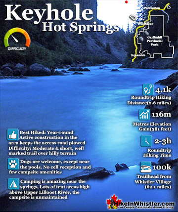
Keyhole Hot Springs Maps
Rainbow Lake Maps
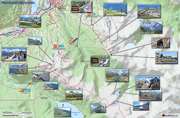
Blackcomb Mountain Maps

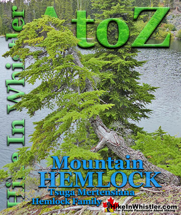
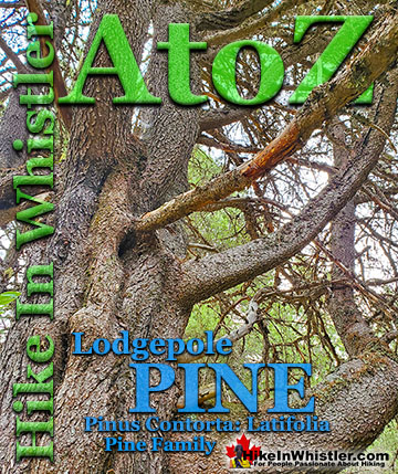
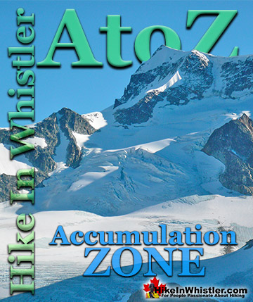
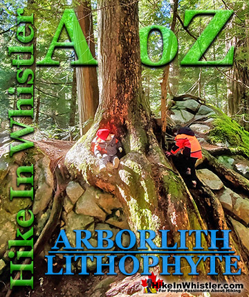
Whistler & Garibaldi Park Glossary A to Z

The Best Whistler & Garibaldi Park Hiking Trails!