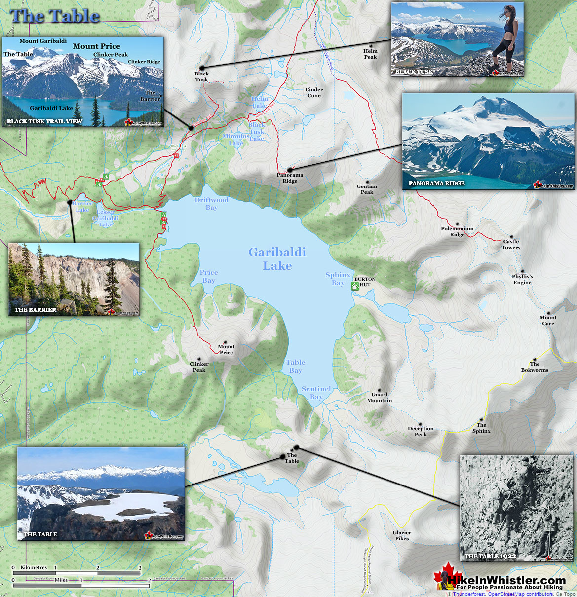
![]() The Table is an extraordinary flat-topped mountain located in Garibaldi Park just one kilometre south of Garibaldi Lake. Sometimes reflexively referred to as Table Mountain, The Table is its commonly used name and distinguishes it from the dozens of mountains worldwide named Table Mountain. About 12000 years ago, the Cordilleran Ice Sheet covered much of North America with a thickness measured in hundreds of metres. The Table formed when an erupting volcano forced magma to the surface of the ice and solidified with a strikingly, near-perfect flat surface.
The Table is an extraordinary flat-topped mountain located in Garibaldi Park just one kilometre south of Garibaldi Lake. Sometimes reflexively referred to as Table Mountain, The Table is its commonly used name and distinguishes it from the dozens of mountains worldwide named Table Mountain. About 12000 years ago, the Cordilleran Ice Sheet covered much of North America with a thickness measured in hundreds of metres. The Table formed when an erupting volcano forced magma to the surface of the ice and solidified with a strikingly, near-perfect flat surface.
Whistler & Garibaldi Hiking
![]() Alexander Falls
Alexander Falls ![]() Ancient Cedars
Ancient Cedars ![]() Black Tusk
Black Tusk ![]() Blackcomb Mountain
Blackcomb Mountain ![]() Brandywine Falls
Brandywine Falls ![]() Brandywine Meadows
Brandywine Meadows ![]() Brew Lake
Brew Lake ![]() Callaghan Lake
Callaghan Lake ![]() Cheakamus Lake
Cheakamus Lake ![]() Cheakamus River
Cheakamus River ![]() Cirque Lake
Cirque Lake ![]() Flank Trail
Flank Trail ![]() Garibaldi Lake
Garibaldi Lake ![]() Garibaldi Park
Garibaldi Park ![]() Helm Creek
Helm Creek ![]() Jane Lakes
Jane Lakes ![]() Joffre Lakes
Joffre Lakes ![]() Keyhole Hot Springs
Keyhole Hot Springs ![]() Logger’s Lake
Logger’s Lake ![]() Madeley Lake
Madeley Lake ![]() Meager Hot Springs
Meager Hot Springs ![]() Nairn Falls
Nairn Falls ![]() Newt Lake
Newt Lake ![]() Panorama Ridge
Panorama Ridge ![]() Parkhurst Ghost Town
Parkhurst Ghost Town ![]() Rainbow Falls
Rainbow Falls ![]() Rainbow Lake
Rainbow Lake ![]() Ring Lake
Ring Lake ![]() Russet Lake
Russet Lake ![]() Sea to Sky Trail
Sea to Sky Trail ![]() Skookumchuck Hot Springs
Skookumchuck Hot Springs ![]() Sloquet Hot Springs
Sloquet Hot Springs ![]() Sproatt East
Sproatt East ![]() Sproatt West
Sproatt West ![]() Taylor Meadows
Taylor Meadows ![]() Train Wreck
Train Wreck ![]() Wedgemount Lake
Wedgemount Lake ![]() Whistler Mountain
Whistler Mountain
![]() January
January ![]() February
February ![]() March
March ![]() April
April ![]() May
May ![]() June
June ![]() July
July ![]() August
August ![]() September
September ![]() October
October ![]() November
November ![]() December
December
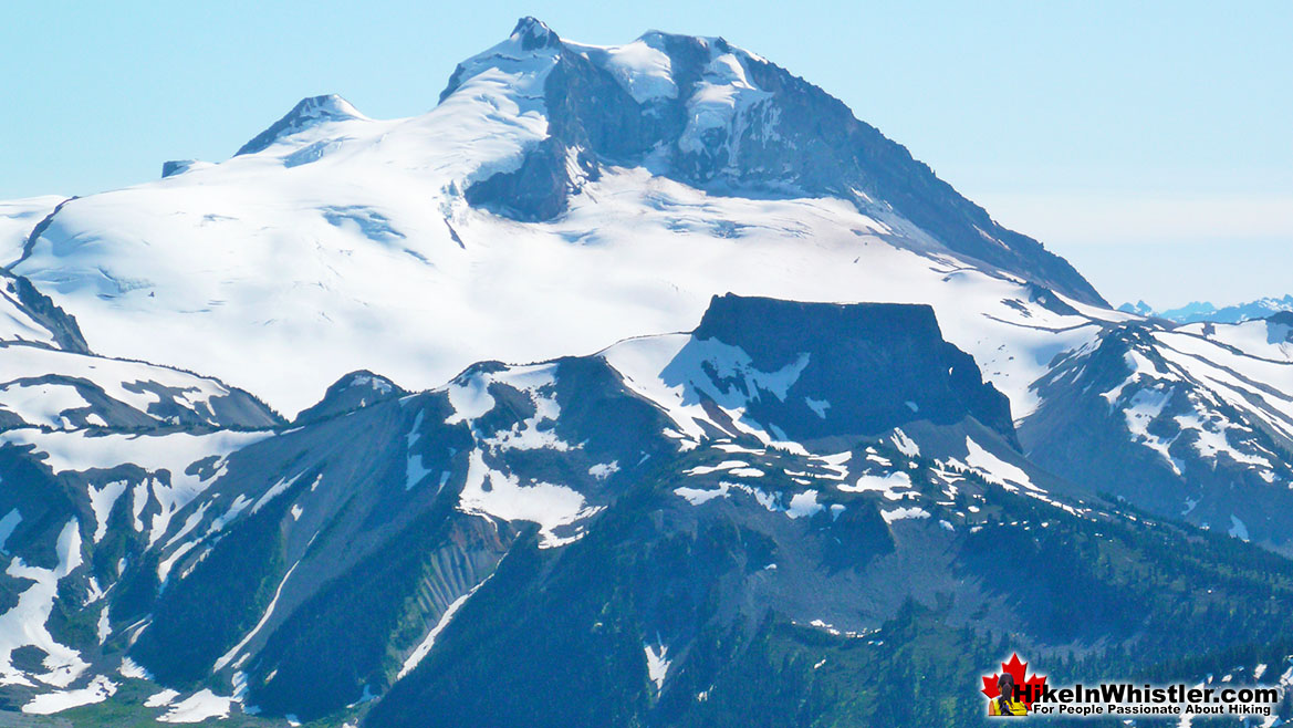
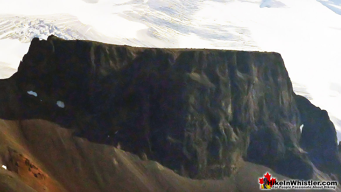
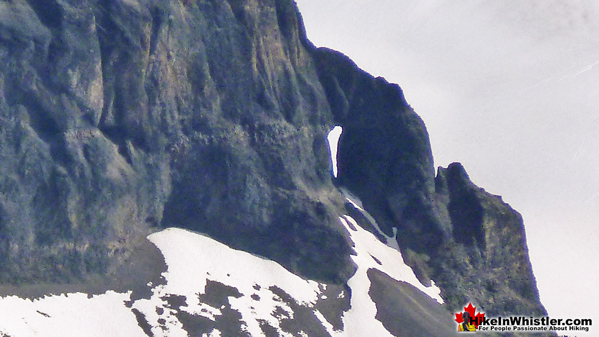
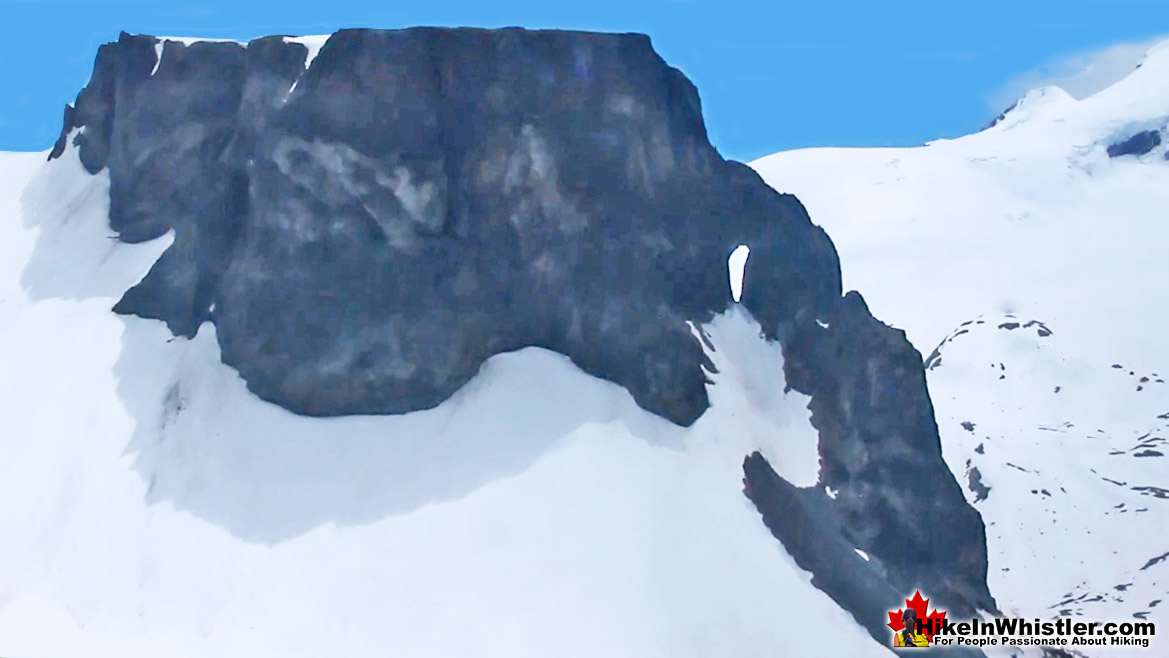
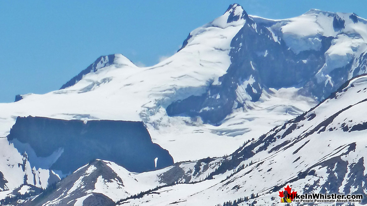
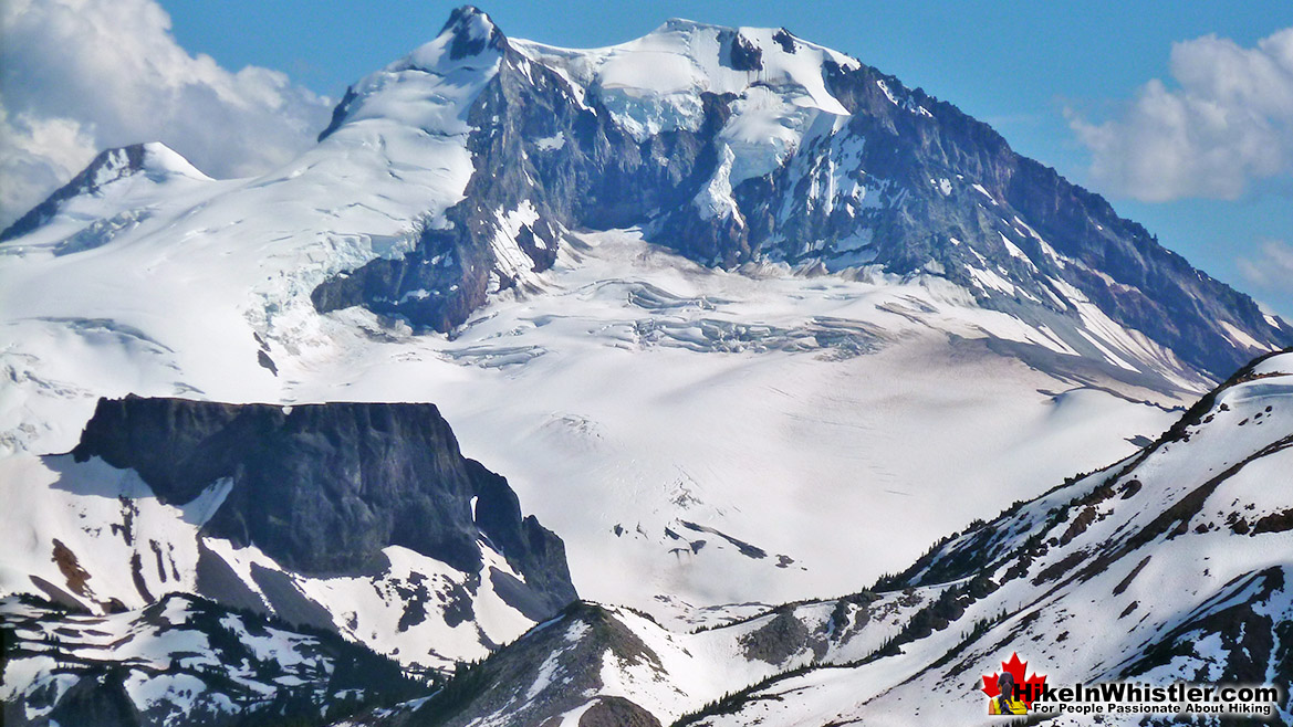
The Table has often been likened to an upside-down teacup because of its angular shape and its handle-like formation on its side. The handle, it has been determined, was the result of magma melting a handle-shaped tunnel into the glacier solidifying along with the rest of The Table. The hole in the handle is estimated to be over 30 metres(100 feet) wide. The height of The Table depends on how you measure it, though it rises over 520metres(1706 feet) from the surface of Garibaldi Lake and the adjacent lake near its base. The flat top of The Table is roughly an oval shape measuring about 450 meters long and 170 metres wide. The Table is an extremely difficult mountain to climb and though it was successfully climbed in 1916, 1922 and 1926 by Tom Fyles, very few have managed to repeat the feat. In fact, the few others that succeeded after Tom Fyles were greatly assisted by the fixed rope he attached to a small tree at the top. It is very difficult to track down details of the various ascents of The Table. One reason, of course is that there are very few attempts, let along, successful attempts made. Another reason is that it seems most of the climbing activity on The Table is decades old. Specifically, the 1920’s and 1930’s when Tom Fyles was actively climbing the area and his rope to the summit was still intact. It is thought that the rope and the tree it was attached to were long gone, at least by the 1950’s. Yet another significant reason why The Table is rarely climbed, or reported to be climbed, is the fact that the BCMC and the Alpine Club of Canada have banned, or at least strongly discouraged official climbs. This means that most of the best climbers in BC avoid The Table, or if they do climb it, they don’t let it be known publicly. This also might explain why two of the known successful ascents were from climbing clubs outside of BC, where success could be reported.
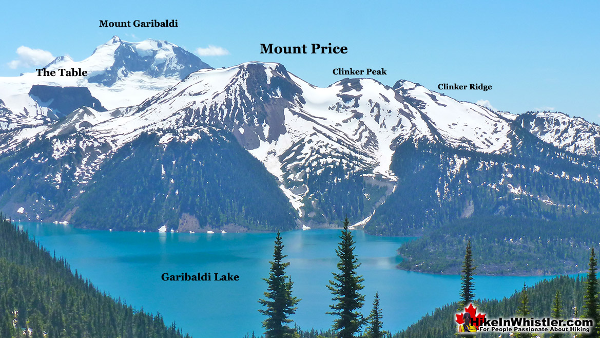
The Table, Mount Garibaldi and Mount Price
The Table and Mount Garibaldi
Garibaldi Volcanic Belt Volcanoes
If you find yourself standing on the top of Black Tusk you will see The Table, 9 kilometres(5.6 miles) away and Mount Garibaldi 14 kilometres(8.7 miles) away. At 5 kilometres(3.1 miles) further away Mount Garibaldi's enormous size seems to engulf The Table. The Table, Mount Garibaldi and Black Tusk are volcanoes that lie within the Garibaldi Volcanic Belt, a chain of volcanoes in the Pacific Ranges of the Coast Mountains. The Garibaldi Volcanic Belt is a subsection of the Cascade Volcanic Arc which extends over eleven thousand kilometres, from southwestern British Columbia to Northern California. Mount St. Helens in Washington State is the most recent major eruption from the Cascade Volcanic Arc and occurred on May 18th 1980. It is still the deadliest and most destructive volcano in United States history. The Table, Mount Garibaldi and Black Tusk have quite different histories as volcanoes and their distinct appearances were the result of fascinating circumstances. Of the three, however, The Table is arguable the most unusual and much more recently understood volcano of a type known as a tuya. Tuya’s are comparatively rare worldwide and The Table was the first piece of the puzzle that would eventually lead to the understanding of these remarkable formations.
Geology of The Table
The Table is thought to have formed just a few thousand years ago when the Cordilleran Ice Sheet covered much of northwest North America. In 1947 Canadian geologist Bill Mathews pieced together how this interesting mountain formed in a paper titled, "Tuyas, Flat-Topped Volcanoes in Northern British Columbia". He theorized that magma must have melted an enormous vertical channel through to the surface of the Cordilleran Ice Sheet. The pooling lava cooled and hardened into a flat topped mountain. Lava that solidified on the surface of the glacier crumbled away when the glacier beneath it melted away. The lack of glacier erosion around The Table indicates that it formed at the end of the last ice age when the Cordilleran Ice Sheet was in quick retreat. Looking at The Table from a distance you can visualize the land all around buried in an ice sheet about level the top of The Table. About 12000 years ago, there was a pure white sea of ice all around, and the flat top of The Table you see today was a lake of molten rock. What a sight it must have been with a cauldron of lava in the midst of a glacier hundreds of metres thick. While studying The Table as well as others in norther British Columbia, Bill Mathews began referring to these flat-topped mountains as tuyas. He called them tuyas after the Tuya River and Tuya Lake in Northern BC where he studied several mountains similar to The Table. The mountain range, which includes several tuyas was officially named Tuya Range in 1951. He named one of the mountains Tuya Butte, as a butte was the closest descriptive term known at the time. A butte is a common geographical name given to flat topped, steep sided tower of rock formed by erosion. Of course, Tuya Butte was not formed by erosion, but rather from a volcano melting magma through to the surface of a glacier. When Mathews came to understand that a new name was needed for this newly understood type of mountain, he chose tuya, after this remarkable mountain range with several of these unusual mountains.
The Table Up Close
The Jug Handle on The Table
Formed From a Lake of Magma Within a Glacier
History of The Table
The Table is an extremely difficult mountain to climb owing to its steep and crumbling sides. The very few written accounts are terrifying and without exception conclude that it is too dangerous to climb. The first ascent in 1916 was led by one of Canada’s greatest rock climbers and possibly the most under appreciated ascent in the history of climbing. Unfortunately, Tom Fyles was as modest as he was an expert climber and a good account from him of the legendary climb is surprisingly hard to find. The few details known, added with the astoundingly harrowing ascents that followed in the next few decades, make his initial ascent of The Table border on miraculous. Joseph T. Hazard, in his excellent book, Snow Sentinels of the Pacific Northwest, recalls that Tom Fyles made that solo ascent after his two British Columbia Mountaineering Club companions gave up and watched for hours as he surmounted the final 240 terrifying feet!
Words seem unable to grasp how difficult The Table is to climb, however Hazard illustrates it well when he described the 1923 ascent he witnessed made by Wallace Burr and “Happy” Fisher. “Wally and Happy climbed a fifty-foot face of scaling rock, of disintegrating, columnar structure, to a sharp edge. Here Happy lay on his back for thirty minutes, bracing himself in position by hooking his legs to both sides of the knife-edge of rock. He held Wally's legs in his arms while for a half-hour Wally cast the middle of a hundred-foot rope at a point of rock, thirty-five feet above.” Hazard continues to describe how, “Climbing The Table is one near impossible obstacle after another.” And, “Each requiring a tremendous feat of courage and expertise to overcome.” Hazard’s admiration of Tom Fyles' skill and bravery is subtly expressed when he concludes, “How he did it alone, he can only tell. He is modest and will not give the whole story.”
The first organized hiking into the Black Tusk/Garibaldi Lake region of Garibaldi Park was done by the British Columbia Mountaineering Club in 1912. Led by the club president Mr. W.J. Gray who, in 1914, described The Table with a mixture of awe and terror. “The dark forbidding walls of the “Table” have defied our most expert rock climbers. The slightest disturbance is sufficient to bring down a shower of sharp stones upon the head of the unwary climber.” He goes on to compare Black Tusk and The Table and concludes that Black Tusk is comparatively easy while “The Table on the other hand, offers but a succession of somber cliffs on all sides, the lower slopes of which are covered with a heavy talus, and are swept by stone avalanches at intervals.” Gray later recalled how the most determined rock climber in their party was, “slowly progressing up the western face when he was summarily arrested by the next man in line, who intimated that “if he had fifty lives, he would not climb any further.” So, The Table remains as the only peak within reach of the camp which has not been climbed.”
Mr. Gray likely never suspected that the first climber to make the daring ascent of The Table just two years later would be the novice climber who recently joined the BCMC and was at the 1914 Garibaldi summer camp. Having just recently moved to Vancouver from England, Tom Fyles recalled later in an interview about his early days in the BCMC, which he joined in late 1912. “It was all new to me. As a matter of fact, camping was new to me.” His first taste of climbing came just a few months after joining, when in 1913 he went with a group to The Lions. They likely summited the short, Class 4 route up the West Lion along the usual route in use today. Class 4 terrain is defined as very steep terrain which rope belays are recommended. Though experienced climbers find class 4 terrain relatively easy and safe to navigate, novices to climbing tend to find class 4 terrain difficult, frightening and dangerous. Class 5 rating is the top end of the rating system and is characterized as technical rock climbing. Owing to the complexity of rock climbing the Class 5 rating is intricately divided into decimal subsections based on technical difficulty for an experienced climber. Therefore, a 5.0 to 5.7 is considered easy, 5.8 to 5.10 is considered intermediate, 5.11 to 5.12 is hard, and 5.13 to 5.15 is reserved for a very elite few. The Table, owing to its complex and crumbling approach, must be classed on the higher end of this Class 5 scale. It appears that Tom Fyles went from an introductory Class 4 climb of The Lions in 1913 to an elite level first ascent of The Table in 1916.
It appears that no one dared to repeat his amazing first ascent in the next five years, though Fyles himself made a couple of modest attempts before 1922. In 1922, Fyles along with Neal Carter and Bill Wheatley made a determined attempt on The Table, which they proclaimed, “The Table or Bust!” Fyles managed to make it to the top and this time he fixed a rope to a small tree and Neal Carter and Bill Wheatley climbed up to join him. This made Tom Fyles, Neal Carter and Bill Wheatley the second mountaineering party to successfully climb The Table. They left their rope from the summit attached to the stubby tree and jagged, firm rock for their ascent and future climbers. The following year, in 1923 Wallace Burr and Clarence Fisher made the next recorded ascent with the help of this rope. Their thrilling ascent was witnessed and written about by Joseph T. Hazard in his excellent book Pacific Crest Trails.
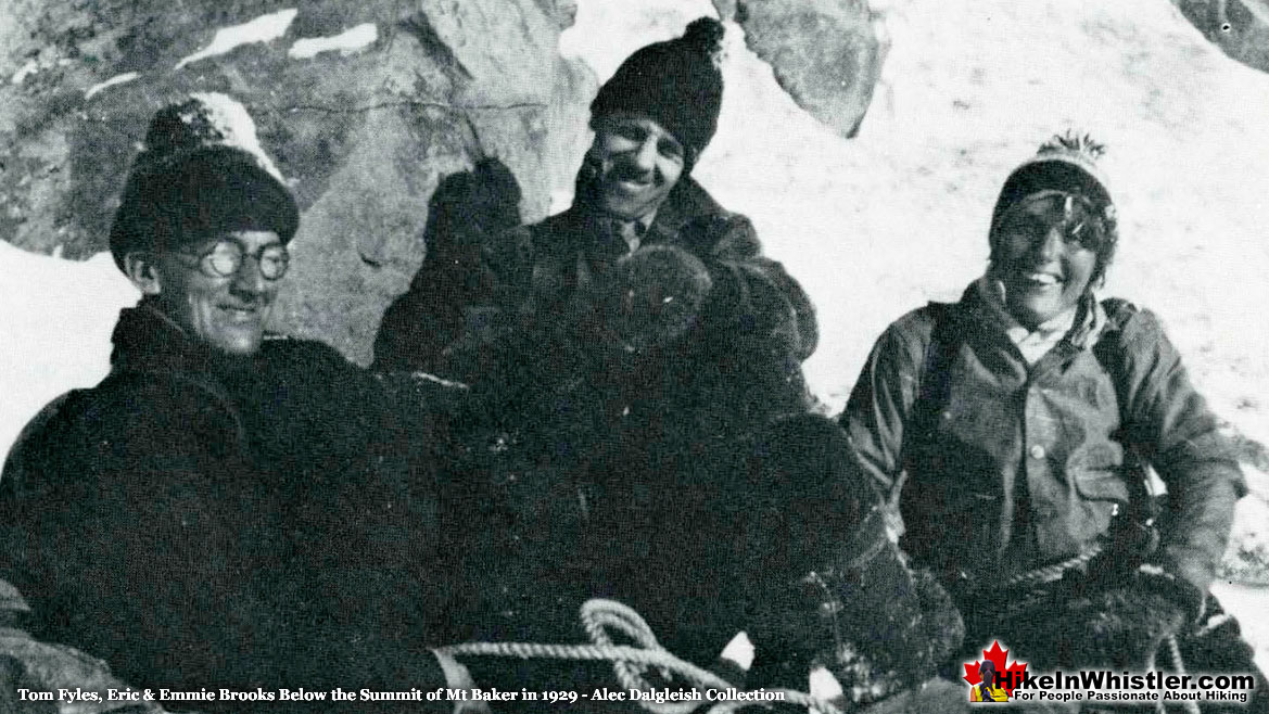
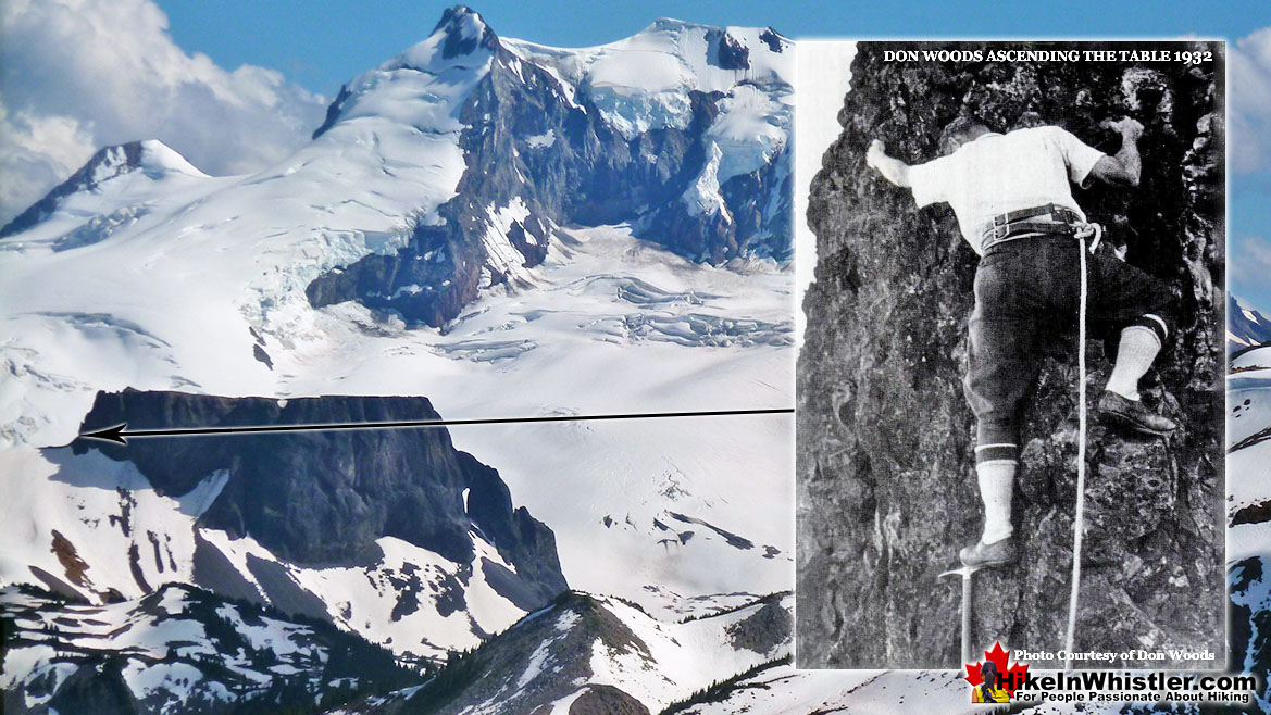
In 1926, Tom Fyles climbed to the summit of The Table for his third time. This time he was joined by Edith Henley and Emmie Milledge. Emmie would later marry fellow climber Eric Brooks and the pair made several impressive climbs with Tom Fyles, Alec Dalgleish, Neal Carter and other elite and prolific climbers of that era. Two other exceptional climbers during that time, Fred Parkes and Harold O’Connor also climbed The Table the same week as Fyles, Henley and Milledge. The next reasonably confirmed ascent wasn’t made again until 1932 when Don Woods, Bestor Robinson, John Yeon and P. Desiata used the old rope left by Tom Fyles to reach the summit of The Table! Woods reportedly replaced the old rope with a new one before making the perilous descent back down. Woods, Robinson, Yeon and Desiata were well known and well accomplished mountaineers from south of the border in the US.
It appears that two and a half decades would pass before another successful ascent of The Table was accomplished. Dick Culbert reportedly made several ascents in early 1959 and left a few pitons along the route he took up. Little seems to be known about Culbert’s ascents, however, two days later, on May 12th, 1959, Karl Ricker and Sev Heiberg, made a spur of the moment decision to take on The Table. They not only succeeded, but Ricker recounted the event in spectacular detail in the VOC Journal later that year. The last paragraph of his article sums up the difficulty of The Table quite succinctly. “Of all the climbs I have ever made in Garibaldi, Table, of only 6625 feet in elevation, was certainly the toughest and most dangerous and it was a fitting climax to my days of V.O.C. trips. Both Sev and I conclude that never again will we go near The Table as we may not be so lucky on a second attempt!”
1916 Tom Fyles First Ascent of The Table
The chronology of known ascents of The Table starts with Tom Fyles in 1916. As mentioned above, he made the solo ascent alone with his two BCMC climbing companions watching from below. One of the BCMC members at the 1916 summer camp was Plyl Munday, who along with her husband Don Munday are the most well known and prolific mountaineers during this time. This is not only due to their massive list of first ascents, but also the extensive array of written and picture accounts that the duo produced and published over the years. We can only wonder how this first ascent would have played out if Don Munday was there, which he most assuredly would have been, had he not been fighting in World War I in Europe. About 30 percent of the British Columbia Mountaineering Club were over in Europe fighting as of 1916 and Tom Fyles went over in late 1917.
One good contemporary account of the first ascent of The Table on August 7, 1916 was published just a couple weeks later in the Vancouver Daily World newspaper with the byline, “Written by a Member of the Party.” The article strangely doesn’t mention the other two climbers in Tom Fyles' party. “A party of three left the camp on the morning of August 7th and made their way around the shores of Garibaldi Lake to the base of The Table. Early in the afternoon the leader had marked a course up the eastern end, and began to climb upwards by means of a narrow chimney. The rocks were very loose and progress correspondingly slow. It soon became apparent that there was great danger from falling fragments, and it was decided to allow the leader to attempt the climb alone, while the rest of the party sought shelter. Above the chimney the climber ascended over the eastern arête, then traversed diagonally up the perpendicular north face till a point was reached almost level with the summit. Ten minutes more and The Table was conquered. The descent was even more dangerous, and some idea of the difficulties may be gathered from the fact that three hours were spent climbing up 300 feet and down again, allowing sufficient time to build a small cairn and leave a record.”
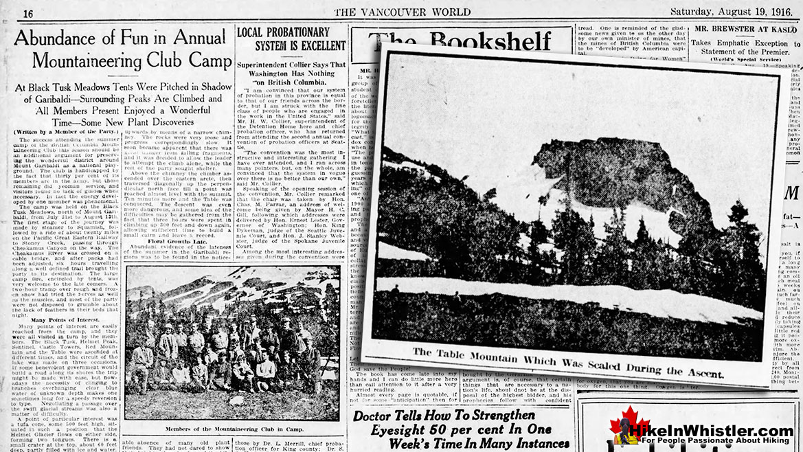
In an interview with Dan Bowers in 1973, Tom Fyles recalled the first ascent of The Table. He described how two year previous, he attended the 1914 summer camp with the BCMC. He was unable to travel with the club and had to get there four days later by navigating the route himself. A pretty challenging feat when you consider that he had never been north of Squamish before and the walking route began along the Pemberton Trail about halfway between Squamish and Stoney Creek. Today we call Stoney Creek, Rubble Creek, but in 1914 the route to Black Tusk Meadows began at Cheakamus River. The route ascended over boulders in roughly the same direction as the 2 kilometre access road used today to reach the Rubble Creek trailhead parking. The route then followed the recently cut trail through the wilderness 12 kilometres up to the alpine meadows near the base of Black Tusk. Fyles recalled that he was able to find his way, at least partly, from recollections from what he read about the descriptions of the mountains.
Fyles described his described his first look at The Table. “The Table is a flat-topped mountain made of basalt and it has a rather peculiar opening at one end that's an archway. The whole area looks like an inverted cup with a handle. It's not very high. It's quite abrupt, and quite steep and made of loose rock. Whilst we went most of the way around and looked at the different chimneys, we didn't do anything more on that trip. We were camped at Black Tusk Meadows and so it made an all-day journey going round the lake. We went round the lake and we came back over Red Mountain.” What we call Mount Price today was called Red Mountain back then.
Tom Fyles recollection of the first ascent of The Table is wonderfully modest and conceals the terrifying difficulty. “I had a long rope. The Mountaineering Club only had two ropes in those days. One was a hundred feet; the other was sixty feet. I think I had the hundred-foot rope. So, I pulled this with me, and I intended to be able to help another man up with the end of the rope. I went up all the way alone, and then traversed across the face a little toward the west and managed to get into another gully which led to the top. The top, of course, was the big more or less level area, just one or two bits of scrubby trees and a few flowers. I walked all over it and I was able to talk to my friends who were there on the ridge below. They were making tea for the time when I got back. I was quite happy to have got to the top because it had been a challenge for some time to different members of the Club. I got down without any great difficulty. There were loose rocks, but by having two handholds and two footholds at the same time, it was possible for the odd piece of rock to give way. But we got down and had our tea and enjoyed it and walked back around the opposite side of the lake from what we'd come over.”
1922 Tom Fyles, Neal Carter & Bill Wheatley
In 1922 Tom Fyles, Neal Carter and Bill Wheatley made the second known ascent of The Table. Thirty-seven years later, in 1959 Neal Carter wrote a letter to Karl Ricker, in which he briefly mentioned the remarkable day. “I was on the second ascent (again in 1922 - I must have been crazy that year). That's one mountain that I never want to climb again! The only consolation was that it was in the fog, so we couldn't see how far the drop below us was as we three clung to the loose chunks of rock that kept threatening to pull out of the sheer wall.”
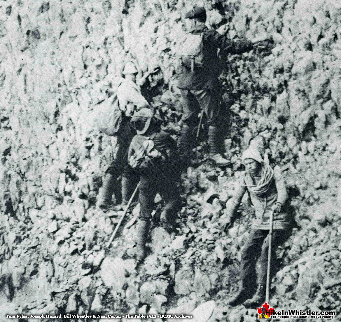
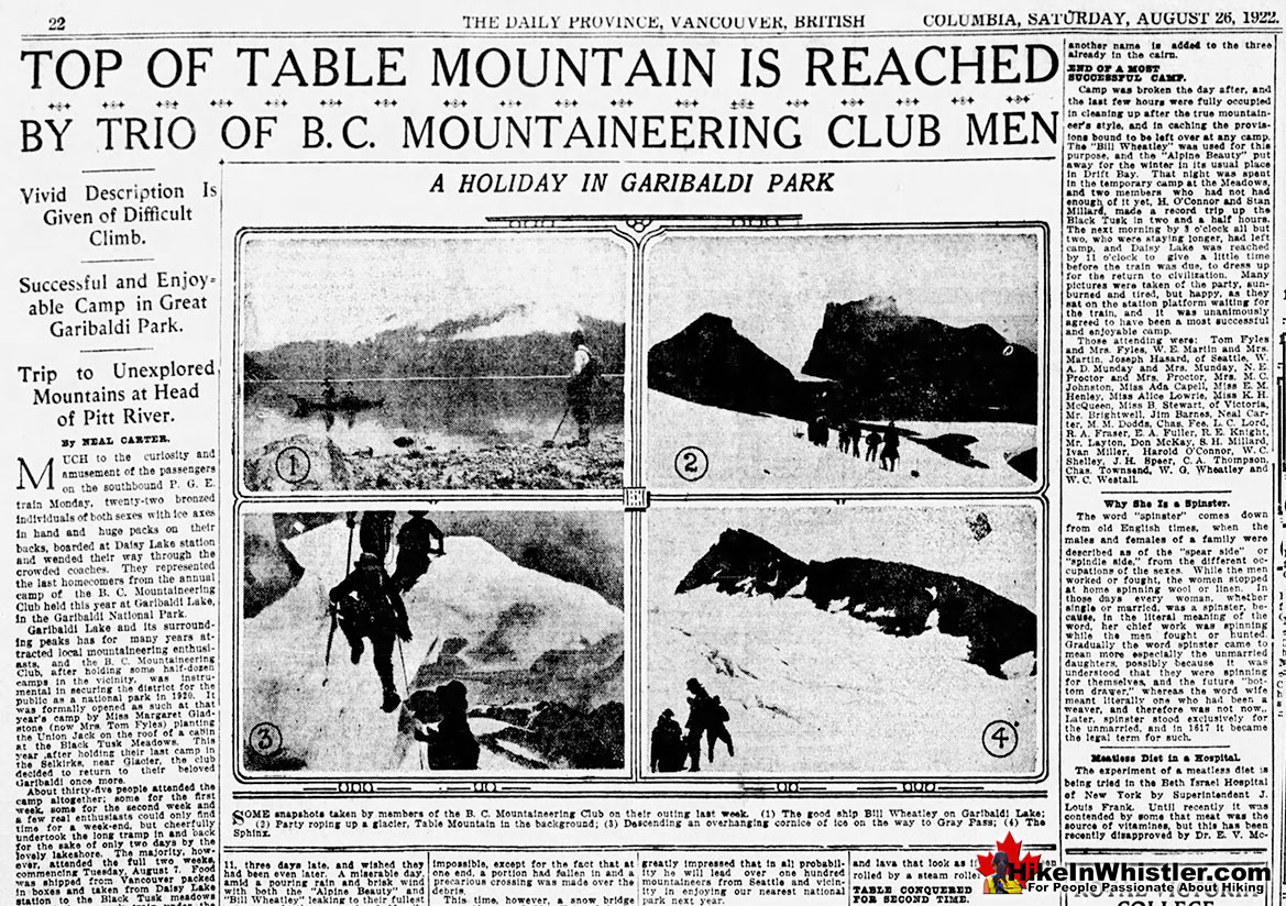
In an article written for The Province newspaper shortly after the 1922 ascent, Neal Carter wrote about the treacherous climb in detail. Recalling how after the first ascent in 1916, “Mr. Fyles, pronounced it so rotten and loose as to warrant the name of an unjustifiable hazard; in 1920 he made two attempts to re-ascend it, but failed. This time we started off with 180 feet of alpine rope and the slogan “Table or bust.” We nearly “bust.”” Neal Carter then continues the story in beautifully vivid detail.
“The weather was most unpropitious and soon after commencing the ascent, rain began to fall. Tom Fyles went up first, with a rope about his waist, and all went well up to the first little pinnacle. Here it was deemed advisable to continue up the arête at the low end; said arête being about as solid as a child’s house of blocks. Sixty feet of rope brought the party to the next stopping place, a little dip in the sharp arête that made a niche just big enough for two of us while Tom continued the ascent with 120 feet of rope dragging behind him. Shower after shower of rock whizzed past our heads as we sat almost motionless for fifty-five minutes during which only 110 feet were gained. Finally, a dim shout was heard: “All right,” and our stiffened bodies were given a chance to exercise themselves on a slanting traverse of a precipitous rock-face composed of the shakiest material imaginable. Fully half a ton of rocks were unavoidably dislodged during the ascent and descent; and did not add much to the confidence of the climbers as they went singing past in the fog to fall uninterrupted on the scree slopes below.
As the rope was followed upward in the fog, it finally landed us beside Mr. Fyles in another niche on a level with the summit, but connected to it by about twenty-five feet of wobbly, knife-edged ridge. One of these rocks was partially demolished to enable us to grip a reasonably firm rock as we straddled along it. Once the summit was reached, it was like stepping on to a macadamized field. We built a good-sized cairn on the edge in plain view from below, and placed our own as well as Mr. Fyles’ previous record in a subsidiary cairn beside it, around which were transplanted a few erigeron, or mountain daisies. Several meanings may be taken from this as to our feelings towards the descent; however, camp was reached again at 7 o’clock and The Table was conquered for the second time after a five and a half hour climb of 240 feet and back, though 120 feet of rope remain attached to the top as a mute token of a guaranteed safe descent for all three of us. It may be some time before another name is added to the three already in the cairn.”
When Neal Carter refers to the summit as like stepping on to a macadamized field, he was using a term evidently more common at the time than now. Macadamize is defined in regards to road building as laying and compacting successive layers of broken stone, often with asphalt. So, Carter's description of the surface of The Table is that of a paved road comprised of broken stones and asphalt.
1923 Wallace Burr & Clarence Fisher Ascent of The Table
Joseph T. Hazard, an expert mountaineer from Seattle and the author of several mountaineering books witnessed the third successful ascent of The Table by Wallace Burr and Clarence(Happy) Fisher. Hazard was also a witness in the 1922 ascent by Tom Fyles, Neal Carter and Bill Wheatley. In his excellent book, Snow Sentinels of the Pacific Northwest, he recounts the incredibly treacherous ascent of 1923. Hazard intended to climb The Table with Burr and Fisher, however he chose to remain at the base of the first pitch due to the danger of loose and falling rock.
“Wally and Happy climbed a fifty-foot face of scaling rock, of disintegrating, columnar structure, to a sharp edge. Here Happy lay on his back for thirty minutes, bracing himself in position by hooking his legs to both sides of the knife-edge of rock. He held Wally's legs in his arms while for a half-hour Wally cast the middle of a hundred-foot rope at a point of rock, thirty-five feet above. At last he snared it. Happy held the two ends of the rope while Wally negotiated that sheer rock spire. Above this, Wally connected with the rope left by the B. C. climbers. From here on the climb was torture to the nerves. The rope angled for 120 feet up the perpendicular face of The Table, with a sheer drop of hundreds of feet below. At one place, Wally was forced to pluck out loose rock and to drop it casually off into space, for a full six minutes by my watch, before he could venture his next step. He worked with the three essentials of such tasks, patience, caution, and skill, and made the top. Later he returned, retrieved Happy who had waited at the lower rope, and came back to earth. I suffered more than either of the climbers, for I stood safely below, with raw nerves and nothing to do. With each harsh scraping on the rock above, or hard thud of a hurtling fragment, I saw in my apprehensions, the toppling form of a friend, plunging hundreds of feet to his doom.”
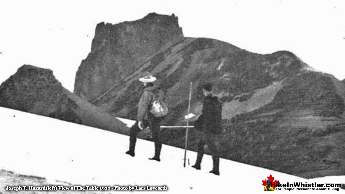
Hazard also wrote about this ascent in his 1948 book Pacific Crest Trails, recalling a funny warning from Tom Fyles.
“Happy, Wally, and I undertook to climb the "Table," an inverted kettle of scaly rock, 240 feet high with a perfect rock handle, carved by artist Nature from the bed of "tertiary lava" beneath Garibaldi. The Table had been climbed twice only, and then by experts. We arrived at the base of the rock, finding it almost perpendicular. Tom Fyles, Canada's most skillful rock climber, who made its first ascent by applying the arts he had acquired in boyhood on the Cliffs of Dover, had told all about the Table. He had ended his admonitions with this warning: "You are too heavy, Hazard, to make the Table. You can climb anything that will hold you—but the Table will not. It will scale off under you and drop you into oblivion! Don't try it." Hope dies hard. I tried the first shoulder and it peeled off as I climbed. After accumulating sundry bruises and abrasions, I gave up, and spent the rest of the afternoon acquiring an ache in the neck looking up at the other two. In the meantime, Happy and Wally had made the "position unstable" of the knife-edged top of the first shoulder, just under the key to the whole ascent, a smooth rock face some 30 feet high. For 30 minutes Happy lay on his back along the rock edge, holding Wally's legs, while Wally cast his rope for the firm nubbin of rock at the top of the unclimbable rock face. His rope caught and held against repeated testing pulls and jerks. Happy held the end while Wally climbed, preventing sway and swing. Wally made it and was on his two-hour way up the final 200 feet of scaling, perpendicular rock face. Happy could not follow, for no one was left to hold the low end of the climbing rope for him. He stood in balance or lay at ease on the sharp rock for the two hours, awaiting Wally's return, that he might help him down. There are dramas, potential tragedies, in the stunt type of rock climbing. If the parties indulging in such sports are kept small enough, with a minimum of three, and are wise in technique and cautions, the element of danger and injury is almost eradicated. Why do these things?”
1926 Fyles, Henley, Milledge, Parkes & O'Connor
In 1926 Tom Fyles made his third ascent of The Table, this time bringing along Edith Henley and Emmie Milledge. The climb was made during the annual BC Mountaineering Club summer camp. As Neal Carter recalled, "Of the more serious climbing, we are pleased to record the first ascent by ladies of the notorious Table. Misses Edith Henley and Emmie Milledge made the top, led by Tom Fyles, its first conqueror. Mills Winram and others were prepared for the ascent, but owing to lateness of the hour, unselfishly gave up their opportunity and assisted the two ladies. As it was, Miss Henley and Tom Fyles had to descend in the darkness by the aid of a bonfire kindled on the ridge below". In the same week Fred Parkes and Harold O'Connor also conquered The Table.
Tom Fyles, Eric & Emmie Brooks(nee Milledge) Mt. Baker 1929
1932 Woods, Robinson, Yeon & Desiata Ascent of The Table
In 1932 Don Woods, Bestor Robinson, John Yeon and P. Desiata reportedly made it to the summit of The Table. Four expert climbers from the United States in the mountaineering organizations, the Mazamas and the Sierra Club. Joseph T. Hazard briefly mentions their ascent of The Table in Snow Sentinels of the Pacific Northwest. “The Table was climbed again this summer, 1932, by four "Mazamas." They used the old rope and replaced it with a new one.” The Mazamas archives have a record of a photo described as the Mazamas outing to Mt Garibaldi, B.C., 1932, including climbs of The Table, Sphinx, Black Tusk, Helmet, Sentinel, and Mt Garibaldi.
1959 Dick Culbert Ascent of The Table
Dick Culbert reportedly completed his 6th ascent of The Table on May 10th 1959. Very little information seems to be available regarding his experience climbing The Table, even in his own books. In his book Alpine Guide to Southwestern British Columbia, Dick Culbert devotes very few words to this interesting, unique and challenging mountain. "Ascent is by E. ridge, with first pitch (class 3) on the S flank. The next two follow ridge and are a loose, dangerous class 5. Descent is difficult due to lack of good rappel placements. This is a serious and unaesthetic ascent." Little can be gleaned from such a brief mention, though it does, by its exacting detail, somewhat confirm that Dick Culbert had an intimate knowledge of The Table that had to result from climbing it.
1959 Karl Ricker & Sev Heiberg Ascent of The Table
Karl Ricker wrote of the thrilling ascent of The Table in the VOC Journal in 1959(VOCJ02). Ricker and fellow mountaineer Sev Heiberg, both extremely accomplished mountaineers. Ricker’s mountaineering accomplishments are astoundingly numerous and varied and reading about them leads you on a seemingly never-ending journey that leaves you mentally exhausted. He’s climbed nearly everything and knew nearly everyone. He contributed to Fred Becky's Challenge of the North Cascades guidebook, Dick Culbert's Coast Mountain guidebooks (1969 and 1973 editions) and Bruce Fairley's A Guide to Climbing & Hiking in Southwestern British Columbia. He also wrote hundreds of articles over the years in countless publications. Of the many lasting contributions to Whistler he made, one in particular stands out. In May 1964 Karl and three other VOC’ers hiked up Blackcomb Mountain and skied a new route around the vast wilderness to Whistler Mountain and established the Spearhead Traverse. Noting that many features along the Spearhead Traverse were well established names, though ‘unofficial’, he founded a naming group. Appropriately, though no less astoundingly, he joined with Neal Carter and Phyllis Munday. Neal Carter and Phyllis Munday, along with the late Don Munday had explored and named numerous peaks around Whistler. Ricker, Carter and Munday comprised about the most ideal naming committee imaginable and to this we owe a debt of thanks for the colourful and descriptive names around Whistler and in Garibaldi Park. Karl Ricker currently lives in Whistler and occasionally hosts amazing events at the Whistler Museum. The Life and Times of Neal Carter he co-hosted in 2016 and Coast Mountain Gothic: A History of the Coast Mountain Gothic Arch Huts in 2018.
With his endless list of accomplishments, it’s probably not surprising that he was one of the very few to climb The Table. After reading his account of the climb, you quickly understand why it is so rarely climbed, and how breathtakingly skilled and daring he and all his predecessors were. For Karl Ricker, Sev Heiberg, Dick Culbert, Don Woods, Bestor Robinson, John Yeon, P Desiata, Edith Henley, Emmie Brooks, Wallace Burr, Clarence Fisher, Neal Carter, William Wheatley and Tom Fyles climbing The Table took unfathomable courage and skill. And having Karl Ricker’s recount the ascent in chilling detail is about as close as the rest of us will likely get to this beautiful and terrifying mountain.
"…on Sunday night of May 12th Sev and I decided we would wind up our Garibaldi trip with an attempt on this famous rotten volcanic stock. Many have tried this peculiar peak but as of yet no active V.O.C.'ers had ever stood on the summit. At 7:00 a.m. on May 13th we were on our way and at Table Bay we skied up to the east ridge of Table Mt. All packs except one small fanny pack were left at the base of the east knife edge arête. The first 80 feet was a gendarme which was avoided by climbing a shallow gully south-west of the gendarme by a few feet. Sev anchored into a piton which felt solid and belayed me up. The next pitch was of much looser rock and was vertical; everywhere Sev tried to ascend up and over the hand-holds and foot-holds gave way. After ten minutes and a short discussion it was agreed that if I couldn't climb up and over we would rope down and head for the cabin. Somehow the pitch was a little easier for me as the next 50 feet was negotiated in about ten minutes. At this point we were about one-half of the way up and the gradient had levelled off momentarily. I straddled the loose-rock arête and up came Sev. He proceeded straight up after climbing over the top of his belayer. About 40 feet above, we found the second B.C.M.C.'ers piton but after a quick test we began to wonder if he had climbed the peak on prayer instead of safety. Sev belayed me to the base of this piton and after throwing away the loose rocks I prepared for the worse. Sev ascended another 40 feet to a third piton which felt loose but which couldn't be pulled out. As there was not a safe spot for a belay point for Sev, he snapped the rope into the piton with a karabiner and found a reasonable belay point 20 feet higher.
The last 40 feet was steep but felt much better than what we had just come through. All that was left was a hundred-foot horizontal traverse on a narrow ridge to the main block of the mountain. Although a cairn was located on the summit, no records were found. The 250-foot arête had taken us two and a half hours, so after taking a few photographs and devouring a piece of fruitcake we reroped and traversed back to the head of the arête. Because of the loose rock, the descent had us very worried and after pulling out the piton by hand we concluded that we would have to push off loose rock until we found a crack in the rocks which would hold a piton safely. Ten minutes later the piton rang true and Sev was belayed through the piton to the B.C.M.C.er's third piton 40 feet lower. I was then belayed, by means of one piton, down to Sev and then tied into the piton while Sev pulled the rope through. As the rock was much too unstable for safe rappelling, I again belayed Sev down to the less steep gradient at the half-way mark and I again used the first procedure. We drove our second piton and again our procedure got us to the notch between the proper arête and its gendarme. A quick rappel out of the first piton brought us back to the snow and our gear. The descent had taken us two long hours and the thought of leaving behind a karabiner and a few pitons hadn't worried us in the least. We were only thankful that we had a 150 foot rope and had padded our shoulders, arms and heads before starting the ascent…"
The Table in Film
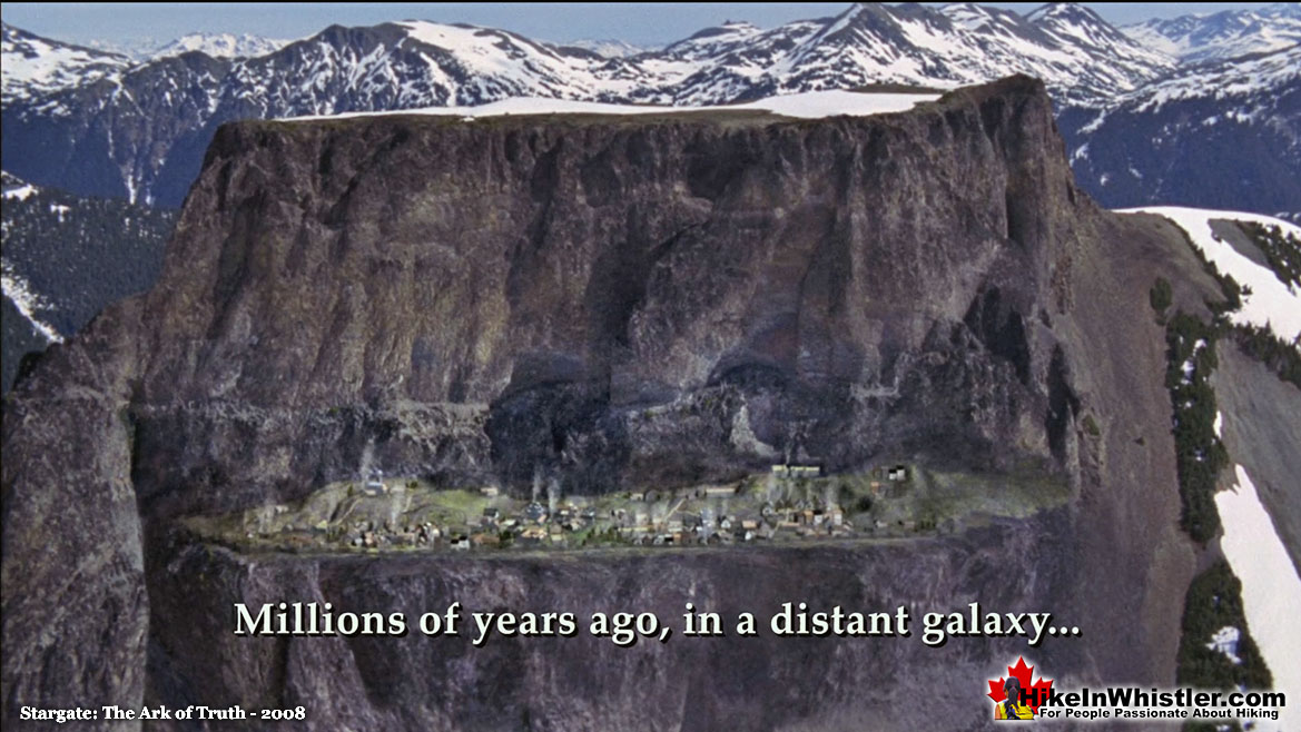
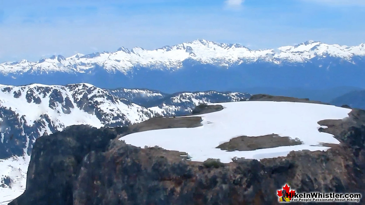
The Table’s extraordinary appearance has found its way into two Hollywood movies and the Canadian band Glass Tiger actually filmed a video on top of it. The music video for “I Will Be There” was filmed on the top of The Table in 1986. While the band performed the song on the broad, snow covered summit of The Table, a helicopter circled them and filmed. The video gives a wonderful vantage point of The Table that almost certainly will never be repeated, as landing aircraft in Garibaldi Provincial Park, let along on the top of The Table, has to be pretty difficult to arrange. The two movies that The Table appeared in were Agent Cody Banks in 2003 and Stargate: The Ark of Truth in 2008. In the Ark of Truth, The Table first appears at the start of the movie with a plateau along its side with a small town on it. The caption across the screen reads, "Millions of years ago in a distant galaxy..." Later in the movie a spaceship emerges from the surface of The Table as the mountain breaks apart.
Glass Tiger Video on The Table
The Glass Tiger video has some amazing shots of the top of The Table. Years after making it, in an interview Alan Frew and Sam Reid of Glass Tiger talked about the video they made on, "Table Top Mountain in Whistler." The lead singer and keyboardist recalled how Al Connely, while playing the guitar solo on the edge of The Table, was blasted by the helicopter wash as it was filming, and they didn't edit it out as it looked good in the video, despite terrifying the producer at the time. Sam Reid also recalled how they were legally required to be off The Table by dusk and to make the deadline they all had to pile into an overloaded helicopter and make an unusual exit. The helicopter was unable to lift off and so the pilot, "wiggled to the edge of the mountain and he goes, guys I've done this a million times... and you fall off until you catch the right altitude... I actually since then talked to a few helicopter pilots and they said, that was ballsy, like that was not a standard move." The Glass Tiger video "I Will Be There" is well worth watching for the amazing and unique views of the top of The Table and the surrounding Garibaldi Park.
Glass Tiger Video on The Table in 1986
More Whistler & Garibaldi Park Hiking A to Z!





The Best Whistler & Garibaldi Park Hiking Trails!
Whistler & Garibaldi Park Best Hiking by Month!



Explore BC Hiking Destinations!

Whistler Hiking Trails

Squamish Hiking Trails

Vancouver Hiking Trails

Clayoquot Hiking Trails

Victoria Hiking Trails


