HikeInWhistler.com

HikeInWhistler.com

Menu
  • Hike
      • Alexander Falls Provincial Park
      • Ancient Cedars & Showh Lakes
      • Black Tusk in Garibaldi Park
      • Blackcomb Mountain Hiking Trails
      • Brandywine Falls Provincial Park
      • Brandywine Meadows
      • Brew Lake & Mount Brew
      • Callaghan Lake Park
      • Cheakamus Lake in Garibaldi Park
      • Cheakamus River & Interpretive Forest
      • Cirque Lake in Callaghan Valley
      • Flank Trail (Rainbow-Sproatt)
      • Garibaldi Lake in Garibaldi Park
      • Helm Creek in Garibaldi Park
      • Jane Lakes West
      • Joffre Lakes Provincial Park
      • Keyhole Hot Springs
      • Logger's Lake
      • Madeley Lake & Hanging Lake
      • Meager Hot Springs
      • Nairn Falls Provincial Park
      • Newt Lake & Ancient Cedars
      • Panorama Ridge in Garibaldi Park
      • Parkhurst Ghost Town
      • Rainbow Falls
      • Rainbow Lake
      • Ring Lake & Conflict Lake
      • Russet Lake in Garibaldi Park
      • Sea to Sky Trail
      • Skookumchuck Hot Springs
      • Sloquet Hot Springs
      • Sproatt West(Northair) Trail
      • Sproatt East(Stonebridge) Trail
      • Train Wreck & Trash Trail
      • Taylor Meadows in Garibaldi Park
      • Wedgemount Lake in Garibaldi Park
      • Whistler Mountain Hiking Trails
  • Snow
      • Blueberry Trail Snowshoeing
      • Brandywine Falls Snowshoeing
      • Cheakamus River Snowshoeing
      • Elfin Lakes Snowshoeing
      • Flank Trail Snowshoeing
      • Joffre Lakes Snowshoeing
      • Nairn Falls Snowshoeing
      • Parkhurst Ghost Town Snowshoeing
      • Rainbow Falls Snowshoeing
      • Rainbow Lake Snowshoeing
      • Rainbow Park Snowshoeing
      • Sproatt East Snowshoeing
      • Taylor Meadows Snowshoeing
      • Train Wreck Snowshoeing
      • Wedgemount Lake Snowshoeing
  • Run
      • Whistler Golf Course 5k(3.1 Mile)
      • Blueberry Hill 6k(3.7 Mile)
      • Lost Lake 6k(3.7 Mile)
      • Alta Lake 8k(5 Mile)
      • Fitzsimmons Creek 9k(5.6 Mile)
      • Alta Green Lost 15k(9.3 Mile)
  • Best
      • Best Whistler Hiking by Month
          • Best by Month
      • Best Walk, Bike or Bus To Trails
      • Best Whistler Kid Friendly Trails
      • Best Whistler Dog Friendly Trails
      • Best Free Camping in Whistler
      • Best Sights Sea to Sky
      • Best Whistler Waterfalls
      • Best Whistler Aerial Views
      • Best Squamish Hiking Trails
      • Best Whistler Hiking Trails
      • Best Vancouver Hiking Trails
      • Best Whistler Snowshoeing
          • Best Whistler Snowshoe Trails
      • Best Whistler Running Trails
      • Best Whistler Hiking Gear Rentals
      • Best Whistler Parks & Beaches
  • AtoZ
      • Ablation Zone
      • Accumulation Zone
      • Adit Lakes
      • Aiguille
      • Alpine Zone
      • Arborlith or Lithophyte
      • Arête
      • A River Runs Through It
      • Armchair Glacier
      • The Barrier
      • Battleship Islands
      • Bears
      • Bench
      • Bergschrund or Schrund
      • Bivouac or Bivy
      • Blue Face House in Parkhurst
      • Bungee Bridge
      • Cairns & Inukshuks
      • Carter, Neal
      • Caterpillar D8
      • Caterpillar RD8
      • Chimney
      • Cirque or Cirque Lake
      • Cloudraker Skybridge
      • Coast Mountains
      • Col
      • Crevasse
      • Deadfall
      • Emerald Forest
      • Erratic or Glacier Erratic
      • The Fissile
      • Fitzsimmons Creek
      • Fitzsimmons Range
      • Fyles, Tom
      • Garibaldi Ranges
      • Garibaldi Volcanic Belt
      • Gemel or Inosculation
      • Glacier Window
      • Green Lake
      • Hoary Marmot
      • Krummholz
      • Moraine
      • Mount Garibaldi
      • Mount James Turner
      • Northair Mine
      • Nunatuk
      • Overlord Mountain & Glacier
      • Peak2Peak Gondola
      • Roundhouse Lodge
      • Rubble Creek
      • Spearhead Range
      • Tarn
      • The Table
      • Usnea or Old Man's Beard
      • Western Redcedar
  • Maps
      • Alexander Falls Maps
      • Ancient Cedars Maps
      • Black Tusk Maps
      • Blackcomb Mountain Maps
      • Brandywine Falls Maps
      • Brandywine Meadows Maps
      • Brew Lake Maps
      • Callaghan Lake Maps
      • Cheakamus Lake Maps
      • Cheakamus River Maps
      • Cirque Lake Maps
      • Garibaldi Lake Maps
      • Helm Creek Maps
      • Joffre Lakes Maps
      • Keyhole Hot Springs Maps
      • Logger's Lake Maps
      • Madeley Lake Maps
      • Meager Hot Springs Maps
      • Nairn Falls Maps
      • Panorama Ridge Maps
      • Parkhurst Ghost Town Maps
      • Rainbow Falls Maps
      • Rainbow Lake Maps
      • Ring Lake Maps
      • Russet Lake Maps
      • Skookumchuck Maps
      • Sloquet Hot Springs Maps
      • Sproatt Maps
      • Taylor Meadows Maps
      • Train Wreck Maps
      • Wedgemount Lake Maps
      • Whistler Mountain Maps
  • More
      • Whistler Hiking News & Blog
      • Live Whistler Webcams
      • Live Tofino Webcams
      • Live Vancouver Webcams
      • Garibaldi Provincial Park
      • Hike in Whistler Glossary

Cirque Lake

Northair Mine

Joffre Lakes

Black Tusk

Callaghan Lake

Brandywine Meadows

Whistler Train Wreck

Newt Lake

Wedgemount Lake

Black Tusk

Adit Lakes

Wedgemount Lake

Logger's Lake

Spectacular Whistler!

Whistler hiking is wonderful! Check out our Best Whistler Hiking by Month guides! WeRentGear.com rents tents, sleeping bags, sleeping pads, camp stoves, packs, complete kits and more!

Best Trails This Week!

Best This Week: Whistler Train Wreck and Parkhurst Ghost Town are easy, fun and dog friendly. Check out our May and June Whistler and Garibaldi Park guides here!

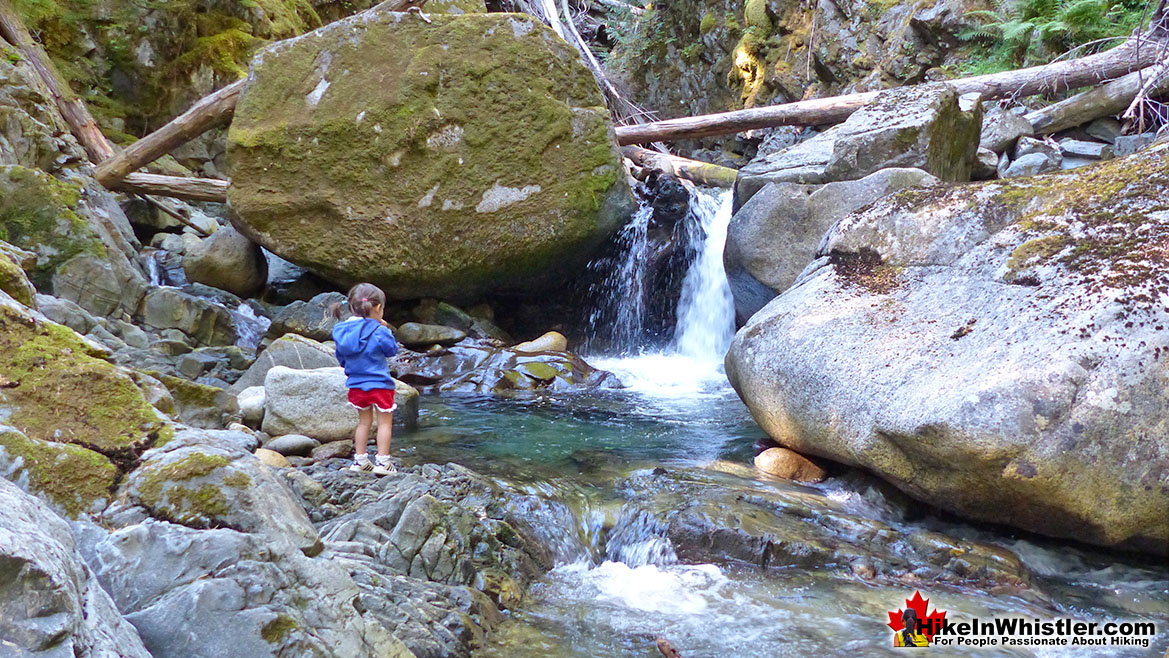
The short, scenic and easy hiking trail to Rainbow Falls is located just a short, half kilometre from the Rainbow Lake or Rainbow Trail trailhead. The trail begins by ascending into deep forest and the trail winds left, right, up and down constantly.  Twentyone Mile Creek, always on your right can be either seen or heard as you hike through beautiful forest to the somewhat hidden Rainbow Falls. 

  • Short trail through beautiful forest to hidden falls
  • Much quieter than most other trails
  • Easy to bike or walk to from Whistler Village
  • Trail is always winding up & down, never boring
  • Great to see on the way to Rainbow Lake
  • Rainbow Park is great to see and close by
  • The falls are not very big or impressive
  • Tricky to get a nice view of the falls
  • Not a lot to see on the short trail
  • Nice to see, but not a must see

Twentyone Mile Creek begins, 8 kilometres away as it drains from Rainbow Lake, making its way eventually to the River of Golden Dreams, before finally draining into Green Lake north of Whistler Village.  A couple minutes into the Rainbow Trail and you come to a fork in the path. You can take either path as they rejoin further up the trail, however taking the right fork is more scenic and only a little more of a steep climb.  A second fork in the trail appears a couple minutes later again, and once again taking the right fork is better. You will then come to a small trail sign indicating "Rainbow Falls". This short trail takes you to the little oasis that Rainbow Falls flows into. After seeing Rainbow Falls, there are a couple more nice vantage points just a short hike further up the Rainbow Trail. If you backtrack from the falls and rejoin the Rainbow Trail, you will zig-zag up some short switchbacks, before coming out to the gravel access road to the water treatment building. Here you will find a nice mapboard showing the Rainbow Trail and some of the connecting trails.

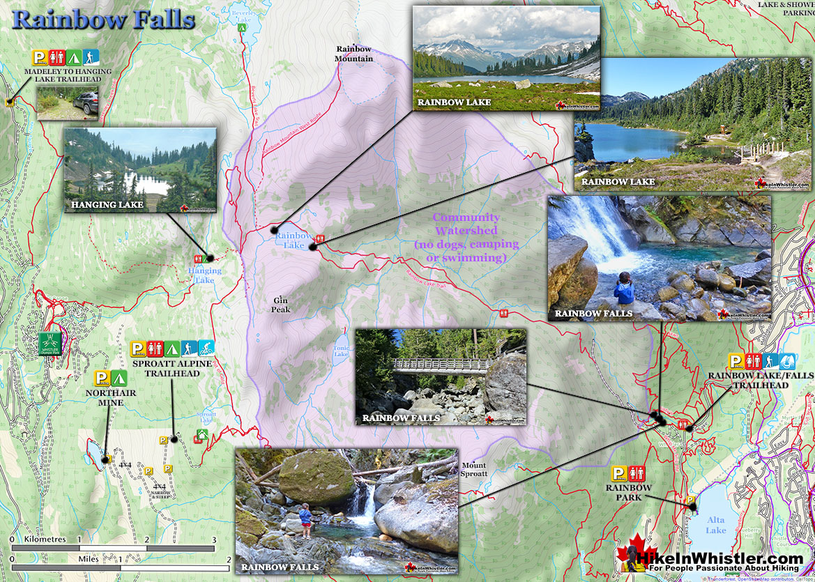
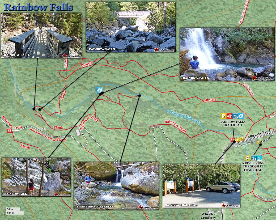
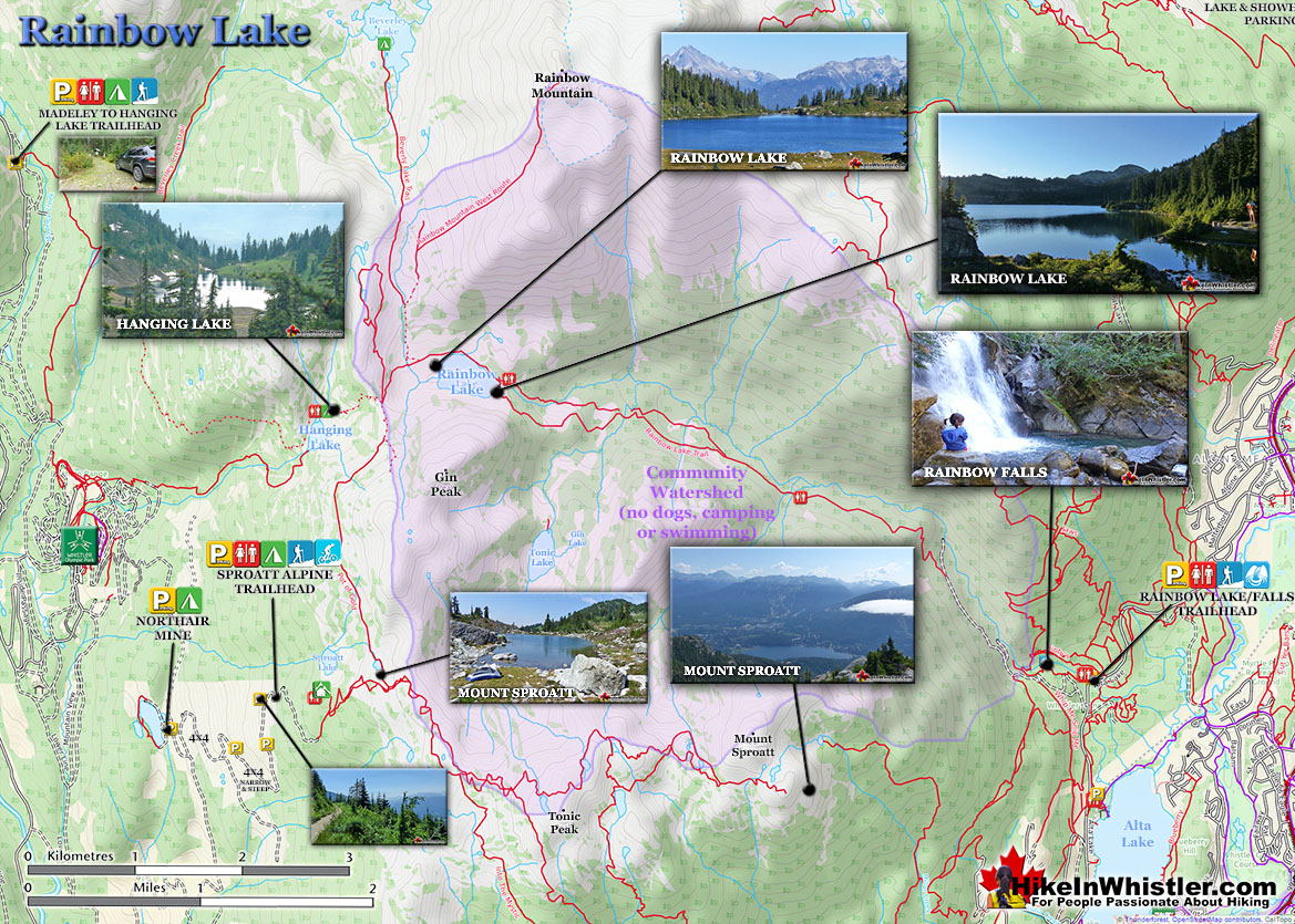
Rainbow Falls Hiking Trail Map

Rainbow Falls Map v11

This section of trail overlaps with the 40 kilometre, Rainbow-Sproatt Flank Trail, so you will see some "Flank Trail" signs as well as Rainbow Lake signs.  If you follow the Flank Trail as it ascends past the water treatment building on its right side, you will quickly come to the beautiful bridge across Twentyone Mile Creek. This is a great vantage point over this very scenic creek. The Flank Trail continues for several kilometres beyond this bridge, eventually coming out near Ancient Cedars, well north of Whistler Village.

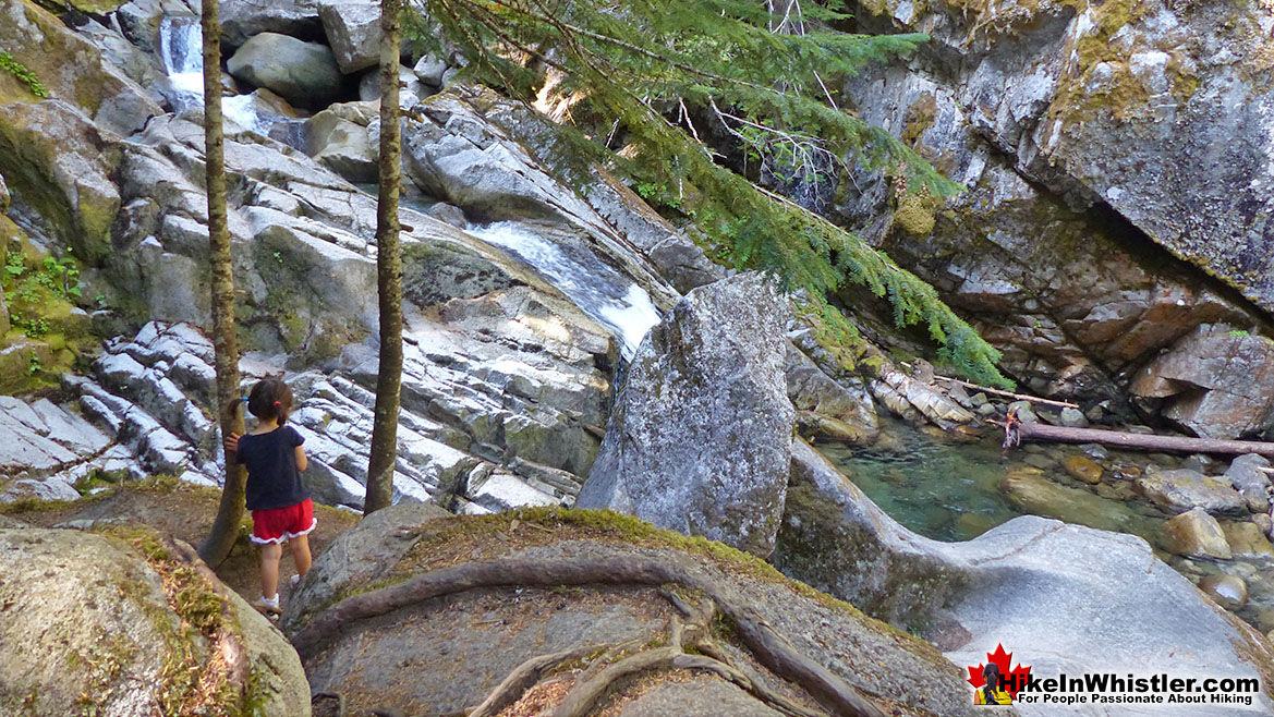
Rainbow Falls South of the Main Falls

Rainbow Falls Map v6a

The Rainbow Trail

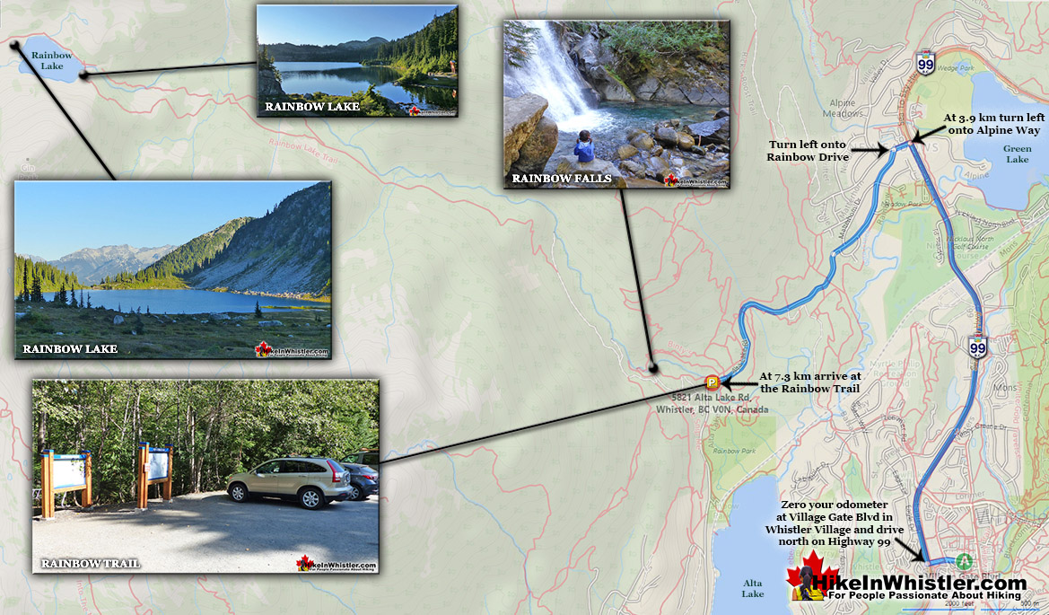
Rainbow Falls TrailheadThe trailhead is a short 15 minute drive from Whistler Village. There is parking at the Rainbow Trail, trailhead as well as Rainbow Park just a couple hundred metres further up Alta Lake Road. At the trailhead you will see an excellent map-board indicating the trails in front of you. There are no signs to Rainbow Falls and you will just see signs for Rainbow Lake, The Flank Trail and Madeley Lake. To find Rainbow Falls you just follow the Rainbow Lake trail from the trailhead for about a half kilometre until you reach the water treatment building (Rainbow Lake is Whistler's water source).  Just before the building the trail forks.

Rainbow Falls in Whistler

Rainbow Falls Boulders in 21 Mile Creek

Rainbow Trail Directions Map

Rainbow Lake Map v11

More Rainbow Falls Hiking info...

More Whistler & Garibaldi Park Hiking Maps!
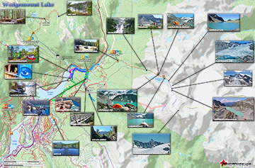
Wedgemount Lake Maps

Wedgemount Lake itself is a magnificent destination for a day hike or spectacular overnight beneath the dazzling mountain peaks and stars. Many sleep under the stars on one of ...
Read more

Callaghan Lake Maps

Callaghan Lake Park is a relatively untouched wilderness of rugged mountainous terrain. The valley walls were formed by relatively recent glaciation. Evidence of this can be ...
Read more

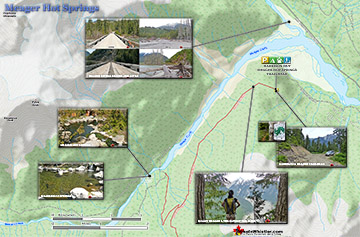
Meager Hot Springs Maps

Meager Hot Springs(aka: Meager Creek Hot Springs) is located 93 kilometres northwest of Whistler, was beautifully developed into gorgeous pools, with a caretaker and usage ...
Read more

Cirque Lake Maps

Cirque Lake is a wild and beautiful lake that hides high above and beyond Callaghan Lake in Callaghan Lake Provincial Park.  What makes Cirque Lake special among the other ...
Read more
More Whistler Hiking Trail Maps

Complete West Coast Trail Hiking Guide

Whistler & Garibaldi Park Glossary A to Z
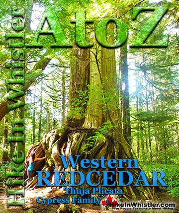
Tarn: a small alpine lake.  The word tarn originates from the Norse word tjorn which translates to English as pond.  In the United Kingdom, tarn is widely ...
Read more
Whistler spruce is a hybrid of the Sitka spruce and the interior Engelmann spruce. Sitka spruce trees thrive in the rainforests of the Pacific Northwest ...
Read more
When hiking to Parkhurst Ghost Town, the first area you will encounter after you cross the disintegrating bridge over Wedge Creek is the wye.  In railroad ...
Read more
Erratic or glacier erratic is a piece of rock that has been carried by glacial ice, often hundreds of kilometres.  Characteristic of their massive size and ...
Read more
Waterbar and Cross-Ditch: the purpose of a waterbar or cross-ditch is to capture and redirect surface water from the road and channel it across the road ...
Read more
Twentyone Mile Creek begins its long and steep journey from Rainbow Lake, high up and between Mount Sproatt and Rainbow Mountain.  Cutting between the two ...
Read more
Mount Garibaldi is the huge, potentially active volcano that Garibaldi Provincial Park is named after.  Mount Garibaldi also lends its name to the Garibaldi ...
Read more
Rainbow Lodge was a popular wilderness lodge in the small community called Alta Lake, and what would eventually be called Whistler  It was a fishing and ...
Read more
More Hike in Whistler Glossary

Free Camping Gear Delivery to Garibaldi Park

The Best Whistler & Garibaldi Park Hiking Trails!
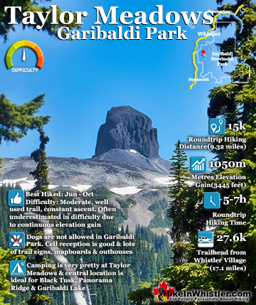
Brandywine Falls is one of the must see sights on the drive to or from Whistler, and arguably the nicest of Whistler’s numerous beautiful waterfalls. Located about halfway between Squamish and Whistler, the ...
Read more
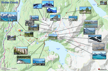
Helm Creek is a cute, meandering creek that winds its way from beyond Black Tusk, down the valley to the wonderful campground that takes its name. From the Helm Creek campground, Helm Creek descends further ...
Read more
Ring Lake is a fantastically serene and wonderfully remote lake similar to Cirque Lake, but considerably farther to hike to reach it. The 10 kilometre(6.2 mile) hike takes you through a rarely hiked forest, ...
Read more
Russet Lake is a surreal little paradise that lays at the base of The Fissile, in Garibaldi Provincial Park. The Fissile is the strikingly bronze mountain visible from Whistler Village. From the Village ...
Read more
More Whistler Hiking Trails & Maps

HikeInWhistler.com HikeInWhistler.com © 2025
  • Contact Us: [email protected]