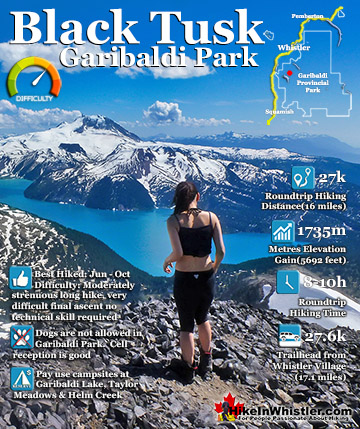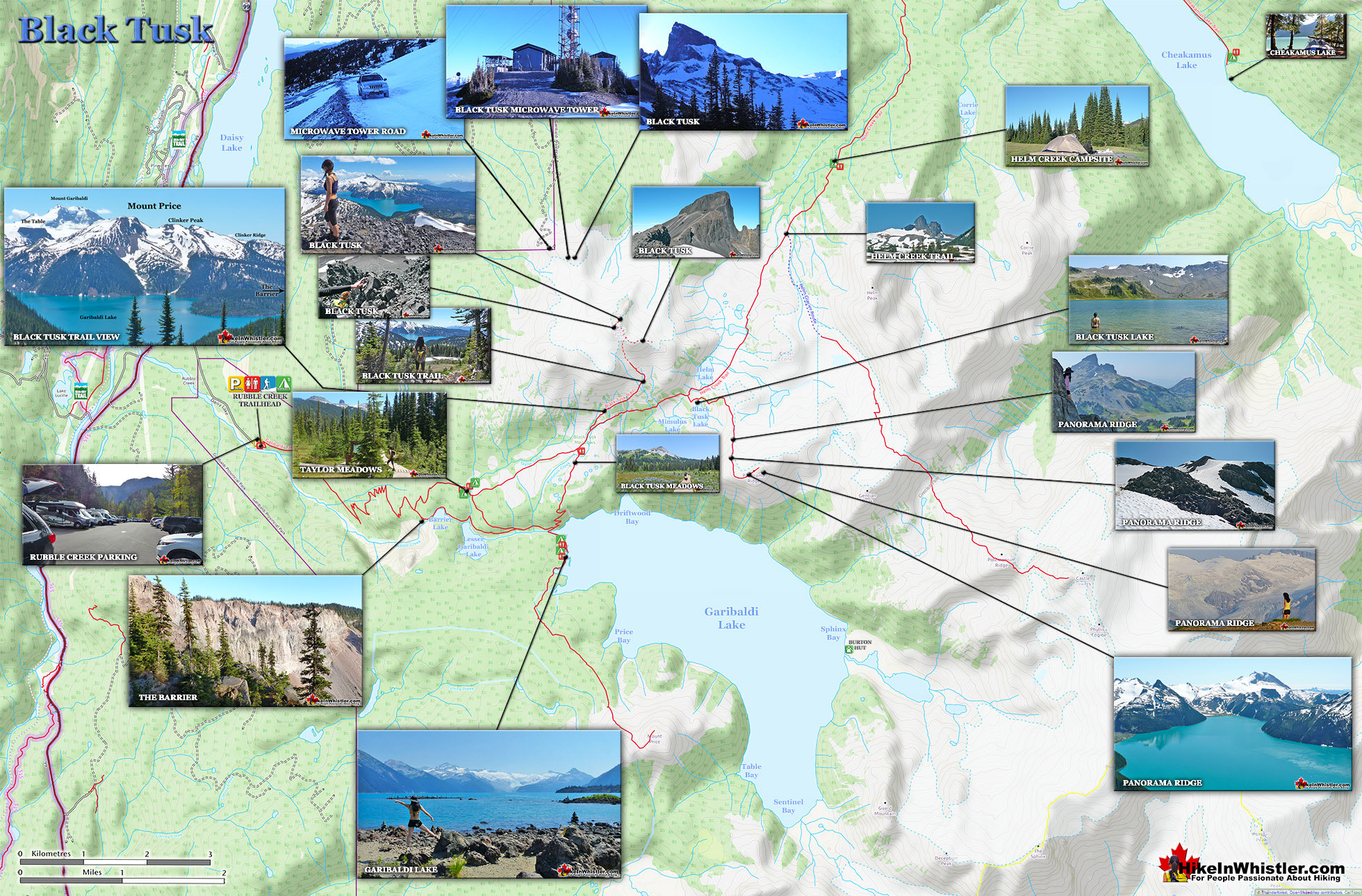
![]() Black Tusk is the extraordinarily iconic and appropriately named mountain that can be seen from almost everywhere in Whistler. The massive black spire of crumbling rock juts out of the earth in an incredibly distinct way that appears like an enormous black tusk plunging out of the ground. Whether you spot it in the distance from the top of Whistler Mountain or from vantage points along the Sea to Sky Highway, its appearance is breathtaking.
Black Tusk is the extraordinarily iconic and appropriately named mountain that can be seen from almost everywhere in Whistler. The massive black spire of crumbling rock juts out of the earth in an incredibly distinct way that appears like an enormous black tusk plunging out of the ground. Whether you spot it in the distance from the top of Whistler Mountain or from vantage points along the Sea to Sky Highway, its appearance is breathtaking.
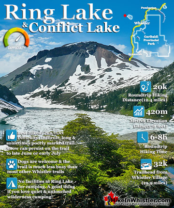
 Stunning icon in Garibaldi Park
- Challenging and rewarding hike
- Wonderful look at an ancient volcano
- Always changing scenery on the hike in
- Great campsite options and further hiking options
- Multiple access routes
- Towering & surreal view from the summit
- The final chute is exhilarating!
- You can skip the summit & still be amazed
 Often crowded with other hikers
Whether you see it from the highway or from closer vantage points such as Taylor Meadows, Helm Creek, Panorama Ridge or Garibaldi Lake, all views make climbing to the top look impossible. In fact, Black Tusk seems to look more impossible to climb the closer you get to it. Even when you are close enough to touch its vertical, black and crumbling sides, you wonder in amazement how anyone can ever reach the top. Black Tusk is accessible from three different trailheads, all accessible via old access roads. From the nearby microwave tower(also visible from the Sea to Sky Highway), from the Garibaldi Park, Cheakamus Lake trailhead, and from the Garibaldi Park, Rubble Creek trailhead. Of the three routes, only the Cheakamus Lake trailhead and the Rubble Creek trailhead are officially used for access to Black Tusk. These two have large and free parking lots equipped with an outhouse at each as well as big map and information boards. Along both trails you will find good signs indicating where to hike as well as kilometre markings. Most hikers use the more direct and popular Rubble Creek trailhead. The microwave tower access road takes you very close to Black Tusk, and has a fairly good gravel 4x4 road to it, however is blocked several kilometres away by a vehicle gate. This is potentially a good way to hike to Black Tusk, however this annoying gate makes what should be a short hike, a long and tedious one. Also, there are of course no signs indicating where to go once you reach the microwave tower. This route is currently being considered to be opened to allow vehicles to park at or near the microwave tower, however, little progress has been made so far. Occasionally you will find this gate open, however driving past this point may get you in trouble.
Black Tusk Map

The Cheakamus Lake trailhead route to get to Black Tusk is a good option as it is quiet, serene and takes you over the beautiful Cheakamus River via suspension bridge and through the wonderfully remote Helm Creek campground. It is, however, quite long at over 15 kilometres each way to the summit of Black Tusk and part of this route is unmarked, requires some route-finding, and a wet crossing of Helm Creek. It is a good option if you are keen on avoiding crowds as the beautiful Helm Creek campground has only about a dozen tent platforms and more often than not, are mostly deserted. Helm Creek is also the gateway to quite a few other great hikes. A quick look at a map indicates several accessible mountains close by as well as the elusive Corrie Lake.


Rubble Creek Trailhead to Black Tusk
The Rubble Creek trailhead is, for most hikers, the best trailhead option for Black Tusk. It is easy to find, clearly marked and the most direct route. The Cheakamus Lake trailhead is a bit longer and you have to leave the marked trail to ascend to Black Tusk. Though this unmarked route is straightforward and surprisingly easy, as it is unmarked it requires a bit of guesswork that may be intimidating. The Cheakamus Lake trailhead route also lacks one other wonderful attribute that the Rubble Creek route has, a pit-stop at Garibaldi Lake. This less than 30 minute detour(one way) allows for a spectacular place to cool off in an always frigid, glacier fed lake!

More Great Hiking Around Black Tusk
![]() The hiking options around and beyond Black Tusk in Garibaldi Park are quite good. Most hike to Garibaldi Lake to camp on the way to Black Tusk. Taylor Meadows is another route to Black Tusk and another campground. If you are hiking in a day, you can hike Rubble Creek to Taylor Meadows, then Black Tusk, returning via Garibaldi Lake. Garibaldi Lake barely adds any hiking distance to the overall journey with just a couple extra kilometres. Panorama Ridge, Helm Creek and Cheakamus Lake are found beyond Black Tusk if hiking from the Rubble Creek side. Added to this you will find a wealth of alpine terrain leading to various mountain peaks and even the wonderful Helm Glacier. Garibaldi Provincial Park is an enormous park, but the huge outdoor playground around Black Tusk is absolutely phenomenal!
The hiking options around and beyond Black Tusk in Garibaldi Park are quite good. Most hike to Garibaldi Lake to camp on the way to Black Tusk. Taylor Meadows is another route to Black Tusk and another campground. If you are hiking in a day, you can hike Rubble Creek to Taylor Meadows, then Black Tusk, returning via Garibaldi Lake. Garibaldi Lake barely adds any hiking distance to the overall journey with just a couple extra kilometres. Panorama Ridge, Helm Creek and Cheakamus Lake are found beyond Black Tusk if hiking from the Rubble Creek side. Added to this you will find a wealth of alpine terrain leading to various mountain peaks and even the wonderful Helm Glacier. Garibaldi Provincial Park is an enormous park, but the huge outdoor playground around Black Tusk is absolutely phenomenal!

Trailhead & Parking Directions to Black Tusk
![]() Rubble Creek is the most popular route to Black Tusk and consequently the most chaotic. The three big parking areas fill up on busy weekends, however the long access road seems to have enough room to accommodate the busiest long weekends. This road is the only paved(not a heavily potholed, gravel road) to access a trailhead to Black Tusk. Though very busy, the Rubble Creek trail to Black Tusk is constantly maintained to a high standard. Plenty of helpful BC Parks Garibaldi Park mapboards and trail signs keep you on track and aware of where you are. The tidy, natural dirt trail is wide enough to hike side-by-side most of the time. The constant ascent from here gets you to the summit of Black Tusk in 13.5 kilometres(8.4 miles). To get to Rubble Creek, drive south from Whistler Village(zero your odometer at Village Gate Boulevard) on Hwy 99. At 24.7 kilometres look for the Black Tusk(Garibaldi) sign on the highway indicating you to turn left. There is a nice, and long dedicated left turn lane on the highway here to allow you to safely exit the highway. There is a fork in the road a couple hundred metre up Daisy Lake road. Take the right fork and continue up the paved road for 2 kilometres to the Garibaldi Park, Rubble Creek trailhead for Black Tusk, Taylor Meadows, Panorama Ridge, Garibaldi Lake and much more.
Rubble Creek is the most popular route to Black Tusk and consequently the most chaotic. The three big parking areas fill up on busy weekends, however the long access road seems to have enough room to accommodate the busiest long weekends. This road is the only paved(not a heavily potholed, gravel road) to access a trailhead to Black Tusk. Though very busy, the Rubble Creek trail to Black Tusk is constantly maintained to a high standard. Plenty of helpful BC Parks Garibaldi Park mapboards and trail signs keep you on track and aware of where you are. The tidy, natural dirt trail is wide enough to hike side-by-side most of the time. The constant ascent from here gets you to the summit of Black Tusk in 13.5 kilometres(8.4 miles). To get to Rubble Creek, drive south from Whistler Village(zero your odometer at Village Gate Boulevard) on Hwy 99. At 24.7 kilometres look for the Black Tusk(Garibaldi) sign on the highway indicating you to turn left. There is a nice, and long dedicated left turn lane on the highway here to allow you to safely exit the highway. There is a fork in the road a couple hundred metre up Daisy Lake road. Take the right fork and continue up the paved road for 2 kilometres to the Garibaldi Park, Rubble Creek trailhead for Black Tusk, Taylor Meadows, Panorama Ridge, Garibaldi Lake and much more.


Guides to the Best of Whistler
 Best Dog Friendly Hiking Trails
Whistler is very dog friendly and the number of wonderful hiking trails that your dog will love is huge. The massively varied hiking trails range from easy, short, close to Whistler Village to challenging, long and deep in the endless wilderness around Whistler. You can find dog friendly trails in and around Whistler Village that take you through deep, dark and magical forests. Or you can drive beyond Whistler Village and take your dog to spectacular alpine lakes. Some requiring little or no hiking, while others are found after hiking challenging and long trails. Many of these places are comparatively quiet and often you and your dog will have the the wilderness to yourselves. In and around Whistler Village you have Lost Lake with its spider web of trails... Continued here.
 Best Free Whistler Camping
Whistler is surrounded by an immense wilderness dotted with spectacular, hidden lakes and amazing places to set up a tent. Decades of logging activity has left a network of forest service roads that has opened easy access to these places. Some of these you can drive to and some you may need a 4x4 to comfortably get to. Some places to camp for free you can drive to, some require a short hike and others are fairly long hikes to reach. Beautiful Callaghan Valley is home to several incredible and free places to camp. Callaghan Lake has a great free drive-to campsite just steps from this spectacular alpine lake. If you have a canoe, you can paddle to the end of Callaghan Lake and hike the short, but steep trail up to Cirque Lake. This gorgeous lake is deep in the alpine wilderness... Continued here.
 No Car? No Problem! Whistler Trails
Whistler as a resort has a wonderful car-free core. The Village Stroll runs through the heart of Whistler Village and is entirely car free. If you are visiting Whistler or living here and you don't have a car, it's no problem. On foot or on a bike you can travel the extensive network of non-motorized trails. The Valley Trail snakes through Whistler Village and extends in several directions, all of which lead to beautiful parts of Whistler. The Sea to Sky Trail and the Lost Lake trails continue this massive, car-free network of trails running almost everywhere in Whistler. When it comes to many of the best hiking trails, getting to the trailheads on foot, by bike or public transit can be tricky at best or complicated and impractical at worst. Many trailheads are far from Whistler Village and... Continued here.
 Kid Friendly Whistler Hiking Trails
There are plenty of excellent, kid and family friendly hiking trails and destinations in and around Whistler. Kid and family friendly generally means an easy and somewhat short trail that a toddler can happily manage. Some of these trails are flat enough to be stroller friendly, such as Brandywine Falls, Whistler Mountain and Blackcomb Mountain. Others such as Logger’s Lake, Cheakamus River and Madeley Lake have short enough trails to reach them that you can manage with little kids that don't want to hike too far. Some of these hikes and walks are popular and close to Whistler Village, like Whistler Mountain, Blackcomb Mountain, Lost Lake Park, Rainbow Park and Meadow Park. Others are a beautiful, but far drive into the mountains and tricky to find... Continued here.
More Whistler & Garibaldi Park Hiking Maps!
Rainbow Falls Maps
Brandywine Falls Maps
Cirque Lake Maps
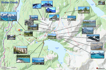
Helm Creek Maps

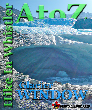
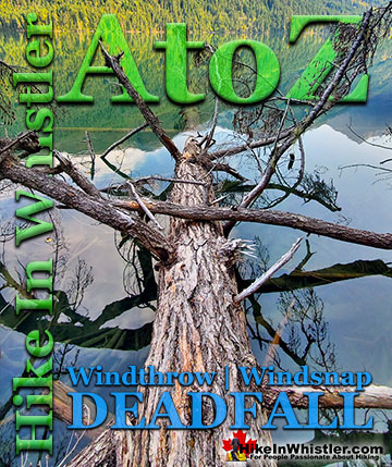
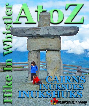
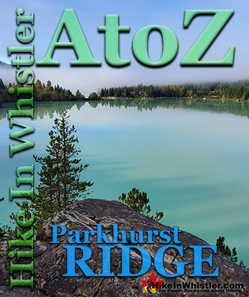
Whistler & Garibaldi Park Glossary A to Z

The Best Whistler & Garibaldi Park Hiking Trails!