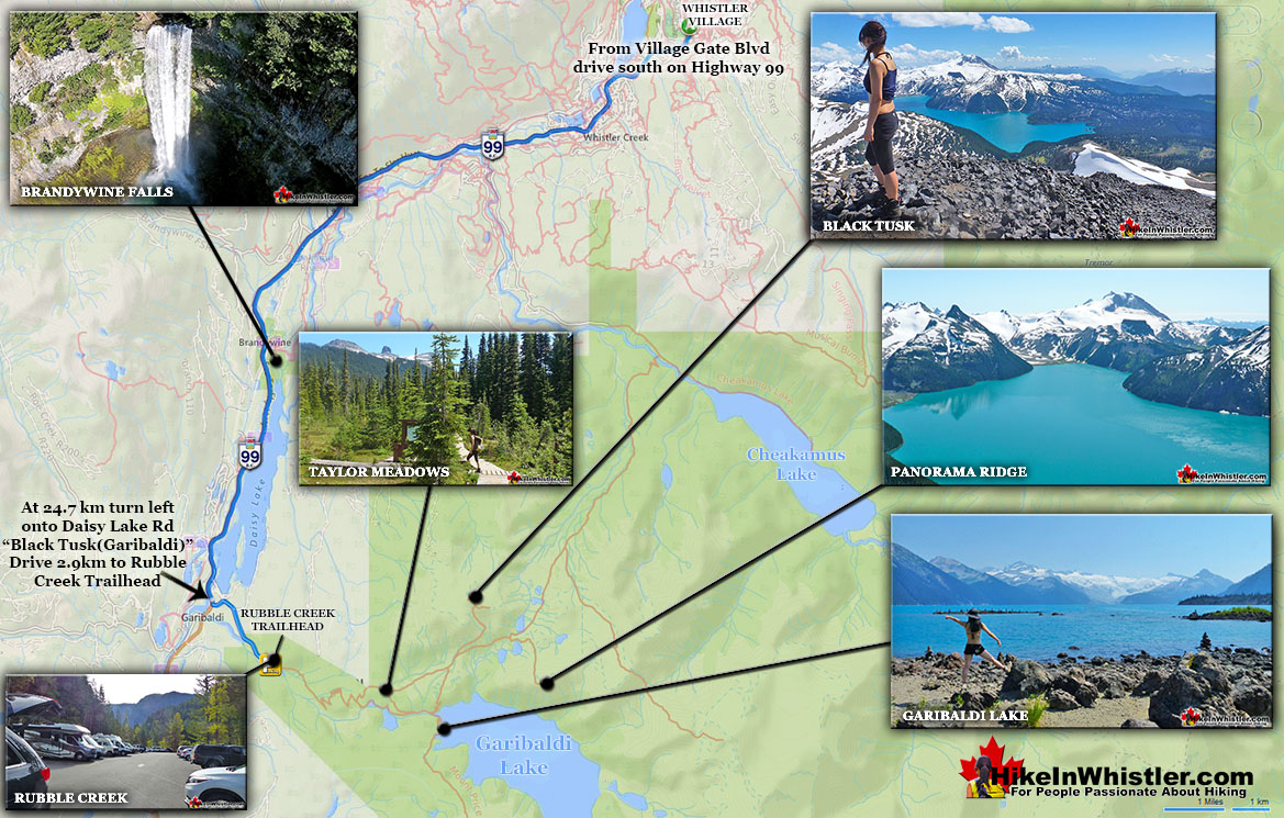
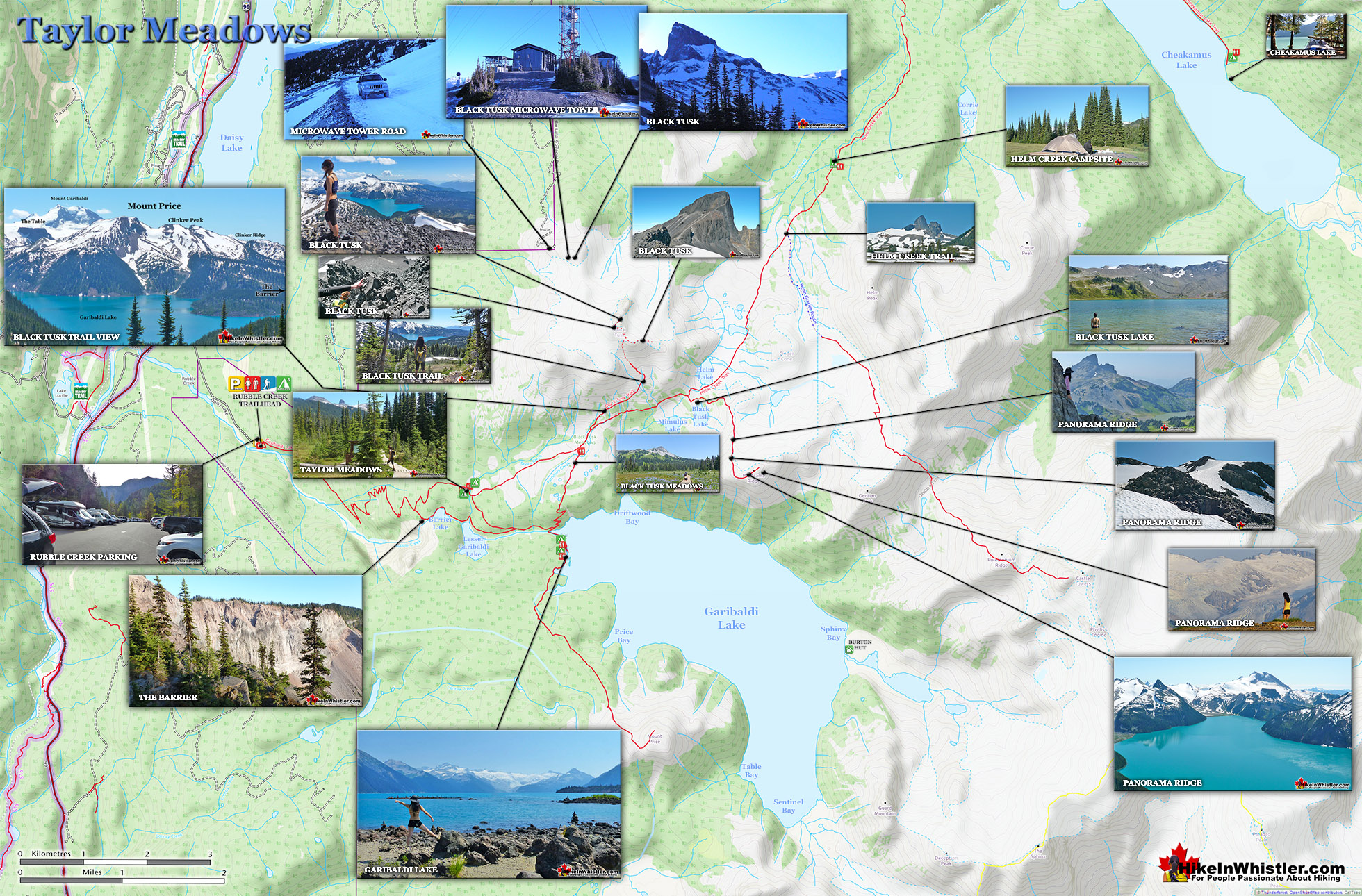
Generally Taylor Meadows is not a destination on its own, but part of a circle route to the spectacular Garibaldi Provincial Park sights in the area. For example, hiking from the Black Tusk(Garibaldi) Rubble Creek trailhead to Taylor Meadows, Taylor Meadows to Black Tusk or Panorama Ridge, then return via Garibaldi Lake and back down to Rubble Creek. This makes for a long hike at 30 kilometres(19 miles), which is why tenting at this perfectly beautiful, and perfectly located Taylor Meadows campsite is a great idea. The trail to Taylor Meadows from Rubble Creek is well marked, well used and with plenty of signs and mapboards. Expect to take well over two hours to reach Taylor Meadows from the trailhead/parking at Rubble Creek. Taylor Meadows gets very busy at times as well with 40 campsites with full service (water, security, etc). There are some small rivers close by but no swimming. The draw for Taylor Meadows camping is the wonderful location. It lays in a beautiful forested meadow full of hills and flowers and views of the towering Black Tusk. It has a less crowded feel than Garibaldi Lake does, though bear in mind that even when crowded these campsites don't feel crowded - they are just that organized and thick with trees and terrain.
Blackcomb Mountain holds an impressive and ever growing array of hiking trails. From the moment you arrive at the Rendezvous Lodge, you see hiking trails ascend into the ...
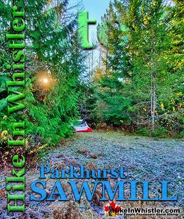
Whistler has an absurd number of wonderful and free hiking trails and Parkhurst Ghost Town certainly ranks as one of the most unusual, exotic and interesting. Parkhurst was a little ...
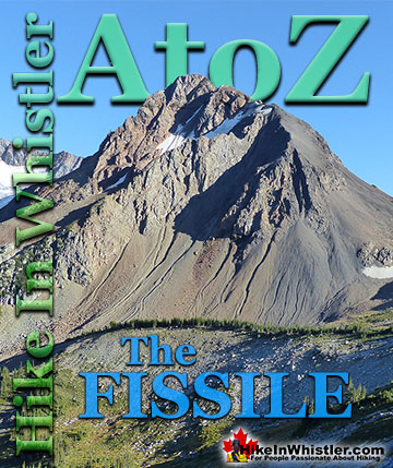
Russet Lake is a surreal little paradise that lays at the base of The Fissile. The Fissile is the strikingly bronze mountain visible from Whistler Village. From the Village ...
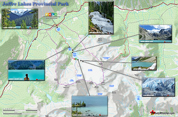
The three Joffre Lakes are some of the most stunning lakes you are likely to ever see. Each lake gets progressively more beautiful and impossibly turquoise from one to the ...
The sawmill at Parkhurst operated on the triangle of land that juts out into Green Lake and also extended north between the train tracks and the lake. The ...
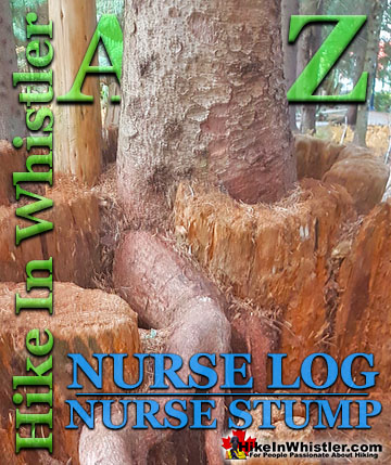
Surprisingly often in Whistler's forests you will find a tree growing on an old fallen tree or out of a decaying tree stump. Decaying logs and stumps in ...
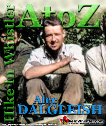
Alec Dalgleish (1 August 1907 - 26 June 1934) was a highly respected mountaineer and climber out of Vancouver in the 1920's and 1930's. His enthusiasm and ...
The Fissile is the stunning Matterhorn-looking mountain that is visible from Village Gate Boulevard in Whistler. Looking up from Village Gate you will see ...
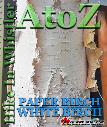
Paper birch, also known as white birch is a type of birch tree that grows in northern North America. Named for its paper-like, white or cream coloured ...
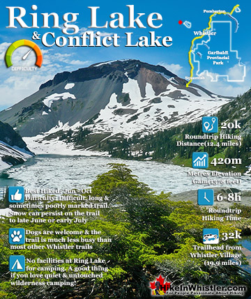
Ring Lake is a fantastically serene and wonderfully remote lake similar to Cirque Lake, but considerably farther to hike to reach it. The 10 kilometre(6.2 mile) hike takes you through a rarely hiked forest, ...
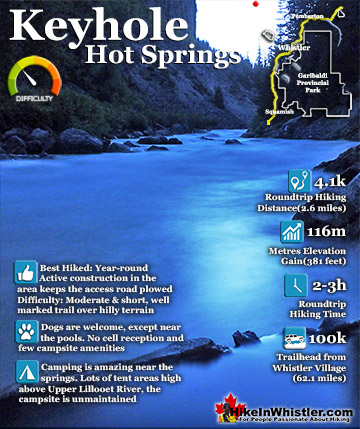
Keyhole Hot Springs (aka Pebble Creek Hot Springs) is located 100 kilometres from Whistler (Village Gate Blvd). Though much of the drive to Keyhole is on logging roads, the route is driveable by most cars ...
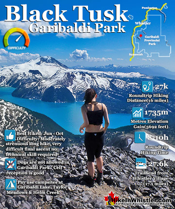
Black Tusk is the extraordinarily iconic and appropriately named mountain that can be seen from almost everywhere in Whistler. The massive black spire of crumbling rock juts out of the earth in an incredibly ...
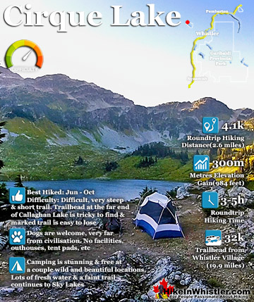
Cirque Lake is a wild and beautiful lake that hides high above and beyond Callaghan Lake in Callaghan Lake Provincial Park. What makes Cirque Lake special among the other sensationally beautiful lakes in the ...
 Idyllic, flower filled valley below Black Tusk
 More of a crossroads than a destination