![]() April in Whistler is a wonderful time of year. The winter deep freeze ends and T-shirt weather erupts. The village comes alive with overflowing patios and the excitement of approaching summer can be seen everywhere. The snow in the village starts the month measured in feet and ends the month, having mostly melted, about halfway up to mid-station on Whistler Mountain. Early in April the usual favourite places to snowshoe are warm and wonderful.
April in Whistler is a wonderful time of year. The winter deep freeze ends and T-shirt weather erupts. The village comes alive with overflowing patios and the excitement of approaching summer can be seen everywhere. The snow in the village starts the month measured in feet and ends the month, having mostly melted, about halfway up to mid-station on Whistler Mountain. Early in April the usual favourite places to snowshoe are warm and wonderful.
April Whistler Trails Guide
- Best Dog Friendly Hiking Trails
- Best Free Whistler Camping
- No Car? No Problem! Whistler Trails
- Kid Friendly Whistler Hiking Trails
- Wander Back to Whistler's Past this April
- Whistler Area Hot Springs in April
- Parkhurst Ghost Town
- Elfin Lakes
- Taylor Meadows
- Rainbow Lake
- Rainbow Falls
- Joffre Lakes
- Whistler Train Wreck
- Cheakamus River
- Brandywine Falls
- Sea to Sky Trail
If you don't have snowshoes, you will probably be fine on the lower elevation trails near Whistler Village. Good trails to try in April without the need for snowshoes are Whistler Train Wreck, Cheakamus River, Logger’s Lake, Rainbow Falls, The Flank Trail, Blueberry Trail, Brandywine Falls, the Bungee Bridge, Alexander Falls, Nairn Falls and Parkhurst Ghost Town. If you are up for an adventure and have snowshoes, the higher elevation hikes are well worth doing on a sunny day. Snowshoeing to Garibaldi Lake, Panorama Ridge, Taylor Meadows, Helm Creek, Cheakamus Lake are amazing in April as you will likely have them all to yourself. They are tough hikes though to do on snowshoes, so be prepared. Pristine, all white valleys, so peaceful in the winter, with the long and ever warming days of spring take hold in the mountains. The temperatures in the mountains can still get below freezing, and certainly at night they always do in April, but the days are amazing. Panorama Ridge and Helm Creek are quite difficult in the deep snow of April. Garibaldi Lake and Taylor Meadows are quite a bit easier, however much tougher in April than on a sunny day in July. Cheakamus Lake is an amazing option in April, though you will likely have to contend with a lot of snow on the access road. If you have to hike in from the start of Cheakamus Lake FSR, you will have to add 8 kilometres to the hike to the lake! The trail to Helm Creek begins 1.5 kilometres into the trail to Cheakamus Lake and has some difficulties of its own in April, May and June. As it is a somewhat less hiked trail into Garibaldi Park, it remains snow covered and untracked by previous hikers. Even with a couple feet of snow on the trail makes it very difficult to navigate. Even with a GPS to guide you, it is easy to find yourself wandering off the already fairly steep trail to Helm Creek.
Guides to the Best of Whistler
 Best Dog Friendly Hiking Trails
Whistler is very dog friendly and the number of wonderful hiking trails that your dog will love is huge. The massively varied hiking trails range from easy, short, close to Whistler Village to challenging, long and deep in the endless wilderness around Whistler. You can find dog friendly trails in and around Whistler Village that take you through deep, dark and magical forests. Or you can drive beyond Whistler Village and take your dog to spectacular alpine lakes. Some requiring little or no hiking, while others are found after hiking challenging and long trails. Many of these places are comparatively quiet and often you and your dog will have the the wilderness to yourselves. In and around Whistler Village you have Lost Lake with its spider web of trails... Continued here.
 Best Free Whistler Camping
Whistler is surrounded by an immense wilderness dotted with spectacular, hidden lakes and amazing places to set up a tent. Decades of logging activity has left a network of forest service roads that has opened easy access to these places. Some of these you can drive to and some you may need a 4x4 to comfortably get to. Some places to camp for free you can drive to, some require a short hike and others are fairly long hikes to reach. Beautiful Callaghan Valley is home to several incredible and free places to camp. Callaghan Lake has a great free drive-to campsite just steps from this spectacular alpine lake. If you have a canoe, you can paddle to the end of Callaghan Lake and hike the short, but steep trail up to Cirque Lake. This gorgeous lake is deep in the alpine wilderness... Continued here.
 No Car? No Problem! Whistler Trails
Whistler as a resort has a wonderful car-free core. The Village Stroll runs through the heart of Whistler Village and is entirely car free. If you are visiting Whistler or living here and you don't have a car, it's no problem. On foot or on a bike you can travel the extensive network of non-motorized trails. The Valley Trail snakes through Whistler Village and extends in several directions, all of which lead to beautiful parts of Whistler. The Sea to Sky Trail and the Lost Lake trails continue this massive, car-free network of trails running almost everywhere in Whistler. When it comes to many of the best hiking trails, getting to the trailheads on foot, by bike or public transit can be tricky at best or complicated and impractical at worst. Many trailheads are far from Whistler Village and... Continued here.
 Kid Friendly Whistler Hiking Trails
There are plenty of excellent, kid and family friendly hiking trails and destinations in and around Whistler. Kid and family friendly generally means an easy and somewhat short trail that a toddler can happily manage. Some of these trails are flat enough to be stroller friendly, such as Brandywine Falls, Whistler Mountain and Blackcomb Mountain. Others such as Logger’s Lake, Cheakamus River and Madeley Lake have short enough trails to reach them that you can manage with little kids that don't want to hike too far. Some of these hikes and walks are popular and close to Whistler Village, like Whistler Mountain, Blackcomb Mountain, Lost Lake Park, Rainbow Park and Meadow Park. Others are a beautiful, but far drive into the mountains and tricky to find... Continued here.
Best Whistler Hiking in April
Wander Back to Whistler's Past this April
![]() Whistler Mountain opened for skiing in the winter of 1965/66 and the newly laid Sea to Sky Highway brought a sudden influx of visitors to Whistler. On Alta Lake a rental house began its transformation into what would famously become known as Toad Hall. After it was discovered that Toad Hall was packed with dozens of skiers/squatters the RCMP issued a court order to the residents of Toad Hall to be evicted and the building demolished. The residents of Toad Hall threw one last farewell party before leaving. Soon after the second incarnation of Toad Hall developed in the abandoned Soo Valley Logging Camp at the north end of Green Lake in Parkhurst.
Whistler Mountain opened for skiing in the winter of 1965/66 and the newly laid Sea to Sky Highway brought a sudden influx of visitors to Whistler. On Alta Lake a rental house began its transformation into what would famously become known as Toad Hall. After it was discovered that Toad Hall was packed with dozens of skiers/squatters the RCMP issued a court order to the residents of Toad Hall to be evicted and the building demolished. The residents of Toad Hall threw one last farewell party before leaving. Soon after the second incarnation of Toad Hall developed in the abandoned Soo Valley Logging Camp at the north end of Green Lake in Parkhurst.
Toad Hall in the Early 1970's

The Famous Toad Hall Poster
 After a few memorable years Toad Hall was once again scheduled for demolition in the summer of 1973. That spring, knowing their time there was nearing its end a bunch of the residents gathered for a photo in their ski gear and nothing else. Photographer Chris Speedie printed 10000 copies in poster size and sold for two or three dollars each. Terry “Toulouse” Spence sold copies along the World Cup ski circuit. Terry “Toulouse” Spence brought a box of the original posters to Whistler Museum. The museum sold the remaining posters from the original 10000 and was able to proudly boast that the original run of the Toad Hall poster sold out almost 45 years after it was first printed. Reprints of the original Toad Hall poster are currently available for purchase at the museum.
Toad Hall Locals in the Early 1970's

The Toad Hall Site in 2021
Below is a picture taken at the same location in 2021. Where the Soo Valley Logging houses and Toad Hall once stood is now a beautifully serene little corner of Whistler. In the picture above of the volleyball game you can see a lot of snow on Blackcomb Mountain which means the photo would have been taken in late April or early May, fifty years ago.
The Toad Hall Site in 2021

Parkhurst Land Purchase in 2017
In 2013 Terry “Toulouse” Spence brought a box of the original posters to Whistler Museum. The museum sold the remaining posters from the original 10000 and was able to proudly boast that the original run of the Toad Hall poster sold out almost 45 years after it was first printed. Reprints of the original Toad Hall poster are currently available for purchase at the museum. Resort Municipality of Whistler purchased the Parkhurst lands (200acres/81 hectares), including the land where the famous Toad Hall picture was taken. The intent is to preserve the historic land and remaining features into a park, however it is likely to remain mostly unchanged for the foreseeable future.

Getting to the Toad Hall Site in April
![]() With no access from the Parkhurst side of Green River this piece of land is a bit isolated and tricky to get to if you don't have a boat. If you don't have a boat you have to walk in from an unmarked gate off the Sea to Sky Highway. There is no set parking so finding parking along the highway is tricky. You can fit a car or two outside the gate if you ignore the no parking sign, but you are best to park across the highway at the Cougar Mountain turnoff. Definitely the best way to get to the old Toad Hall site is by water from the Green Lake Pier just short, 5 minute paddle to the north end of Green Lake. The Green Lake Pier and nearby Green Lake Park are located just off the Sea to Sky Highway on Summer Lane. From Village Gate Boulevard in Whistler Village zero your odometer and drive north on Highway 99. At 7.5 kilometres you will see the sign on your right for Summer Lane. Turn right off the highway, then left onto Summer Lane. Take the next right onto Lakeshore Drive and look for the sign on your right for Green Lake Park. There is room for a couple cars to park just off the road. The Green Lake Pier & Boat Launch is just around the corner on Summer Lane and there is room for several cars to park. The map below shows the Green Lake Pier & Boat Launch and red lines indicating the route to Parkhurst Ghost Town directly across the lake. To paddle directly to the old Toad Hall site, you just need to paddle to the north end of Green Lake, off the top of this map, though shown on the map above.
With no access from the Parkhurst side of Green River this piece of land is a bit isolated and tricky to get to if you don't have a boat. If you don't have a boat you have to walk in from an unmarked gate off the Sea to Sky Highway. There is no set parking so finding parking along the highway is tricky. You can fit a car or two outside the gate if you ignore the no parking sign, but you are best to park across the highway at the Cougar Mountain turnoff. Definitely the best way to get to the old Toad Hall site is by water from the Green Lake Pier just short, 5 minute paddle to the north end of Green Lake. The Green Lake Pier and nearby Green Lake Park are located just off the Sea to Sky Highway on Summer Lane. From Village Gate Boulevard in Whistler Village zero your odometer and drive north on Highway 99. At 7.5 kilometres you will see the sign on your right for Summer Lane. Turn right off the highway, then left onto Summer Lane. Take the next right onto Lakeshore Drive and look for the sign on your right for Green Lake Park. There is room for a couple cars to park just off the road. The Green Lake Pier & Boat Launch is just around the corner on Summer Lane and there is room for several cars to park. The map below shows the Green Lake Pier & Boat Launch and red lines indicating the route to Parkhurst Ghost Town directly across the lake. To paddle directly to the old Toad Hall site, you just need to paddle to the north end of Green Lake, off the top of this map, though shown on the map above.
Green Lake Pier & Boat Launch Map

Whistler Area Hot Springs in April
The various hot springs near Whistler are also great destinations in April. Skookumchuck Hot Springs is open year-round and the two hour drive to reach it is really part of the fun. It is a beautiful drive through Pemberton, Mount Currie and along the beautiful and massive Lillooet Lake and Lillooet River. Sloquet Hot Springs is an hours drive past Skookumchuck and extraordinarily beautiful and desolate. Though gaining popularity, the remoteness almost guarantees no one there but you on a typical April day. You can normally drive right to Sloquet Hot Springs, but lingering snow on the unmaintained logging road may be too deep so, always be prepared to hike up to 8 kilometres if needed from your car to the campsite. Though bumpy and with lots of potholes, the road to Skookumchuck and Sloquet are still driveable with all types of cars, year-round.
Skookumchuck Hot Springs

Skookumchuck & Sloquet Hot Springs Directions Map

Parkhurst Ghost Town - Best Whistler Hiking in April
![]() Parkhurst Ghost Town is an interesting hike to do anytime of the year and in April, because it is off the radar for most hikers, you will likely have it all to yourself. Located on the far side of Green Lake, Parkhurst was a small logging town from 1926 to 1956, when there was little else going on in the valley. With a few trappers, prospectors and Rainbow Lodge, Parkhurst was the biggest concentration of industry and activity in the valley until it closed in 1956. The town has remained relatively untouched since it was abandoned almost 7 decades ago. All but two of the houses have been flattened by snow and several interesting old logging artifacts remain as they were in 1956. Three logging tractors remain in the town and one of the big monsters is perched on the edge of Green Lake and marks the entrance to Parkhurst if you are getting there by boat. In April ice on Green Lake should be mostly gone and you can paddle across the lake from Green Lake Park or the nearby Green Lake Pier. If you are hiking in, you should be able to drive to the unmarked trailhead at the north end of Green Lake, depending on how much snow is on the road. Usually by April you can drive right to the trailhead. If there is too much snow on the road to drive, you can easily park just off the highway and walk an extra kilometre or two depending where you park.
Parkhurst Ghost Town is an interesting hike to do anytime of the year and in April, because it is off the radar for most hikers, you will likely have it all to yourself. Located on the far side of Green Lake, Parkhurst was a small logging town from 1926 to 1956, when there was little else going on in the valley. With a few trappers, prospectors and Rainbow Lodge, Parkhurst was the biggest concentration of industry and activity in the valley until it closed in 1956. The town has remained relatively untouched since it was abandoned almost 7 decades ago. All but two of the houses have been flattened by snow and several interesting old logging artifacts remain as they were in 1956. Three logging tractors remain in the town and one of the big monsters is perched on the edge of Green Lake and marks the entrance to Parkhurst if you are getting there by boat. In April ice on Green Lake should be mostly gone and you can paddle across the lake from Green Lake Park or the nearby Green Lake Pier. If you are hiking in, you should be able to drive to the unmarked trailhead at the north end of Green Lake, depending on how much snow is on the road. Usually by April you can drive right to the trailhead. If there is too much snow on the road to drive, you can easily park just off the highway and walk an extra kilometre or two depending where you park.
Getting to Parkhurst Ghost Town in April
![]() There are several ways to get to Parkhurst Ghost Town and they range from alright to amazing. You can hike from the far end of Green Lake via the Parkhurst Trail (pretty good), the Parkhurst Ridge Trail (amazing), the Green Lake Loop (some of it is nice) or the Sea to Sky Trail(not great) ranging in length from 2.9 kilometres to 3.4 kilometres (one way). Or you can hike or bike in from the south from Lost Lake near Whistler Village along the Sea to Sky Trail and/or the Green Lake Loop. Starting from Lost Lake near Whistler Village, you can hike or bike to Parkhurst along the Sea to Sky Trail/Green Lake Loop in 6.2 kilometres. It is a very nice and wide, gravel trail with a few hills as you ascend up the back of Green Lake. There are several panoramic vantage points over the lake as you wind through the nice forest in a comparatively quiet corner of Whistler. Keep in mind that you may encounter a lot of snow on these trails in April and your hiking time may be a lot longer than planned. In April, because of this the best way to hike to Parkhurst is by the Parkhurst Trail and the Parkhurst Ridge Trail as they are much shorter than hiking in from Lost Lake.
There are several ways to get to Parkhurst Ghost Town and they range from alright to amazing. You can hike from the far end of Green Lake via the Parkhurst Trail (pretty good), the Parkhurst Ridge Trail (amazing), the Green Lake Loop (some of it is nice) or the Sea to Sky Trail(not great) ranging in length from 2.9 kilometres to 3.4 kilometres (one way). Or you can hike or bike in from the south from Lost Lake near Whistler Village along the Sea to Sky Trail and/or the Green Lake Loop. Starting from Lost Lake near Whistler Village, you can hike or bike to Parkhurst along the Sea to Sky Trail/Green Lake Loop in 6.2 kilometres. It is a very nice and wide, gravel trail with a few hills as you ascend up the back of Green Lake. There are several panoramic vantage points over the lake as you wind through the nice forest in a comparatively quiet corner of Whistler. Keep in mind that you may encounter a lot of snow on these trails in April and your hiking time may be a lot longer than planned. In April, because of this the best way to hike to Parkhurst is by the Parkhurst Trail and the Parkhurst Ridge Trail as they are much shorter than hiking in from Lost Lake.

The Parkhurst Loop Trail
![]() The Parkhurst Loop Trail is roughly a triangle with each side about 300 metres long. This trail runs through the now deep forest where most of the houses once stood in Parkhurst. Part of the loop trail was once an old gravel road which explains how the various wrecked vehicles managed to get there. Wrecked, old trucks from the 1950’s, an old car from the 1970’s and dozens of collapsed houses lay rotting along this trail. It is fun to wander through the forest here as you can never tell what you will find around the next bend in the trail. The triangle shaped loop trail surrounded by deep forest is strangely disorienting. You find yourself wandering for a while in a direction you are sure is away from Green Lake, only to suddenly emerge from the forest just steps from the water. Unlike other hiking trails in Whistler where you have a set destination, at Parkhurst you have a non-stop series of curious structures, beautiful sections of forest and endless great lake views.
The Parkhurst Loop Trail is roughly a triangle with each side about 300 metres long. This trail runs through the now deep forest where most of the houses once stood in Parkhurst. Part of the loop trail was once an old gravel road which explains how the various wrecked vehicles managed to get there. Wrecked, old trucks from the 1950’s, an old car from the 1970’s and dozens of collapsed houses lay rotting along this trail. It is fun to wander through the forest here as you can never tell what you will find around the next bend in the trail. The triangle shaped loop trail surrounded by deep forest is strangely disorienting. You find yourself wandering for a while in a direction you are sure is away from Green Lake, only to suddenly emerge from the forest just steps from the water. Unlike other hiking trails in Whistler where you have a set destination, at Parkhurst you have a non-stop series of curious structures, beautiful sections of forest and endless great lake views.

The Parkhurst Sawmill Site in April
The old Parkhurst Sawmill was located on the peninsula adjacent to the old Caterpillar tractor. A little bit of bushwhacking takes you into a surprisingly big clearing in tangle of forest. The clearing is caused by the collapsed sawmill's metal roof covering the forest floor and preventing big trees from taking root. You can only see some of the huge metal sheets as most of it lays under a carpet of forest that has settled in over the past 65 years. The clearing is serene and cut off from the world by a thick perimeter of jungle, making it a sunny paradise on a nice day.

Venturing into the forest around the clearing you will encounter the huge, old chimney from the sawmill as well as a pile of bricks that once housed the sawmill's furnace that powered everything. Further into the forest you will find two more logging tractors. An old Cletrac tractor that dates from the mid 1940's and an unexpectedly impressive Caterpillar buried in the forest with its huge plow being lifted off the ground by several trees. You will probably find yourself crawling around in amazement, peering under the 4000 kilogram plow, wondering how it is possible.
4000kg Plow Lifted by Trees!

Trailhead & Parking Directions to Parkhurst
![]() There are several ways to get to Parkhurst, but the access from the Wedgemount Lake turnoff on the Sea to Sky Highway is the most direct if arriving on foot or bike. If you zero your odometer at Village Gate Blvd in Whistler Village and drive north on Highway 99, at 11.9 kilometres you will see the Wedgemount (Garibaldi) turnoff on your right. Turn here, cross the train tracks and then the bridge over Green River, turn right and follow the gravel road for a few hundred metres. You will pass Whistler Paintball on your left and then see a yellow gate and a sign for the Sea to Sky Trail. Park on the clearing across from the yellow gate and walk straight ahead along the old gravel road, passing the yellow gate, road and Sea to Sky Trail on your left. Biking or hiking the 10 kilometres to Parkhurst from Whistler Village is a very nice option, though lots of steep hills makes it a tough trek for some. Biking from the Village takes about a half an hour if you are fast, and hour if you are slow, and follows the beautiful Sea to Sky Trail up around Green Lake. Hiking to Parkhurst from the Village will take the average hiker 2-3 hours each way. This map shows the driving directions to the unmarked Parkhurst Ghost Town trailhead near the north end of Green Lake. This trailhead gets you to Parkhurst much quicker and easier than the long trek from Whistler Village.
There are several ways to get to Parkhurst, but the access from the Wedgemount Lake turnoff on the Sea to Sky Highway is the most direct if arriving on foot or bike. If you zero your odometer at Village Gate Blvd in Whistler Village and drive north on Highway 99, at 11.9 kilometres you will see the Wedgemount (Garibaldi) turnoff on your right. Turn here, cross the train tracks and then the bridge over Green River, turn right and follow the gravel road for a few hundred metres. You will pass Whistler Paintball on your left and then see a yellow gate and a sign for the Sea to Sky Trail. Park on the clearing across from the yellow gate and walk straight ahead along the old gravel road, passing the yellow gate, road and Sea to Sky Trail on your left. Biking or hiking the 10 kilometres to Parkhurst from Whistler Village is a very nice option, though lots of steep hills makes it a tough trek for some. Biking from the Village takes about a half an hour if you are fast, and hour if you are slow, and follows the beautiful Sea to Sky Trail up around Green Lake. Hiking to Parkhurst from the Village will take the average hiker 2-3 hours each way. This map shows the driving directions to the unmarked Parkhurst Ghost Town trailhead near the north end of Green Lake. This trailhead gets you to Parkhurst much quicker and easier than the long trek from Whistler Village.
Parkhurst Ghost Town Driving Directions Map

More Parkhurst Ghost Town hiking info...
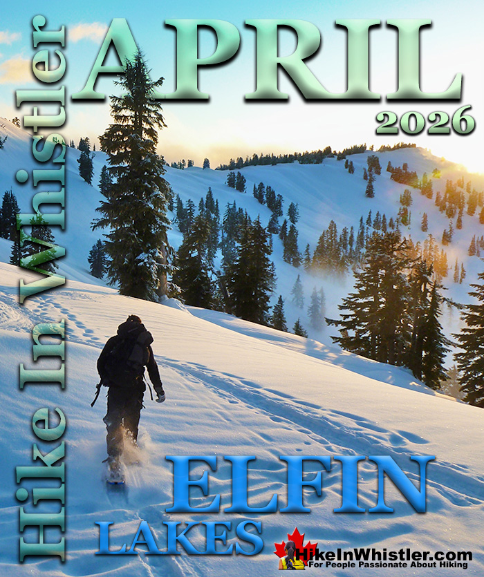
Elfin Lakes - Best Whistler Snowshoeing in April
![]() Elfin Lakes in Garibaldi Provincial Park is another beautiful place to snowshoe. Located at the south end of Garibaldi Park, the Elfin Lakes trailhead is found in Squamish. The trail is not overly difficult, however it is quite long. A consistently uphill, 11 kilometre(6.8 mile) trail through some spectacular scenery takes you to the marvelous Elfin Lakes hut. This two level, heated hut even has electric lights that run on solar power. A wonderful oasis in the mountains, the Elfin Lakes hut is surrounded by spectacular mountain views in all directions and deep snow well into May! Camping at Elfin Lakes is an amazingly beautiful experience. The valley is huge with stunning mountain peaks all around. The hiking/snowshoeing possibilities seem endless. Year-round the Elfin Lakes hut has bunk beds for 33 people(11 double bunks and 12 single bunks). The hut also has 4 huge picnic tables inside as well as 2 propane stove-top burners, a washing sink as well as a giant propane stove and solar powered lights. Adjacent to the hut is a row of outhouses. The campsite area at Elfin Lakes is quite large and well organized. 35 tent platforms dot the landscape and on a typical summer weekend, you will find most of them occupied! In the winter months, these tent platforms with be hidden under metres of snow and you can put up a tent nearly anywhere you want. There are various excellent spots overlooking the vast valley just a few dozen metres from the hut. For those seeking solitude, there are endless tent site possibilities further away. Hardcore winter campers often shovel out snow caves to sleep in. Often you will find them in the slopes adjacent to the hut. Pretty amazing and surprisingly comfortable. In 2015, the new campsite at Rampart Ponds was completed. Just 1.5 kilometres before Mamquam Lake, this new campground replaces the old one at Mamquam Lake that was closed recently. It is located 10 kilometres from Elfin Lakes on the trail to Mamquam Lake. The new campground has 12 tent platforms, an outhouse and food storage facilities.
Elfin Lakes in Garibaldi Provincial Park is another beautiful place to snowshoe. Located at the south end of Garibaldi Park, the Elfin Lakes trailhead is found in Squamish. The trail is not overly difficult, however it is quite long. A consistently uphill, 11 kilometre(6.8 mile) trail through some spectacular scenery takes you to the marvelous Elfin Lakes hut. This two level, heated hut even has electric lights that run on solar power. A wonderful oasis in the mountains, the Elfin Lakes hut is surrounded by spectacular mountain views in all directions and deep snow well into May! Camping at Elfin Lakes is an amazingly beautiful experience. The valley is huge with stunning mountain peaks all around. The hiking/snowshoeing possibilities seem endless. Year-round the Elfin Lakes hut has bunk beds for 33 people(11 double bunks and 12 single bunks). The hut also has 4 huge picnic tables inside as well as 2 propane stove-top burners, a washing sink as well as a giant propane stove and solar powered lights. Adjacent to the hut is a row of outhouses. The campsite area at Elfin Lakes is quite large and well organized. 35 tent platforms dot the landscape and on a typical summer weekend, you will find most of them occupied! In the winter months, these tent platforms with be hidden under metres of snow and you can put up a tent nearly anywhere you want. There are various excellent spots overlooking the vast valley just a few dozen metres from the hut. For those seeking solitude, there are endless tent site possibilities further away. Hardcore winter campers often shovel out snow caves to sleep in. Often you will find them in the slopes adjacent to the hut. Pretty amazing and surprisingly comfortable. In 2015, the new campsite at Rampart Ponds was completed. Just 1.5 kilometres before Mamquam Lake, this new campground replaces the old one at Mamquam Lake that was closed recently. It is located 10 kilometres from Elfin Lakes on the trail to Mamquam Lake. The new campground has 12 tent platforms, an outhouse and food storage facilities.


Taylor Meadows - Best Whistler Hiking in April
![]() Taylor Meadows, in Garibaldi Provincial Park is an amazing place to snowshoe in the winter near Whistler. Beautiful snowy meadows surrounded by mountains everywhere you look. Black Tusk towering in the distance so close and blanketed in wonderful, beautiful snow. Garibaldi Lake is accessible as well on this snowshoeing hike. The Taylor Meadows trail forks partway up, left goes to Taylor Meadows, right to Garibaldi Lake. The trail joins again at the far side of both campsites. Garibaldi Lake, so massive and dramatically beautiful in the winter, a huge frozen valley. The downside to this hike is the length of hiking to get to the beautiful parts. In the summer it's not so bad as the trailhead is a moderately difficult 9 kilometre hike from Garibaldi Lake. In the winter however, the same 9 kilometres is considerably more strenuous as you have the added weight of winter gear and clothing. In the past you also had to snowshoe up an additional 2 kilometres because the access road was never plowed to the trailhead parking lot. In the winter of 2020/2021 BC Parks finally relented after considerable public pressure to plow the access road during the snowy winter months. If you snowshoe the beautiful route to Taylor Meadows and return via Garibaldi Lake the route is 21 kilometres long and very strenuous as a one day snowshoe trip. Camping at either Taylor Meadows or Garibaldi Lake are great options if you can stand the cold and are well prepared for winter camping. If you plan to do this trip in one day be sure to leave very early and be well equipped for winter hiking. In the winter the days are very short so always have lights with you. Although the trail will likely be tracked out by previous hikers and skiers, having a gps is an excellent backup in case you lose the trail. Taylor Meadows - Best Snowshoeing in Whistler
Taylor Meadows, in Garibaldi Provincial Park is an amazing place to snowshoe in the winter near Whistler. Beautiful snowy meadows surrounded by mountains everywhere you look. Black Tusk towering in the distance so close and blanketed in wonderful, beautiful snow. Garibaldi Lake is accessible as well on this snowshoeing hike. The Taylor Meadows trail forks partway up, left goes to Taylor Meadows, right to Garibaldi Lake. The trail joins again at the far side of both campsites. Garibaldi Lake, so massive and dramatically beautiful in the winter, a huge frozen valley. The downside to this hike is the length of hiking to get to the beautiful parts. In the summer it's not so bad as the trailhead is a moderately difficult 9 kilometre hike from Garibaldi Lake. In the winter however, the same 9 kilometres is considerably more strenuous as you have the added weight of winter gear and clothing. In the past you also had to snowshoe up an additional 2 kilometres because the access road was never plowed to the trailhead parking lot. In the winter of 2020/2021 BC Parks finally relented after considerable public pressure to plow the access road during the snowy winter months. If you snowshoe the beautiful route to Taylor Meadows and return via Garibaldi Lake the route is 21 kilometres long and very strenuous as a one day snowshoe trip. Camping at either Taylor Meadows or Garibaldi Lake are great options if you can stand the cold and are well prepared for winter camping. If you plan to do this trip in one day be sure to leave very early and be well equipped for winter hiking. In the winter the days are very short so always have lights with you. Although the trail will likely be tracked out by previous hikers and skiers, having a gps is an excellent backup in case you lose the trail. Taylor Meadows - Best Snowshoeing in Whistler

Rainbow Lake - Best Whistler Hiking in April
![]() Rainbow Lake is a tough and beautiful 8 kilometre(5 mile)snowshoeing trail, high up in the mountains across the valley from Whistler Mountain and Blackcomb Mountain. The trail is generally well marked and easy to follow, however some sections are tricky to follow as the heavy snow bends the bushes down obscuring the trail. The trail is a constant, fairly steep ascent and you may notice ski tracks along the route. A somewhat popular skiing attraction in Whistler is to get heli-dropped on Rainbow Mountain and skiing back to Whistler. Rainbow Falls is a nice detour near the beginning of the Rainbow Lake trail. When you come to the small water purification building you will see a distinct fork in the trail and a sign directing you to Rainbow Lake turn left. If you go right however, in just a few hundred metres you will come to the beautiful Rainbow Falls as well as a nice picturesque bridge over the river. You of course have to backtrack to get back to the Rainbow Lake trail. Though Rainbow Lake is only 8k from the trailhead, on snowshoes it will likely take nearly four hours to get there. You can snowshoe around up there for quite a while so you have to be careful with the time as in the winter the sun goes down before 5pm. The Rainbow Mountain trailhead is easy and close to Whistler Village. You just need to drive to Alta Lake Road on the far side of Alta Lake, just a 15 minute drive away. There is a big sign for the Rainbow Lake trailhead on your right if coming from the neighbourhood of Alpine. The trailhead is about 200-300 metres from the Rainbow Park parking lot. Rainbow Lake is a tough but rewarding snowshoe hike through a thick and beautiful forest. There are several viewpoints looking across the valley to Wedge Mountain, Blackcomb Mountain and Whistler Mountain as well as Whistler Village. It certainly is a good idea to combine this snowshoeing hike with a look at Rainbow Park and Rainbow Falls as both are nearby. Rainbow Lake - Best Snowshoeing in Whistler
Rainbow Lake is a tough and beautiful 8 kilometre(5 mile)snowshoeing trail, high up in the mountains across the valley from Whistler Mountain and Blackcomb Mountain. The trail is generally well marked and easy to follow, however some sections are tricky to follow as the heavy snow bends the bushes down obscuring the trail. The trail is a constant, fairly steep ascent and you may notice ski tracks along the route. A somewhat popular skiing attraction in Whistler is to get heli-dropped on Rainbow Mountain and skiing back to Whistler. Rainbow Falls is a nice detour near the beginning of the Rainbow Lake trail. When you come to the small water purification building you will see a distinct fork in the trail and a sign directing you to Rainbow Lake turn left. If you go right however, in just a few hundred metres you will come to the beautiful Rainbow Falls as well as a nice picturesque bridge over the river. You of course have to backtrack to get back to the Rainbow Lake trail. Though Rainbow Lake is only 8k from the trailhead, on snowshoes it will likely take nearly four hours to get there. You can snowshoe around up there for quite a while so you have to be careful with the time as in the winter the sun goes down before 5pm. The Rainbow Mountain trailhead is easy and close to Whistler Village. You just need to drive to Alta Lake Road on the far side of Alta Lake, just a 15 minute drive away. There is a big sign for the Rainbow Lake trailhead on your right if coming from the neighbourhood of Alpine. The trailhead is about 200-300 metres from the Rainbow Park parking lot. Rainbow Lake is a tough but rewarding snowshoe hike through a thick and beautiful forest. There are several viewpoints looking across the valley to Wedge Mountain, Blackcomb Mountain and Whistler Mountain as well as Whistler Village. It certainly is a good idea to combine this snowshoeing hike with a look at Rainbow Park and Rainbow Falls as both are nearby. Rainbow Lake - Best Snowshoeing in Whistler

Rainbow Falls - Best Whistler Hiking in April
![]() The short, winding, and ever-changing hiking trail to Rainbow Falls is the same as the much more popular trailhead for Rainbow Lake. The trailhead is marked as the Rainbow Trail, and the trail quickly ascends into the forest winding left, right, up and down almost constantly. Twentyone Mile Creek, always on your right can be either seen or heard as you hike through the forest to the somewhat hidden Rainbow Falls. For the adventurous, the best time to see Rainbow Falls is in August and September when the creek is low and you can get down to the marvellous creek bed. To get there you hike down further along another path just a hundred or so metres back. You will have passed the large, chain sawed tree along the right(creek) side of the trail. At one end of the tree you will see a very visible trail descend steeply down to the creek. You will see some beautiful views of the creek weaving its way through enormous boulders that have tumbled down over the centuries. Continued here...
The short, winding, and ever-changing hiking trail to Rainbow Falls is the same as the much more popular trailhead for Rainbow Lake. The trailhead is marked as the Rainbow Trail, and the trail quickly ascends into the forest winding left, right, up and down almost constantly. Twentyone Mile Creek, always on your right can be either seen or heard as you hike through the forest to the somewhat hidden Rainbow Falls. For the adventurous, the best time to see Rainbow Falls is in August and September when the creek is low and you can get down to the marvellous creek bed. To get there you hike down further along another path just a hundred or so metres back. You will have passed the large, chain sawed tree along the right(creek) side of the trail. At one end of the tree you will see a very visible trail descend steeply down to the creek. You will see some beautiful views of the creek weaving its way through enormous boulders that have tumbled down over the centuries. Continued here...


Joffre Lakes - Best Whistler Hiking in April
![]() Joffre Lakes is yet another amazing snowshoeing trail near(kind of) to Whistler. About 1 hour and 20 minutes north of Whistler gets you to the Joffre Lakes trailhead. Located up on the Duffy Lake Road north of Pemberton, Joffre Lakes is well known for its incredibly surreal, turquoise water. In the winter of course all three of the Joffre Lakes are frozen over but the trail is popular with skier and snowshoers between the months of November and early June (depending on snowfall). Though the trail is fairly well marked and often snowshoe and ski tracked in the winter it is possible to lose the trail after dark or after or during heavy snowfall. So caution should be taken on this trail. Make sure you don't go snowshoeing to Joffre Lakes immediately after heavy snow. Pick a nice, sunny day and leave yourself lots of daylight and be prepared with headlights as the winters bring very early sunsets, especially in the mountains. The trail is sometimes steep as you gain 400 metres of altitude in just 5k trailhead to the third Joffre Lake. On snowshoes expect to reach the third lake in about two hours. On a sunny day the frozen lake is beautiful and almost warm feeling. However, as soon as the sun goes behind the mountains the temperature gets bitter cold so be prepared with very warm clothing on any snowshoeing adventure there. You do occasionally see people camp overnight at Joffre Lakes in the winter. The usual campsite area is buried in snow as it lays at the base of the mountains so people usually put their tens directly on the frozen lake. Extraordinary! Joffre Lakes - Best Snowshoeing in Whistler
Joffre Lakes is yet another amazing snowshoeing trail near(kind of) to Whistler. About 1 hour and 20 minutes north of Whistler gets you to the Joffre Lakes trailhead. Located up on the Duffy Lake Road north of Pemberton, Joffre Lakes is well known for its incredibly surreal, turquoise water. In the winter of course all three of the Joffre Lakes are frozen over but the trail is popular with skier and snowshoers between the months of November and early June (depending on snowfall). Though the trail is fairly well marked and often snowshoe and ski tracked in the winter it is possible to lose the trail after dark or after or during heavy snowfall. So caution should be taken on this trail. Make sure you don't go snowshoeing to Joffre Lakes immediately after heavy snow. Pick a nice, sunny day and leave yourself lots of daylight and be prepared with headlights as the winters bring very early sunsets, especially in the mountains. The trail is sometimes steep as you gain 400 metres of altitude in just 5k trailhead to the third Joffre Lake. On snowshoes expect to reach the third lake in about two hours. On a sunny day the frozen lake is beautiful and almost warm feeling. However, as soon as the sun goes behind the mountains the temperature gets bitter cold so be prepared with very warm clothing on any snowshoeing adventure there. You do occasionally see people camp overnight at Joffre Lakes in the winter. The usual campsite area is buried in snow as it lays at the base of the mountains so people usually put their tens directly on the frozen lake. Extraordinary! Joffre Lakes - Best Snowshoeing in Whistler

Whistler Train Wreck - Best Hiking in April
![]() In the lower elevations the snow line will have risen above Whistler Village by early April and some great hiking areas open up such as Whistler Train Wreck. It is hard to say enough about the Whistler Train Wreck. It is fantastic for so many reasons. The huge wrecks are enormous up close and brutally mangled. Some on their sides, some upside down. Each one of the seven cars is an interesting adventure to explore. A sort of wilderness art exhibit. The wreckage stretches for almost a kilometre and can bring out the kid in anyone. The area is very kid friendly as the trails are wide and generally flat. There are several extraordinarily surreal places to put up a tent or, as many often do, sleep on the edge of the incredible river or even in a wrecked car. There are indications in all the cars of thousands of past gatherings which gives the place a charm that seems characteristically Whistler. Train Wreck is a spectacularly beautiful and interesting place, just like Whistler. The trail to Whistler Train Wreck is an easy, yet varied route through deep forest, across a great suspension bridge over Cheakamus River, to a stunning array of wrecked train cars. The trail from your car to the wrecks only takes about 15 minutes, however once you reach one wreck, you see another, then another. There are seven wrecks in total that are spread over an area about 400 metres long. Along with the surreal train wrecks painted with stunning murals, you find yourself in a thick forest that runs along Cheakamus River. Cheakamus River is a beautiful, wild and crashing river that snakes past the train wrecks. Numerous side trails take you to some marvellous viewpoints, several metres above the rushing water below. If you follow a trail past the wrecks(heading north or in the direction of Whistler Village) you will emerge at the train tracks. If you are adventurous you will then walk along, beside the tracks for a couple hundred metres and some truly breathtaking views of Cheakamus River. Continued here...
In the lower elevations the snow line will have risen above Whistler Village by early April and some great hiking areas open up such as Whistler Train Wreck. It is hard to say enough about the Whistler Train Wreck. It is fantastic for so many reasons. The huge wrecks are enormous up close and brutally mangled. Some on their sides, some upside down. Each one of the seven cars is an interesting adventure to explore. A sort of wilderness art exhibit. The wreckage stretches for almost a kilometre and can bring out the kid in anyone. The area is very kid friendly as the trails are wide and generally flat. There are several extraordinarily surreal places to put up a tent or, as many often do, sleep on the edge of the incredible river or even in a wrecked car. There are indications in all the cars of thousands of past gatherings which gives the place a charm that seems characteristically Whistler. Train Wreck is a spectacularly beautiful and interesting place, just like Whistler. The trail to Whistler Train Wreck is an easy, yet varied route through deep forest, across a great suspension bridge over Cheakamus River, to a stunning array of wrecked train cars. The trail from your car to the wrecks only takes about 15 minutes, however once you reach one wreck, you see another, then another. There are seven wrecks in total that are spread over an area about 400 metres long. Along with the surreal train wrecks painted with stunning murals, you find yourself in a thick forest that runs along Cheakamus River. Cheakamus River is a beautiful, wild and crashing river that snakes past the train wrecks. Numerous side trails take you to some marvellous viewpoints, several metres above the rushing water below. If you follow a trail past the wrecks(heading north or in the direction of Whistler Village) you will emerge at the train tracks. If you are adventurous you will then walk along, beside the tracks for a couple hundred metres and some truly breathtaking views of Cheakamus River. Continued here...


Cheakamus River - Best Whistler Hiking in April
![]() Cheakamus River is a beautiful, crashing, turquoise coloured river that flows from Cheakamus Lake, through Whistler Interpretive Forest at Cheakamus Crossing, then down past Brandywine Falls to Daisy Lake. Also a popular kayaking route, the main attraction to Cheakamus River is the wonderful and quite extensive network of hiking and biking trails that run along either side of it. The Riverside trail and the Farside trail run on either side of Cheakamus River and connect at both ends by bridges. Connecting to the Riverside trail is the short trail to Logger's Lake, which in turn is surrounded by more hiking and biking trails. The Lake Loop trail, Crater Rim trail, the Ridge trail, Upper Ridge trail, and the Lower Ridge trail. On the Farside trail along Cheakamus River you can connect to Cheakamus Road(gravel road) and hike 6 kilometres up to the Cheakamus Lake trailhead. On the other side of the neighbourhood of Cheakamus Crossing, which Cheakamus River bends around keeping the Sea to Sky Highway and train tracks on its opposite side, you find still more hiking and biking trails. Trash trail hugs the river all the way to the beautiful bridge to Whistler Train Wreck. Or, continue past the bridge to connect with the Sea to Sky trail. For the most part, however, if you are talking about the Cheakamus River trails you are likely talking about the Farside and Riverside trails in Whistler's Interpretive Forest. Continued here...
Cheakamus River is a beautiful, crashing, turquoise coloured river that flows from Cheakamus Lake, through Whistler Interpretive Forest at Cheakamus Crossing, then down past Brandywine Falls to Daisy Lake. Also a popular kayaking route, the main attraction to Cheakamus River is the wonderful and quite extensive network of hiking and biking trails that run along either side of it. The Riverside trail and the Farside trail run on either side of Cheakamus River and connect at both ends by bridges. Connecting to the Riverside trail is the short trail to Logger's Lake, which in turn is surrounded by more hiking and biking trails. The Lake Loop trail, Crater Rim trail, the Ridge trail, Upper Ridge trail, and the Lower Ridge trail. On the Farside trail along Cheakamus River you can connect to Cheakamus Road(gravel road) and hike 6 kilometres up to the Cheakamus Lake trailhead. On the other side of the neighbourhood of Cheakamus Crossing, which Cheakamus River bends around keeping the Sea to Sky Highway and train tracks on its opposite side, you find still more hiking and biking trails. Trash trail hugs the river all the way to the beautiful bridge to Whistler Train Wreck. Or, continue past the bridge to connect with the Sea to Sky trail. For the most part, however, if you are talking about the Cheakamus River trails you are likely talking about the Farside and Riverside trails in Whistler's Interpretive Forest. Continued here...


Brandywine Falls - Best Whistler Hiking in April
![]() Brandywine Falls is one of the must see sights on the way to or from Whistler. The falls drop from a 66 metre(216 feet), unnaturally abrupt looking cliff to the valley below. Brandywine Falls Provincial Park is such a popular, accessible and beautiful sight that it has a large and elaborate viewing platform directly opposite the falls. Located just 20 minutes south of Whistler, Brandywine Falls is just off of the Sea to Sky Highway. The impressive falls are just one of a few sights to see in Brandywine Falls Provincial Park. Swim Lake, the Whistler Bungee Bridge and the Sea to Sky Trail running through the park make it a hiking, biking, jogging, snowshoeing paradise. You can set off from Whistler Village by bike on the Sea to Sky Trail and reach the falls in about an hour or two.. and rarely emerge from forest! The Sea to Sky Trail miraculously avoids roads and civilisation for most of its 33 kilometres! Continued here...
Brandywine Falls is one of the must see sights on the way to or from Whistler. The falls drop from a 66 metre(216 feet), unnaturally abrupt looking cliff to the valley below. Brandywine Falls Provincial Park is such a popular, accessible and beautiful sight that it has a large and elaborate viewing platform directly opposite the falls. Located just 20 minutes south of Whistler, Brandywine Falls is just off of the Sea to Sky Highway. The impressive falls are just one of a few sights to see in Brandywine Falls Provincial Park. Swim Lake, the Whistler Bungee Bridge and the Sea to Sky Trail running through the park make it a hiking, biking, jogging, snowshoeing paradise. You can set off from Whistler Village by bike on the Sea to Sky Trail and reach the falls in about an hour or two.. and rarely emerge from forest! The Sea to Sky Trail miraculously avoids roads and civilisation for most of its 33 kilometres! Continued here...


Sea to Sky Trail - Best Whistler Hiking in April
![]() The Sea to Sky Trail is a 180 kilometre multi-use trail that runs from Squamish to D'Arcy. The trail is still under construction in many parts, however, the amazing route through Whistler is finally in place. The Whistler section of the Sea to Sky Trail is 33 kilometres long between Brandywine Falls Provincial Park and WedgeWoods Estates just north of Green Lake(north of Whistler Village). The 33 kilometre Whistler section of the Sea to Sky Trail is either paved, dirt or crushed rock and often very wide. Much of the trail just north and south of Whistler Village is wide, two lanes and paved with plenty of signs and occasional mapboards. North of Whistler Village the trail can be challenging with several hills as it rises above and beyond Parkhurst Ghost Town. South of Whistler, the paved trail ends at Cheakamus Crossing and becomes a narrow at times dirt trail with some wider sections of crushed rock. This beautiful section follows Cheakamus River making four dramatically beautiful river crossings. The Cal-Cheak area south of Cheakamus Crossing is more challenging and sometimes narrow and hilly, dirt trails. South of Cal-Cheak the forest opens up and the trail widens to the luxurious feeling, wide and hard packed gravel all the way to Brandywine Falls Provincial Park where the trail joins with the Sea to Sky Highway. The Whistler section of the Sea to Sky Trail passes near and through an amazing array of whistler sights. The always impressive Brandywine Falls Provincial Park at the southern end of the 33 kilometre area shown here. Heading north from Brandywine Falls you cross the huge bungee jumping bridge that spans the enormous chasm over the Cheakamus River. Soon after you cross the suspension bridge at the Cal-Cheak Recreation area. Continued here...
The Sea to Sky Trail is a 180 kilometre multi-use trail that runs from Squamish to D'Arcy. The trail is still under construction in many parts, however, the amazing route through Whistler is finally in place. The Whistler section of the Sea to Sky Trail is 33 kilometres long between Brandywine Falls Provincial Park and WedgeWoods Estates just north of Green Lake(north of Whistler Village). The 33 kilometre Whistler section of the Sea to Sky Trail is either paved, dirt or crushed rock and often very wide. Much of the trail just north and south of Whistler Village is wide, two lanes and paved with plenty of signs and occasional mapboards. North of Whistler Village the trail can be challenging with several hills as it rises above and beyond Parkhurst Ghost Town. South of Whistler, the paved trail ends at Cheakamus Crossing and becomes a narrow at times dirt trail with some wider sections of crushed rock. This beautiful section follows Cheakamus River making four dramatically beautiful river crossings. The Cal-Cheak area south of Cheakamus Crossing is more challenging and sometimes narrow and hilly, dirt trails. South of Cal-Cheak the forest opens up and the trail widens to the luxurious feeling, wide and hard packed gravel all the way to Brandywine Falls Provincial Park where the trail joins with the Sea to Sky Highway. The Whistler section of the Sea to Sky Trail passes near and through an amazing array of whistler sights. The always impressive Brandywine Falls Provincial Park at the southern end of the 33 kilometre area shown here. Heading north from Brandywine Falls you cross the huge bungee jumping bridge that spans the enormous chasm over the Cheakamus River. Soon after you cross the suspension bridge at the Cal-Cheak Recreation area. Continued here...

Whistler's Best Parks & Beaches
Lost Lake Park - Best Whistler Parks
![]() Lost Lake is a tranquil and secluded lake that hides in the forest extending from Whistler Village. Just a 20 minute, leisurely walk or 5 minute bike ride along the well signed Valley Trail will lead you to this beautiful little lake. The wide and paved Valley Trail turns into a wide and gravel trail as you enter Lost Lake Park and. Trails circle the lake and extend in all directions. The main trail around the lake is a popular running route from Whistler Village as roundtrip from the Village, around Lost Lake and back to the Village is just 6 kilometres. There are plenty of nice viewpoints along the main trail as well as quite a few short trails that lead to several access points to the lake, some with great places to sit and relax in the sun and take in the view. Lost Lake has a very popular beach at one end and in the height of summer can get busy as it is the most convenient beach from Whistler Village. There are several swimming platforms out in the lake as well as a wonderful and huge pier along the right hand side of the lake. An amazing place to catch the sunsets over Whistler Mountain. In the winter months when there is snow in Whistler, Lost Lake becomes a cross country and snowshoeing area and there is a charge to access the main trails around the lake. Usually from mid December to early April. If there is snow on the ground in Whistler Village, you will likely find the park gated for admission only snowshoeing and cross-country skiing. Continued here...
Lost Lake is a tranquil and secluded lake that hides in the forest extending from Whistler Village. Just a 20 minute, leisurely walk or 5 minute bike ride along the well signed Valley Trail will lead you to this beautiful little lake. The wide and paved Valley Trail turns into a wide and gravel trail as you enter Lost Lake Park and. Trails circle the lake and extend in all directions. The main trail around the lake is a popular running route from Whistler Village as roundtrip from the Village, around Lost Lake and back to the Village is just 6 kilometres. There are plenty of nice viewpoints along the main trail as well as quite a few short trails that lead to several access points to the lake, some with great places to sit and relax in the sun and take in the view. Lost Lake has a very popular beach at one end and in the height of summer can get busy as it is the most convenient beach from Whistler Village. There are several swimming platforms out in the lake as well as a wonderful and huge pier along the right hand side of the lake. An amazing place to catch the sunsets over Whistler Mountain. In the winter months when there is snow in Whistler, Lost Lake becomes a cross country and snowshoeing area and there is a charge to access the main trails around the lake. Usually from mid December to early April. If there is snow on the ground in Whistler Village, you will likely find the park gated for admission only snowshoeing and cross-country skiing. Continued here...

Green Lake Park - Best Whistler Parks
![]() Green Lake is stunning, vivid turquoise coloured lake just north of Whistler Village. The Sea to Sky Highway runs along the edge of the lake for most of its length, giving you excellent view of its stunning colour surrounded by thick forests rising up to mountains. Along the highway there is a nice pull-out viewpoint that gives you a fantastic view of Green Lake, Wedge Mountain, Blackcomb Mountain and Whistler Mountain beyond. There is a small neighbourhood with houses lining the shore of Green Lake near the highway. Tucked into this neighbourhood is a very small, easy to miss park right on the waterfront. Green Lake Park is a small section of land along the shore of this beautiful lake. Squeezed between two houses, the park looks like a vacant lot where a house would have been built. Instead of a house there is a small building with washrooms and a nice little forest with picnic tables. The rocky shore is perfect for launching a canoe and there is a public storage area for canoes and kayaks. Green Lake Park is directly across from Parkhurst Ghost Town, a derelict old logging town long abandoned. The ghost town is easy to spot with its abandoned log loader perched on the edge of the lake, almost directly across from the park. This huge, very solid metal machine that looks somewhat like a tractor has been sitting there for several decades. Looking like a museum piece, this beautiful piece of history marks the entrance to Parkhurst if you are arriving by boat. A trail cuts through the bushes, crosses the train tracks, then ascends up a short hill into the forest where you will find many collapsed houses, one still standing and dozens of interesting curiosities. There is a hiking and biking trail to Parkhurst, but paddling across the Green Lake from Green Lake Park is the easiest and nicest way to get there. Continued here...
Green Lake is stunning, vivid turquoise coloured lake just north of Whistler Village. The Sea to Sky Highway runs along the edge of the lake for most of its length, giving you excellent view of its stunning colour surrounded by thick forests rising up to mountains. Along the highway there is a nice pull-out viewpoint that gives you a fantastic view of Green Lake, Wedge Mountain, Blackcomb Mountain and Whistler Mountain beyond. There is a small neighbourhood with houses lining the shore of Green Lake near the highway. Tucked into this neighbourhood is a very small, easy to miss park right on the waterfront. Green Lake Park is a small section of land along the shore of this beautiful lake. Squeezed between two houses, the park looks like a vacant lot where a house would have been built. Instead of a house there is a small building with washrooms and a nice little forest with picnic tables. The rocky shore is perfect for launching a canoe and there is a public storage area for canoes and kayaks. Green Lake Park is directly across from Parkhurst Ghost Town, a derelict old logging town long abandoned. The ghost town is easy to spot with its abandoned log loader perched on the edge of the lake, almost directly across from the park. This huge, very solid metal machine that looks somewhat like a tractor has been sitting there for several decades. Looking like a museum piece, this beautiful piece of history marks the entrance to Parkhurst if you are arriving by boat. A trail cuts through the bushes, crosses the train tracks, then ascends up a short hill into the forest where you will find many collapsed houses, one still standing and dozens of interesting curiosities. There is a hiking and biking trail to Parkhurst, but paddling across the Green Lake from Green Lake Park is the easiest and nicest way to get there. Continued here...

Alpha Lake Park - Best Whistler Parks
![]() Alpha Lake Park is a beautiful little park on the shores of Alpha Lake in Creekside, just 5 kilometres south of Whistler Village. Located partway along Lake Placid Road just past the Husky gas station and Nita Lake Lodge. This quiet residential street leads to this park that is home to tennis courts, a basketball court, a huge waterfront dog park, an elaborate kids play park, a floating dock, two piers and biking/walking/running trails everywhere you look. Alpha Lake Park has a much more local feel to it than other Whistler parks such as the popular Rainbow Park, Lakeside Park and Lost Lake Park. The abundance of trees and the irregular shoreline make the relatively small size of Alpha Lake seem quite a bit bigger than it is. Trails run around both sides of Alpha Lake. The wide and paved Valley Trail runs along the shore on the near side and a gravel trail runs along the far side. This gravel trail, squeezed between the train tracks and the lake takes you to Pine Point Park, a nice rocky outcrop in the top-middle of the lake. Here the trails zig-zag through the forest to several hidden vantage points over the lake. These spots are always facing the sun and amazing on a sunny day. Continued here...
Alpha Lake Park is a beautiful little park on the shores of Alpha Lake in Creekside, just 5 kilometres south of Whistler Village. Located partway along Lake Placid Road just past the Husky gas station and Nita Lake Lodge. This quiet residential street leads to this park that is home to tennis courts, a basketball court, a huge waterfront dog park, an elaborate kids play park, a floating dock, two piers and biking/walking/running trails everywhere you look. Alpha Lake Park has a much more local feel to it than other Whistler parks such as the popular Rainbow Park, Lakeside Park and Lost Lake Park. The abundance of trees and the irregular shoreline make the relatively small size of Alpha Lake seem quite a bit bigger than it is. Trails run around both sides of Alpha Lake. The wide and paved Valley Trail runs along the shore on the near side and a gravel trail runs along the far side. This gravel trail, squeezed between the train tracks and the lake takes you to Pine Point Park, a nice rocky outcrop in the top-middle of the lake. Here the trails zig-zag through the forest to several hidden vantage points over the lake. These spots are always facing the sun and amazing on a sunny day. Continued here...

Alta Lake Park - Best Whistler Parks
![]() Alta Lake Park is one of several scenic parks on Alta Lake. Lakeside Park, Blueberry Park, Rainbow Park and Wayside Park are also along the shore of this huge lake that covers much of the valley edged by Whistler Village. These parks, all on Whistler's beautiful Valley Trail system, ensure that you are never far from one of several spectacular vantage points over Alta Lake. Alta Lake Park is on the far side of Alta Lake, just 4 kilometres from Whistler Village. It is just an hours walk or 10 minute bike ride away on the Valley Trail. The Valley Trail is a huge spider web network of paved walking, biking and running trails that connect Whistler Village to dozens of beautiful parks and sights. Over 40 kilometres of trails throughout Whistler, with direction signs at every junction make the Valley Trail much more than just a transportation network. It's an interpretive tour of the area, where you can wander on foot or by bike and use the signs at each junction to choose your route Located on the opposite shore to Wayside Park, Alta Lake Park is unlike all the other parks around this huge lake. It is secluded feeling where the others are often crowded and chaotic. The two Alta Lake Park piers are far more serene and the views of Whistler Mountain and Blackcomb Mountain are excellent. One of the piers is quite old and sits directly across from the Wayside Park pier. Continued here...
Alta Lake Park is one of several scenic parks on Alta Lake. Lakeside Park, Blueberry Park, Rainbow Park and Wayside Park are also along the shore of this huge lake that covers much of the valley edged by Whistler Village. These parks, all on Whistler's beautiful Valley Trail system, ensure that you are never far from one of several spectacular vantage points over Alta Lake. Alta Lake Park is on the far side of Alta Lake, just 4 kilometres from Whistler Village. It is just an hours walk or 10 minute bike ride away on the Valley Trail. The Valley Trail is a huge spider web network of paved walking, biking and running trails that connect Whistler Village to dozens of beautiful parks and sights. Over 40 kilometres of trails throughout Whistler, with direction signs at every junction make the Valley Trail much more than just a transportation network. It's an interpretive tour of the area, where you can wander on foot or by bike and use the signs at each junction to choose your route Located on the opposite shore to Wayside Park, Alta Lake Park is unlike all the other parks around this huge lake. It is secluded feeling where the others are often crowded and chaotic. The two Alta Lake Park piers are far more serene and the views of Whistler Mountain and Blackcomb Mountain are excellent. One of the piers is quite old and sits directly across from the Wayside Park pier. Continued here...

Blueberry Park - Best Whistler Parks
![]() Blueberry Park is a very scenic park on Alta Lake that most Whistler locals don't even know about. If you have been to Rainbow Park you would have noticed three piers across Alta Lake surrounded by forest. These public piers sit at the edge of Blueberry Park, with the Blueberry Trail running from one side of the forest to the other. The park covers most of the hill beyond these piers and stretches between and connects the neighbourhoods of Whistler Cay and Alta Vista. The beautiful, deep forest trail runs from the shores of Alta Lake in Alta Vista, up and across Blueberry Hill and descends again to reach Whistler Cay. Along the trail there are several beautiful viewpoints of Alta Lake in the foreground and the enormous Mount Sproatt beyond. For most of the trail, however, it is steep, rocky, wild and natural looking. The forest is deep and dark. Massive tree roots criss-cross the trail and fallen trees and boulders are strewn everywhere. It has a wonderful remote and natural feeling to the forest that make you forget that you are so close to civilization. Continued here...
Blueberry Park is a very scenic park on Alta Lake that most Whistler locals don't even know about. If you have been to Rainbow Park you would have noticed three piers across Alta Lake surrounded by forest. These public piers sit at the edge of Blueberry Park, with the Blueberry Trail running from one side of the forest to the other. The park covers most of the hill beyond these piers and stretches between and connects the neighbourhoods of Whistler Cay and Alta Vista. The beautiful, deep forest trail runs from the shores of Alta Lake in Alta Vista, up and across Blueberry Hill and descends again to reach Whistler Cay. Along the trail there are several beautiful viewpoints of Alta Lake in the foreground and the enormous Mount Sproatt beyond. For most of the trail, however, it is steep, rocky, wild and natural looking. The forest is deep and dark. Massive tree roots criss-cross the trail and fallen trees and boulders are strewn everywhere. It has a wonderful remote and natural feeling to the forest that make you forget that you are so close to civilization. Continued here...

Lakeside Park - Best Whistler Parks
![]() Lakeside Park on the shore of Alta Lake in Whistler is a beautiful beach park just a short distance from Whistler Village. Located on the Valley Trail, it is just 2 kilometres or a 30 minute walk, or 10 minute bike ride away. Similar to the popular Rainbow Park across the lake, Lakeside Park has a concession stand for food and drinks, picnic tables, BBQ stands, canoe and kayak rentals a huge grass field, pier, a sandy beach and an elaborate little kids play are. Swimming and relaxing are the main draws to Lakeside Park, but fishing off the piers is a common sight as well. The Lakeside Park pier is just one of many places on the lake good for fishing, but generally fishing on Alta Lake is best done by boat. There is a proper boat launch on Lakeside Drive just a couple hundred metres north of the beach. Alta Lake is catch and release only as is the nearby Green Lake, and there is a bait ban on the lake. The two small lakes adjacent to Alta Lake, Alpha Lake and Nita Lake you can keep what you catch and they are stocked with hundreds of fish every June. Lost Lake on the other side of Whistler Village, you can keep what you catch as well as at Logger’s Lake near Cheakamus Crossing. The beach at Lakeside Park is south facing making it a fantastic place to watch the sun set over the towering Mount Sproatt across the lake. If you are looking for a quiet place to relax the main beach may be too chaotic for you, however there is a beautiful place to escape the noise just a 5 minute walk away. To the left of the beach, cross the small bridge, follow the Valley Trail and keep your eyes out on the right for a trail veering off the main trail into the trees. Continued here...
Lakeside Park on the shore of Alta Lake in Whistler is a beautiful beach park just a short distance from Whistler Village. Located on the Valley Trail, it is just 2 kilometres or a 30 minute walk, or 10 minute bike ride away. Similar to the popular Rainbow Park across the lake, Lakeside Park has a concession stand for food and drinks, picnic tables, BBQ stands, canoe and kayak rentals a huge grass field, pier, a sandy beach and an elaborate little kids play are. Swimming and relaxing are the main draws to Lakeside Park, but fishing off the piers is a common sight as well. The Lakeside Park pier is just one of many places on the lake good for fishing, but generally fishing on Alta Lake is best done by boat. There is a proper boat launch on Lakeside Drive just a couple hundred metres north of the beach. Alta Lake is catch and release only as is the nearby Green Lake, and there is a bait ban on the lake. The two small lakes adjacent to Alta Lake, Alpha Lake and Nita Lake you can keep what you catch and they are stocked with hundreds of fish every June. Lost Lake on the other side of Whistler Village, you can keep what you catch as well as at Logger’s Lake near Cheakamus Crossing. The beach at Lakeside Park is south facing making it a fantastic place to watch the sun set over the towering Mount Sproatt across the lake. If you are looking for a quiet place to relax the main beach may be too chaotic for you, however there is a beautiful place to escape the noise just a 5 minute walk away. To the left of the beach, cross the small bridge, follow the Valley Trail and keep your eyes out on the right for a trail veering off the main trail into the trees. Continued here...

Meadow Park - Best Whistler Parks
![]() Meadow Park is a huge recreation area in Whistler that has a hockey rink, huge gym, swimming pool, squash courts, baseball diamonds, tennis courts, basketball courts, ball hockey court and a wonderfully elaborate kids play park. Meadow Park is wonderfully located along the River of Golden Dreams, a cute little, slow, winding river that connects Alta Lake and Green Lake. Along the River of Golden Dreams you will find impossibly idyllic picnic tables and park benches. Wedge Mountain, Blackcomb Mountain and Whistler Mountain are stretched out before you with the serene river flowing past. The kids play park has a variety of the usual slides and swings, but also a fun water park activated by a hidden button on a metal, ride on blue whale. The button activated two opposing water guns, a little water slide and several fountains. Surrounding the water park are lovely, grass areas for the parents to lay in the sun. There are also several picnic tables between the water park and the rest of the kids area with slides and climbing walls. Adjacent to the kids park is a ball hockey court that doubles as two basketball courts. Next to that are some very nice tennis courts. Continued here...
Meadow Park is a huge recreation area in Whistler that has a hockey rink, huge gym, swimming pool, squash courts, baseball diamonds, tennis courts, basketball courts, ball hockey court and a wonderfully elaborate kids play park. Meadow Park is wonderfully located along the River of Golden Dreams, a cute little, slow, winding river that connects Alta Lake and Green Lake. Along the River of Golden Dreams you will find impossibly idyllic picnic tables and park benches. Wedge Mountain, Blackcomb Mountain and Whistler Mountain are stretched out before you with the serene river flowing past. The kids play park has a variety of the usual slides and swings, but also a fun water park activated by a hidden button on a metal, ride on blue whale. The button activated two opposing water guns, a little water slide and several fountains. Surrounding the water park are lovely, grass areas for the parents to lay in the sun. There are also several picnic tables between the water park and the rest of the kids area with slides and climbing walls. Adjacent to the kids park is a ball hockey court that doubles as two basketball courts. Next to that are some very nice tennis courts. Continued here...

Nita Lake Park - Best Whistler Parks
![]() Nita Lake is a tranquil little lake located in Creekside, just 4 kilometres south of Whistler Village. Whistler's beautiful Valley Trail runs right along the edge of Nita Lake and continues past the beautiful Nita Lake Lodge. A small gravel beach with a creek flowing through it gives the park consistently good fishing. Two picnic tables sit in a forest clearing next to the creek. At the end of the lake there are two piers. One is a public pier and the other is for Nita Lake Lodge guests. Nita Lake is comparatively quiet as compared to other Whistler lakes and parks. The main reason is that it lacks a sizable beach and facilities to go along with it. Though this may seem like a drawback, it is also an attraction. On a busy summer day you may find hundreds of people in and around the neighbouring Alpha Lake, yet less than a dozen on Nita Lake. It is relaxing and serene when everywhere else is not. Nita Lake Park is just 4 kilometres from Whistler Village along the Valley Trail and walking, running or biking there is a great option. From the Village the Valley Trail takes you along the edge of Whistler Golf Course, then past Blueberry Park, Lakeside Park and Wayside Park. Blueberry Park is a wonderful, deep forest and secluded feeling park on the edge of Alta Lake. Lakeside Park is a big, lively and fun park on Alta Lake with boat rentals, concession stand, piers and a sandy beach. Wayside Park is similar to Lakeside Park, though a bit smaller, and is near the end of Alta Lake. Alta Lake and Nita Lake are separated by just a few dozen metres and the Valley Trail branches in three directions here. Nita Lake to the south and to the north the Valley Trail goes on either side of Alta Lake. Continued here...
Nita Lake is a tranquil little lake located in Creekside, just 4 kilometres south of Whistler Village. Whistler's beautiful Valley Trail runs right along the edge of Nita Lake and continues past the beautiful Nita Lake Lodge. A small gravel beach with a creek flowing through it gives the park consistently good fishing. Two picnic tables sit in a forest clearing next to the creek. At the end of the lake there are two piers. One is a public pier and the other is for Nita Lake Lodge guests. Nita Lake is comparatively quiet as compared to other Whistler lakes and parks. The main reason is that it lacks a sizable beach and facilities to go along with it. Though this may seem like a drawback, it is also an attraction. On a busy summer day you may find hundreds of people in and around the neighbouring Alpha Lake, yet less than a dozen on Nita Lake. It is relaxing and serene when everywhere else is not. Nita Lake Park is just 4 kilometres from Whistler Village along the Valley Trail and walking, running or biking there is a great option. From the Village the Valley Trail takes you along the edge of Whistler Golf Course, then past Blueberry Park, Lakeside Park and Wayside Park. Blueberry Park is a wonderful, deep forest and secluded feeling park on the edge of Alta Lake. Lakeside Park is a big, lively and fun park on Alta Lake with boat rentals, concession stand, piers and a sandy beach. Wayside Park is similar to Lakeside Park, though a bit smaller, and is near the end of Alta Lake. Alta Lake and Nita Lake are separated by just a few dozen metres and the Valley Trail branches in three directions here. Nita Lake to the south and to the north the Valley Trail goes on either side of Alta Lake. Continued here...

Wayside Park - Best Whistler Parks
![]() Wayside Park in Whistler is one of several idyllic parks along the shore of Alta Lake. Rainbow Park, Lakeside Park and Blueberry Park are also along the shore of this huge lake that covers much of the valley edged by Whistler Village. These four parks, all on Whistler's beautiful Valley Trail system, ensure that you are never far from one of several amazing vantage points over Alta Lake. Wayside Park sits near the bottom end of Alta Lake and at just 3 kilometres from Whistler Village is just an hours walk or 10 minute bike ride away. The Valley Trail is a huge spider web network of paved walking/biking/running trails that connect Whistler Village to dozens of beautiful parks and sights. Over 40 kilometres of trails throughout Whistler, with directions at every junction make the Valley Trail much more than just a transportation network. It's an interpretive tour of the area, where you can wander on foot or by bike and use the signs at each junction to choose your route. Whistler's Valley Trail is in fact, now part of the 180 kilometre Sea to Sky Trail that runs from Squamish to D'Arcy. In the summer months, swimming and relaxing in the sun are the main attractions to Wayside Park. The piers are a fantastic way to view Alta Lake as it stretches north, edged by forest, hills and mountains in the distance. Canoeing, kayaking and paddleboarding are all popular from Wayside Park and Whistler Eco Tours has a popular rental area here in the summertime. They also do canoe rentals where you can start canoeing at Wayside Park and finish at Green Lake. This 7 kilometre route takes you the length of Alta Lake then down the River of Golden Dreams to Green Lake. The current moves with you the entire journey making it a very relaxing route to paddle. Continued here...
Wayside Park in Whistler is one of several idyllic parks along the shore of Alta Lake. Rainbow Park, Lakeside Park and Blueberry Park are also along the shore of this huge lake that covers much of the valley edged by Whistler Village. These four parks, all on Whistler's beautiful Valley Trail system, ensure that you are never far from one of several amazing vantage points over Alta Lake. Wayside Park sits near the bottom end of Alta Lake and at just 3 kilometres from Whistler Village is just an hours walk or 10 minute bike ride away. The Valley Trail is a huge spider web network of paved walking/biking/running trails that connect Whistler Village to dozens of beautiful parks and sights. Over 40 kilometres of trails throughout Whistler, with directions at every junction make the Valley Trail much more than just a transportation network. It's an interpretive tour of the area, where you can wander on foot or by bike and use the signs at each junction to choose your route. Whistler's Valley Trail is in fact, now part of the 180 kilometre Sea to Sky Trail that runs from Squamish to D'Arcy. In the summer months, swimming and relaxing in the sun are the main attractions to Wayside Park. The piers are a fantastic way to view Alta Lake as it stretches north, edged by forest, hills and mountains in the distance. Canoeing, kayaking and paddleboarding are all popular from Wayside Park and Whistler Eco Tours has a popular rental area here in the summertime. They also do canoe rentals where you can start canoeing at Wayside Park and finish at Green Lake. This 7 kilometre route takes you the length of Alta Lake then down the River of Golden Dreams to Green Lake. The current moves with you the entire journey making it a very relaxing route to paddle. Continued here...

Hiking in Whistler and Garibaldi Park by Month!


Whistler Hiking Glossary A to Z
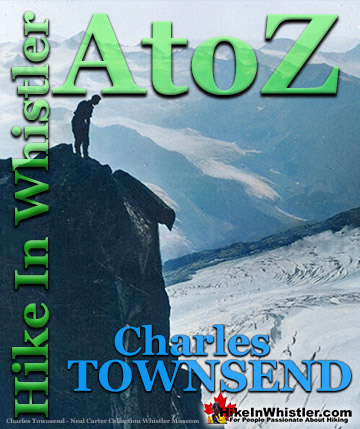
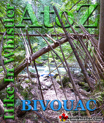
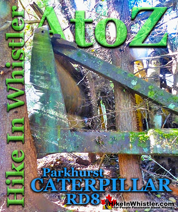
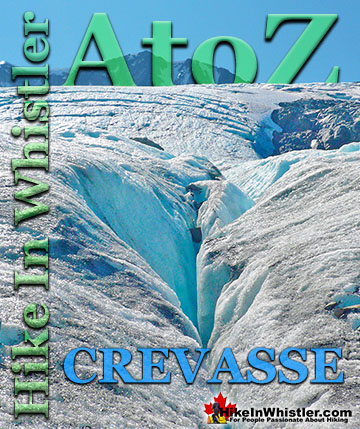
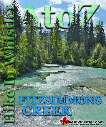
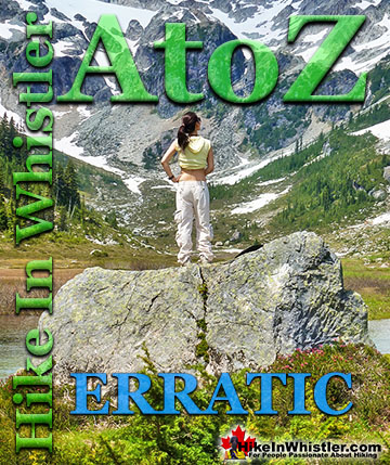
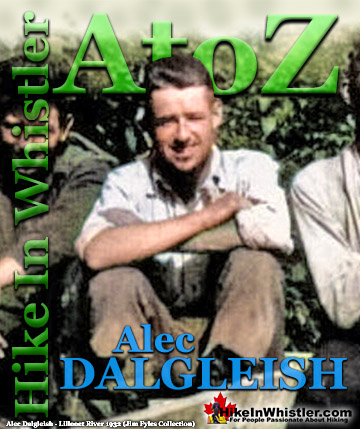
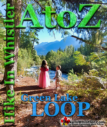

Explore BC Hiking Destinations!

Whistler Hiking Trails

Squamish Hiking Trails

Vancouver Hiking Trails

Clayoquot Hiking Trails
Victoria Hiking Trails

