![]() The West Coast Trail was created after decades of brutal and costly shipwrecks occurred along the West Coast of Vancouver Island. One shipwreck in particular was so horrific, tragic and unbelievable that it forced the creation of a trail along the coast, which previously had been simply a route through mostly impenetrable forest. Just before midnight, at 11:50pm on Monday, January 22nd the Valencia struck an underwater ledge of rock just a few hundred metres from the shore of Vancouver Island.
The West Coast Trail was created after decades of brutal and costly shipwrecks occurred along the West Coast of Vancouver Island. One shipwreck in particular was so horrific, tragic and unbelievable that it forced the creation of a trail along the coast, which previously had been simply a route through mostly impenetrable forest. Just before midnight, at 11:50pm on Monday, January 22nd the Valencia struck an underwater ledge of rock just a few hundred metres from the shore of Vancouver Island.
The Valencia Disaster
![]() 1. The Valencia
1. The Valencia ![]() 2. The Voyage
2. The Voyage ![]() 3. The Boats
3. The Boats ![]() 4. The McCarthy Boat
4. The McCarthy Boat ![]() 5. The Bunker Party
5. The Bunker Party ![]() 6. On the Valencia
6. On the Valencia ![]() 7. The Rafts
7. The Rafts ![]() 8. The Turret Raft
8. The Turret Raft ![]() 9. The Rescue Ships
9. The Rescue Ships ![]() 10. The Aftermath
10. The Aftermath ![]() 11. The Survivors
11. The Survivors ![]() 12. The Lost
12. The Lost
The West Coast Trail
![]() Prologue
Prologue ![]() 1: The West Coast Trail
1: The West Coast Trail ![]() 2: When to Hike & Fees
2: When to Hike & Fees ![]() 3: Trailheads
3: Trailheads ![]() 4: Getting There
4: Getting There ![]() 5: Considerations
5: Considerations ![]() 6: Campsites
6: Campsites ![]() 7: Shipwrecks
7: Shipwrecks ![]() 8: Routes
8: Routes
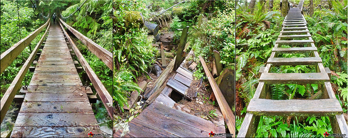
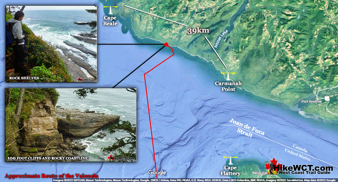
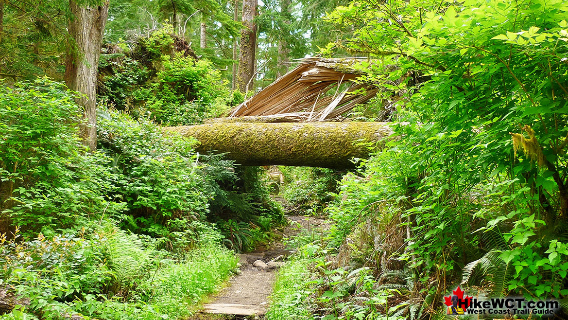
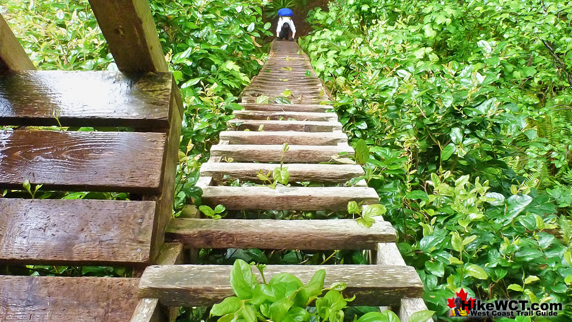
With her bow lodged on the underwater obstruction, the Valencia’s stern drifted to point toward the shore. It was estimated that in the first 5 or 6 minutes that 6 feet of water had already poured into the ship and she was sinking fast. Captain Johnson ordered the ship’s engines full astern into the darkness to beach her before sinking. Moments later she backed onto a reef just 18 metres from the shore and surrounded by crashing water. In relation to the West Coast Trail today, the location is just past KM18 and in the middle of a 4 kilometre stretch of coastline with steep cliffs and enormous rock outcrops extending out for hundreds of metres. The Valencia was surrounded by huge waves breaking over and churning around huge, flat, rock shelves. Every few seconds another huge swell would slam into the Valencia with its stern grounded and its bow slanting down into the ocean. The people aboard the Valencia could barely make out the shore in the darkness and wouldn’t find out until morning that the cliffs along the shore were vertical and about 100 feet tall. To add to the confusion, all on board assumed that they were located along the coast of Washington State, south of Cape Flattery. Their actual location was along the mostly uninhabited West Coast of Vancouver Island. The terrain along the coast is steep, crisscrossed with creeks and rivers, and covered in such dense vegetation as to often be characterized as impenetrable. The cold, rainy weather also added to their misery and the coast was blanketed with a few centimetres of snow. These pictures show the West Coast Trail as it looks today, when the Valencia wrecked in 1906, there were no bridges, ladders, signs, route markers, trail clearing, or even a trail to clear. Ravines had to be slid down and crawled up. Creeks and rivers had to be waded through or if you were lucky, crossed by a well placed deadfall tree sprawled across.
Bridges and Ladders Overcome the Impenetrable Forest
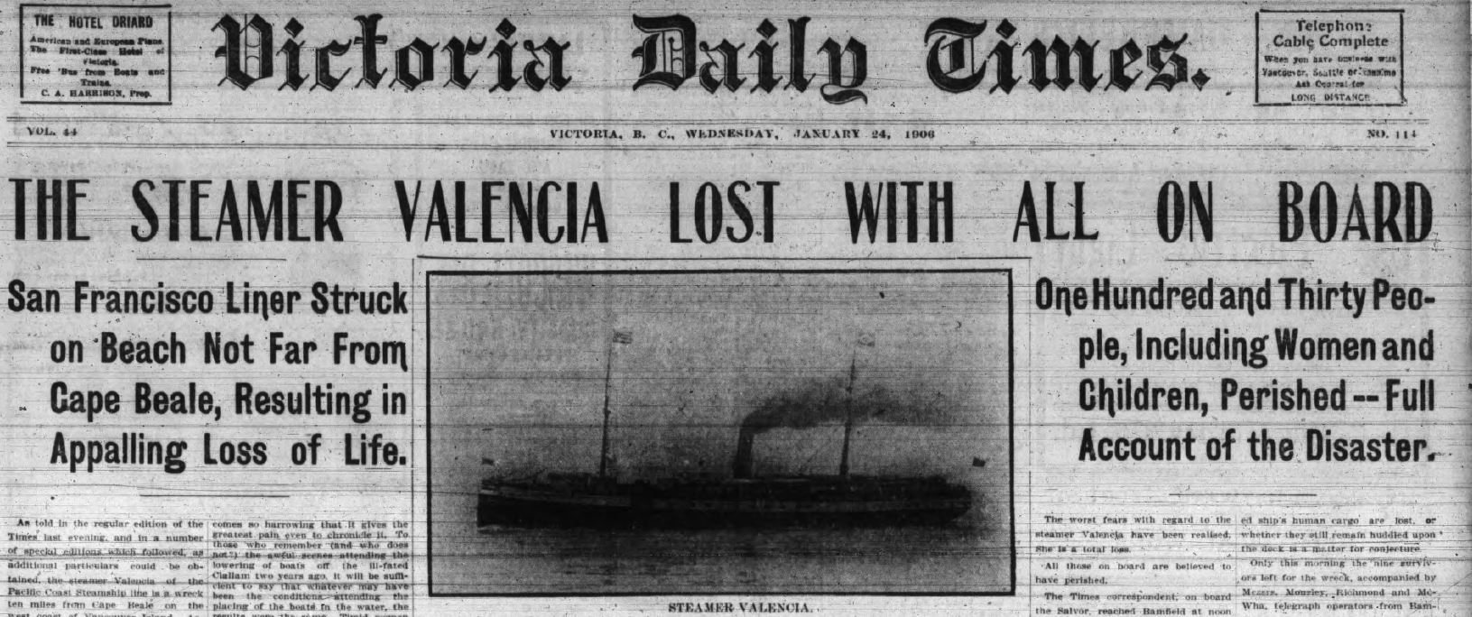
Victoria Daily Times January 24, 1906
Near to Civilization, Yet Inaccessible and Isolated
There was a telegraph wire along the coast that linked the lighthouses at Cape Beale and Carmanah. Due to the brutal forest terrain, the line mostly ran along the beach, dangling from tree to tree. Where the Valencia wrecked, the line was inland due to the inaccessible shoreline. Maintained by a lineman, there were a few lineman’s huts located along various beaches. These simple shelters were often made of beach wood and contained a small amount of food as well as the ability to tap into the telegraph line to contact the lighthouses. The United States government report that investigated the Valencia disaster titled, The Wreck of the Steamer Valencia, describes the region as, “Taken as a whole, it would be hard to find a place so comparatively near to civilization and yet practically so inaccessible and isolated as the place where the Valencia went ashore."
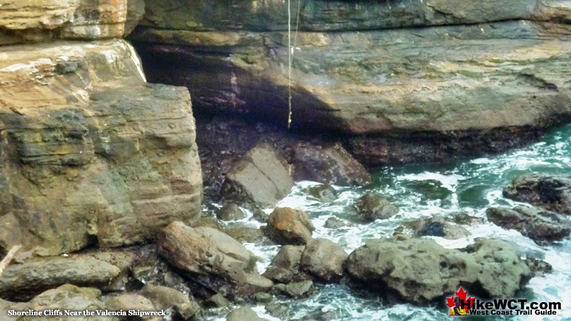
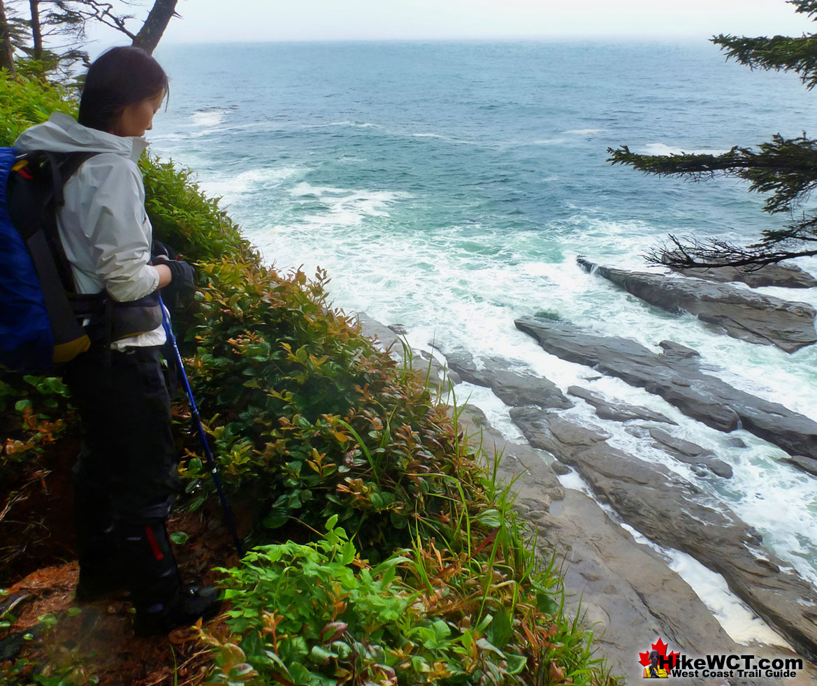
Coastline Cliffs Near the Valencia Wreck
Extraordinary Challenges the Valencia Survivors Faced
Though the stern of the ship was estimated to be just 18 metres from the vertical cliffs along the shore, the crashing waves coming in made getting to the top of the cliffs nearly impossible. If they could reach the shore, climbing up the cliffs would be another terrifyingly brutal challenge. If they could reach the shore and climb to the top of cliffs, they would find the forest in either direction overgrown, unmarked, steep, and crossed by deep ravines. If they overcame all these obstacles, they would still have to contact the outside world along this coast where few people lived. An estimated 140 people died in the Valencia disaster and just 38 would survive the horrific circumstances faced along this beautiful, yet brutally wild West Coast of Vancouver Island. The Valencia disaster forced the creation of lifesaving measures to be created and built to prevent or at least better assist future shipwrecks. The West Coast Trail originated from one of these measures.
Wreck of the Valencia Near KM18 of the West Coast Trail
The Incredible West Coast Trail
The West Coast Trail is incredible. Everything about it is amazing. From the wildly, incomprehensibly enormous trees to endless jaw dropping views. And it's tough. Very tough. It is a trail that shouldn't exist. Hiking trails always form out of the easiest route worn down over the years to some worthwhile destination. The West Coast Trail evolved out of the need to get shipwreck survivors out of this this otherwise beautiful place. This trail was formed out of necessity and the route today is the only route realistically possible along this tangle of rainforest over brutally changing terrain. Flanked by steep cliffs on one side and the Graveyard of the Pacific on the other the route evolved where it shouldn't have. Who would clear a trail through such impenetrable wilderness unless absolutely necessary. Always wet, always up and down, hundreds of rivers, creeks, canyons, fallen trees and lots and lots of ladders. Even with all the construction of suspension bridges, cable car crossing and ladders it's brutal. And yearly, winter storms blast down monstrously huge trees and leave them sprawling across the trail.
Difficulties Faced On the West Coast Trail
The West Coast Trail's difficulty can be measured by its relatively short length of 75 kilometres yet it takes 5-7 days to complete. This is for two wonderful, spectacular and telling reasons. First, the trail's length is misleading as it doesn't take into account the thousands of zig-zags along the route. Both left and right as well as up and down. It is a jigsaw of a trail, up and down over endless chasms tangled with rainforest. Does that 75km take into account the 50 foot ladders? It just takes a long time to snake through and you quickly discover that 2 kilometres on the map shows as 4.8 kilometres on your gps! Added to that your pace is bogged down by whole sections of mud, crawling under and over fallen trees, and of course pausing almost every 5 minutes to soak in a sensational view.
Magnificent Destruction Along the West Coast Trail
Even the wrecked sections of trail become a thing of wonder and amusement. Often you stroll along an ancient, but lovely wooden boardwalk only to stop at a sizable length missing. A chunk of boardwalk a few metres long inexplicably missing. You stand at the end of the boardwalk and look across the gap which is a deep pool of mud with impenetrable jungle on either side. Then you spot it. On either side of the gap is a chainsawed end of an enormous tree that crashed down on the boardwalk during some winter storm a long time ago. You can tell it has been a few years because of the weathering of the two ends of the tree flanking the gap as well as the waterlogged and disintegrating pieces of this monster cut away. The tree was so massive that it sprang up when cut and the two ends are levered up to eye level with the weight of the length of tree that quickly disappears into the thick forest. Why haven't they fixed the boardwalk here? That thought crosses your mind a few times, until you pass a few more of these along the trail and realize that they must happen astonishingly often and repairing the damage takes a considerable amount of work. You would need an army of workers to keep on top of the needed repairs to the West Coast Trail. This of course is not realistic, and you slowly come to the conclusion that the trail is much more colourful and interesting with its smashed sections and constant reminders of the wild, destructive power of Vancouver Island's West Coast.
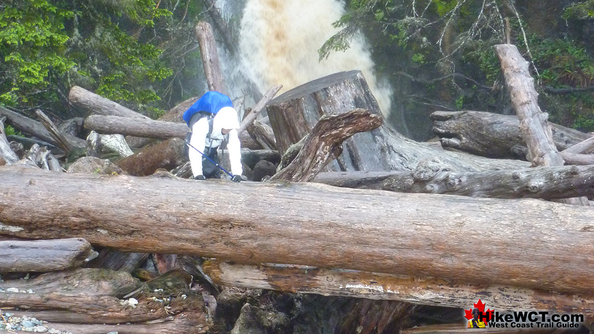
Crossing Orange Juice Creek on the West Coast Trail
Wild, Brutal and Beautiful West Coast Trail
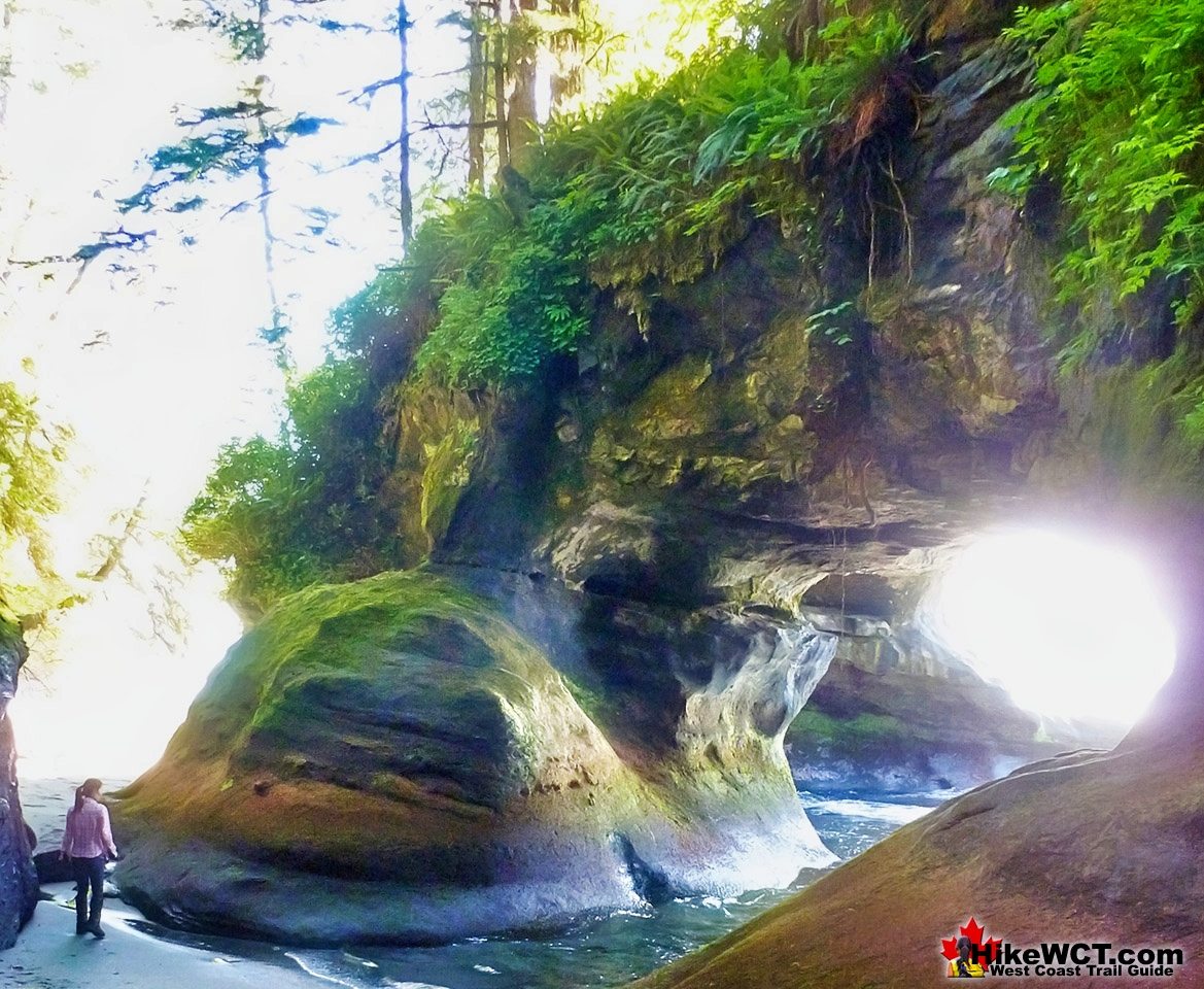
It takes a couple days on the West Coast Trail to grasp how wonderful it is. It's so beautiful. Wildly beautiful, and this is a phenomenon that the West Coast Trail is alive with. It's constantly changing at every glance. Everywhere you look you spot a work of art in the form of a splayed tree over a river valley or a sudden gap in the forest revealing the ocean a thousand feet below. A swirling morass of green water and white, swirling foam churned up by the waves crashing from the Pacific. This constantly changing terrain with endless views and obstacles alone would secure this hike as one of the worlds best. But there is another aspect that combined with its beauty, makes it what it is. The West Coast Trail. This is a characteristic that is seldom understood or explained for how wonderful it actually is. The harsh difficulty of the trail.
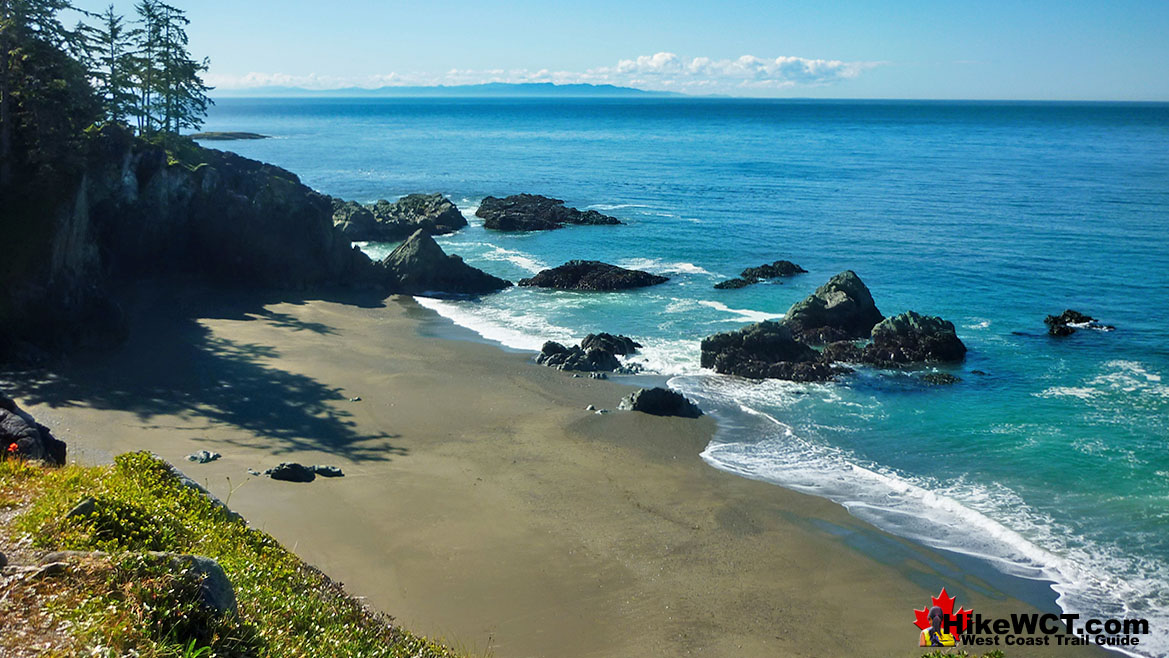
Valencia Bluffs Near the Site of the Valencia Shipwreck
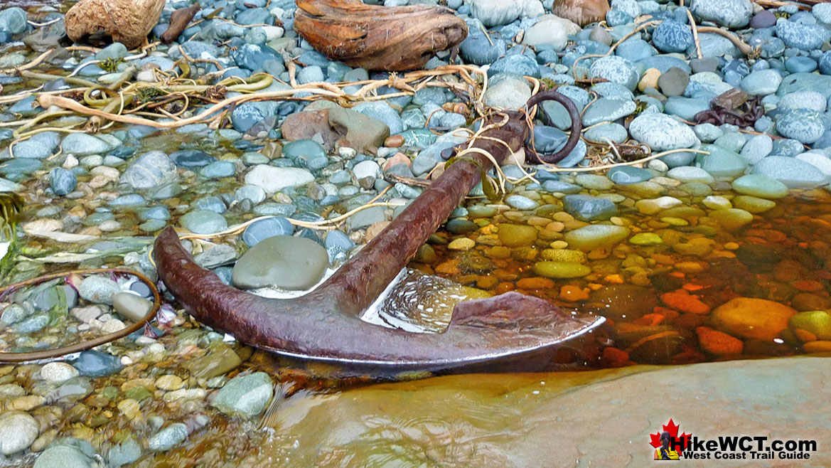
Shipwreck Relics Along the West Coast Trail
The trail is brutal. It's often raining, so you are usually soaking wet. This makes you soggy and crabby, tired and exhausted. The treacherous trail in this wet is muddy, slippery and requires your full attention at every step. This mesmerizes you as you hike. You focus completely on your next step and your mind relaxes into a meditative state. This is when it happens. You look up, catch a glance of what's around you, and it's marvellous. This is it. The West Coast Trail is a perfect combination of brutal difficulty, spectacular wildness and stunning natural beauty. Added to that you occasionally get a glimpse of history that carries you back in time. A piece of a shipwreck along the beach or a massive anchor left 150 years ago after the ship it came from succumbed to the Graveyard of the Pacific in some calamitous storm that smashed it here. Continued here...

